Standard of Ur Royal Graves at Ur, Sumeria, 2600 B.C., British Museum,
photograph Brian W. Coad
Introduction
1. Introduction
-
(includes as one file Contents,
Acknowledgements,
Purpose,
Materials and Methods,
History of Research,
Fisheries,
Geography,
Climate,
Habitats,
Environmental Change,
Drainage Basins,
Scientific Names,
Fish Structure,
Collecting Fishes,
Preserving Fishes,
Checklists,
Glossaries, and
Quotes).
Note that Voume 1 of Carps and Minnows of Iran (see below for link) repeats and
expands on these entries.
b. Cobitidae + Nemacheilidae + Salmonidae + Cyprinodontidae;
c.
Sparidae+
Cichlidae
+
Gobiidae.
3.
Bibliography 1711-2013
(note the papers
listed in Published Accounts have updated bibliographies and contain references
not found here).
4.
The families Adrianichthyidae (Oryzias latipes), Percichthyidae (Morone saxatilis), Centrarchidae (Lepomis macrochirus and Micropterus salmoides), Mullidae (Mullus barbatus), Scophthalmidae (Psetta maxima) and Pleuronectidae (Platichthys flesus) are deleted from this work as the species therein have not been confirmed from Iran (see Coad and Abdoli (1993b) for some details).
Revised sections of this website appeared as review articles in the Iranian Journal of Ichthyology (http://ijichthyol.org/) and the International Journal of Aquatic Biology (www. ij-aquaticbiology.com), both published by the Iranian Society of Ichthyology. These families are no longer accessible here and will not be updated further. Note that the species formerly in the family Cyprinidae are now assigned to seven families in Iran. The less speciose families are published as journal articles. The two largest families (carps or Cyprinidae and minnows or Leuciscidae) appear here as downloadable files. A more permanent home will eventually be found these latter two as their size precludes publishing in book form for cost reasons (both to produce the books and their probable retail price).
|
Families |
Genera |
Common Names |
Journal |
|
Anguillidae |
Anguilla |
Freshwater Eels |
International Journal of Aquatic Biology, 4(2):102-107, 2016. |
|
Atherinidae |
Atherina |
Silversides |
International Journal of Aquatic Biology, 3(5):282-289, 2015. |
|
Bagridae |
Mystus |
Bagrid Catfishes |
Iranian Journal of Ichthyology, 1(4):218-257, 2014. |
|
Carcharhindae |
Carcharhinus |
Freshwater Sharks |
International Journal of Aquatic Biology, 3(4):216-221, 2015. |
|
Chanidae |
Chanos |
Milkfishes |
Iranian Journal of Ichthyology, 2(2):65-79, 2015. |
|
Channidae |
Channa |
Snakeheads |
Iranian Journal of Ichthyology, 3(1):65-72, 2016. |
| Clupeidae |
Alosa, Clupeonella, Tenualosa |
Herrings |
International Journal of Aquatic Biology, 5(3):128-192, 2017. |
| Cyprinoidei:- |
Carps, Minnows and relatives |
|
|
| - Acheilognathidae |
Rhodeus |
Bitterlings |
Iranian Journal of Ichthyology, 5(4):257-267, 2018. |
| - Cyprinidae |
Arabibarbus, Bangana, Barbus, Capoeta, Carasobarbus, Carassius, Cyprinion, Cyprinus, Garra, Luciobarbus, Mesopotamichthys, Schizocypris, Schizothorax, Schizopygopsis, Tariqilabeo |
Carps |
Carps and Minnows of Iran |
| - Danionidae |
Barilius, Cabdio |
Danionids |
International Journal of Aquatic Biology, 6(4):179-188, 2018. |
| - Gobionidae |
Gobio, Pseudorasbora, Romanogobio |
Gobionids |
Iranian Journal of Ichthyology, 6(1):1-20, 2019. |
| - Leuciscidae |
Abramis, Acanthobrama, Alburnoides, Alburnus, Ballerus, Blicca, Chondrostoma, Leucaspius, Leuciscus, Pelecus, Petroleuciscus, Rutilus, Scardinius, Squalius, Vimba |
Minnows |
Carps and Minnows of Iran
|
| - Tincidae |
Tinca |
Tench |
Iranian Journal of Ichthyology, 6(2):82-91, 2019. |
| - Xenocyprididae |
Ctenopharyngodon, Hemiculter, Hypophthalmichthys, Mylopharyngodon |
East Asian Minnows |
|
| Esocidae |
Esox |
Pikes |
Iranian Journal of Ichthyology, 3(3):161-180, 2016. |
|
Gasterosteidae |
Gasterosteus, Pungitius |
Sticklebacks |
Iranian Journal of Ichthyology, 2(3):133-147, 2015. |
| Gobiidae |
Anatirostrum, Babka, Benthophiloides, Benthophilus, Boeleophthalmus, Caspiosoma, Chasar, Glossogobius, Hyrcanogobius, Knipowitschia, Mesogobius, Neogobius, Periophthalmus, Ponticola, Proterorhinus, Rhinogobius |
Gobies |
|
|
Heteropneustidae |
Heteropneustes |
Stinging Catfishes |
Iranian Journal of Ichthyology, 1(4):218-257, 2014. |
| Lotidae |
Lota |
Cuskfishes |
Iranian Journal of Ichthyology, 3(4):229-235, 2016. |
|
Mastacembelidae |
Mastacembelus |
Spiny Eels |
Iranian Journal of Ichthyology, 2(1):1-12, 2015. |
| Mugilidae |
Chelon, Ellochelon, Mugil, Planiliza (and Liza) |
Mugilidae |
Iranian Journal of Ichthyology, 4(2):75-130, 2017. |
| Percidae |
Perca, Sander |
Perches |
International Journal of Aquatic Biology, 4(3):143-170, 2016. |
| Petromyzontidae | Caspiomyzon | Lampreys | International Journal of Aquatic Biology, 4(4):256-278, 2016. |
| Poeciliidae |
Gambusia, Poecilia, Xiphophorus |
Livebearers |
Iranian Journal of Ichthyology, 4(4):305-330, |
|
Siluridae |
Silurus |
Sheatfishes |
Iranian Journal of Ichthyology, 1(4):218-257, 2014. |
|
Sisoridae |
Glyptothorax |
Sisorid Catfishes |
Iranian Journal of Ichthyology, 1(4):218-257, 2014. |
|
Syngnathidae |
Syngnathus |
Pipefishes |
Iranian Journal of Ichthyology, 2(3):133-147, 2015. |
Alphabetical Links to Genera
Acanthopagrus Acipenser Aphanius Cobitis Coregonus Huso Ilamnemacheilus Iranocichla Metaschistura Misgurnus Oncorhynchus Oreochromis Oxynoemacheilus Paracobitis Paraschistura Pseudoscaphirhynchus Sabanejewia Salmo Salvelinus Seminemacheilus Stenodus Tilapia Triplophysa Turcinoemacheilus
Alphabetical Links to Families
Acipenseridae Cichlidae Cobitidae Cyprinodontidae Nemacheilidae Salmonidae Sparidae
Marine species entering fresh water from the Persian Gulf and Sea of Oman can be accessed through a Marine List in the Checklists of the Introduction.
Some sections of this work are incomplete but have been posted as is. They will be updated and queries resolved as time permits. Apart from files not yet complete, distribution maps, some figures and habitat photographs are the main items to be added. A question mark may appear in the text appended to items that need to be checked by me. Numerous queries have led me to post incomplete material.
This work has been carried out over a period of 45 years, starting in 1971. I arrived in Iran in January 1976
and, in that year, 7 articles were published strictly on Iranian fishes (3 on parasites, 1 on pesticides, 1 on fisheries, 1 describing the blind white fish and 1 a summary of the latter; 2 were in Farsi).
A generation later in 2006, over 160 articles on Iranian fishes appeared, along with hundreds of relevant works from neighbouring countries, works on the
aquatic environment in Iran and works on taxonomy and systematics relevant to Iran. The study of fishes is now a very active field within Iran and the Middle
East and much of the newer literature is easily available on-line (see
Bibliography). Accordingly, 2011 is the last year that this work was updated although some systematic and taxonomic studies may still be incorporated.
The Published Accounts (see above) were updated versions from content in this
website.
A wide range of people in Iran, Canada and elsewhere have assisted me in this work over more than 40 years. Inevitably, I will have forgotten some names, which I regret. Some people I never met formally, an example being the gentleman nattily dressed in suit by a stream near Kazerun who jumped fully-clothed into the water to help me catch fish. Numerous other Iranians have assisted my studies and this website is dedicated to them.
The staff at the Department of Biology, Shiraz (then Pahlavi) University helped me in numerous ways to collect fishes during a three-year tenure as an Associate Professor. Dr. Bahman Kholdebarin was Chairman of the Department for much of my time in Iran and it is only through his support that I was able to make the collections that enabled this work to be done. The Research Council of Pahlavi University funded field trips and is gratefully acknowledged for this support. Collections were made with the help of drivers and assistants and their efforts over long periods in the field are gratefully acknowledged. They include H. Assadi, M. H. Jaferi, Sh. Mansoorabadi, A. Shirazi, A. Tofangdar and N. Yaghar. Various other people assisted too and are mentioned below under the Pahlavi University name.
Studies on Iranian fishes since my residence in Iran have been supported by grants from the Canadian Museum of Nature, Ottawa (CMN, fish collection acronym CMNFI), by assistance from staff there including Noel Alfonso, Jadwiga Frank, C. G. Gruchy, Sylvie Laframboise, Alison Murray, Claude Renaud and Michèle Steigerwald, and by a wide range of students and volunteers. The staff in the CMN library searched out all the numerous and varied papers on fishes in Iran and neighbouring countries without which this synthesis would not be possible. One paper took six years to locate and arrived in the form of a microfilm from the Soviet Union. I am particularly indebted to Victor Adomaitis who kindly volunteered for the unrewarding task of scanning hundreds of images and converting them to thumbnails and usable files. Mollie MacCormac carried on this task, making a wide variety of images available for the website.
Various students of Iranian fishes have permitted use of their colour photographs of fishes and are acknowledged where that picture occurs. Most of the line drawings were executed by Susan Laurie-Bourque, with a few by Charles Douglas.
In particular, I should like to acknowledge the support and encouragement of the late Dr. D. E. McAllister, Curator of Fishes, CMN over many years, in terms of training and education, both formal and informal, of financial and moral support, and in practical terms in the ways and means of collecting, cataloguing, identifying, and studying fishes, and of getting things done.
Co-authors are evident in the Bibliography and their added expertise made several studies possible.
Various people and their organisations are mentioned below separately for their particular assistance; these are in alphabetical order.
Dr. Asghar Abdoli collected numerous specimens including exotics and allowed me to incorporate these discoveries in several papers.
Dr. P. Bănărescu, Institutul de Biologie, Bucureşti has communicated much information in detailed letters on fishes in the Middle East as well as loaning and exchanging specimens, for all of which his assistance is acknowledged.
Dr. R. J. Behnke, Colorado State University, Fort Collins is gratefully acknowledged for his extensive loans of, and access to, collections he and associates made. These are listed more fully in the Materials and Methods.
Prof. Dr. P. G. Bianco, University of Naples, allowed me free access to materials, including types, in his possession at the University of Naples and his hospitality is acknowledged.
Dr. N. Bogutskaya and Dr. A. Naseka, Laboratory of Ichthyology, Zoological Institute, Academy of Sciences, St. Petersburg are thanked especially for their hospitality, access to collections, data analyses and interpretations on Iranian fishes, as well as co-authorship.
Dr. C. E. Bond, Department of Fisheries and Wildlife, Oregon State University, Corvallis allowed extensive loans of fishes from Iran under his care and these materials are listed in the Material and Methods (see Contents).
Staff at the Fish Section, British Museum (Natural History) (now the Natural History Museum) have loaned materials and hosted visits on numerous occasions; their help has been much appreciated for the extensive collections are a required study to understand the Iranian fauna. They include Dr. K. Banister, B. Brewster, P. Campbell, O. Crimmen, S. Davidson, Dr. P. H. Greenwood, A.-M. Hodges, G. Howes, J. Maclaine, Dr. N. Merrett, Dr. D. Siebert, Dr. E. Trewavas, A. Wheeler and Dr. P. J. P. Whitehead.
Dr. H. R Esmaeili, Shiraz University has contributed many items of information, DNA data, specimens and photographs, and has collaborated on a variety of studies on Iranian fishes. His students have carried out field work in these respects and include Ali Gholamifard, Benafsheh Parsi, Golnaz Sayadzadeh, Somayeh Ghasemiyan, Sorror Mirghiasi, Rasol Zamanian, Siavash Babai and Mohadeseh Tahami.
Dr. Karol Hensel for help in visiting Afghan collections in Bratislava and Ján Kautman for access to the material in the Slovak National Museum.
Dr. T. Hrbek, Washington University School of Medicine, St. Louis is acknowledged for his complementary studies on tooth-carps using molecular techniques.
Dr. M. Kasparek and Prof. Dr. R. Kinzelbach kindly appointed me to the Advisory Board of the journal Zoology in the Middle East which has given me an interesting and valuable overview of studies in that region.
Dr. Yazdan Keivany translated abstracts of his manuscript reports and first posted my bibliography of Iranian freshwater fishes on the internet - a stimulus to this work!
Dr. Bahram Kiabi, Gorgan University of Agricultural Sciences and Natural Resources is thanked for various items of information on fishes, translations and gifts of Farsi articles and many interesting fish specimens. His efforts at facilitating collegiality and his students have formed the core of modern university researchers on the fishes of Iran.
Dr. F. Krupp, Johannes Gutenburg-Universität Mainz and Forschungsintitut Senckenberg (NaturMuseum Senckenberg), Frankfurt am Main contributed a wide variety of information on Middle Eastern fishes, sent me copies of his theses and in his letters provided many stimulating points of discussion which helped me clarify my views on the fishes. His published works are a model for students on fishes in that region. He, with Prof. Dr. Kinzelbach, kindly invited me to the Symposium on the Fauna and Zoogeography of the Middle East in Mainz, 1985 and later he also invited me to the First Middle Eastern International Congress, Aqaba, Jordan, 2008.
Nasser Najafpour, Iranian Fisheries Research and Training Organization, Jahad-e Sazandegi,Ahvaz was instrumental in arranging visits to Iran and associated field trips. His enthusiastic cooperation in the field resulted in many interesting new specimens and his studies on distributions of fishes in Khuzestan have been very important for this web site. The team at Ahvaz is acknowledged below individually and in teaching me Farsi names of fishes. J. Gh. Marammazi was head of that team and his hospitality and efforts to bring me to Iran are gratefully acknowledged.
The late Dr. T. T. Nalbant, National Museum of Natural History "Grigore Antipa", Bucharest, examined loaches I collected in Iran and provided identifications. Z. Ljabner, ?, Prague also worked on these collections.
Staff at the National Museum of Natural History (Smithsonian Institution), Washington arranged loans of specimens and allowed access to the collections during several visits. They include K. A. Bruwelheide, Dr. B. B. Collette, S. Jewett, S. Karnella and Dr. J. T. Williams.
Robin Ade, Stephane Ostrowksi, Ellis Pennington and David Currie sent specimens, photographs of fish and their habitats, drawings, and other data on fishes based on their field work in Afghanistan. Chris Shank sent, or arranged, the despatch of specimens and copies of documents as well as comments on fish names and other useful information.
Staff at the Fischsammlung, Naturhistorisches Museum Vienna have also loaned materials and hosted visits and their assistance has been essential to studies on Iranian fishes based on the collections of J. J. Heckel. They include Dr. H. Ahnelt, Dr. E. Mikschi, Dr. B. Herzig and Dr. R. Hacker.
Dr. J. G. Nielsen and Dr. P. R. Möller, Zoological Museum, University of Copenhagen facilitated access to collections despite the "orkan".
Dr. P. Bartsch and Mrs. C. Lamour, Museum für Naturkunde, Humboldt-Universität zu Berlin for access to collections.
Dr. Peter Rask Møller and Tammes Menne for access to and a loan of material from the Zoological Museum, University of Copenhagen.
M. Rabaniha and F. Owfi, Persian Gulf Fisheries Research Centre, Bushehr and Iranian Fisheries Research and Training Organization, Jahad-e Sazandegi, Tehran, kindly copied the MMTT catalogue for me and showed me various specimens of fishes from their work in Bushehr Province and southern Iran.
Dr. Jalal Valiallahi provided stimulating discussions on the limits and the content of the genus Barbus sensu lato in Iran while working at the CMN as well as a variety of photographs of these sometimes immense fish.
Prof. Dr. H. Wilkens, Ralf Thiel and Irina Eidus, Zoologisches Institut und Zoologisches Museum der Universität Hamburg kindly loaned materials and facilitated two visits to the museum to examine materials.
Various people collected material for me or made gifts of material, sent specimens for identification, identified material, allowed access to collections under their care, made loans of material, provided other useful data and general information, and exchanged ideas. These are listed below in alphabetical order with their affiliations at the time of their contribution (sometimes only email addresses were known; and apologies if any titles are missing):-
add all co-authors from Bibliog?
K. Abbasi, Gilan Fisheries Research Centre, Bandar Anzali, I. M. Abd, Nature Iraq, Baghdad, H. A. Abdolhay, Tehran, I. M. Abd, Nature Iraq, Baghdad, Iraq, A. Abdoli, Fisheries Research Centre, Sari and Gorgan University of Agricultural Sciences and Natural Resources, S. Abdolmalaki, Gilan Fisheries Research Centre, Bandar Anzali, S. M. A. Abdullah, Iraq, Dr. T. Abe, University Museum, University of Tokyo, Dr. M. Abedi, Savadkooh University, H. Abyot, Iranian Fisheries Research and Training Organization, Jahad-e Sazandegi, Ahvaz, T. K. Aday, Iraq, Dr. A. Adhami, Muze-ye Melli-ye Tarikh-e Tabi'i, Tehran, A. Afzali, Bandar Abbas, Fikret Ahsenböre, Turkey, Dr. A. Akbary Pasand, University of Zabol, Zabol, A. Alamdari, Organization of the Environment, Shiraz, A. A. Al-Attar, Basrah University, A. J. Al-Faisal, Basrah University, A. W. Al-Hakim, University of Nottingham, L. A. J. Al-Hassan, School of Biological Sciences, University of Auckland, S. A. S. Al Hatimy, Oman Natural History Museum, Muscat, W. Al-Baharna, Directorate of Fisheries, Bahrein, B. A. Al-Hussein Al-Saadi, Iraq, Dr. N. M. Ali, Biological Research Centre, University of Baghdad, Dr. T. S. Ali, University of Basrah, S. Alinejad, Offshore Fisheries Research Centre, Chah Bahar, Iranian Fisheries Research and Training Organization, Jahad-e Sazandegi, H. R. Alizadeh, Iranian Fisheries Research and Training Organization, Jahad-e Sazandegi, Tehran, A. R. Al-Jafery, Department of Hydrobiology, Baghdad, Dr. H. Alkahem, King Saud University, Riyadh, M. A. Al-Mukhtar, Fisheries Research Centre, Ahvaz, Dr. A. J. Al-Rudainy, University of Baghdad, Iraq, Dr. A. Al-Shamma'a, Ministry of Science and Technology, Iraq, Nisreen Alwan, Forschungsinstitut Senckenberg, Germany, Prof. O. A. Amin, Arizona State University, Tempe, Dr. F. Andreone, Museo Regionale di Scienze Naturali, Torino, Dr. R. Arai, National Science Museum, Tokyo, G. Arbocco, Museo Civico di Storia Naturale "Giacomo Doria", Genova, Dr. J. D. Archibald, Yale University, Connecticut, Dr. N. B. Armantrout, Portland, Oregon and family, Dr. G. Arratia, University of Kansas, Lawrence, S. Asadollah, Isfahan University of Technology, A. Ashraf, Encyclopædia Iranica, Columbia University, New York, Dr. J. W. Atz, Department of Herpetology and Ichthyology, American Museum of Natural History, New York, Prof. S. Balik, Ege University, Izmir, Prof. E. Balletto, Istituto di Zoologia, Genova, G. A. C. Balma, Museo Civico di Storia Naturale, Carmagnola, Dr. K. Banister, Fish Section, British Museum (Natural History), London, A. J. Bardhun, Shiraz, D. M. Bartley, Food and Agriculture Organization, Rome, Dr. V. V. Barsukov, Zoological Institute, Academy of Sciences, Leningrad, M. L. Bauchot, Laboratoire d'Ichtyologie générale et appliquée, Muséum National d'Histoire Naturelle, Paris, R. Beck, COFAD GmbH, Tutzing, Dr. W. C. Beckman, Opelousas, Louisiana, Dr. A. Ben-Tuvia, Hebrew University of Jerusalem, Dr. M. Berberian, Uinversity of Cambridge, Dr. P. Berrebi, Université Montpellier, Dr. A. D. Berrie, Freshwater Biological Association, Wareham, Dr. E. Bertelsen, Zoologisk Museum, Copenhagen, Prof. Dr. P. G. Bianco, Universita degli Studi di l'Aquila, Italy, F. Biglari, National Museum of Iran, Tehran, K. L. Bist, Government Postgraduate College, Gopeshwar, J. Bohlen, Academy of Sciences, Libechov, Dr. J. E. Böhlke, Academy of Natural Sciences, Philadelphia, K. Borkenhagen, Forschungsinstitut Senckenberg, Germany, Dr. A. H. Bornbusch, Duke University, Durham, Dr. J. Briggs, King Faisal University, Dammam, Dr. J. C. Briggs, Watkinsville, Georgia, Dr. K. E. Carpenter, Food and Agriculture Organization, Rome, V. Chamanara, Gorgan University of Agricultural Sciences and Natural Resources, L. A. Cloutier, Department of the Environment, Tehran, Dr. D. Coffey, Pahlavi University, Shiraz, Dr. M. J. Collares-Pereira, Museu Bocage, Lisbon, Dr. B. B. Collette, National Museum of Natural History, Washington, J. Collins, Food and Agriculture Organization, Rome, Dr. J. T. Collins, Museum of Natural History, University of Kansas, Lawrence, Dr. L. J. V. Compagno, J. L. B. Smith Institute of Ichthyology, Grahamstown, Dr. B. B. Collette, National Museum of Natural History, Washington, G. H. Copp, Centre for Environment, Fisheries and Aquaculture Science, Lowestoft, Dr. L. Cornwallis, Oxford, S. Cowton, U.S. Army Corps of Engineers, A. S. Creighton, Division of Fishes, Museum of Zoology, University of Michigan, Ann Arbor, Dr. F. Cross, University of Kansas, Lawrence, Dr. E. J. Crossman, Department of Ichthyology and Herpetology, Royal Ontario Museum, Toronto, E. L. Daniel, Encyclopædia Iranica, Columbia University, New York, F. Darvishi, Mazandaran, S. Deeb, American University of Lebanon, Beirut, S. Dehqan-Mediseh, Iranian Fisheries Research and Training Organization, Jahad-e Sazandegi, Ahvaz, Dr. G. B. Delmastro, Museo Civico di Storia Naturale, Carmagnola, M. Desoutter, Laboratoire d'Ichtyologie générale et appliquée, Museum National d'Histoire Naturelle, Paris, Dr. M. M. Dick, Museum of Comparative Zoology, Harvard University, Cambridge, P. Dickinson, National Zoological Garden, Al Ain, Abu Dhabi, W. A. Dill, Davis, California, J. Dominique, Freshwater and River Ecology Research Unit, Villeurbane, M. Doroudi, Iranian Fisheries Research and Training Organization, Jahad-e Sazandegi, Bandar-e Lengeh, Dr. A. DouAboul, Kitchener, Ontario, Dr. P. Dugan, Penang, Malayasia, Dr. J. D. Durand, ESA CNRS, Villeurbane, J. Dusek, Prague, A. Ebrahimi, Lorestan University, Khorramabad, M. Ebrahimi, Kerman, J. Edmondson, Liverpool Museum, Dr. G. Ekingen, Veteriner Fakultesi, Elazig, O. Elter, Museo ed Istituto di Zoologia Sistematico, Universita di Torino, Dr. B. Elvira, Ministerio de Agricultura y Pesca, Madrid, G. El Zein, Université Libanaise, Ksara, F. Emamai, Shilat, Iran, Dr. F. Erk'akan, Hacettepe University, Ankara, Dr. W. N. Eschmeyer, Department of Ichthyology, California Academy of Sciences, San Francisco, Gh. Eskandary, Fisheries Research Centre, Jahad-e Sazandegi, Ahvaz, Dr. H. R. Esmaeili, Shiraz University, E. Esmaily Nejad, Shahid Beheshti University, Tehran, D. Evans, IUCN, Cambridge, K. Evans, Pahlavi University, Shiraz, K. Fakhro, Directorate of Fisheries, Bahrein, R. Fatemi, Tehran, Dr. A. M. Fazel, Natural Resources Faculty, Tehran University, Karaj and Natural History Museum, Department of the Environment, Tehran, , H. Fazly, Fereydun Kenar, Mazandaran, R. F. Field, Muscat, Dr. E. Firouz, Tehran, Dr. W. Fischer, Food and Agriculture Organization, Rome, J. Fitzpatrick, Food and Agriculture Organization, Rome, Dr. R. Fricke, Staatliches Museum für Naturkunde in Stuttgart, Dr. J. Freyhof, Leibniz Institute of Freshwater Ecology and Inland Fisheries, Berlin, P. A. M. Gaemers, Rijksmuseum van Geologie en Mineralogie, Leiden, M. D. Gallagher, Oman Natural History Museum, Muscat, M. Geerts, Swalmen, The Netherlands, Prof. Dr. R. Geldiay, Ege University, Izmir, Dr. C. George, Union College, Schenectady, Dr. H. Ghadirnejad, Iranian Fisheries Research and Training Organization, Jahad-e Sazandegi, Tehran, A. Ghamoosi, Shahid Beheshti University, Tehran, S. M. Ghasempouri, Tarbiat Modares University, Noor, Dr. D. I. Gibson, British Museum (Natural History), London, Z. Gholami, Ludwig-Maximilians-Universität, München, D. Golani, Zoological Museum, Hebrew University of Jerusalem, K. Golzarianpour, Tehran, Dr. M. Goren, Tel Aviv University, S. Gorgin, Shiraz, Dr. B. Groombridge, UNEP World Conservation Monitoring Centre, Cambridge, Dr. S. H. Gruber, University of Miami, J. M. Gunn, University of Ottawa, R. Haas, California State University, Fresno, M. Hafezieh, Research Centre for Natural Resources and Animal Husbandry, Jahad-e Sazandegi, Shiraz, Dr. J. Halpern, Pahlavi University, Shiraz, A. Hardy, Iraq, Dr. K. E. Hartel, Museum of Comparative Zoology, Harvard University, Cambridge, S. S. Hasan, University of Basrah, Dr. M. R. Hassannia, Jahad-e Sazandegi, Tehran, M. R. Hemami, Isfahan University of Technology, D. M. Herdson, The Laboratory, Plymouth, E. Holm, Department of Ichthyology and Herpetology, Royal Ontario Museum, Toronto, Dr. R. A. Hinrichsen, Shad Foundation, Seattle, A.-M. Hodges, Fish Section, British Museum (Natural History), London, M. L. Holloway, Fish Section, British Museum (Natural History), London, L. Honarmond, University of Tehran, Dr. J. Holčík, Institute of Zoology, Slovak Academy of Sciences, Bratislava, Drs. F. and Sh. Hosseinie, Shiraz University, Dr. C. Hubbs, University of Texas, Austin, Dr. J. Huber, Muséum National d'Histoire Naturelle, Paris, J. Hull, University Museum, Oxford University, Dr. N. A. Hussain, Marine Science Centre, University of Basrah, Dr. S. A. Hussein, University of Basrah, Ch. Izadi, Research Centre for Natural Resources and Animal Husbandry, Jahad-e Sazandegi, Shiraz, Gh. Izadpanahi, Dr. B. Jalali, ABZIGOSTAR, Tehran, Dr. S. Jahromi, Pahlavi University, Shiraz, Dr. S. Jamili, Iranian Fisheries Research and Training Organization, Jahad-e Sazandegi, Tehran, Gh. A. Jasimi, Iranian Fisheries Research and Training Organization, Jahad-e Sazandegi, Ahvaz, Dr. M. N. Javed, Government College, Lahore, Dr. K. C. Jayaram, Zoological Survey of India, Calcutta, K. Jazebizadeh, Iranian Fisheries Research and Training Organization, Ahvaz, Dr. J. B. Jensen, Pahlavi University, Shiraz, S. A. Johari, Birjand University and Tarbiat Modarres University, Noor, Dr. R. K. Johnson, Field Museum of Natural History, Chicago, W. J. Jones, Al Ain, U.A.E., A. H. Kadun, University of Basrah, B. B. Kamangar, University of Kordestan, Sanandaj, Dr. H. G. Kami, University of Tehran, Dr. E. Kamrani, University of Hormozgan, Bandar Abbas, J. M. Kapetsky, Food and Agriculture Organization, Rome, Dr. M. H. Karim Koshteh, University of Guelph, M. S. Kashani, Iran, Dr. M. Kasparek, Kasparek Verlag, Heidelberg, Dr. E. J. Keall, Royal Ontario Museum, Toronto, F. Kedairy, Iraq, M. D. Keene, Al-Sabah Collection, Kuwait, Dr. A. Keyvanfar, Centre national de Transfusion sanguine-Institut, Paris, R. Khaefi, Shiraz University, Dr. G. Khalaf, Lebanese University, Mansourieh-el-Metn, Dr. N. R. Khamees, University of Basrah, S. Khera, Punjab University, Chandigarh, A. Khodady, Shahid Chamran University, Ahvaz, Dr. E. Khurshut, Institute of Zoology, Tashkent, Uzbekistan, Prof. Dr. R. Kinzelbach, Zoologisches Institut, Darmstadt, Dr. W. Klausewitz, Forschungsintitut Senckenberg, Frankfurt, Dr. W. L. Klawe, Inter-American Tropical Tuna Commission, Scripps Institution of Oceanography, La Jolla, Dr. M. Kottelat, Zoologsiches Staatsammlung, Munich, Dr. A. Kownacki, Laboratory of Water Biology, Polish Academy of Sciences, Krakow, Dr. S. O. Kullander, Swedish Museum of Natural History, Stockholm, the late E. Kullmann, Bonn, Dr. K. Kuronuma, Tokyo University of Fisheries, Dr. M. Kuru, Hacettepe University, Ankara, P. Lamothe, Hydro Québec, Montréal, Dr. K. J. Lazara, US Merchant Marine Academy, Kings Point, New York, A. Lealmonfared, Shahid Beheshti University, Tehran, Dr. R. E. Lee, Pahlavi University, Shiraz, Dr. K. E. Limburg, State University of New York, Syracuse, Dr. R. Littman, University of Hawaii, Honolulu, Prof. Dr. H. Loffler, Vienna, R. Lolea, Gorgan University, J. Long, Department of Fisheries and Wildlife, Oregon State University, Corvallis, O. Lucanus, Montreal, Dr.Mabee, Department of Zoology, Duke University, Durham, A. A. Mahdi, University of Basrah, A. Mahjoor Azad, Shahid Beheshti University, Tehran, Dr. P. S. Maitland, Institute of Terrestrial Ecology, Edinburgh, Dr. H. Malicky, Biologische Station Lunz, L. Maltz, Tel Aviv University, Dr. N. E. Mandrak, Fisheries and Oceans Canada, Burlington, Ontario, J. Mansoori, Iranian Fisheries Research and Training Organization, Jahad-e Sazandegi, Ahvaz, J. Gh. Marammazi, Iranian Fisheries Research and Training Organization, Jahad-e Sazandegi, Ahvaz, M. Maramazi, Khorramshahr University of Marine Science and Technology, R. Martino, American Killifish Association, Dr. M. Masoumian, Iranian Fisheries Research and Training Organization, Jahad-e Sazandegi, Tehran, Dr. A. Matinfar, Iranian Fisheries Research and Training Organization, Jahad-e Sazandegi, Tehran, Y. Mayahi, Iranian Fisheries Research and Training Organization, Jahad-e Sazandegi, Ahvaz, Dr. R. L. Mayden, Department of Biological Sciences, University of Alabama, Tuscaloosa, J. J. McAniff, National Underwater Accident Center, University of Rhode Island, Kingston, M. McDavitt, Alexandria, Virginia, S. Mickleburgh, Fauna and Flora Preservation Society, London, H. Meeus, Belgische Killifish Vereniging, Wommelgen, R. Mehrani, Lorestan Research Centre of Natural Resources and Animal Science, Khorramabad, Dr. A. G. K. Menon, Zoological Survey of India, Calcutta, Dr. S. N. Messieh, UNDP, Abu Dhabi, Dr. F. T. Mhaisen, University of Baghdad, Dr. A. Miller, Royal Botanic Garden, Edinburgh, I. D. Miller, United States-Saudi Arabian Joint Commission, New York, Dr. P. Miller, University of Bristol, Dr. R. R. Miller, Division of Fishes, Museum of Zoology, University of Michigan, Ann Arbor, Dr. A. A. Mirhosseyni, National Natural History Museum, Tehran, Dr. M. R. Mirza, Lahore, A. Mobaraki, Department of the Environment, Tehran, M. R. Mohaghegh, Tehran, M. Mohammadi, Gorgan Agricultural and Natural Resources University, Dr. H. Mohammadian, Muze-ye Melli-ye Tarikh-i Tabi'i, Tehran, Dr. S. Moini, Department of the Environment, Tehran, Dr. B. Mokhayer, University of Tehran, Dr. K. Molnár, Veterinary Medical Research Institute, Hungarian Academy of Sciences, Budapest, Dr. F. Moravec, Institute of Parasitology, Czechoslovak Academy of Sciences, Prague, R. Morgan, U.S. Army, Iraq, E. Morin, SOGREAH, Echirolles, Dr. M. Morris, St. Andrews, Scotland, H. Mostafavi, Universität für Bodenkultur Wien, Dr. E. O. Murdy, Bureau of Oceans and International Environmental and Scientific Affairs, Washington, Dr. G. S. Myers, Scotts Valley, California, R. Naddafi, Uppsala University, Sweden, M. Naderi, Mazandaran Fishery Research Centre, Sari, S. Naem, Faculty of Veterinary Medicine, Urmia University, A. Nasrollahzadeh, Gilan, Prof. Dr. C. M. Naumann, Universität Bielefeld, H. Nazari, Shahid Beheshti University, Tehran, Dr. S. Nazeeri, Iranian Fisheries Research and Training Organization, Jahad-e Sazandegi, Khorramabad, R. B. Nehring, Department of the Environment, Tehran, N. Niameymandi, Persian Gulf Fisheries Research Centre, Bushehr, Dr. H. Nijssen, Instituut voor Taxonomisch Zoölogie, Zoölogisch Museum, Universiteit van Amsterdam, M. Nikpaey, Iranian Fisheries Research and Training Organization, Jahad-e Sazandegi, Ahvaz, H. Niksirat, Iran, N. Nouri, Iranian Fisheries Research and Training Organization, Jahad-e Sazandegi, Tehran, Dr. O. Oliva, Charles University, Prague, H. Ostavari, Iran, Dr. H.-J. Paepke, Museum für Naturkunde der Humboldt-Universität, Berlin, Dr. A. Paltrinieri, World Health Organization, Muscat, F. Papahn, Shahid Chamran University, Ahvaz, Dr. L. R. Parenti, National Museum of Natural History, Washington, J. Parkinson, Edmonton, A. Parsamanesh, Iranian Fisheries Research and Training Organization, Ahvaz, D. Peck, IUCN, Gland, T. Petr, Food and Agriculture Organization, Rome, H. Piri Zirkohy, Gilan Fisheries Research Centre, Bandar Anzali, Dr. E. P. Pister, Desert Fishes Council, Bishop, California, E. Penning, Delft Hydraulics, The Netherlands, S. P. Platania, Colorado State University, Fort Collins, T. Plosch, Ganderkesee, L. Podshadley, Department of Ichthyology, California Academy of Sciences, San Francisco, Dr. M. Pourgholam, Iranian Fisheries Research and Training Organization, Jahad-e Sazandegi, Sari, M. Price, Division of Fishes, Museum of Zoology, University of Michigan, Ann Arbor, Dr. G. S. Proudlove, Department of Environmental Biology, University of Manchester, T. A. Qureshi, Technical Institute for Agriculture, Amara, M. Rabbaniha, Persian Gulf Fisheries Research Centre, Bushehr, A. Rahdari, Zabol Hatchery, Sistan, Dr. H. Rahimian, University of Tehran, Dr. M. Ramin, Iranian Fisheries Research and Training Organization, Jahad-e Sazandegi, Tehran, Dr. S. Rasool, University of Salahaddin, Erbil, F. M. Razi, Nature and Wildlife Museum, Tehran, Dr. W. J. Rainboth, University of California, Los Angeles, R. W. Redding, Museum of Zoology, University of Michigan, Ann Arbor, M. Raissy, Azad University, Shahr-e Kord, D. Rees, BBC, London, Dr. B. Reichenbacher, Department für Geo- und Umweltwissenschaften Paläontologie & Geobiologie, München, Dr. K. Relyea, Kuwait Institute for Scientific Research, H. Rezai, Tehran, Dr. S. Rezvani Gilkolaei, Iranian Fisheries Research and Training Organization, Jahad-e Sazandegi, Tehran, S. Richards, Murray, Utah, Dr. T. R. Roberts, Kasetsart University, Bangkok, A. Roohi, Sabzevar Teaching and Training University, Sabzevar, Khorasan, Dr. I. Rostami, Shahid Chamran University, Ahvaz, C. Rubec, Canadian International Development Agency, Ottawa, B. Saadallah, Iraq Natural History Museum, Baghdad, M. A. G. Saadati, Department of the Environment, Mashhad, H. Saadoni, Iranian Fisheries Research and Training Organization, Jahad-e Sazandegi, Ahvaz, H. R. A. Sabet, Iranian Fisheries Research and Training Organization, Tehran, A. R. Saeed, University of Kerman, E. Saderigh-Nejad Massouleh, Iranian Fisheries Research and Training Organization, Jahad-e Sazandegi, Khorramabad, H. Safikhani, Iranian Fisheries Research and Training Organization, Jahad-e Sazandegi, Ahvaz, Dr. A. Salnikov, Institute of Zoology, Academy of Sciences, Ashkhabad, Dr. A. Samaie, Muse-ye Melli-ye Tarikh-e Tabi'i, Tehran, B. Sanford, Montrose, Colorado and Port Ludlow, Washington, Dr. A. Sanyal, Zoological Survey of India, Calcutta, Dr. A. Sari, University of Tehran, Dr. M. Sarieyyüpoglu, Firat Üniversitesi, Elazig, Dr. A. Savari, Faculty of Oceanography, Shahid Chamran University, Ahvaz, M. Sayfali, Shahid Beheshti University, Tehran, T. Schulz, Büdingen, Germany, Dr. D. A. Scott, Dursley, Gloucestershire, Dr. D. E. Sergeant, Arctic Biological Station, Ste-Anne de Bellevue, Quebec, Gh. Shakhiba, Iranian Fisheries Research and Training Organization, Ahvaz, A. J. Shams, Directorate of Fisheries, Bahrein, Dr. I. Sharifpour, Iranian Fisheries Research and Training Organization, Ahvaz, J. W. Sherman, Academy of Natural Sciences, Philadelphia, Dr. A. Shiralipour, Pahlavi University, Shiraz, S. Shiri, Iranian Artemia Research Centre, Urmia, Dr. I. Q. Siddiqui, King Faisal University, Al Hasa, Dr. P. Skelton, Fish Section, British Museum (Natural History), London, Dr. G. R. Smith, Museum of Zoology, University of Michigan, Ann Arbor, Dr. W. F. Smith-Vaniz, Academy of Sciences, Philadelphia, M. Soleymani, Green Front of Iran, Tehran, K. Solgi, Iran, J. Stewart, U.S. Army, D. Steere, Smithsonian Institution, Washington, Dr. A. N. Svetovidov, Zoological Institute, Academy of Sciences, Leningrad, Dr. C. C. Swift, Natural History Museum of Los Angeles County, A. Teimori, Ludwig-Maximilians-Universität, München, Dr. F. Terofal, Zoologische Sammlung des Bayreischen Staates, München, M. V. Tofighi, Iranian Fisheries Research and Training Organization, Jahad-e Sazandegi, Tehran, A. Torfi, Iranian Fisheries Research and Training Organization, Jahad-e Sazandegi, Ahvaz, Dr. W. Torke, Institut fur Urgeschichte, Tübingen, J. Thull, Montana State University, Bozeman, A. J. Toman, Basrah University, Dr. E. Tortonese, Museo Civico di Storia Naturale, Genova, Dr. R. A. Travers, Fish Section, British Museum (Natural History), London, R. G. Tuck, Muze-ye Melli-ye Tarikh-e Tabi'i, Tehran, Dr. H. Türkmen, Istanbul Üniversitesi, Dr. E. Unlu, University of Dicle, Diyarbakir, Dr. I. Unsal, Istanbul Üniversitesi, T. Valinasab, Fisheries Research and Training Organization, Jahad-e Sazandegi, Tehran, Dr. J. Valiallahi, Tarbiat-e Modarres, Noor, W. van Neer, Royal Museum of Central Africa, Tervuren, Prof. Dr. R. Victor, Sultan Qaboos University, Muscat, Dr. B. Vilenkin, Ottawa, Ontario, Prof. Dr. W. Villwock, Zoologisches Institut und Zoologisches Museum, Hamburg, Dr. V. D. Vladykov, University of Ottawa, A. Vosughi, Iranian Fisheries Research and Training Organization, Jahad-e Sazandegi, Tehran, B. Waaland, Pahlavi University, Shiraz, P. Walczak, Department of the Environment, Tehran, Dr. B. G. Warner, University of Waterloo, Ontario, Dr. B. A. Whitton, University of Durham, F. Wicker, Forschungsintitut Senckenberg, Frankfurt am Main, Dr. J. Williams, Smithsonian Institution, Washington, Dr. R. Winterbottom, Department of Ichthyology and Herpetology, Royal Ontario Museum, Toronto, Dr. G. H. Wossughi, University of Tehran, Dr. T. C. Young, Royal Ontario Museum, Toronto, A. H. Zalaghi, Iran, M. Zapater, Zaragoza, A. R. Zeanaie, Payam-e Noor University, Bandar Abbas, A. F. Zivotovsky, Bar Ilan University, Ramat Gan, Israel, Dr. J. Zorriezahra, Iranian Fisheries Research Organization, Tehran, .
Individual Iranians, too numerous to mention here, kindly enunciated carefully and repeatedly Farsi fish names for my cloth ear. However it would be remiss not to mention staff at the Iranian Fisheries Research and Training Organization, Ahvaz including N. Najafpour, Gh. Marammazi, Gh. Eskandari, and M. A. Al-Mukhtar, as well as E. Firouz, Tehran, B. Kiabi and A. Abdoli, Gorgan Agricultural and Natural Resources University, and Y. Keivany, University of Alberta, Edmonton.
And finally I must thank my wife Sylvie and son Nicholas for supporting me in
my obsession with fishes from Iran and Nick for constructing the index page for
this website and linking it to the internet.
This work is meant to provide a guide to the freshwater fishes of Iran. There are no modern keys to this fauna, some available books are incomplete or cursory treatments or outdated, and the detailed and diverse scientific literature is widely scattered in time, languages and journals. Iran lies at a region of major zoogeographical interchange and has a diverse and interesting ichthyofauna about which comparatively little is known. An accurate identification is a pre-requisite for further scientific studies and this website aims to serve that purpose and to be an introductory guide to the fishes. The guide is aimed at a mixed audience, including scientists familiar with ichthyology to whom some introductory sections of this work will be superfluous, and those whose knowledge of fishes is embryonic or who may have limited access to literature sources.
This work has been carried out over a period of 40 years from my first studies on Iranian fishes in 1971 at the University of Ottawa on collections made by V. D. Vladykov along the Caspian coast, continuing during a three-year residence in Iran from January 1976. In that year, 7 articles were published strictly on Iranian fishes (3 on parasites, 1 on pesticides, 1 on fisheries, 1 describing the blind white fish and 1 a summary of the latter; 2 were in Farsi). In 2006, 160 articles on Iranian fishes appeared, along with many relevant works from neighbouring countries, works on the aquatic environment in Iran and works on taxonomy and systematics relevant to Iran. The study of fishes is now a very active field within Iran and the Middle East. Accordingly, 2010 is the last year that this work is updated although some systematic and taxonomic studies may still be incorporated.
Literature on fishes of Iran can be found in Zoological Record (Pisces) and at the Scientific Information Database (or SID at http://www.sid.ir/En/Index.asp)which has lists of publications in Iranian journals and abstracts, both in English, as well as in Farsi.
The main Introduction contains several explanatory sections. These sections include detailed methods of counting and measuring characters, an explanation of scientific names of fishes, details of fish structure so that keys can be readily understood, ways of capturing and preserving fishes and recording the all-important collection data, and how to identify fishes. This introductory part also includes a brief review of the history of research on Iranian fishes and descriptions of the environment including geography, climate, habitats, environmental change and drainage basins.
The bulk of the text is the Species Accounts which serve to identify, describe and map the distribution of each species. Families of fishes follow Nelson (2006) with genera and species arranged alphabetically within each family. Each Species Account is comprised of the following parts: the scientific name, common names, sections on systematics, key characters, morphology, sexual dimorphism, colour, size, distribution, zoogeography, habitat, age and growth, food, reproduction, parasites and predators, economic importance, conservation, further work, sources, and an illustration and a distribution map.
The biological information may be cursory. Many species are poorly known and their biology has not been studied, especially within Iran. Some information is available for species shared with Turkey and Iraq and I have tried to incorporate this literature as being less well known or accessible. Many Caspian Sea basin species are shared with Europe and the former U.S.S.R., are comparatively well-known and have an extensive literature, often summarised in books, bibliographies and synopses. It is not known in many cases if their biology in Iran is similar. Iranian populations are often referred to distinct subspecies and occur at the southern limit of the species range. Only a brief, summary account of their biology is therefore given from synoptic literature sources. Biological information generally is a brief summary of literature and readers should consult the original papers for more details.
Some anecdotal biological information is added from my field collections where spawning individuals were noted or gut contents examined superficially. Most fish spawn in the spring. Feeding habits can often be deduced from morphology. Fish with an arched and ventral mouth, horny jaw edge, elongate gut and black peritoneum are feeders on detritus and aufwuchs scraped from rocks. Most fish with a simple, s-shaped gut feed on invertebrates such as crustaceans and aquatic insect larvae. A few fish with molar pharyngeal teeth have a diet of molluscs whose shells are crushed by the heavy teeth. Some fish are piscivorous and have an appropriate jaw shape and streamlined appearance suitable for catching and holding their fish prey. Fish with elongate and numerous fine gill rakers filter phytoplankton or zooplankton from the water column. Very few fish feed on macrophytes (large plants).
Checklists summarise the diversity of the ichthyofauna. Glossaries
explain both ichthyological terms for those new to the science and
Farsi and geographical terms for those unfamiliar with that
language. A Bibliography comprises books and papers referred to in the text and other relevant
works, which form a good general basis for the
serious student of Iranian freshwater fishes.
1. Materials
The descriptions in this work are founded on original observations of material and a consideration of the literature. The sources of this material are various museums which house a scattering of Iranian species including in particular the Natural History Museum, London (formerly the British Museum (Natural History)), the Naturhistorisches Museum Wien, and the Zoological Institute, St. Petersburg which are depositories for older type material, but the bulk of the research has been based on four collections. The first of these was made by V. D. Vladykov during 1961 and 1962 when he was an Inland Fisheries Biologist under the Expanded Programme of Technical Assistance of the Food and Agriculture Organization, UN. This material was deposited in the National Museum of Natural Sciences, Ottawa (now the Canadian Museum of Nature) and consists mainly of specimens from the Caspian Sea basin. The second collection was made by employees of the Department of the Environment, Tehran, and N. B. Armantrout and R. J. Behnke. Half this collection was placed in the National Museum of Natural History, Tehran (Muze-ye Melli-ye Tarikh-e Tabi'i) and half was retained by R. J. Behnke and formed the basis of Saadati's (1977) thesis at Colorado State University, Fort Collins. This collection covered the whole of Iran except the Caspian and Sistan basins. Through the courtesy of Dr. Behnke I have been able to examine this material in Fort Collins and make extended loans for study in Ottawa. The Muze-ye Melli-ye Tarikh-e Tabi'i collection is small (examined in 1995; catalogue 2000) and not as diverse as the Fort Collins material. Oregon State University contains a collection of fishes made by W. Kinunen, S. Bullock, R. RaLonde and P. Walczak, who were members of the Peace Corps in Iran (some of this collection was deposited at the Smithsonian Institution, Washington, which helped to fund the collection and transport of specimens). Dr. Carl Bond kindly loaned me much of this material for long periods. This collection was from all parts of Iran. The last collection, comprising the bulk of the material, was made by me from 1976 to 1979 while I was teaching at Pahlavi (now Shiraz) University in Shiraz. This collection is housed in the Canadian Museum of Nature, Ottawa (formerly NMC, now CMNFI), and covers all of Iran except the extreme northeast and northwest. Field trips were funded by the Research Council of Pahlavi University. Subsequently various Iranian colleagues have sent me specimens and these too are incorporated in the present work. Principal among these were materials collected by Asghar Abdoli (then based in Golestan) and Nasser Najafpour and associates of the Iranian Fisheries Research Organisation (IFRO), Ahvaz. These collections together effectively cover all the major drainages of Iran and provide the best foundation yet assembled for a study on this ichthyofauna.
All material stored at the Canadian Museum of Nature, Ottawa was examined in 45% isopropyl alcohol. Preservative was later changed to 70% ethanol. The Canadian Museum of Nature also stores extensive field records including slides, numerous data sheets on most species (counts and measurements including x-ray plates), an extensive literature base including translations from foreign languages, and comparative specimens and literature from other countries in Southwest Asia.
2. Methods
Specimens collected by me were caught by any means that presented themselves. Gear used included seines of various lengths and mesh sizes (much repaired and patched!), gill-nets of various stretch meshes (sometimes used as seines), cast-nets of several diameters (thrown skilfully by others and poorly by me), by hand, and by purchase from small boys and anglers using a variety of techniques (of angling on their part and of persuasion on mine to extract catches from their possession). The object was to sample any water body for all the kinds of habitat found there within the limitations of a hasty schedule and the available equipment. Most habitats were visited for less than one hour, but in the small springs and streams, which comprise the bulk of Iranian fresh waters outside the large rivers and lakes of Khuzestan and Sistan and the deep waters of the Caspian Sea, this was more than adequate to catch a good and varied sample of most species. This was borne out by repeated visits of longer duration to certain localities near Shiraz. Pools and flowing sections were seined, gill-netted or cast-netted. Riffle areas were also attacked in this fashion or seines were used to block off sections of riffle and upstream rocks disturbed by kicking to scare secretive species like loaches into the fixed net. In small streams a dip-net was placed downstream of individual rocks which were kicked over and the net scooped along the stream bed. Cast-nets proved particularly useful in rocky streams which had little open water. Draped over the rocks and only partly in the water, they nevertheless caught large and fast specimens which were unobtainable by seining. The available fishing gear was less effective on large rivers and on the Caspian Sea. Here boats, long gill-nets and trawl gear would have been most useful. The collections are poor in inhabitants of the main current of large rivers and in the deep water species of the Caspian Sea. Larger specimens in major water bodies undoubtedly evaded my nets with ease; some samples of larger individuals were available from other collections and by purchase from commercial fisheries.
Several criteria were used to select specimens for counts and measurements. Where few specimens were available, all were counted and measured. Where several hundred specimens were available selection was by size (usually larger fish; sometimes much smaller fish as well for comparison with adult values), by sex to ensure an adequate representation of males and females, and by locality where geographical variation was examined. Badly damaged or grossly deformed specimens were excluded but there was no (conscious) selection for "ideal" specimens.
Wherever a putative species was collected from more than one drainage basin and material diversity permitted, a comparison was made between the drainage basins. This work is continuing and details of methods and materials are to be seen in published results. Students of Iranian fishes should note that the application of sufficient statistical "weight" will reveal differences between drainage basin samples and this is especially true of a desert and semi-desert country like Iran. Springs and streams may have been colonised by only a few founders. A small population sampled in the lower reaches of a stream may not have had any contact with conspecifics higher up in the stream for many generations. Conversely, several seasons of heavy rain may have afforded recent opportunities for contact and gene exchange. A one-time sample from a stream may therefore give a quite inaccurate picture of the character suite of that population. Whether any of the differences detected have systematic significance requires careful consideration. For example, Balletto and Spano (1977) described 9 subspecies of Garra tibanica in the southwest of the Arabian Peninsula using Principal Components Analysis. This has been termed "statistical overkill" by Alkahem and Behnke (1983). Also Krupp (1983) has observed that samples of Garra rufa from the same locality collected in different years or seasons varied in several characters. Description of subspecies based on limited material requires a great deal of care therefore.
There are various methods of measuring and counting anatomical features of fishes. The ones I have used are outlined below. They are based on Hubbs and Lagler (1958) and Trautman (1981). Some particular characters are outlined in papers by me in the Bibliography.
The method of counting fin rays differs from that in use in North America since unbranched and branched rays are counted separately. A "III,8" count in the European literature would be "9" in the system advocated by Hubbs and Lagler (1958), i.e. the soft ray count is increased by one to convert from the "European" to the "American" system. The bulk of the work on fishes of southwest Asia follows the European system and I have adopted this methodology to facilitate comparisons, although eschewing Roman numerals.
A) Meristic characters
In this book, scale counts, number of gill rakers and of vertebrae are usually expressed as ranges based on literature sources since frequency counts are rarely given. A separate section gives counts on Iranian fish examined by me followed by a frequency in parentheses (..). Fin ray counts often show strong modes, but citing the mode alone would be misleading. Pharyngeal tooth formula is often a modal value from the literature; loss of or incomplete development of major or minor row teeth is not uncommon, so counts may vary quite markedly.
Scale counts and paired fin ray counts were made on the left side of each fish. In some instances, such as a badly deformed fin or where scales on the left were mostly missing, counts were made on the right. These instances were rare and restricted to species with low sample sizes.
Not all meristic characters had equal sample sizes; some material from other museums was not available for x-rays, large series of pharyngeal tooth counts was not often available because removal of arches damages specimens, some specimens were damaged in certain characters, time did not always permit all characters to be counted, some species are well-known and additional data from Iran is clearly a subset of widely gathered data, some species were examined in detail to address systematic problems, and so on.
1) Vertebrae
All vertebrae were counted including the hypural plate as one vertebra. In Cypriniformes and Siluriformes, the four Weberian vertebrae were included in the count. Almost all counts were made from radiographs.
2) Gill rakers
All rakers on the first gill arch were counted. A lower limb count in the literature includes any raker at the angle of the upper and lower limbs. Gill raker counts presented something of a problem when comparing specimens of disparate sizes. The smaller fish often had very small rakers at each end of the arch. These were easily missed or torn off when cleaning a debris-encrusted arch. Removal of arches for a more careful examination may also damage or destroy the finer rakers which are intimately associated with the tissues adjacent to the arches. Alizarin preparations can be of assistance, but the finer rakers may have no bony content and thereby be omitted. Counts of juvenile fish may therefore give lower values than counts for larger fish, whether this be due to an increase in gill raker number with age or because rakers are more easy to count in larger fish. This kind of variation is only critical where this character is being used in species identification or in analyses meant to define and relate species.
3) Pharyngeal teeth
The teeth of the modified fifth gill arch in Cyprinidae were counted in each row and given as a formula from left to right. A count of 2,5-4,2 consists of two teeth in both the outer left and outer right rows, five teeth in the inner left row and four teeth in the inner right row. Pharyngeal teeth rows in Iranian cyprinids varied from one to three on each side. In certain cases, it was evident from the presence of a socket that a tooth had been lost. The count then included that tooth.
4) Fin rays
a) Dorsal and anal fins
Fin ray counts were divided into two types. One count is of spines or hardened soft rays or any unbranched, unpaired unsegmented rays and this is usually given in Roman numerals in the literature. In deference to some Iranian unfamiliarity with Roman numerals, the spine count is given in Arabic numerals in this text. Spine count included rudimentary rays which, at the anterior dorsal and anal fins, may be obscured by flesh or scales requiring some probing or dissection. Radiographs were often useful to confirm counts made under a microscope. The second count is of soft rays and is also indicated by Arabic numerals. These rays are usually branched, flexible, segmented and laterally paired. The last two unbranched rays often arise from a single internal base and were then counted as one. This is generally the case in Cyprinidae. The branched ray count is the most diagnostic and variable in such fishes. Some families contain species with more than one dorsal fin. The first dorsal fin may be composed of spines and the second dorsal fin of spines and soft rays. In such species the count is given separately for each fin.
b) Caudal fin
The branched caudal fin rays only were counted. Dorsal and ventral to these central rays are a series of unbranched rays which become progressively smaller and may be obscured by flesh and scales where the caudal fin attaches to the caudal peduncle. Counts in other works often comprise the branched rays plus one dorsal and one ventral unbranched ray. Caudal fin ray counts are remarkably uniform within families. In Cyprinidae the count is almost always 17, except for occasional variants. Garra persica was unique in having a strong modal count of 16 branched caudal fin rays.
c) Paired fins
Paired fin ray counts can be separated into unbranched and branched rays. A small splint in some species at the origin of the paired fins was excluded from the count. There is usually one unbranched ray which is not included in counts cited here. The branched ray counts were the most important and are the ones given here. However, in the pectoral fin the innermost rays were often difficult to discern and may increase with age.
5) Scales
a) Lateral line count
The first scale counted was that scale contacting the pectoral girdle. The count continued along the flank following the pored scales and including small, additional scales lying between the large, regular scales as well as any unpored scales. The small, additional scales were relatively rare occurrences and any obviously abnormal fish - those with healed injuries for example - were not counted. The count terminated with the scale lying over the end of the hypural plate as determined by flexing the caudal fin. Some works recommend inclusion of a scale overlying the flexure only if most of its exposed field is closer to the body than to the caudal fin. Since the flexure of the caudal fin produces a relatively broad groove, this is difficult to judge in smaller fish. Therefore, the most posterior scale whose exposed surface touched the groove was the last scale counted. I have also continued the count onto the caudal fin in some species for a total count as this sometimes proved useful in comparison with counts in older literature.
b) Scales above the lateral line
This count commenced with the scale at the origin of the first dorsal fin and continued down and back to, but not including, the lateral line scale. Any scale partially or wholly straddling the dorsal fin origin was counted as one scale. The count followed the natural scale row and included any small or irregular scales in the row.
c) Scales below the lateral line
This count commenced with the scale at the origin of the anal fin, followed the natural scale row up and forward to, but not including, the lateral line scale and included any small or irregular scales. In this, and the previous count, it sometimes proved necessary to shift the counting row because of the scale arrangement. This was always a backward shift. In some instances there were several scales at the anal fin origin which overlapped each other very closely. All these were counted and account for the large degree of variation in counts between individuals of some species.
d) Scales between the lateral line and the pelvic fin origin
This count was made as in the above count.
e) Predorsal scale rows
All rows of scales between the origin of the dorsal fin and the head were counted just below the mid-line of the back on the upper flank. The final "row" at the occiput may consist of a single scale. This method was used because scales on the mid-line may be small and irregular, obscured by heavy pigment, or absent.
f) Caudal peduncle scales
This was the lowest count of the scale rows around the caudal peduncle, usually at its narrowest point. Both lateral line scales were included. Scale rows were counted even when the scale arrangement was such that occasional alternate rows touched. This count may be quite consistent between individuals of a species, but it may also vary markedly. The variation depended on the presence of large scales dorsally and ventrally on the caudal peduncle connecting the flank scale rows. When such large scales were present bridging over the top and bottom of the caudal peduncle, the total count could be, e.g. 12, but in some individuals two or more smaller scales occupied their positions so that the scale count jumped to 16.
B) Morphometric characters
All measurements were to the nearest 0.1 mm using dial calipers. Measurements were taken on the left side unless a left fin, for example, was badly deformed or broken. Badly deformed specimens were not measured. Distortions due to preservation, such as a gaping mouth or expanded gill covers, were gently adjusted to as natural a position as possible. The following list explains how the various measurements were taken. All measurements were taken in a straight line and not over the curve of the head or body.
1) Total length
From the anteriormost part of the head to the tip of either lobe of the caudal fin when that fin is normally splayed.
2) Standard length
From the anteriormost part of the snout (even when the lower jaw projects) to the end of the hypural plate (the end of the plate is found by flexing the caudal fin; in small fish it may be seen by shining a strong light through the caudal region). Standard length can be an inaccurate measurement. The end of the hypural plate is obscured by scales, flesh and caudal rays. Its position is determined by flexing the caudal fin; this flexure is taken to be the end of the hypural plate. Small fish have thin, delicate bones and the flexure may be at the anterior base of the hypural plate, at the origin of the caudal fin rays which articulate with and overlap the end of the hypural plate, or even between the last whole vertebra and the hypural plate. Large fish have a broad flexure which can give a variety of measurements by independent observers. Fortunately, in this study most fish were comparatively small and strong illumination helped to discern the end of the hypural plate. For larger fish I can only plead an attempt at consistency.
3) Head length
From the anteriormost part of the snout to the bony margin of the opercle (excluding the opercular membrane).
4) Body depth
Maximum straight line depth excluding fins or fleshy and scaly structures at fin bases
5) Body width
Maximum distance from one side of the body to the other.
6) Head depth
From the occiput vertically to the breast or lower head surface.
7) Head width
The distance between the opercles when in their normal, closed position. The opercles are gently pressed into a closed position if greatly dilated.
8) Snout length
From the anteriormost part of the snout or upper lip at the mid-line to the bony front margin of the orbit.
9) Orbit diameter
Greatest diameter between the bony rims of the orbit. This distance is not always horizontal.
10) Postorbital length
Greatest distance between the posterior bony orbit margin and the bony opercular margin.
11) Interorbital width
Least bony width between the orbits over the top of the head in a straight line.
12) Predorsal length
From the base of the anteriormost dorsal fin ray to the tip of the snout or upper lip.
13) Prepelvic length
From the base of the anteriormost pelvic fin ray to the anteriormost point on the head (snout or upper lip).
14) Preanal length
From the base of the anteriormost anal fin ray to the anteriormost point on the head (snout or upper lip).
15) Length of caudal peduncle
The oblique distance from the insertion of the anal fin to the mid-point of the end of the hypural plate.
16) Depth of caudal peduncle
The least depth of this structure from the mid-line of the ventral surface.
17) Length of the longest dorsal and anal fin rays
From the structural base of the ray to its tip.
18) Length of the dorsal and anal fin bases
From the anteriormost ray base (the origin of the fin) to the point where the fin membrane contacts the body behind the last ray (the insertion of the fin).
19) Length of the pectoral and pelvic fins
From the extreme base of the uppermost, outermost or anteriormost ray to the tip of the fin.
20) Distance between pectoral and pelvic fin bases
Used principally in Cyprinidae and Cobitidae, this and the following measurement are from the extreme base of the anteriormost, uppermost or outermost ray of the appropriate fin to the anterior base of the next fin.
21) Distance between the pelvic and anal fin bases
As above.
22) Length of fin spine
From the base of the spine to its tip. In pungent spines,
as in catfishes, this excludes soft rays or membranes distal to the sharp
tip, but in more flexible spines, which may taper gradually as in Cyprinidae,
this measurement includes the soft tip.
Written records extend back to the third millennium B.C. in Mesopotamia, the plain shared between Iran and Iraq. The Uruk IV symbol for fish dates to 3100 B.C. or 5050 B.P. Later cuneiform writing on clay tablets refer to fishes and attempts have been made to identify the species, with variable results (Scheil, 1918; Diemel, 1926; Civil, 1961: Landsberger, 1962; Salonen, 1970; Sahrhage and Lundbeck, 1992). About 324 Sumerian and Babylonian fish names have been identified referring to about 90 species (some of which are marine). Fish played a prominent part in every day life, both as food and as religious symbols (van Buren, 1948; Salonen, 1970; de Moor, 1998; Potts, 2012).
Fishing regulations had set penalties and fishing rights were leased. Guilds of fishermen existed and transport to cities with marketing was organised. Fish were sun-dried, salted, pickled, fermented and possibly smoked. Fishermen had to deliver part of their catch to the temples or as duties. Surplus fish were sold to the public. Consumption of fish was prohibited on certain days (Sahrhage and Lundbeck, 1992). See also Freshwater Fishes of Iraq website here.
The Babylonian Epic of Creation mentions nets and splitting fish for drying. Amulets and cylinder seals depicting fish are common. A hymn which praises Ishtar of Uruk gives the result of her favour as "whole channels are filled with fish, the channels swarm with fish and with dates". Fish were offered as sacrifices to gods and as part of funeral rites, as symbols of life and its renewal, and of fertility (Wright, 1990). The amount of fish required was clearly stipulated and whether it should be fresh, roasted or dried. The commoner species were requested by the basketful but rarer species were requested by numbers so a practical knowledge of diversity existed in the distant past. So numerous were sacrificial offerings that at Uruk I the floor of a room or court was covered with a thick layer of fish scales and fatty waste that gave it a deep golden-yellow tinge. Some areas had layers of compacted fish, 4-5 cm thick, comprising skeletons, skin and scales, indicative that these were not kitchen wastes but were sacrifices (van Buren, 1948). An Assyrian king would have 10,000 fish served at a banquet, although these were cheaper food items and the Sumerians favoured large, plant-eating carps from muddy pond bottoms (de Moor, 1998).
Archaeological remains containing fish bones at Abu Salabikh, Iraq, dated to 3000 B.C. (and summarised for south Mesopotamia), have been identified to include Barbus (= Luciobarbus) esocinus, Barbus (= Tor) grypus, B. (= Luciobarbus) kersin, B. (= Carasobarbus) luteus, Barbus (= Mesopotamichthys) sharpeyi, B. (= Luciobarbus) xanthopterus, Aspius vorax, Acanthobrama (presumably A. marmid), Cyprinion sp., Alburnus sp., Silurus triostegus, Mystus pelusius, Mastacembelus mastacembelus, Liza abu, Acanthopagrus sp., and Tenualosa ilisha.
Radcliffe (1926), Salonen (1970) and Sahrhage and Lundbeck (1992) review fishing in Assyrian and Sumerian-Akkadian times using nets, spears, traps, weirs and copper hooks and line. Contracts concerned with fish ponds date from the reign of Darius II, in 422 B.C., and with fishing in 419 B.C. He also discusses Ea, the god of water dating back to Sumerian times, for which a fish-god or man-fish was a symbol, still to be seen on ancient monuments in Iran (see also Green (1986)). The Middle Elamite rock relief at Tall-i Bakun near Persepolis in Fars depicts a river filled with fish but these are highly stylised and not identifiable to species.
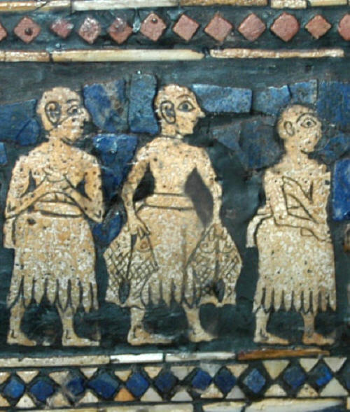
Standard of Ur Royal Graves at Ur, Sumeria, 2600 B.C., British
Museum,
photograph Brian W. Coad
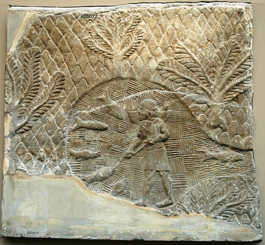
Assyrian fisherman about 700-692 B.C., Southwest Palace, Nineveh,
British Museum, photograph Brian W. Coad
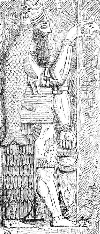
Assyrian fish god from Whymper's
"The Fisheries of the World",
1883
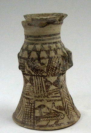
Fish do appear on bowls and other objects or in the round from archaeological collections and some are illustrated below courtesy of F. Biglari and the National Museum of Iran:-
Vessel 5th millennium B.C., Susa, Khuzestan
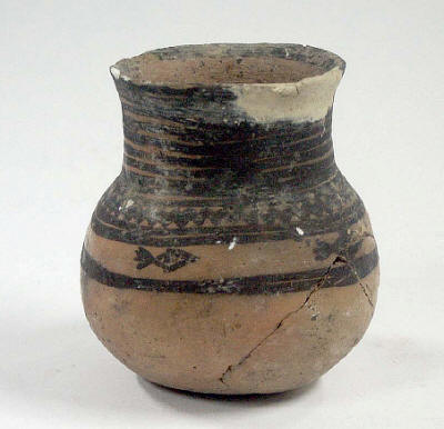
Vessel 5th millennium B.C., Tal-e Shoqa, Fars
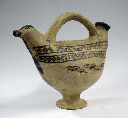
Rython, 3rd millennium B.C., Tal-e Shoqa, Fars
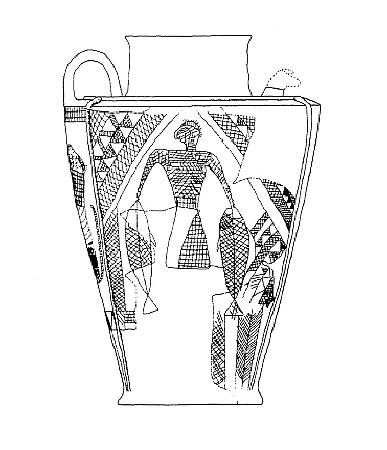
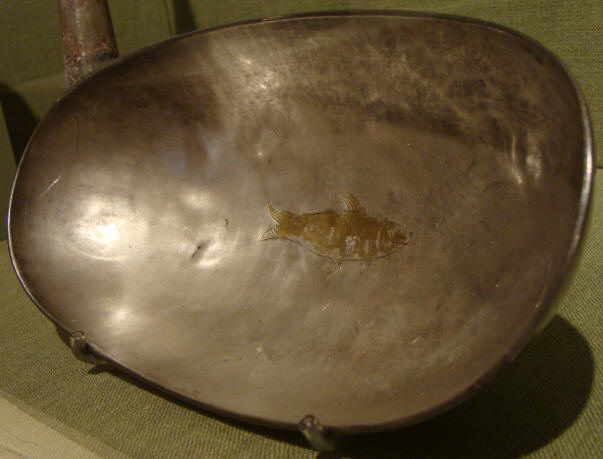
Jar, 4th millennium B.C., Choqa Mish, Khuzestan
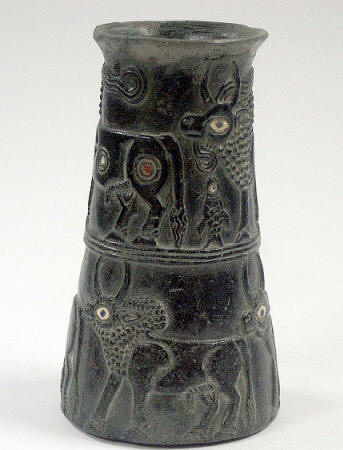
Chlorite vessel, 3rd millennium B.C., Jiroft, Kerman
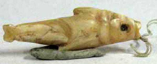
Ivory or bone 5th millennium B.C., Susa, Khuzestan
Sassanian bowl with fish, San Antonio Museum of Art (Wikimedia
Commons).
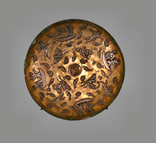
Gold and silver Sassanian plate showing a fishing party, Iran
Bastan Museum, Tehran
(Wikimedia Commons).
A'lam (1999b) briefly reviews fish in pre-Islamic Persian lore but most, if not all, the fishes referred to are unidentifiable today. Illustrations of fishes often occur in art work but are generally unidentifiable to species. One example is a 14.5 cm, 12th century bowl from Iran in the Victoria and Albert Museum, London. The bowl has shoals of fish in a rotating design painted in black slip on a frit ware bowl under a turquoise clear glaze (www.iranian.com/Arts/July97/Design/Page6.html, downloaded 10 June 1997). Governmental revenue from the Caspian fisheries have been recorded as early as 820-873 under the Taherids. Alam (no date) summarises the history of fisheries in Iran.
The Arabic work Aja'ibu-l-Makhluqat or "Wonders of Creation" by Zakariya b. Muhammad b. Mahmud al-Kammuni al-Qazwini published in 1263 A.D. and later translated into Persian and enlarged in 1275, records sharks entering rivers at the head of the Persian Gulf to Basrah on the Tigris and comments on their ferocity and their teeth like points of spears, swords or saws. Other Arabic and Persian works contain few recognisable species of freshwater fishes although the tenth century Kitab al-Tabikh from Baghdad contains some fish names such as bunni (= probably Mesopotamichthys sharpeyi) and shabbût (= probably Tor grypus)(Perry, 1998). Probably the best example of an early "scientific" Islamic work on zoology is the fourteenth century "Nuzhatu-l-Qulub" or "Hearts Delight" by Hamdullah Al-Mustaufi Al-Qazwini (translated into English by Stephenson (1928)). Only the "tarikh" is identifiable as a freshwater fish - Alburnus tarichi from Lake Van in modern Turkey.
Generally paintings of fish on historic items are insufficiently detailed to allow identification to species (see Stchoukine (1936) for some examples). However an interesting painting of a fish is found on a Persian miniature of the fourteenth century stored in the Metropolitan Museum of Art, New York (Dimand, 1934). The painting shows Jonah leaving the mouth of a fish. A colour figure of this painting is found in Gould and Atz (1996), although the image is reversed and a corrected colour version is in Coad et al. (2000). The painting is from Rashid ad-Din's Jami` al-Tawarikh or "Universal or World History" which contains accounts of various historical and mythical events, including the history of China and Mongolia, the Bible and incidents in the lives of Mohammad and Buddha. As Dimand (1934) points out, this book was highly favoured by Persian painters of the fourteenth century and several copies exist, the earliest being 707 A.H. (= 1307 A.D.). The painting, dating to about 1400 A.D., shows Jonah being cast up by a fish. The text on Jonah's arms however reads "The disk of the sun entered into darkness" on the left arm and "Jonah entered the mouth of the fish" on the right arm. The former, which was taken from the Gulistan (= Flower Garden) of Sa`di written in 1258, being a more poetic rendering of the latter. The angel, however, appears to be offering the naked Prophet a garment, and this, as well as the proximity of terrestrial vegetation, suggests he is leaving the mouth of the fish.
The fish undoubtedly was copied by the Persian artist from Chinese paintings (Rice, 1976; Blair, 1995). It most closely approximates some kind of carp but its mouth has been enlarged to accommodate the squatting figure, and the opercular opening approaches the eye too closely to make it a recognisable rendition of any particular species. There also are two dorsal fins (not found in any member of the carp family), and the pectoral fins are located too far from the head. Nevertheless, the fish does exhibit a number of well-observed features such as symmetrical, overlapping scales on the body with smaller ones on the caudal peduncle, paired and median fins with fin rays, and the absence of head scales and teeth.
In modern Iran, the fish is still a symbol of prosperity, blessings, abundance and happiness at Now Ruz, the Persian New Year on 21 March, when a live fish from a store (usually a goldfish) or local stream is kept in a bowl. In Persian mythology the earth is balanced on the horn a gigantic cow and as the new year starts the cow throws the earth from one horn to the other. The movement of the fish in the bowl when this happens shows that the new year has begun (Noorbaksh, 1995). Anahita, the ancient god of water, watched over people in their dealings with water and fish (Sajaadyeh, 1995).
A general survey of natural history studies in the Muslim world is given by Mirza (1983), an Islamic approach to the environmental crisis by Zaidi (1981), and Islamic principles for conservation by Ba Kader et al. (1983).
Travelers from Europe often wrote up accounts of their visits to Persia and some commented on the fishes although such comments were mostly of a general nature and species were rarely identified. An exception is the trout near Tehran and some of the older comments on these populations are given in the species description. A summary and translation into English of the earlier accounts may be found in Pinkerton (1758-1826). Adam Olearius noted that the king leased fishing in the rivers entering the Caspian. The lessees blocked the river from September to April near the mouth to catch migrating fishes. Outside this area anyone was free to fish. Sir John Chardin, in a series of English and French editions from 1686 to the early nineteenth century of his Description of Persia and Other Eastern Nations, briefly mentioned fishes (see quote at the beginning of this work, taken from Sykes (1927)) as did Fraser (1825; 1834), both authors observing the lack of diversity in a water-poor country but commenting on the presence of fishes in qanats. Continuing in full the abbreviated quote from Fraser (1825) at the beginning of this work:-
Cornelius Bruyn (1652-1719) (or Corneille LeBrun, de Bruin) depicts several fishes from his journey through Russia and Persia, mostly from the Persian Gulf, but including one called "sjir-majie" (= shir mahi or milk fish) which Heckel (1843b) identifies as Capoeta trutta and states that it is from Esfahan. Capoeta trutta is not found near the city of Esfahan. This illustration appears in volume 1, page 185, plate 69 of the Amsterdam edition in French published in 1718. However a reading of the text and examination of the illustration (slides kindly provided by Martine Desoutter of the Muséum national d'Histoire naturelle, Paris) show that the fish cannot be identified so clearly. No scales are shown and the colour pattern is unusual and unlike any Iranian freshwater fish. The colour pattern is vaguely reminiscent of Barbus lacerta, although much exaggerated. The illustration is possibly based on a Barbus or a Capoeta species. The author was in Esfahan on 23 November 1703 when describing the fish but the specimen is mentioned in the same paragraph as a "Lezard de mer....prend dans le Golfe Persique" and I take this to mean that the fish too may come from a locality on or near the Persian Gulf rather than the neighbourhood of Esfahan as Heckel (1843b) has it.
Floor (2003) devotes some considerable space to fisheries in Qajar Iran, not repeated here. The most important were the Caspian caviar fishery but also dried mullets were exported. Mullet were caught on mats stretched across a stream, the shadow of the mat causing the mullet to jump to avoid it and thus becoming stranded on the mat surface. The Russians controlled much of the Caspian fishery although there were also Persian concessionaires.
Scientific works relevant to Iran begin with the Systema Naturae, 10th edition, by Carolus Linnaeus (1701-1778) published in 1758 and in which scientific naming in zoology has its beginning. Linnaeus adopted many of the names from the system developed by Petrus Artedi (1705-1735) who, on a visit to Amsterdam to examine a collection of fishes from the East and West Indies, drowned in one of the canals. Genera subsequently found in Iran include Acipenser, Perca, Cobitis, Silurus, Salmo, Esox, Atherina, Mugil, Cyprinus, and Syngnathus and various species were described in these and other genera. After this date a variety of papers were published by authors in many countries describing fishes scientifically and some of these fishes were eventually found to occur in Iran, as with the Linnaean genera and species. Examples include Marc Elieser Bloch (1723-1799), a physician who began to devote himself to ichthyology at the age of 56, and Johann Gottlob Schneider (1750-1822) who collaborated with Bloch and published their "Systema Ichthyologiae" in 1801 after Bloch's death. This work contains all known species at that time (Bloch also wrote "Naturgeschichte der ausländischen Fische, 1785-1795) and in these works appear such Iranian species as diverse as the Indian stinging catfish, Heteropneustes fossilis, and the snakehead, Channa gachua (see Karrer et al., 1994); Johannes Müller (1801-1858) and Friedrich Gustav Jacob Henle (1807-1885) who published their "Systematische Beschreibung der Plagiostomen" in 1838-1841, the classical work on sharks and their relatives; Antoine Risso (1777-1845), an apothecary, who published in 1810 his "Ichthyologie de Nice" in which are described two mullet species (Liza aurata and L. saliens) and an atherinid (Atherina boyeri - see A. caspia) and in a later work (1826) the pipefish (Syngnathus abaster - see S. caspius) which are now recorded from Iran; and lastly Franz Steindachner (1834-1919), director of the "Kaiserlich-Königliches Naturhistorisches Hof-Museum (or Imperial-Royal Natural History Court-Museum - now the Naturhistorisches Museum at Vienna), who wrote so copiously on fishes from all over the world that any systematist eventually must consult his works, e.g. for the description of Schizopygopsis stoliczkae (1866) and Nemacheilus (= Oxynoemacheilus) angorae (1897)(see Kähsbauer, 1959; Adler, 1989; Herzig-Straschil, 1997). A number of fish species are named by others for Ferdinand Stoliczka (1838-1874), who collected extensively in the Himalayas and was appointed naturalist to the Second Mission to Yarkand, but who died on the way to Leh through hardships encountered on this journey (see Day, 1876; 1878).
Fish descriptions from the Middle East begin with the work of Fredrik Hasselquist (1722-1752) in his "Iter Palaestinum eller Resa til Heliga Landet Förrättad ifrån År 1749 till 1752" or "Voyage to the Holy Land Undertaken from the Year 1749 to 1752" which was published by Linnaeus in 1757 after Hasselquist "Succumbed to the fatigues and cares of the Journey" (Günther, 1869). Although this work appeared before Linnaeus' 10th Edition and is thus rejected as far as scientific nomenclature goes, it still contains recognisable and scientific descriptions of fishes.
Alexander Russell, physician to the British Factory at Aleppo from 1742?-1753, gave an account of four undescribed fishes from modern Syria in 1756 (see Russell (1794) for greater detail) of which Mystus pelusius and Mastacembelus mastacembelus were later found in Iran. The descriptions in this work are attributed to Daniel Carl Solander (1736-1782) and to Sir Joseph Banks (1743-1820) and Solander respectively (Wheeler, 1958). Since then a number of works have appeared on Middle East fishes and although many were restricted to Syria, the Jordan River basin or drainages of Anatolian Turkey they often contain descriptions of species also found in Iran (see Bibliography).
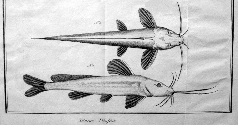
Mystus pelusius from Russell (1794), photograph Brian W. Coad
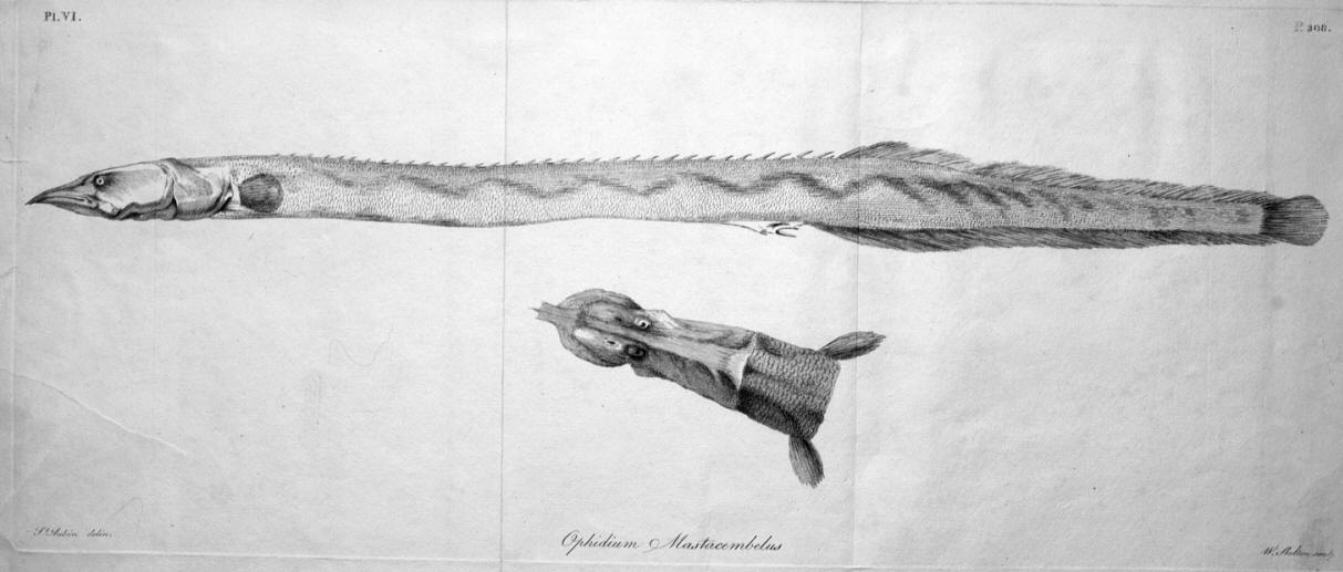
Mastacembelus mastacembelus from Russell (1794), photograph Brian W. Coad
Peter Simon Pallas (1741-1811) and Johann Anton von Güldenstädt (1745-1781) described species from the Caspian Sea basin but outside Iranian waters (Pallas, 1771, 1776, 1787, 1814; Güldenstaedt, 1772, 1773, 1778). von Güldenstädt was a naturalist on the expedition led by Pallas charged with exploring the Russian Empire of Catherine II. Pallas travelled to the Urals and eastwards while Güldenstädt went south to the Caucasus, only returning to St. Petersburg seven years later (Mearns and Mearns, 1988). Güldenstädt died in St. Petersburg at only 36 years of age from fever, his resistance weakened by diseases caught in the Caucasus. Pallas based some of his descriptions on the work of Samuel Gottlieb Gmelin (1743, 1744 or 1745-1774), an explorer and Professor of Botany at St. Petersburg employed by the Russian government who visited Gilan and Mazandaran in 1770-1772, living at Anzali for some months. Gmelin died a captive of a Caucasian chieftain, the Khan of Khaïtakes. A translated account in English of his travels in northern Iran is given by Floor (2007). It includes descriptions of fishes and fishing methods such as cast nets and gill nets.
Other important eighteenth and early nineteenth century authors describing and collecting fishes eventually found in northern Iran include A. Lovetzky and Johann Friedrich Brandt (1802-1879), Director of the Zoological Museum at St. Petersburg, who worked on sturgeons and described respectively Acipenser nudiventris and Acipenser gueldenstaedtii, and Karl Eduard von Eichwald (Eduard Ivanovich Eikhval'd) (1795-1876) who travelled to the Caucasus and Caspian Sea including Iran (1825-1826) and collected fishes although he was prevented from landing at Anzali by the Persian Governor. Eichwald's "Fauna Caspio-Caucasica" (1841) was of particular importance as it carried descriptions of new species and records of a variety of other fishes. Édouard Ménétries (= Menestrier) (1802-1861) was Curator of the Zoological Collection at St. Petersburg and collected fishes in the Caucasus during 1829-1830 and reached the Talish Mountains (Kuhha-ye Tavalesh). He listed a number of species found in the Caspian Sea and its tributaries in his Catalogue (1832). Alexander von Nordmann (1803-1866) described the fishes of the Black Sea in 1840 including gobies (Gobiidae) since found in the Caspian Sea and the herring Clupeonella cultriventris (= caspia) and the minnow Rutilus frisii.
Further to the east, there were Francis Buchanan (1762-1829) (see also under Scientific Names below) whose work on the fishes of the Ganges River in India with 269 species published in 1822 contains species later found at the westernmost extremity of their range in south-eastern Iran such as Aspidoparia morar (Gudger, 1924), and John McClelland (1805-1875) who described fishes collected by William Griffith (1810-1845) with the Army of the Indus in Afghanistan including the Helmand River basin which shares waters with Iran (McClelland, 1842). Some material was lost or badly damaged and the descriptions are "inadequate and highly confusing" (Hora, 1933).
Several authors worked on marine fishes in the Indian Ocean and Red Sea, describing species eventually found to penetrate or live in fresh waters of southern Iran. First among these was Petrus Forsskål (1732-1763), a Swedish member of a Danish expedition to the Red Sea in 1762 (Nielsen, 1993). Forsskål and four of his companions died and it was left to the sole survivor, Carsten Niebuhr (1783-1815), to publish Forsskål's fish descriptions posthumously in 1775. Some of Forsskål's specimens survive as dried skins in the Zoological Museum of Copenhagen. Forsskål was the describer of the milkfish, Chanos chanos. Wilhelm Peter Eduard Simon Rüppell (1794-1884) of the Senckenberg Museum, Frankfurt collected fishes in the Red Sea in 1822 and published "Fische des rothen Meeres" in his "Atlas zu der Reise im nördlichen Afrika" (1828-1830) followed by further field work in 1831 resulting in a second "Fische des rothen Meeres" in Neue Wirbelthiere zu der Fauna von Abyssinien gehörig (1835-1838). Rüppell described the tooth-carp Lebias dispar (= Aphanius dispar) now found throughout southern Iran. Later works are summarised by Dor (1984) and Dor and Goren (1994) for the Red Sea. The Persian Gulf fishes have received attention although there has been no comprehensive review of the fauna and its literature. Some principal works on this marine fauna include Blegvad and Loppenthin (1944), White and Barwani (1971), Randall et al. (1978), Relyea (1981), Sivasubramanian and Ibrahim (1982), Fischer and Bianchi (1984), Al-Baharna (1986), Kuronuma and Abe (1986) Asadi and Dehqani Posterudi (1996), and A'lam (1999a).
However, the most important early work on the Middle East and specifically on Iran is that of Johann Jakob Heckel (1790-1857), Inspector at the Imperial Royal Court Collection of Natural History in Vienna. He described the collections sent by Theodor Kotschy (1813-1866) to Vienna from "Syria" which includes such places as the Quwayq (= Coic, Kueik or Kuweiq) and Orontes rivers near Aleppo and Antioch, Damascus, the Jordan River, Mosul on the Tigris River and Kurdistan (Herzig-Straschil, 1997). In addition, collections were made in Iran from around Shiraz including the streams of the Maharlu basin in the Shiraz valley, the Kor River basin north of Shiraz, the Mand River (= Qarah Aqaj) which drains to the Persian Gulf and Lake Perishan (= Famur) near Kazerun. (Note that measurements used by Heckel are the "Wiener Zoll" = 26.34 mm comprising 12 "Linien" (= 2.195 mm) as opposed to the English inch (= 25.40 mm) from information courtesy of Dr. Barbara Herzig, Naturhistorisches Museum Wien). Heckel's descriptions appeared in Joseph Russegger's "Reisen in Europa, Asien und Afrika" in 1843 (volume 1, part 2) for the "Süsswasser-Fische Syriens" continued in 1846-1849 as a "Naturhistorischer Anhang" (usually dated 1847 for fishes dealt with here) followed by "Die Fische Persiens gesammelt von Theodor Kotschy" (both in volume 2, part 3). The Syrian collections contained a number of species later found in Iran. In total 70 species were described or mentioned from "Syria" and many of the specimens are still to be found in excellent condition in the Naturhistorisches Museum, Wien. Note that these collections contained numerous specimens (and still do) while the catalogue in Vienna lists relatively few, presumably those which Heckel intended to be the type series. Heckel's publications often do not give accurate counts of the specimens on which the species is founded. It is not always evident which specimens are types and the whole series from a type locality is regarded as syntypes.
The dating of Heckel's works is not clear for the "Naturhistorischer Anhang" and the "Die Fische Persiens..." parts which have 1846-1849 on the cover. According to the International Code of Zoological Nomenclature the final date is the correct one if it cannot be demonstrated that parts of the work have their own dates. The copies of Heckel's works I have seen (mostly xeroxes) do not seem to have individually dated parts or sections and so I had used 1849 for the date whereas many earlier authors have used 1846. The Catalog of Fishes and the Naturhistorisches Museum Wien favour 1847. This does not have any significant taxonomic complications as there are no other works with potential synonyms in this date range.
The nominal Iranian species numbered 22 and these too may be found in Vienna. Of 89 species described from Syria and Iran (two were deemed to be found in both countries and a third is listed merely as the trout), 72 were described as new species by Heckel, although all are not now recognised as valid. Heckel's new species from Iran may be summarised as follows:-
1. Barbus barbulus (= Luciobarbus barbulus)
2. Systomus albus var. alpina (= Carasobarbus luteus)
3. Scaphiodon amir (= Capoeta damascina)
4. Scaphiodon niger (= Capoeta damascina)
5. Scaphiodon macrolepis (= Capoeta aculeata)
6. Scaphiodon saadii (= Capoeta damascina)
7. Cyprinion tenuiradius
8. Discognathus crenulatus (= Garra rufa)
9. Alburnus iblis (= Alburnus mossulensis)
10. Alburnus schejtan (= Alburnus mossulensis)
11. Alburnus caudimacula (= Alburnus mossulensis)
12. Alburnus megacephalus (= Alburnus mossulensis)
13. Cobitis persa (= Oxynoemacheilus persus)
14. Acanthopsis linea (= Cobitis linea)
15. Lebias sophiae (= Aphanius sophiae)
16. Lebias punctata (= Aphanius sophiae)
17. Lebias crystallodon (= Aphanius sophiae)
In all, only 4 new species were discovered according to the modern interpretation of these taxa. In addition the following 21 species (under their modern names) described from Syria and Iraq by Heckel have since been found in Iran: Acanthobrama marmid, Aspius vorax, Barbus lacerta, Carasobarbus luteus, Luciobarbus esocinus, Luciobarbus kersin, Luciobarbus pectoralis, Luciobarbus xanthopterus, Capoeta trutta, Alburnus mossulensis, Chondrostoma regium, Cyprinion kais, C. macrostomum, Garra rufa, G. variabilis, Squalius lepidus, Tor grypus, Ovynoemacheilus frenatus, Silurus triostegus, Aphanius mento and Liza abu. Heckel therefore described 25 of the species now known from Iran, the highest proportion of the fauna by a single scientist.
Some of this material was sent on exchange or as gifts to other museums although it is not always clear in their records whether the material comprises types, e.g. the Muséum national d'Histoire naturelle, Paris contains specimens marked from Vienna or Heckel of Alburnus sellal from Persepolis (sic, possibly a Heckel species re-identified as sellal)(1638), Chondrostoma regium from Mosul (1635), Cyprinion kais from Mosul (1641), Cyprinion tenuiradius from Perse (1640), Garra rufa obtusa from the Tigris (1633), Garra rufa rufa from the Orontes (1634), and Squalius lepidus from Mosul (1636). The Museum für Naturkunde, Universität Humboldt, Berlin (ZMB) has some Heckel types listed as such, plus additional material marked as from the Wiener Museum with type localities such as Aleppo and Mosul but without dates. Some of these may also be part of Heckel's material but are not indicated as types in the catalogue. The Senckenberg Museum, Frankfurt also holds some Heckel material. All this additional material has not been investigated in detail by me as to type status, although some has been examined in these museums as indicated in the species descriptions.
At the time Heckel's descriptions came out a series of 22 volumes was being published in Paris covering all the fishes then known. This work by Baron Georges Léopold Chrétien Frédéric Dagobert Cuvier (1769-1832) and Achille Valenciennes (1794-1865) appeared from 1828 to 1849 and was a seminal work in ichthyology, the "Histoire naturelle des poissons" (see Bauchot et al. (1990) for more details). It contained new species and summaries of descriptions by other authors for a total of over 4500 fishes. New species from Iran were collected by Pierre Martin Rémi Aucher-Éloy (1793-1838), a French botanist and printer, who traveled extensively in Iran from 1835-1838, eventually dying at Julfa in Esfahan from "an excess of zeal for natural sciences" (Jaubert, 1843; Cuvier and Valenciennes, 1828-1849 (1844:298); Bauchot et al., 1990). In 1835 he traveled from Baghdad to Hamadan, Esfahan, Tehran and Tabriz and in 1837-1838 he visited Shiraz, Bushehr, Bandar Abbas and the Bakhtiari mountains. The fishes he collected were Leuciscus maxillaris (= Alburnus mossulensis), Leuciscus albuloides (= ? Alburnus chalcoides) and Chondrostoma aculeatum (= Capoeta aculeata) but collection data were poor, stating only "rivers of Persia".
A similar work was undertaken by Albert Carl Ludwig Gotthilf Günther (1830-1914) whose "Catalogue of the Fishes of the British Museum" in 8 volumes appeared from 1859 to 1870 and contained new descriptions and reviews of earlier works with over 6840 species described and over 1680 doubtful species mentioned. A new species from Iran later found there was Barbus (= Luciobarbus) subquincunciatus. Günther also founded the Zoological Record, an annual index of the zoological literature.
Several other works appeared between these major, synoptic works of Heckel, Cuvier and Valenciennes and Günther and the next major work on Iranian fishes by Berg (1949) and these are outlined below.
Graf Eugen Keyserling joined a scientific expedition in 1858-1859 sent by the Russian Imperial Government to explore Khorasan under the direction of the acting privy councilor N. Chanikoff. The difficulty of baggage transport limited the quantity of alcohol Keyserling could carry and early fish collections spoiled. However he did draw cyprinid fishes from nature and gave good descriptions of 9 new species and reported 2 others from what is now northwest and western Afghanistan south of Esfahan, Yazd and Khabis near Kerman. Only one of his new species is now regarded as a distinct species, namely Squalius latus.
Filippo de Filippi (1814-1867) an Italian zoologist, Professor at Turin and Director of the Museum (1848-1865), accompanied an Italian embassy to Persia in 1862 visiting Tabriz, Qazvin, Tehran, Rasht and the Caspian Sea. His companion the Marquis Giacomo Doria collected fishes as far south as Shiraz. Seventeen species were described from the Caspian basin and inland waters of Iran although locality data were poor in some instances (Coad, 1985). Seven species were described as new of which 2 are still regarded as full species (Acanthalburnus microlepis and Cobitis aurata).
Albert Günther, referred to above, also described collections and new species from the borders of Iran presented to the Natural History Museum (formerly the British Museum (Natural History)), London. The earliest of these was the collection made by William Henry Colvill at Baghdad which Günther referred to 9 extant species in 1874, including a freshwater shark, and 2 new species, Barbus (= Mesopotamichthys) sharpeyi and Macrones colvillii (= Mystus pelusius). Barbus faoensis (= Mesopotamichthys sharpeyi) was described from Fao (= Faw) in another paper in 1896. The Afghan Delimitation Commission was dispatched by the British government to mark the western borders of Afghanistan. J. E. T. Aitchison was appointed Naturalist and made collections, mostly on the Afghan side of the border, from Sistan to the Hari Rud which were described in 1889 by Günther. Seven species were discovered, 3 new, of which only Paraschistura kessleri is still recognised as valid. Robert Theodore Günther (1869-1940) was the first curator of the Lewis Evans Collection (1924) which later became the Oxford Museum for the History of Science in 1935. In the summer of 1898 he made collections of a variety of animals and fossils in the Lake Orumiyeh (= Urmia) basin, including fishes, through the assistance of the Persian authorities and the Archbishop of Canterbury's Mission to the Assyrian Christians. These were described by Albert Günther in 1899 and comprised 6 species already described elsewhere and 4 new species which are still regarded as valid names, with the exception of Leuciscus gaderanus (= Petroleuciscus ulanus also described in this work). The papers of R. T. Günther, containing some notes on fishes, were examined in the New Bodleian Library, University of Oxford in 2007.
Karl Fedorovich Kessler (1815-1881) was a Russian zoologist who helped organise the St. Petersburg Society of Naturalists in 1868 and later became its President for 11 years. Kessler worked on fishes of the Volga River and in 1877 published his important monograph on the "Fishes of the Aral-Caspian-Pontic Ichthyological Region". Kessler described in this and earlier works a number of species now found in Iran including the still valid species Caspiomyzon wagneri, Clupeonella grimmi, Alburnus filippii, Luciobarbus brachycephalus, Capoeta buhsei (from "Persia", apparently near Tehran (Berg, 1949)), Chondrostoma oxyrhynchum, Oxynoemacheilus brandti, Paracobitis longicauda, and Pungitius platygaster, plus a number of other species since synonymised and other valid species reported from the Caspian Sea basin but not yet recorded from Iran.
Francis Day (1829-1889), Inspector-General of Fisheries in India and Burma, was the leading nineteenth century ichthyologist of the Indian subcontinent, attaining this position from his initial career as a medical officer with the Madras establishment of the East India Company when fishes were but a hobby. His numerous studies have some items of relevance to Iran and his 1875-1878 monograph "The Fishes of India" with its 1888 Supplement and the two-volume "Fishes" in the Fauna of British India series contain useful data and descriptions of over 1400 species.
Henri Emile Sauvage (1844-?) described in 1882 and 1884 the fishes collected by Ernest Chantre of the Lyon Museum on a scientific expedition to Syria, upper Mesopotamia, Kurdistan and the Caucasus including several new species from the borders of Iran, namely Silurus chantrei (= S. triostegus ?) from the Kura River of the Caspian Sea basin (but Berg (1948-1949) suggests that this species was collected in Syria or the Tigris basin but without any explanation), Barbus microphthalmus from the Kura River (= Luciobarbus mursa) and Labeobarbus euphrati from the Euphrates River (= Luciobarbus esocinus).
Oscar von Grimm described two species of herrings (Clupeidae) from the Volga River at Astrakhan (Alosa kessleri and A. saposchnikowii), now known also from Iran.
Aleksandr Mikhailovich Nikol'skii (1858-1942) described in three papers the fishes collected by N. A. Zarudnyi (see below) in Iran. Nikol'skii was primarily a herpetologist, head of the herpetological department of the Zoological Museum of the Academy of Sciences in St. Petersburg, and later professor at Kharkov University in the Ukraine (Adler, 1989). These included the first record of Channa orientalis from Iran and the new species Capoeta fusca, Capoeta nudiventris (= C. fusca), Capoeta gibbosa (= C. capoeta), Aspiostoma zarudnyi (= Schizothorax zarudnyi), Barbus bampurensis (= C. watsoni), Cyprinion kirmanense (= C. watsoni), Nemacheilus (= Paraschistura) bampurensis, Nemacheilus (= Paraschistura) sargadensis, Discognathus rossicus (= Garra rossica) ?
Serghyei Nikolaevich Kamenskii of Kharkov University described in 1899-1901 "Die Cypriniden der Kaukasusländer" in two volumes which described a number of new species notably in the genus Barbus since synonymised.
Nikolai Andreevich Borodin (1866-1937) was Chief Specialist in Fish Culture in the Department of Agriculture and Professor in the Petrograd Agricultural College and later an exile in the U.S.A., becoming Curator of Fishes in the Harvard Museum of Comparative Zoology. He wrote a number of articles on the sturgeons and herrings of the Caspian Sea and discovered such new species as Acipenser persicus, Alosa braschnikowii, Clupeonella engrauliformis check others?. In 1908 he co-authored with E. K. Suvorov "Caspian herrings and their commercial exploitation", the results of the Caspian Expedition of 1904. Suvorov described Alosa curensis.
Erich Zugmayer (1879-?) collected fishes along the Mekran coast of what is now Pakistani Baluchistan describing, in 1912, 6 freshwater species including 5 new ones from internal and Sea of Oman basins close to or shared with those of Iran, namely at Panjgur in the Mashkel (= Mashkid) River drainage and the Dasht River drainage. A later work (1913) added additional records for Baluchistan. The specimens were deposited in the Zoological Museum, Munich (Zoologische Staatssammlung, München) but all fishes were destroyed in World War II on 25 April 1944 (Fritz Terofal, pers. comm., 1981; Neumann, 2006). Single type specimens were deposited in the Naturhistorisches Museum Wien (NMW) and the Zoological Survey of India, Calcutta (ZSI) of Labeo macmahoni (NMW 81256), Scaphiodon daukesi (NMW 19784, ZSI F8028, ZSI F8032), and Nemacheilus (= Paraschistura) baluchiorum (NMW 19851). None of the species has been collected in Iran.
William Thomas Blanford (1832-1905)(Anonymous, 1905) accompanied the Persian Boundary Commission in 1872, publishing a two-volume account in 1876. The Commission mapped the boundary between Persia and Baluchistan. Major (later Sir) Oliver St. John, with a collector from the Indian Museum, Calcutta, also made collections from 1869-1871. Fish collections were minor and not included in Blanford's books. Part of the collections was described by J. T. Jenkins in 1910 from material deposited in Calcutta. Blanford and St. John marched from Gwadar through Jalk, Bampur and Kerman to Shiraz, with Blanford carrying on alone through Esfahan to Tehran. One new species is from what is now Pakistani Baluchistan, close to the Iranian border in the Nihing-Dasht drainage (Scaphiodon baluchiorum = Cyprinion watsoni) while the remaining material, comprising 3 new species of tooth-carps, is from the neighbourhood of Shiraz. Further discussion about the tangled nomenclatural history of these little fishes can be found in the relevant Species Accounts.
(Thomas) Nelson Annandale (1876-1924) was founder and then Director of the Zoological Survey of India (Anonymous, 1925; Kemp et al., 1925; Adler, 1989). He and a co-author reviewed the fishes of Sistan (1920) collected by Colonel Sir A. Henry McMahon and other officers of the Seistan Arbitration Commission of 1901-1904 and by officers of the Zoological Survey of India in the winter of 1918. Nine species were described, one of which, (Nemacheilus macmahoni), formed the basis for a new genus, Adiposia, since synonymised with Nemacheilus and now Paracobitis. The McMahon collection had been examined by Charles Tate Regan (1878-?), later to be Director of the British Museum (Natural History), London (now the Natural History Museum) who found 2 new species out of 5 collected in his 1906 work (Scaphiodon macmahoni (= Cyprinion watsoni) and Nemacheilus rhadinaeus (= Paracobitis rhadinaea)), by Banawari Lal Chaudhuri of the Indian Museum, Calcutta in 1909 who reported a new loach (Nemacheilus macmahoni (= Paracobitis rhadinaea)) and by Annandale in 1919 who described 2 new species of Discognathus, D. adiscus (= Crossocheilus latius) and D. phryne (= Garra rossica).
Annandale's co-author on the "Fish of Seistan" was Sunder Lal Hora (1896-1955) who was to become the leading ichthyologist of India on a par with Hamilton and Day, and Director of the Zoological Survey of India.
A. Ya. Nedoshivin and B. S. Iljin produced two lengthy papers in Russian in 1927 and 1929 on fishery capture data for Iranian waters, forming an important historical record.
Alfons Gabriel and his wife collected fishes in the neighbourhood of Bandar-e Abbas including the Genu hot spring and the Baschakird Mountains. This material was described in 1929 by Maximilian Holly of the Naturhistorisches Staatsmuseum in Vienna and contained Cyprinodon (= Aphanius) ginaonis and Barbus baschakirdi (= Cyprinion watsoni) from fresh waters.
Viktor Pietschmann (1881-1956), originally Steindachner's assistant and later (1919-1946) in charge of the fish collection at the Naturhistorisches Museum Wien, described Mugil pseudotelestes (= Liza abu) and Glyptothorax steindachneri (identification uncertain) from the Tigris River basin in Iraq based on materials collected on the Mesopotamian Expedition in 1910 (Kähsbauer, 1957).
Lev Semenovich Berg (1876-1950) was a leading Soviet physical geographer and biologist. From 1930 until his death, he was head of the "Special Laboratory of Ichthyology" of the Zoological Institute of the Academy of Sciences of the U.S.S.R. in Leningrad and an Academician (Oliva, 1977). His contributions to the ichthyology of the former U.S.S.R. and to that of Iran appeared in a number of shorter articles and in lengthy monographs from the late nineteenth century onwards. The shorter works are listed in the Bibliography and include descriptions of such new species as Alosa sphaerocephala, Barilius mesopotamicus, Alburnus atropatenae, Garra persica, Nemacheilus cristatus (= Metaschistura cristata), Glyptothorax kurdistanicus, Anatirostrum profundorum, Knipowitschia caucasica and Knipowitschia iljini. His summary work "Freshwater Fishes of the U.S.S.R. and adjacent countries" was published in 1948-1949 and in English translation in 1962-1965 and has much of relevance to northern Iran, although the taxonomy is now dated. His 1940 work on the "Zoogeography of freshwater fish of the Near East" placed that fauna in context and included Iran but it was his 1949 work "Freshwater Fishes of Iran and adjacent countries" which has been the major modern work on Iranian fishes south of the Caspian Sea basin and the Lake Orumiyeh basin. This was based on collections deposited in the U.S.S.R. Academy of Sciences Zoological Institute in Leningrad (acronym ZIL, now St. Petersburg, Russia with the acronym ZISP). The collections had been made by two Russian biologists. The first of these was Nikolai Alekseevich Zarudnyi (1859-1919), a zoologist and ornithologist who made four journeys to Iran for which he was awarded medals and the Przheval'skii Prize by the Russian Geographical Society. His first journey in 1896 was to Kuchan, Sistan and Mashhad, his second in 1898 was to eastern Khorasan and Beluchistan, the third (1900-1901) was to Khorasan, Sistan and Beluchistan including the Bampur region and the Makran, and the last journey (1903-1904) was to Gorgan, western Khorasan, western Kuhistan, southern Irak-Ajemi and Khuzestan. Zarudnyi's material had previously been examined and described by Nikol'skii (see above). The second biologist was P. V. Nestorov who worked with the Turko-Persian Demarcation Commission in 1914 and collected fishes in the Tigris basin along the present Iran-Iraq frontier.
The Zoological Museum of the Lomonosov Moscow State University (MSU) contains collections from the Caucasus and Transcaucasia including the Kura River basin and Azerbaijan but none apparently from Iran (Verigina, 1991).
Anton Bruun (1901-1961 - see Spärck (1962)) was the lead author on the description of Iranocypris typhlops, the Iranian cave fish, later the reason and subject of popular books and articles by Anthony Smith (see Bibliography).
Relevant works since 1950 can be found in the Bibliography and encompass a wide range of papers and books of varying quality and utility. There has been a rapid increase in studies on fishes of Iran, starting in the 1990s. Prior to 1900, this Bibliography lists less than 100 publications relevant to this work, many not strictly on Iranian fishes. On a decadal basis, it is only in the 1960s that publications exceed 100 and by the 1990s are an order of magnitude larger.
Several books have appeared in recent years in Farsi on Iranian freshwater fishes and include "Freshwater Fishes" by Vossughi and Mostajeer (1994), "Identification of some freshwater fishes of Khuzestan Province" by Najafpour (1997), "Atlas of Iranian Fishes. Gilan Inland Waters" by Abbasi, Valipour, Talebi Haghighi, Sarpanah and Nezami (1999), "Freshwater Fishes of Iran" by Mohammadian (1999), "The Inland Water Fishes of Iran" by Adoli (2000), "A Guide to the Fauna of Iran" by Firouz (2000; in English as "The Complete Fauna of Iran", 2005), "Iranian sturgeons in the Caspian Sea (Systematic, biology, artificial propagation, biomass evaluation and conservation, fishing and production of caviar" by Keyvan (2003), "Freshwater fishes of Khuzestan Province (Part II)" by Najafpour (2003), "Fish Species Atlas of South Caspian Sea Basin (Iranian Waters)' by Naderi and Abdoli (2004), "A Biological Review of Caspian Sturgeons" by Sarafraz and Akbarian (2005), "Applied Ichthyology" by Hedayatifard and Ramezani (2007), "Biodiversity of Fishes of the Southern Basin of the Caspian Sea" by Abdoli and Naderi (2009), and, in English, "Fishes of Tehran Province and adjacent areas" by Coad (2008).
A report on water laws and institutions in Iran was authored by Dezfouli (1996) and gives some background on legislation affecting fish habitats through regulation of water abstraction and pollution prevention.
Several general works on zoogeography of fishes have encompassed Iran as part of their study. These include Berg (1933b; 1940), Banarescu (1960; 1977; 1992b) and Por and Dimentman (1989). Most of Iran is part of the West Asian area, which includes southern Anatolia, the Levant, and the Arabian Peninsula, or an Iranian Province which excludes the Caspian Sea, Lake Orumiyeh and Persian Gulf and Sea of Oman drainages. Berg (1940) lists the following districts within the Iranian Province: the Tehran District (= Namak Lake basin here), the Turkmen District (= includes the Tedzhen or Hari River basin here), the Sistan District (= Sistan basin here), and a Fars District (= the rest, or the basins Dasht-e Kavir, Esfahan, Kerman-Na'in, Sirjan, Lake Maharlu, Kor River, Hamun-e Jaz Murian, Hamun-e Mashkid, Dasht-e Lut, and Bejestan here). The Caspian Sea drainage is regarded as a separate area. The fauna is a mixture of elements from the European (western Palaearctic), the Mediterranean, southern Asia, High Asia and Africa and should be regarded as a transitional region (various views briefly summarised in Mirza (1994b; 1995)). Zoogeography is dealt with here in the individual Species Accounts with some mention in the drainage basin accounts.
A brief history of Afghanistan ichthyology is given in
Coad (1981d) and Petr (1999), of Pakistan in Mirza (1978) and Bilqees et
al. (1995). Literature, and therefore history, on Turkey is summarised
in Coad and Kuru (1986) and Fricke et al. (2007), and on Iraq and the Tigris-Euphrates basin in Coad
and Al-Hassan (1989). Much of the earlier Russian literature on the Caspian
Sea and adjacent waters is given in Romanov (1955).
Freshwater fisheries are increasing in Iran and with this exploitation there is a commensurate need for an understanding of the whole ichthyofauna. Coad and Abdoli (1996) and Coad (1998; 1999) review the biodiversity of Iranian freshwater fishes. Reviews of fisheries, including aquaculture, can be found in the magazine Abzeeyan, e.g. Anonymous (1992c) and Madbaygi (1992), at the Food and Agriculture Organization of the United Nations website (www.fao.org), at www.agri-jahad.org, the Iranian ministry concerned with fisheries, at the Caspian Environment Programme (CEP), Baku, Azerbaijan at www.caspianenvironment.org and in various articles such as Matinfar and Nikouyan (1995), Nash (1997a, 1997b), Mehrabi (2002), Sadeghi and Agheli (2002), Saeedi (2002), Falahatkar and Nasrollazadeh (2011) and Alam (no date). Additional information is found under each of the Species Accounts, in particular for sturgeons (Acipenseridae), the most valuable fishery.
Fisheries data from various sources (and sometimes the same source) are not always compatible or comparable. The data should be treated as indicative of trends and relative fishing pressure between species. Some years may have been inadequately reported, data is incomplete, sources for figures are disparate, poaching levels have varied, and low numbers may not reflect actual catches.
Early accounts of fisheries along the Caspian shore of Iran are given by Nedoshivin and Iljin (1927; 1929), Vladykov (1964) and Keddie (1971). The freshwater fish catch increased from 6954 tonnes/year in 1974-1976 to 24,613 tonnes/year in 1984-1986, a 254% increase and five times the world average (Gleick, 1993). Inland fisheries finfish production was 30,924 tonnes in 1986 and in 1992 Iran had an inland capture fishery of 40,000 t, as did Turkmenistan; Kazakhstan had 80,000 t, Uzbekistan 27,439 t, Azerbaijan 36,371 t, Iraq 4400 t, and Armenia 4500 t (Food and Agriculture Organization, Rome, Inland Water Resources and Aquaculture Service, Fishery Resources Division, 1995a). The Caspian Sea fisheries grew from 25,987 t to 98,000 t in the decade 1990-2000 (www.agri-jahad.org, downloaded 3 November 2003). Saheli (1999) gives figures that show total aquatic production was dominated by Persian Gulf and Sea of Oman fisheries in 1995 at 63%, the Caspian Sea occupied 15% and inland waters 15%, the remainder being from international waters. Petr and Marmulla (2002) give an average catch of 30,000 t for 1995-1999 in inland waters. Kilka was the most important factor for increased catches in the Caspian and aquaculture in inland fisheries. The catch in 1998 was 75,000 t for inland waters (IRNA, 15 June 1999) - catch records vary between sources but give a general idea of the importance of freshwater fisheries. The value of all fish production in Iran rose to 1046 billion rials in 1996 from 171 billion rials in 1989 (Tehran Times, 27 July 1998). Freshwater landings increased from 22,177 t in 1985 to 115,000 t in 1994 (Food and Agriculture Organization, Fisheries Department, 1996). Cold and warm water fish production was 67,000 t in 2001 with per capita annual consumption at 5.2 kg. Production was expected to rise to 220,000 t in 2000-2005 (IRNA, 11 November 2001). Per capita yields for inland capture fisheries in kilogrammes after Food and Agriculture Organization, Rome, Inland Water Resources and Aquaculture Service, Fishery Resources Division (1995a) was as follows and shows marked increases over these years:-
| 1987 | 1988 | 1989 | 1990 | 1991 | 1992 |
| 0.321 | 0.329 | 0.342 | 0.444 | 1.038 | 0.667 |
These values compare with neighbouring countries as follows for the
same period:- Iraq (range 0.182-0.672), Turkey (0.666-0.903),
Afghanistan (0.079-0.102) and Pakistan (0.773-0.874). Per capita supply of
cultured fish was 1.3 kg in 2003 while capture fisheries yielded 5.1 kg (Food
and Agriculture Organization, Fisheries Department, 2006). This same publication
gives fish consumption in kilogrammes per capita as follows:-
| 1969-1971 | 1979-1981 | 1990-1992 | 1995-1997 | 2000-2002 |
| 0.7 | 1.5 | 4.4 | 4.7 | 4.7 |
Catches in the Caspian Sea for 1991 and 1992 were 3036 t and 2692 t of sturgeons respectively, 13,817 and 21,527 t of kilka (herrings of the genus Clupeonella, family Clupeidae), and 18,571 and 16,873 t of bony fishes. The herring catch reached 51,000 t in 1994 from none 10 years previously (Food and Agriculture Organization, Fisheries Department, 1996). The FAO also records that the silver carp catch went from none in 1989 to 24,720 t in 1994. In inland waters the catches of warm water fish were 19,947 t and 21,462 t, of cold water fish 579 t and 775 t (both presumably from fish farming) and from "natural resources" 24,905 t and 20,183 t. These catches (totals 80,855 t and 83,512 t) are less than the totals for the marine catches in the Persian Gulf and Sea of Oman at 277,000 t and 271,000 t but are still significant (Abzeeyan, Tehran, 5(9):III, 1995).
In 1996, the total Caspian Sea catch was 58,000 t while the southern, marine fisheries reached 265,000 t. The gross value of all catches (1995) including marine fish and shrimps was U.S.$45 million while fish imports were at $65 million. Caviar made up nearly 60% of exports in 1994 and nearly half of imports are fish meal. The industry had 111,800 primary employees in 1995, including about 8000 fish farmers. Most fish (70%) is eaten fresh, 15% is frozen and canned, with some smoked or salted and the remainder is made into fish meal (Food and Agriculture Organization, Fishery Country Profile, 1997, at www.fao.org/waicent/faoinfo/fishery/fcp/irane.htm). In 1998, the annual fish catch was listed as 65,000 t with the aim of raising the catch to 110,000 t by the end of the 1995-1999 economic development plan. It was estimated that 150,000 t could be obtained from 500,000 ha of ponds and dam reservoirs (IRNA, 23 October 1998).
TACIS (2002) demonstrates the growth in catches in the Caspian Sea basin of
Iran as follows. The kilka catch was 2000 tonnes per year in 1932-1959, 63,300
t/y in 1996-1998, mullets 390 t/y growing to 4560 t/y, and total catch 7440 t/y
to 81,360 t/y. Nezami et al. (2000) gives the following figures for fish
harvested from Caspian coastal provinces in Iran:-
Golestan:-
| Species/Year | 1997-98 | 1998-99 |
| Rutilus frisii | 174,869 kg | 191,680 kg |
| *Rutilus rutilus | 20,124 kg | 18.025 kg |
| Mugilidae | 43,016 kg | 229,487 kg |
| Cyprinus carpio | 229,734 kg | 260,890 kg |
| Other | 2712 kg | 10,529 kg |
| Total | 470,455 kg | 710,611 kg |
*May include R. caspicus as these taxa were not distinguished.
This province demonstrates a great variation in mullet catch between years.
Mazandaran (1998):-
| Species | tonnes |
| Cultured fishes | 12,363 |
| Rutilus frisii | 2174 |
| Mugilidae | 1533 |
| Clupeonella (kilka) | 31,583 |
| Other bony fishes | 374 |
| Total | 48,027 |
Gilan (1997):-
| Species | tonnes |
| Clupeonella (kilka) | 36,077 |
| All bony fishes | 2813 |
| Acipenseridae (sturgeons) | 264 |
| Total | 39,154 |
Unauthorised fishing in Gorgan Bay in the southeastern Caspian was estimated at 167,681 kg in 2000-2001 (Kamran, 2006). Mullets (Liza aurata and L. saliens) comprised 35.7% of the catch.
The biomass of fishes in the Iranian Caspian is estimated at 556,530 t,
12.7% of the total for the sea, with a fish density of 50.6 tonnes/nautical mile
(the lowest values of any Caspian state)(Ivanov and Katunin, 2001). The Caspian
Environment Programme (1998) gives the following tables for bony fish production
in the Iranian Caspian Sea (tonnes) in recent years:-
| Year/Species | Kilka (Clupeonella spp.) |
Rutilus frisii |
Mugilidae | Salmo trutta (= caspius) |
Cyprinus carpio |
Sander lucioperca |
Abramis brama |
*Rutilus rutilus |
Alosa
pontica (= kessleri) |
Silurus glanis |
Others | Total |
| 1973 | 1013 | 2.63 | 927.3 | 2.9 | 93.5 | 2.2 | 0.3 | 22.5 | 2 | 6 | 19.2 | 2091.53 |
| 1974 | 1170 | 338.6 | 403.5 | 1.3 | 101.6 | 2.8 | - | 34.6 | 2 | 10 | 20.6 | 2085 |
| 1975 | 1286 | 695.7 | 963.4 | 1.4 | 84.4 | 9 | 0.3 | 29.5 | 4.5 | 6.5 | 27.8 | 3108.5 |
| 1976 | 900 | 1231.8 | 2004.6 | 1.1 | 47.4 | 6.8 | 2.4 | 94.8 | 5.5 | 5.5 | 33 | 4332.9 |
| 1977 | 1261 | 530.6 | 1297.9 | 1.5 | 40.1 | 11.2 | 1 | 18.6 | 2 | 5 | 36.5 | 3205.4 |
| 1978 | 771 | 191.1 | 373.8 | 0.7 | 13 | 2.8 | 0.06 | 3.6 | - | 2.5 | 9.8 | 1368.36 |
| 1979 | 836 | 84.1 | 352.4 | 0.6 | 69.6 | 0.4 | - | 11.9 | - | 0.1 | 2.6 | 1357.7 |
| 1980 | 619 | 158.2 | 1411.7 | 0.3 | 69.6 | - | - | 71.2 | 0.1 | - | 3.5 | 2333.6 |
| 1981 | 1341 | 252.1 | 408.3 | 0.4 | 129 | 1.6 | - | 217.4 | 0.4 | 2.5 | 9.7 | 2362.4 |
| 1982 | 798 | 342.3 | 2674.7 | 1.1 | 128.4 | 13.5 | - | 915.5 | 10.4 | 3.5 | 15.7 | 4903.1 |
| 1983 | 621 | 277.9 | 1637.7 | 0.7 | 160.2 | 4.1 | - | 108.6 | 1.6 | 3.5 | 16.7 | 2832 |
| 1984 | 1517 | 252.3 | 1219.5 | 1.2 | 173.4 | 3.5 | - | 384.4 | 20.3 | 3.5 | 17.2 | 3592.3 |
| 1985 | 1828 | 174.5 | 1402.9 | 1.1 | 16.4 | 0.7 | - | 200.5 | 34.8 | 3.5 | 10 | 3672.4 |
| 1986 | 2450 | 110.4 | 177.2 | 0.7 | 3.4 | 0.16 | - | 27.4 | 71.9 | 3.5 | 1.7 | 2846.36 |
| 1987 | 4389 | 162.7 | 109 | 0.5 | 19.5 | 0.2 | - | 6 | 13 | 3.8 | 10.5 | 4714.2 |
| 1988 | 4700 | 5000 | 1750 | 0.5 | 20 | 5 | 0 | 100 | 16 | 3.5 | 105 | 11,700 |
| 1989 | 7902 | 6500 | 2380 | - | - | 5 | - | 130 | 30 | - | 2068 | 015 |
| 1990 | 8814 | 8500 | 1503 | 110 | - | 10 | - | 100 | 30 | 1000 | 3671 | 23,738 |
| 1991 | 13,817 | 12,000 | 2500 | 130 | - | 100 | - | 120 | 35 | 1000 | 2686 | 32,388 |
| 1992 | 21,527 | 12,000 | 2200 | 130 | - | 100 | 20 | 120 | 35 | 1000 | 1445 | 38,577 |
| 1993 | 28,730 | 12,727 | 5135 | 1 | - | 16 | 17 | 714 | 893 | 670 | 2155 | 51,058 |
| 1994 | 51,000 | 9277 | 2809 | 1 | - | 95 | 29 | 1366 | 720 | 28 | 2475 | 67,800 |
| 1995 | 41,000 | 8435 | 5014 | 13 | - | 10 | 5 | 1178 | 490 | 5 | 650 | 56,800 |
| 1996 | 57,000 | 9222 | 2554 | 8 | - | 6 | 3 | 878 | 330 | 22 | 2477 | 72,500 |
*May include R. caspicus as these taxa were not distinguished.
Abdolmalaki and Psuty (2007) give figures over a wide range of years for Iranian coastal catches in the southern Caspian Sea as follows:-
| Catch and frequency | 1927-1936 | 1937-1946 | 1947-1956 | 1957-1966 | 1967-1976 | 1977-1986 | 1987-1996 | 1997-2003 |
| Total recorded catch (t) | 8959 | 7224 | 4986 | 3262 | 5547 | 5384 | 16,903 | 16,201 |
| Sander lucioperca (%) | 29.7 | 1.7 | 1.0 | 0.2 | 0.4 | 0.1 | 0.1 | 0.2 |
| Sturgeon meat + caviar (%) | 13.4 | 8.8 | 16.3 | 50.9 | 40.9 | 34.2 | 9.4 | 5.0 |
| Cyrpinus carpio (%) | 9.8 | 8.5 | 1.8 | 2.5 | 2.6 | 1.1 | 6.3 | 6.1 |
| Rutilus frisii kutum (%) | 12.2 | 43.0 | 24.9 | 25.8 | 17.8 | 19.8 | 53.2 | 45.4 |
| *Rutilus rutilus (%) | 20.7 | 25.5 | 18.8 | 0.7 | 0.8 | 2.3 | 5.8 | 6.1 |
| Alosa spp. (%) | 1.9 | 6.2 | 14.7 | 2.9 | 0.3 | 0.2 | 3.2 | 3.9 |
| Liza aurata and L. saliens (%) | 0 | 1.8 | 20.9 | 15.8 | 36.1 | 42.2 | 19.7 | 28.9 |
| Other species (%) | 12.3 | 4.5 | 1.6 | 1.2 | 1.1 | 0.2 | 2.5 | 4.4 |
*May include R. caspicus as these taxa were not distinguished.
The Statistical Center of Iran (www.iranworld.com/Indicators/isc-t023.asp, downloaded 4 April 2005) gives kilka catches for 1997 as 60,400 t, for 1998 as 85,000 t and for 19919.79 as 95,000 t.
The bony fish catches in the Iranian Caspian Sea waters for 1999-2000 were given by D. Ghaninejad (5th International Symposium on Sturgeon, Iranian Fisheries Research Organizatio, 9-13 May 2005, Ramsar). Beach seine cooperatives took 11,170 t and the total catch, allowing for poaching, was estimated at 16,860 t. The total kutum (Rutilus frisii) catch was 1400 t and this species had an estimated biomass in Iranian waters of about 22,000 t. The catch of Liza aurata was estimated at 3559 t with about 22% undersized and the biomass estimated at 11,100 t. Cyprinus carpio biomass was very low and was estimated at 4200 t. The Rutilus rutilus (presumably includes R. caspicus) catch was estimated at 1340 t for 2000-2001, mostly poached with gill nets, and Sander lucioperca at 18 t for the same period, mostly undersized and immature. The total catch of Abramis brama was estimated to be 17 t, again undersized and immature.
Catches in the Caspian Sea showed no differences between 7 regions based on catch-per-unit-effort (cpue) (Mirzajani et al., 2005). Catches varied from 88 to 459 kg/cpue for 1991-92 and 31-418 kg/cpue for 1994-95. In 2000-01, the Anzali region had the highest values, significantly different from the Astara-Hashtpar and east of Gilan province regions.
Beach seines are known as pareh in Farsi, usually referring to a seine without a cod-end. Beach seine cooperatives increased from 68 in 1989 to 151 in 2004 while the numbers of fishers doubled from 6000 to 12,000. About 85-100 people are members of each beach seine cooperative. The beach seines are 1000 m long, with a cod-end 10-15 m wide and 100 m long and with a mesh size legally fixed at 30 mm (smaller meshes are used too). They are hauled in by tractors. Although there are minimum sizes for fish retention, e.g. 34 cm fork length for Sander lucioperca, fisheries do retain smaller ones for home consumption or even marketing (Abdolmalaki and Psuty, 2007). Some further details on Sander lucioperca catches are given in the appropriate Species Account. Ghorbani et al. (2010) surveyed fish catches in beach seine cooperatives in Golestan Province in 2005-2006, species caught varying with zones and their bottom composition and hence available prey items.Taghavi Motlagh et al. (2011a, 2011b) compared beach seine height and mesh size on fish catches in the Caspian Sea, with a 20 m seine height catching more than a 24 m seine and 33 mm mesh catching more Rutilus kutum and less Liza aurata than a 30 mm mesh.
Salehi (2008c) summarises the Iranian Caspian fisheries for bony fishes. In 2006 the industry employed more than 10,000 fishermen with 142 co-operatives managing the industry. Average yearly production was over 18,000 t for 1980-2006. Landings of Rutilus kutum were estimated to average 46.6% of the total bony fish catch from 1983 to 2006 due to the stock enhancement project for this species. Average fingerling production of this species from 1981 to 2006 was 191,776,000 fish (17,536,000 for sturgeon, 18,024,000 for Abramis brama and 11,012,000 for Rutilus rutilus). Beach seines are back in use as the gill nets of the 1980s were found to adversely affect sturgeon stocks. Each net may require up to 100 people and a tractor to operate. Re-introduction of beach seines partly accounts for catches rising from 17,629 t in 1993 to 21,845 t in 2005 and 23,802 t in 2006. Ghaninezhad and Abd Almalaki (2009) give further details on bony fish exploitation in the Caspian Sea and Alyan (2010) comments on declines in the fishery.
Caviar and sturgeon catches from the Statistical Center of Iran (www.iranworld.com/Indicators/isc-t023.asp, downloaded 4 April 2005) were as follows (note that the Iranian years run from March to March, so the western years are an approximation here and in the above table) :-
| Year | Beluga caviar | Beluga meat | Asetra caviar | Asetra meat | Sevryuga caviar | Sevryuga meat |
| 1995 (1374) | 6 | 135 | 68 | 516 | 108 | 512 |
| 1996 (1375) | 7 | 165 | 96 | 669 | 92 | 461 |
| 1997 (1376) | 5 | 126 | 81 | 550 | 65 | 324 |
| 1998 (1377) | 6 | 168 | 92 | 684 | 59 | 348 |
| 1999 (1378) | 4 | 141 | 57 | 569 | 36 | 290 |
The whole fisheries industry, including the Persian Gulf marine fin fisheries and shellfish, received an investment of 500 billion rials by government and 800 billion rials by the private sector, apparently for the period 1989-1993. Nine billion rials were allocated to aquaculture by the government in 1993, planned to rise to 23 billion rials in 1994, and to 210 billion rials in the next five-year economic development plan. In 1995, 200 billion rials were allocated to preparation and provision of infrastructure activities for fish farming (http://netiran.com/news/IranNews/html/9503131INEC.html). A national project to expand fish farming within a six-year period would raise annual production by 50,000 t, create 30,000 jobs, earn $50 million a year and increase consumption of fish to 10 kg per person (IRNA, 22 January 2000). Consumption of fish in Iran is estimated at 5 kg per capita, having risen from 1 kg in the decade prior to 1999 and is expected to rise to 6.5 kg in the next five-year economic plan (by the year 2000) and to 10 kg by 2004 (later revised to 8.5 kg by 2005 (IRNA, 25 September 2000)). Per capita consumption of fish increased due to increased production but also a government policy of lower prices than for meat and poultry (IRNA, 6 March 1999; 31 May 1999). In 1993, 350,000 t of seafood products were produced comprising 30% of the country's protein requirements and a sevenfold increase over catches before the Islamic Revolution in 1979 (Abzeeyan, Tehran, 4(9):VI, 1993). The annual fisheries output was expected to reach 1 million tons by the year 2004 from a 1999 level of 400,000 tons (IRNA, 6 March 1999). Fish exports were expected to earn Iran $400 million and create 150,000 jobs by 2004. The 1999-2000 government budget allocated 300 billion rials to fisheries (IRNA, 6 March 1999). In 1998, Rana and Bartley (1998) report the average per capita fish consumption in Iran to be 4.5 kg, low compared to the world average of 13.5 kg. The Government's plan is to increase consumption to 6.5 kg by the year 2020 which would require an increase in fishery production from 382,000 t in 1995 to 670,000 t; these amounts conflicting with news reports.
Adeli and Shaabanpour (2007) looked at consumption of aquatic products in Tehran in 2001 and 2005. Per capita consumption rose from 2.8 to 3.46 kg, 16.6% of people preferred more packaged food, and farmed aquatics were consumed more than other products, live rainbow trout being preferred the most. Adeli et al. (2011) found fish consumption per capita in Tehran was 13.3 kg in 2008, with 6.4 k from farmed fishes, 5.8 kg from wild fishes and 1.1 kg from canned fishes. Protein preferences were poultry, mutton, beef, trout, wild fishes and Chinese carps. Salehi and Mokhtari (2008) investigated attitudes in fish consumption among Iranian nutrition experts. The experts listed various factors such as fish market expansion, advertisements and promotions, health factors, and quality and trust in the seller as having effects on the increase of fish consumption in Iran.
The Caspian Sea at this time produced 60,000 t and other inland waters 59,000 t. These waters would have production increased to 420,000 t by 2020. Aquaculture has a high priority in this plan and expanded at 8.2% per year during 1990-1996, the value in 1996 being U.S.$306.6 million for a production of 30,000 t. However aquaculture production for 1988 was only exceeded in 1995 (www.fao.org/fi/publ/circular/c886.1/wasia3.asp).
Over 975 million fingerlings were released into the Caspian Sea and inland waters from hatcheries or given to fish farmers to be cultured in ponds during the first five-year plan, 1989-1993. During the next five-year economic plan, the catch was expected to increase to 2.6 million t from 1.309 million t and 1.9 billion fingerlings would be released (Abzeeyan, Tehran, 4(9):V, 1993). The "Iranian Fisheries Research and Training Organization" was expected to have a budget of 35 billion rials by the end of 1993, indicative of the importance attached to developing fisheries in Iran (Abzeeyan, Tehran, 4(5):IV, VII, 1993).
Prior to the Islamic Revolution in 1979, the Iranian fisheries were divided into two companies, known as Shilat in Farsi, a northern one centred on the Caspian Sea and a southern one centred on the Persian Gulf. The combined companies, known as the Iranian Fisheries Organization or Shilat, were under the Jihad-e Sazandegi Ministry, starting in 1987. Jihad-e Sazandegi translates as "Construction Crusade" and is indicative of the attempt to develop the fisheries to serve the growing population of Iran. The Organisation is now known as Jihad-e Agriculture as of the year 2000. The Iranian Fisheries Research and Training Organization officially commenced its activities in 1990 and is now known as the Iranian Fisheries Research Organization . It has departments of Research, Training, Scientific Information and Administration and Research Centres at Bandar Anzali and Sari in the north of Iran and at Bushehr, Bandar Abbas, Ahvaz, Bandar Lengeh and Chahbahar in the south. A general account of the fisheries and their organization in Iran is given at http://netiran.com/press/economy-domestic/html/000000XXDE0090.html which was available on the net on 14 April 1997 and a more recent version was at www.netiran.com/php/artp.php?id=1609, downloaded 19 July 2004.
Aquaculture is now of major significance. Demand for fishery products is expected to outstrip that available from fisheries (Salehi, 2003). Iran is a major producer of Chinese carps (Billard and Berni, 2004). For the year 1986-1987 aquaculture production was the largest in Southwest Asia and in 1992 at 42,420 t, it represented 50% of the production for West Asia and by value it was 62% (Food and Agriculture Organization, Rome, Inland Water Resources and Aquaculture Service, Fishery Resources Division, 1995b). Yearly cultured fish production climbed from 4753 t in 1985, to 15,000 t in 1986, 18,000 t in 1987, 33,684 t in 1988, 39,913 t in 1989, and to 45,134 t in 1990. In 1995, Iran had 32% of the main aquaculture production in West Asia (among Turkey, Israel, Iraq and Syria) although it had been 47% in 1984. The decline was due to a slower growth rate. The 1995 production was 29,000 t (Shehadeh, 1997). However other sources differ with a freshwater aquaculture production of 13,615 t for 1995 according to the Food and Agriculture Organization, Rome, Fisheries Department and Network of Aquaculture Centres in Asia-Pacific Bangkok (1997). This source summarises action plans and national objectives for aquaculture. The year 2005-2006 had 96,000 tons of warm and 32,000 tons of cold water production (Iran Daily, 10 May 2006).
The Food and Agriculture Organization, Rome, Inland Water Resources and Aquaculture Service, Fishery Resources Division (1995b) also gives different figures for a range of years:-
| Year | 1984 | 1985 | 1986 | 1987 | 1988 | 1989 | 1990 | 1991 | 1992 |
| tonnes (t) | 18,369 | 17,776 | 20,930 | 24,820 | 28,900 | 31,000 | 45,134 | 20,226 | 42,420 |
| $U.S. x 1000 | 36,988 | 62,217 | 94,650 | 164,201 | 251,500 | 299,000 | 446,876 | 208,298 | 424,534 |
| % West Asia t | 47.72 | 44.58 | 48.54 | 50.80 | 50.15 | 50.87 | 57.76 | 35.84 | 50.30 |
| % West Asia $ | 33.23 | 44.54 | 51.26 | 63.47 | 63.40 | 66.32 | 71.23 | 49.33 | 62.04 |
The Caspian Environment Programme (1998) gives annual production (in thousands) of the main cultured fish species in government and private hatcheries as follows:-
| Year/Species | Rutilus frisii |
Acipenseridae | Cyprinus carpio |
Salmo trutta (= caspius) |
Oncorhynchus mykiss |
Abramis brama |
Sander lucioperca |
Total |
| 1978 | 11,857.4 | 3244.8 | - | - | - | - | - | 15,102.2 |
| 1979 | 2637.8 | 2911.4 | - | - | - | - | - | 5549.2 |
| 1980 | - | - | 3003.5 | - | - | - | - | 3003.5 |
| 1981 | 405 | 2044 | 5 | - | - | - | - | 2454 |
| 1982 | 280 | 1016.2 | 811.7 | - | - | - | - | 4637.1(sic)1 |
| 1983 | - | 25,335.3 | 1028.9 | 2185.8 | - | - | - | 28,550.2(sic)* |
| 1984 | 28,342.2 | 1104.7 | 5036.5 | - | 570 | - | - | 35,053.5(sic)* |
| 1985 | 38,000 | 1132.1 | 12,836.1 | - | 1804.5 | - | - | 53,772.8(sic)* |
| 1986 | 51,704.9 | 2283.6 | 20,831 | - | 1565.2 | - | - | 76,384.8(sic)* |
| 1987 | 72,000 | 3040 | 19,044 | - | 3012 | - | - | 97,096 |
| 1988 | 84,306.7 | 3157.5 | 50,021.9 | 50 | 50 | - | - | 138,036.3(sic)2 |
| 1989 | 140,158 | 3149 | 61,176 | - | 7280 | - | - | 211,763 |
| 1990 | 156,268 | 4343 | 93,377 | 155 | 5389 | 66 | 118 | 259,716 |
| 1991 | 109,843 | 6608 | 84,208 | 155 | 4979 | 2275 | 1630 | 209,693(sic)* |
| 1992 | 144,680 | 3457 | 42,709 | 360 | 1834 | 5929 | 2443 | 200,782(sic)3 |
| 1993 | 100,047 | 4176 | 73,321 | 335 | 7401 | 5524 | 1160 | 191,964 |
| 1994 | 142,734 | 6295 | 104,089 | 640 | 8423 | 10,350 | 2888 | 275,418(sic)* |
| 1995 | 117,919 | 9125 | 112,824 | 800 | 11,937 | 11,217 | 2270 | 266,092 |
| 1996 | 142,092 | 12,456 | 130,371 | 424 | 28,940 | 8478 | 2414 | 325,175 |
*Total from CEP (1998), not quite accurate; 1 = 2107.9; 2 = 137,586; 3 = 201,412.
Aquaculture production was expected to reach 110,000 t by 1999 (Abzeeyan, Tehran, 6(8):V, 1995) although reports in 2001 list a figure of 90,000 t. The production target for 2006 was 550,000 t, an increase of 1800% over 1995 (Shehadeh, 1997). These figures conflict with the ones in the table above*. The following table from www.agri-jahad.org, downloaded 15 November 2002 gives somewhat different figures for production of aquatic farms but it is not always clear whether the same values and methods of organising data are being used:-
| Description/Year | 1996 | 1997 | 1998 | 1999 | 2000 |
| Number of Farms | 3330 | 3647 | 3801 | 4524 | - |
| Area (ha) | 558,151 | 516,268 | 741,592 | 819,052 | - |
| Production (tonnes) | 65,000 | 65,000 | 72,000 | 67,800 | 66,000 |
Hosseinzadeh (2003) gives the following figures in tonnes for total fisheries
production in Iran (note that southern waters are marine captures):-
| Year/Area | Caspian Sea | Southern Waters | Inland Waters | Total |
| 1978 | 3724 | 25,500 | 3219 | 32,443 |
| 1987 | 14,401 | 130,000 | 15,000 | 159,401 |
| 1989 | 21,193 | 239,000 | 40,490 | 300,683 |
| 1990 | 25,978 | 247,000 | 42.040 | 315,018 |
| 1991 | 34,596 | 248,000 | 45,131 | 327,727 |
| 1992 | 40,769 | 271,000 | 42,420 | 354,189 |
| 1993 | 52,768 | 272,000 | 44,123 | 368,891 |
| 1994 | 69,700 | 235,000 | 45,300 | 350,000 |
| 1995 | 58,300 | 265,000 | 59,000 | 382,300 |
| 1996 | 74,100 | 260,920 | 65,000 | 400,020 |
| 1997 | 76,200 | 259,000 | 65,000 | 400,200 |
| 1998 | 101,500 | 226,500 | 72,000 | 400,000 |
| 1999 | 110,000 | 234,200 | 67,800 | 412,000 |
Hosseinzadeh (2003) also gives warmwater fish (major carps, see below)
production by province. Average production (tonnes/ha) increased as follows:
1989 (1 t/ha), 1990 (1.5), 1991 (1.5), 1992 (2.8), 1993 (3.0), 1994 (3.1), 1995
(3.3), 1996 (3.5), 1997 (3.4), 1998 (3.5) and 1999 (3.6). Coldwater fish
production (primarily rainbow trout, Oncorhynchus mykiss) was as follows in tonnes:-
| Province/Year | 1989 | 1990 | 1991 | 1992 | 1993 | 1994 | 1995 | 1996 | 1997 | 1998 | 1999 |
| Fars | 219 | 118 | 104 | 148 | 203 | 410 | 350 | 491 | 717 | 1066 | 1174 |
| Tehran | 297 | 302 | 250 | 308 | 283 | 365 | 368 | 495 | 339 | 638 | 691.8 |
| Bakhtiari | 25 | 39.5 | 70 | 70 | 105 | 220 | 271 | 381 | 468 | 707 | 1104.6 |
| Mazandaran | 20 | 57 | 97 | 150 | 140 | 141 | 170 | 196 | 346 | 740 | 844.5 |
| Azarbayjan (west) | 4 | 4 | 30 | 22 | 25 | 104 | 64 | 84 | 108 | 234 | 257.7 |
| Lorestan | - | - | - | 3 | 2 | 11.6 | 11 | 68 | 131 | 319 | 670 |
| Bovir Ahmadi va Kohkiluyeh | 6 | 9 | 9 | 53 | 45 | 39 | 24 | 52 | 43 | 124 | 239.2 |
| Khorasan | 18 | 17 | 18 | 21 | 32 | 38 | 35 | 38 | 55 | 88 | 174.5 |
| Others | 0 | 0 | 0 | 0 | 0 | 0 | 39 | 93 | 303 | 1078 | 1876 |
| Total | 589 | 546.5 | 578 | 775 | 835 | 1328.6 | 1332 | 1898 | 2510 | 4994 | 7032 |
| Average (kg/cu m) | - | 9.5 | 9.5 | 9.5 | 9.3 | 10.3 | 10.7 | 11.2 | 12 | 12 | - |
The website www.iranseafoodexpo.ir/portion.asp, downloaded 9 February 2006, gives the following production of freshwater fishes, presumably in tonnes, with some obvious rounding of figures and conflicts with figures above:-
| Year | 1993 | 1994 | 1995 | 1996 | 1997 | 1998 | 1999 | 2000 | 2001 | 2002 | 2003 |
| Cold water | 835 | 1200 | 1500 | 1900 | 2510 | 4994 | 7000 | 9000 | 12,170 | 16,026 | 23,137 |
| Warm water | 43,288 | 44,728 | 51,554 | 63,229 | 61,964 | 66,137 | 55,862 | 52,987 | 53,843 | 79,084 | 67,811 |
Carp culture is the most important fisheries subsector according to Salehi
(1999, 2004a). Chinese major carps are reared in hatcheries and, at about 8 days
of age, they are transferred to nursery ponds. At about 10 g in weight they are
transplanted into water bodies or grown out to market size (1 kg) in farm ponds
(Saheli, 1999). Salehi's 1999 thesis gives an economic, marketing and consumer
study of carp culture in Iran in the 1990s, concentrating on Cyprinus carpio.
He maps fish culture facilities and hatcheries, gives production of carps by
species and by provinces, and also gives an overview of Caspian fisheries apart
from carps. However carp culture is more generally used in the sense of the Chinese major carps (Cyprinus carpio,
Hypophthalmichthys molitrix, Ctenopharyngodon idella and
Hypophthalmichthys nobilis, often reared in polyculture. C. idella
commands the highest price followed by H. molitrix with C. carpio
the cheapest. Polyculture stocking in natural and artificial water bodies is
usually 28-32% Cyprinus carpio, 40-50% Hypophthalmichthys molitrix,
5-10% H. nobilis and the rest Ctenopharyngodon idella. Average
yields varied from 43 kg/ha in 1993, to 40 kg/ha in 1994 to 49 kg/ha in 1995.
Higher yields are cited by Salehi (2004a) at 1540 kg/ha in 2001 but this may be
for growth in summer months and special condition. Total carp production was
54,000 t in 2001 (but see below after FAO, also from Salehi). Salehi's data
differ from those of Hosseinzadeh (2003) above. The following figures are in
tonnes:-
| Species/Year | 1991 | 1993 | 1995 | 1997 | 1999 | 2000 | % growth 1990-2000 |
| Cyprinus carpio | 5502 | 4206 | 6561 | 5435 | 4600 | 7000 | 27 |
| Hypophthalmichthys nobilis | 983 | 1052 | 1269 | 1360 | 1150 | 1500 | 53 |
| Hypophthalmichthys molitrix | 10,019 | 12,619 | 15,228 | 16,310 | 13,800 | 17,000 | 70 |
| Ctenopharyngodon idella | 3143 | 3155 | 3942 | 4078 | 3450 | 2000 | -36 |
| Total | 19,647 | 21,032 | 27,000 | 27,138 | 23,000 | 27,500 | 40 |
Production by major fish-culturing provinces from Salehi (2004a) for carps is
as follows:-
| Province/Year | 1991 | 1993 | 1995 | 1997 | 1999 | 2001 | % share in 1995 | % share in 2001 |
| Khuzestan | 9119 | 6019 | 2830 | 12,000 | 4309 | 200 | 11 | 0.8 |
| Gilan | 6689 | 2164 | 1445 | 1360 | 1029 | 1270 | 6 | 4.8 |
| Mazandaran and Golestan | 1958 | 3813 | 8975 | 10,060 | 9518 | 15,700 | 36 | 60.9 |
| Sistan and Baluchestan | 4353 | 3000 | 4600 | 4200 | 11,307 | 0 | 19 | 0 |
| Fars | 216 | 2657 | 1320 | 1450 | 743 | 400 | 5 | 1.5 |
| West Azarbayjan | 875 | 1065 | 1633 | 1800 | 1905 | 2350 | 7 | 9 |
| Others | 1693 | 3539 | 4036 | 3915 | 5007 | 5865 | 16 | 23 |
| Total | 24,903 | 22,257 | 24,836 | 34,785 | 33,818 | 25,785 | 100 | 100 |
New aquaculture developments are reported regularly, e.g. see Abzeeyan, Tehran, 7(4):IV-VI, 1996; Aavakh-Kismi, 1996). The share of aquaculture compared with total fisheries production more than doubled between 1980 and 1987, from 5.5% to 12% due to high private sector investment while the monetary value climbed from 10.9% to 22.2%. Aquaculture is concentrated in Gilan, Mazandaran, Khuzestan and Markazi or Tehran provinces where 96% of the total number of existing establishments are found and 87% of total production (Ahmadi, 1993). Various other areas of the country are taking on fish culture plans, e.g. Anonymous (1991b; www.irna.com/newshtm/eng/08151227.htm, IRNA, 29 July 2000) - Lorestan Province; Anonymous (1992b) - Chahar Mahall va Bakhtiari Province; Anonymous (1996) - Kermanshahan Province; Islamic Republic News Agency (19 October 1997) - Ilam Province). In 1992 there were over 8047 ha of ponds and 503,500 ha of natural and semi-natural reservoirs. Consumption of aquaculture products was 800 g and over 10,400 people were employed in private sector aquaculture (Emadi, 1993a). The number of warm-water fish farms in 1996 was 3736 with an area of 7989 ha and the number of cold-water fish farms was 79 with an area of 164,984 ha (Iranian Fisheries Research and Training Organization Newsletter, 17:4-5, 1997). Lorestan Province produced 772 t of farmed fish in 1997 with 1000 t predicted for 1998 and a long-term goal of 21,000 t worth 156 billion rials and 10,000 jobs. In 1997, 50 fish farms were under construction along with 125 pools for fish culture purposes and 10 billion rials were invested (Tehran Times, 22 September 1998). Yazd Province produced 36 t of trout from ponds, 16 t of this from saline water, in 1997. In Dehshir and Marvast, 250 t were to be cultured with 200 t in salt water. For 1999, 500 t were forecast for this province (Tehran Times, 17 September 1998). The Azadegan Fish Farm south of Ahvaz was scheduled to produce 70,000 t of cold and warm water fishes annually from 342 pools of 15 or 40 ha, employing 4250 people directly and 13,000 indirectly, and with a gross revenue of 305 billion rials annually (IRNA, 11 November 1998). In the Iranian year ending 20 March 2002, warmwater fish culture produced 3843 t and coldwater culture 12,169 t (www.irna.com, downloaded 6 November 2002). Confusingly, the warmwater fish production in the year ending 20 March 2003 was expected to be 30,000 t according to IRNA (17 December 2002), and compare tables above.
The following table from www.agri-jahad.org, downloaded 15 November 2002 shows production of fry of various species in thousands:-
| Description/Year | 1996 | 1997 | 1998 | 1999 | 2000 |
| Kutum | 142,092 | 154,367 | 143,361 | 147,879 | 147,437 |
| Sturgeons | 12,456 | 21,626 | 24,557 | 18,857 | 18,279 |
| Carps | 130,371 | 113,172 | 33,785 | 99,493 | 116,398 |
| Salmon | 424 | 349 | 510 | 412 | 400 |
| Trout | 28,940 | 28,651 | 75,378 | 71,930 | 115,166 |
| Bream | 8478 | 12,995 | 13,792 | 14,231 | 14,325 |
| Perch (probably zander) | 2414 | 3800 | 3615 | 4257 | 3931 |
| Other | - | 15,800 | 13,896 | 10,977 | 16,900 |
| Total | 325,175 | 350,760 | 308,894 | 368,036 | 432,836 |
Kutum or whitefish (Rutilus frisii) is very popular in Iran and has local cultural significance, hence the effort expended. Carps presumably includes the common carp (Cyprinus carpio) and other major carps (Hypophthalmichthys spp., Ctenopharyngodon) farmed in numerous localities as is rainbow trout (Oncorhynchus mykiss) which probably accounts for most, if not all, of trouts above. The salmon is Salmo caspius, difficult to re-establish its Caspian Sea migratory stocks because of habitat changes.
Integrated rice-carp farming and trout farming during the post-harvest period is also being developed. In 1999 rice-field farming yielded 126 t of fish, as well as fertilising the fields and controlling the rice stem borer (Petr and Marmulla, 2002). Salehi and Momen Nia (2006) analysed the benefits of fish and rice integrated culture in Iran and found it would increase farmer's profits and reduce the need for fertilisers and pesticides.
Drought conditions have severely affected fish farming in parts of Iran, e.g. the warm-water farming in Golestan and Mazandaran provinces which lost $6.5 million in 2006 because of low rainfall and the subsequent drought. Output shrank by 5000 tons in Mazandaran and 1000 tons in Golestan and projected growth of 15-20% was not attained. This report, from www.agriculturenews.net, downloaded 2 February 2007, noted that Mazandaran alone accounts for 30% of Iran's farm fish production.
Various studies have been carried out on aquaculture facilities or fish farms in Iran, aimed at improving the yield and combating problems. For example, Ebrahimzadeh Mousavi and Khosravi (2001) found the toxigenic fungi Aspergillus flavus, Alternaria spp., Penicillium spp. and Fusarium spp. at a fish farm for common, grass and silver carp in northern Iran. Shahsavani et al. (2001) found carp pox in common, grass, silver and bighead carp in a fish farm in Mashhad; Fathiazad et al. (2002) found clove oil to be a suitable substitute anaesthetic for MS-222 (which has side effects and 21-day withdrawal period) in juvenile Cyprinus carpio, Hypophthalmichthys molitrix and Ctenopharygodon idella; Abtahi et al. (2002) found the LC50 of clove essence was no different from MS-222 for cultivated Acipenser persicus, Oncorhynchus mykiss and Cyprinus carpio; Rabani and Nourouzi (2002) studied the quality of the water output from the Neka Power Station in the eastern Caspian basin for its possible use in warmwater carp culture, finding it suitable except for dissolved oxygen levels; Yakhchali and Mahmudihesar (2002) surveyed abundance of Ichthyophthirius multifilis (a protozoan causing white spot disease) in coldwater fish farms in West Azarbaijan and Seyed Moratzaei et al. (2002) studied this parasite's in vitro culture; Ebrahimzadeh et al. (2003) examined polyculture of female grass carp x male bighead carp with silver, bighead and common carp (final weight gain was not different between hybrids and grass carp, for example); Ghomi Marzdashti and Azari Takami (2004) studied effects of polyculture of silver, common, grass and bighead carp (only bighead showed increased growth, for example); Safari (2006) sampled bacteria on 51 farms and examined their use in improving chemical conditions; Esteki (2006) determined the best conditions for manuring fish farms; Rahmani and Ehsani (2006) studied ion exchange and air stripping methods for removing ammonium, which can kill fish in culture systems; Ghorbani Vaghei and Ahmadi (2007) studied the diversity and abundance of of macrozoobenthos at three fish farms for Chinese carps in Gilan; etc..
Parasites of fishes are common in aquaculture and wild-caught fishes; the species are detailed in each of the Species Accounts. Clostridium botulinum is present in coastal areas of northern Iran and is a potential food hazard if preservation is inadequate. Contamination rate was 10% in Sander lucioperca and 6.66% in Salmo trutta (= caspius if native) (Tavakoli and Razavilar, 2003; Tavakoli and Tabatabei, 2005), 2.2% of smoked carp, 1.1% of fresh carp, 1.1% of smoked kutum and 1.1% of osetr caviar (R. S. E. Khandaghi in 5th International Symposium on Sturgeon, Iranian Fisheries Research Organization, 9-13 May 2005, Ramsar).
Shariati and Nikfetrat (2005) survey the attitudes of fishermen to stock enhancement and conservation efforts in Gilan Province and found a significant positive attitude. Overfishing and illegal fishing were commonly cited as major problems. Emami and Hosseini (2004) also assessed the participation of fishery cooperatives from Sari in preserving fish resources.
Marketing fish in Iran was discussed at www.shilat.com (downloaded 28 February 2007) and in Salehi (2006) including such items as product quality, availability, variety, safety, price control, shelf-life, size control, consumption behaviour, prices, among others. Adeli et al. (2010) found households in Tehran bought farmed fish 11 times per year, with trout having the highest demand, and reviewed factors preferred by consumers such as live fish and price decrease in competition with wild fish.
Quliyev (2006) details fish farming in the neighbouring country of Azerbaijan
with relevance to Iranian Caspian Sea basin species.
Iran is the second largest country in Southwest Asia (after Saudi Arabia with less than 20 freshwater fish species), has an area of 1,648,000 sq km and ranks fourteenth in the world in size, nearly as large as the British Isles, France, Italy and Spain combined (Firouz et al., 1970). It lies between latitudes 25°N and 40°N and longitudes 44°E and 63°E. Its northern border is shared with the former U.S.S.R. (Armenia (35 km long) and Azerbaijan (611 km) in the west opposite Iranian Azarbayjan, and Turkmenistan (992 km) in the east opposite Mazandaran, Golestan and Khorasan) and includes the southern part of the Caspian "Sea", by far the world's largest lake (436,284 sq km) and one of the deepest (1025 m). The Iranian coastline extends for 740 km. The eastern border is shared with Afghanistan (936 km) and Pakistan (909 km). The southern border fronts on the Sea of Oman and the Persian Gulf, a coastline of 2440 km. The western border is with Iraq (1458 km) in the south and Turkey (499 km) in the north. Much of Iran lies at an average altitude of about 1000 m, a feature found only in a few countries world-wide. Only Khuzestan, the Caspian Sea coast and the Persian Gulf coast form lowlands. These lowlands are quite narrow, often less than 20 km wide. Mountains are the most prominent feature of the Iranian landscape. The two major chains are the Alborz or Elburz, which rim the Caspian Sea basin in the north, and the Zagros which form a chain down the western side of the country. Inland of these chains lies the Iranian plateau, which is flanked on the east and south by lesser chains of mountains. The country has been likened to a bowl or saucer. This central plateau has extremely high summer temperatures and often very cold winters. The deserts of this plateau are barren and among the driest in the world. Rain falls only in winter. The terminal basins for streams and springs may be dry for years. There are extensive salt crusts, known as kavirs, over black, slimy mud and large areas are composed of hard, gravel plains known as dashts, prominently the Dasht-e Kavir and the Dasht-e Lut. Water is scarce in these regions, often restricted to small streams and springs. Larger rivers have their source in distant mountains. Between the Tigris and the Indus, only the Hirmand River on the Afghanistan border is large enough to be a river on a world scale - various "rivers" in the intervening area are really small streams easily fordable on foot for much of the year.
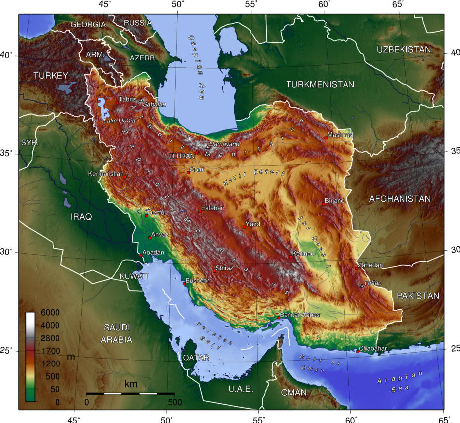
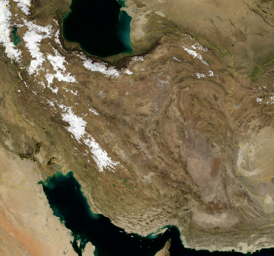
Iran, satellite view (NASA and Wikimedia Commons)
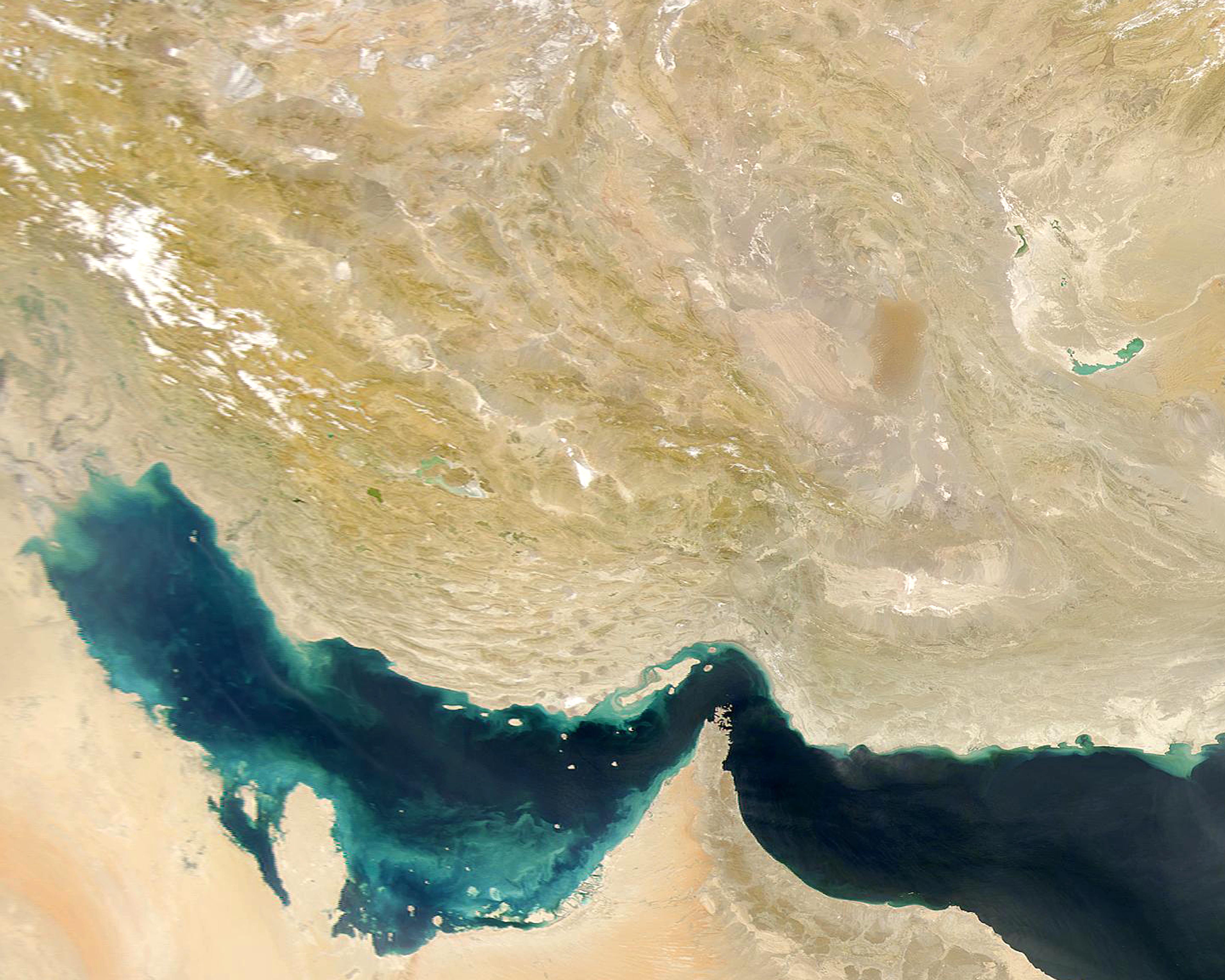
Southern Iran, Persian Gulf and Sea of Oman, NASA
The total renewable water resource of Iran is estimated as 137.5 km3/year. 9 km3/year are through transboundary rivers such as the Hirmand, Tedzhen and Aras and about 10 km3/year is surface runoff to other countries notably Iraq. More than 1900 km or 22% of Iran's borders are rivers (Chavoshian et al., 2005).
Fisher (1968) gives a general, physical geography and Breckle (1983) gives a general account of the features and life (excepting fishes) of deserts and semi-deserts in Iran. Barthold (1984) gives an historical geography of Iran and Yarshater (continuing) has many articles on geographical features. Geological literature is summarised in Dürkoop et al. (1979) and Davoudzadeh (1997).
It is pertinent here to interject a note on geographical names. Transliteration of Farsi place names into English is possible by more than one system. This results in variant spellings for geographical features in articles and on maps of Iran. For convenience, I have followed the official standard names approved by the U.S. Board on Geographic Names. The Board publishes a gazetteer for Iran with a designation of the geographical place (e.g. lake, populated place, stream, spring, etc.) and its latitude and longitude. The latest gazetteer is available from the Defense Mapping Agency, Combat Support Center, Washington, D.C. 20315-0010. Some literature localities could not be identified from maps or gazetteers. They are placed in quotes (".....").
I have not included the diacritical marks used in the Board's system. They would be of little help to those unfamiliar with Farsi and perhaps unnecessary to those who are. Needless to say, there are variant diacritical marking systems and in any case pronunciation varies throughout Iran.
The situation is further complicated by transliterations into other European languages and readers should be aware of this when reading non-English papers on Iran or Iranian fishes, e.g. the English Shiraz is Chiraz in French, and Genu, the type locality of Aphanius ginaonis, has such variants as Ginau, Genow, Gueno, Geno, and finally Ginao from the German transliteration, hence the trivial name. As if this were not enough, the vagaries of political fortune are writ large upon the face of Iran (which used to be Persia). Bandar-e Pahlavi has reverted to its older name of Anzali (often spelt Enzeli on older maps), Reza'iyeh to Orumiyeh (= Urmia in older English literature), and Shahreza to Qumisheh after the fall of the Pahlavi Dynasty in 1979. Other variants are Bandar-e Khomeyni (formerly Bandar-e Shahpur), Bakhtaran (formerly Kermanshah), and Khuninshahr or City of Blood (formerly Khorramshahr or City of Joy, and again Khorramshahr). I have retained names current for the years 1976-1979 recorded in the Board's gazetteer (1984). One exception is the province of Hormozgan (or Hormozdgan) which I have preferred for its brevity over the older name on some maps of Saheli-ye Jazayer va Banader-e Khalij-e Fars va Darya-ye Oman! The province of Mazandaran is now split into two with the eastern part termed Golestan, and Khorasan and Markazi have also been split up. Iranian governments have a distressing tendency to change the names and borders of provinces. The provinces used here are as follows, being what existed when the data was compiled:-
Ardabil
Azarbayjan-e Bakhtari (= Azarbayjan-e Gharbi or West Azarbayjan)
Azarbayjan-e Khavari (= Azarbayjan-e Sharqi or East Azarbayjan)
Gilan
Mazandaran (now split to include Golestan in the east)
Kordestan
Zanjan
Semnan
Khorasan
Kermanshahan (or Bakhtaran)
Hamadan
Markazi (= Central or Tehran; sometimes split into Tehran and a southeast part called Markazi)
Qazvin
Qom
Esfahan
Ilam (or Ilam va Postkuh)
Lorestan
Khuzestan
Chahar Mahall va Bakhtiari
Bovir Ahmadi va Kohkiluyeh (or Boyer Ahmadi-ye Sardsir va Kohkiluyeh)
Fars
Yazd
Kerman
Bushehr (or Khalij-e Fars)
Hormozgan (or Hormozdgan or Saheli-ye Jazayer va Banader-e Khalij-e Fars va Darya-ye Oman)
Sistan va Baluchestan
Another complication is the tendency for long rivers to have several names along their course, sometimes taken from the nearest population centre, and for locally used names to be different from map or gazetteer names. Names also vary with language and through time. One of the major rivers of Fars Province appears on maps as the Mand River, but near Shiraz it is called by its Turkic name Qarah Aqaj (also transliterated Qara Aghach, Qareh Aghaj, Qara Agach, Qareh Aqaj, Qareh Aqach, Kara Agach, and Kara Agaj). The Kor River, also in Fars, is known in older papers as the Araxes River which is not the same as that forming the border between Iran and the former U.S.S.R. (which anyway is often spelt Aras or Araks!).
The early geological history of Iran and neighbouring areas has necessarily affected the distribution of fishes, facilitating dispersal or hindering it, isolating or joining species. Some historical features are discussed under the appropriate drainage basin descriptions below or under the relevant genus or species but others are more widespread and are briefly outlined here. Sources include in particular Wolfart (1987) but also Harrison (1968), Takin (1972), Falcon (1974), Stöcklin (1968, 1974a, 1974b), Krinsley (1970), Stoneley (1974), Kashfi (1976), Shearman (1976), Booth (1977), Jackson and Wood (1980), Berberian and King (1981a, 1981b), Haynes (1981), Rögl and Steininger (1984), Šengör (1984), Oosterbroek and Arntzen (1992), Rögl (1998; Rögl, 1999), and Adams et al. (1999). There have been no cladistic analyses of taxa on which history can be determined. Zoogeographical analyses are based on present day distribution and suppositions on relationships. During the Cretaceous and through the Early Oligocene the Tethys Sea, several thousand kilometres wide, extended from the Mediterranean Sea to the Indian Ocean, separating the Afro-Arabian and Eurasian continents. Afro-Arabia was part of Gondwanaland. The usual assumption is that Iran belongs to Eurasia, perhaps with Central Iran a microcontinent or island or as a northern continuation of Arabia, and with East Iran a microcontinent or peninsula of Eurasia. Förster (1976), however, maintains that Central Iran, and probably North Iran, were part of Gondwana. The Tethys covered much of what is now Iran and was a barrier to the movement of freshwater fishes. The ocean regressed during the Late Oligocene except for a Euphrates-Persian Gulf furrow and the Zagros and Makran troughs. Continental sediments were deposited in endorheic basins of Iran. The Tethys closed in the Middle to Late Miocene as evidenced by mammal migrations between Asia and Africa. The establishment of continental conditions over Iran has been continuous since the Late Miocene except for an inundation in the Late Pliocene in the Zagros trough and the Makran coastal region. There may also have been an early Miocene connection between Arabia and Iran/Iraq allowing movements of freshwater fishes (Adams et al., 1999). Iran is therefore composed of parts of Gondwana, which was the continent south of the Tethys, welded to the northern continent and parts of the Eurasian plate (such as the central and eastern Iranian microcontinent). The northeastward movement of the Arabian Plate caused the closure of the Tethys and led to the folding which in the Miocene/Pliocene orogenies formed the Zagros Mountains, a prominent feature of western Iran important in zoogeographic studies of fishes (see Kashfi (1976) for an opposing view). The Zagros orogeny is related to the opening of the Red Sea which formed a barrier to fish dispersal. The Alborz Mountains are a northern part of the Alpine-Himalayan orogen of which the Zagros are a southern part and started to rise in the upper-lower Pliocene (Krinsley, 1970; Stöcklin, 1974). A continuous land-bridge between Eurasia and Africa has been in existence since the upper Miocene, facilitating freshwater fish dispersal. Hora (1937) and Menon (1957) refer to wet, marshy, tropical conditions and headwater captures along the whole southern face of the Himalayas and westwards during the Pliocene and early Pleistocene facilitating the spread of fishes from the east to Iran. Hora (1937) and Briggs (1987) consider that cyprinids entered Africa from southeast Asia 18-16 MYA, in the early Miocene, while other groups moved through Iran and the Arabian Peninsula beginning in the early Eocene. Kosswig (1951; 1952; 1955a; 1955b) notes the similarity at the generic level between Indian and African fishes, e.g. the cyprinids Barilius, Garra and Labeo, indicating that these fishes arrived in Africa from India after the desiccation of the Syrian-Iranian Sea in the Pliocene. The primary route, according to Kosswig and to Por (1987), was a northern one around the barrier of the Persian Gulf and Sea of Oman via northern Arabia, Syria and the Levant. Cooling conditions in these areas during the Pliocene and especially the Pleistocene glaciations, and arid climates at times, were unsuitable for tropical forms. These movements left a selection of fishes in what is now Iran including the cyprinid Garra, the sisorid catfish Glyptothorax and the spiny eel Mastacembelus.
The Pleistocene fore-deep of the Himalayas may have had connections with the Tigris-Euphrates basin which extending down the Persian Gulf as a river valley. The Tigris-Euphrates basin formed during the Pliocene and was colonised by primary freshwater fishes no earlier than the late Pliocene (Krupp, 1983). Movements of fishes into Iran from the west and north were also affected by the presence of the Tethys Sea and a brief account is given under the genus Barbus sensu lato which has been studied in this regard.
The present picture of the Arabian peninsula is of an
arid desert unsupportive of fish life. The presence of fishes in Arabia
and the Levant, and even Africa, with apparent relationships to fishes
from Iran and the east indicate that fishes must once have traversed this
area. Movements of fishes are thought to have been in a northern arc around
the Fertile Crescent or its earlier version. However this modern picture
is perhaps illusory as there is evidence of a more hospitable environment
in the Arabian Peninsula at various times in the past. Wadis were active
during "pluvial" periods of the Pleistocene as evidenced by deposition
of fluvial material (Al-Asfour, 1978). One of these wadis drained much
of central Arabia to the Kuwait area. The "Kuwait River" once ran from
the Hijaz Mountains in western Saudi Arabia northeastwards for about 850
km to drain into the Persian Gulf via a vast delta occupying much of modern
Kuwait. The river was 8 km wide and over 15 m deep along most of its length
(Hamblin, 1987; Anonymous, 1993b). This river last ran between 11,000 and
6,000 years ago and could have provided a highway for fish dispersal. Earlier
rivers of this nature dating to the Late Miocene (Forey and Young, 1999;
Hill and Whybrow, 1999; Friend, 1999), the Pliocene (Gerson, 1982), and
others like it in other parts of the peninsula, as well as shallow lakes
(e.g. Lake Mundafan in the Rub' al Khali at 36,000-17,000 B.P. and again
at 9000-6000 B.P.) would have facilitated transfer of species across the
Arabian Peninsula, today an impassable desert for fishes, e.g. at the height
of the Würm glaciation 40,000 years ago (Chapman, 1971; McClure, 1976;
Al-Sayari and Zötl, 1978; Brice, 1978; Jado and Zötl, 1984; Wagstaff,
1985). A freshwater connection between Iran and Arabia was almost continuous
from 70,000 to 20,000 years B.P. (Krupp, 1983). However no fish remains
have been found in the late Pleistocene lakes although freshwater molluscs
are frequent, Hippopotamus remains are reported and Neolithic fish
hooks have been found in Al Hasa in eastern Saudi Arabia. Incomplete Miocene
freshwater fish fossils are reported from the Jizan basin in the Tihama
north of the Saudi Arabian-Yemen border (Brown, 1970). One was identified
as a Barbus and the other as a Tilapia. Both these identifications
are of such a general nature (see account on the genus Barbus and related
genera for
example) as to throw little light on past history or relationships with
modern taxa. The Lower Miocene fauna of Al-Sarrar at 15-17 MYA, northwest
of Dhahran in eastern Saudi Arabia, contains pharyngeal teeth thought to
be Barbus sensu lato, and more interestingly several thought to be Labeo
(Thomas et al., 1982). This latter genus is not now found in the
Middle East but occurs in the Indian subcontinent and Africa. The Late
Miocene Baynunah Fauna of Abu Dhabi in the United Arab Emirates contains
Clarias, Bagrus shuwaiensis and Barbus sensu lato in a river connected with an
ancestral Tigris-Euphrates system (Forey and Young, 1999). These fossils
tend to confirm the hypothesis that fishes of Asian origin reached Africa
through the Middle East and could have taken what may be termed a southern
route across the Arabian Peninsula. However Forey and Young (1999) point
out that the modern Arabian fauna may not have a history stretching back
to the Miocene but is due more to a re-invasion after a loss of an earlier
fauna. The modern Iranian fauna, in part, may be a remnant of movements
at various times yet to be resolved in the absence of species-level phylogenies.
The general climate of Iran is based on Bobek (1952), Ganji (1960, 1968), Taha et al. (1981), "Aquastat" from the Food and Agriculture Organization, Rome (www.fao.org/ag/agl/aglw/aquastat/iran.htm) and www.bibliothecapersica.com/articlenavigation/index.html, under ab (= water) and climate, downloaded 24 December 2004. Kouchoukos et al. (1998) give an overview of climatology for Southwest Asia based on satellite datasets. Precipitation, its amount, nature and seasonality, is important in determining the water regime and thus the habitats for fishes. Iran is sparsely vegetated, both naturally and through the agency of man, and the air temperature and amount of insolation has a direct effect on water temperatures. Insolation is continuous through summer days when clouds are a rarity over much of Iran and the weather remains settled for weeks at a time.
In general, the climate of Iran can be classified as arid to semi-arid, with more than 80% of the country characterised by less than 250 mm annual rainfall. Mountain ranges block off the interior of Iran and give extremely continental conditions except for the narrow littoral zones on the Caspian shore and the Persian Gulf. Summers are hot and dry with little change from day to day. Three main climatic types are found: warm, temperate and rainy with a dry summer in the Caspian coastal area, dry, hot desert in the central plateau, and dry, hot steppe in the rest of the country. Humidity is generally low because of the altitude, much of Iran being over 1000 m average height. Coastal regions along the Persian Gulf have a high humidity, especially in summer. Wind patterns are deflected by the Zagros and Alborz ranges in the west and north. Summer winds are mainly north and northwest over much of northern and central Iran and are hot, dry, and strong for long periods. The Sistan "Wind of 120 Days" from the northwest blows from the end of May to September continuously and is very hot, dry and sand-laden. The "shamal" blows from the northwest over Khuzestan and coastal regions of the Persian Gulf from February to October, most intensely in summer. These summer winds undoubtedly contribute to the desiccation and, in some cases, filling-in of water courses. In the south the winds are west and southwest.
Temperature varies greatly over Iran with latitude and altitude, as well as with the seasons. Winter lows are found in January and summer highs in July in general, with the Zagros and Alborz mountains and the Caspian shore having maximum temperatures in August as a result of the influence of altitude and the sea. The mean monthly temperatures for January at 15 selected stations across Iran (Ganji, 1968) had a range of -1°C to 20°C, average about 8°C. For July these figures are 25 to 37°C, average 30°C. The annual range is 14C° at Jask on the Sea of Oman and 30.5C° at Mianeh in East Azarbayjan. Outside the coastal areas of the Caspian and Gulf, the annual range is considerable, and daily ranges also are large. Nights can be very cold in the northeast, less so on the plateau. Some areas, like the Khuzestan plains, have maximum temperatures over 50°C (53°C at Gatvand near Dezful; possibly over 55°C in the interior, hotter than anywhere else on earth) in summer while in the northwest in winter the temperature can fall below -30°C (to a low of -36°C at Bijar in Kordestan). Five temperature provinces have been delineated for Iran: the Caspian zone along the littoral which has a low annual temperature range; the Persian Gulf zone which has a low annual range but high values; the Zagros zone with a much higher range than the first two zones and a very low January mean; the Alborz zone which is similar to the Zagros but has higher temperatures and a greater range; and the interior zone with the greatest annual range coupled with relatively high values.
Precipitation falls in winter as snow on the mountains of the north and west. The highest mountains remain snow-covered year round. The plateau also receives snow but it does not last long and there is no snow along the Persian Gulf coast. Rain falls mainly in November to May with a mean annual of 416 mm, although the Caspian littoral is much higher and the interior plateau much less. Rain is uncommon from May to October over most of Iran. Maximum rain is found on the outward slopes of the Alborz and Zagros ranges where the mean annual rainfall is more than 1200 mm, 1950 mm at Anzali. The plateau has less than 120 mm annually, Sistan less than 70 mm, and Mirjaveh on the Pakistani border only 48 mm annually. The Caspian littoral has rain in every month at some localities. The plateau receives most of its rain in spring, the Caspian in autumn, and the Gulf coast in winter. The result of this pattern of rainfall is heavy runoff in spring with silt-laden floods and erosion a feature. Many streams marked on maps are actually dry for much of the year. Even a major, interior basin river like the Zayandeh which flows through Esfahan does not reach its terminal basin for much of the year.
A review of modern and historical floods in Iran can be found in Mazra'eh, News, Analytical and Educational Monthly, No. 10, January 1998 at www.netiran.com/Htdocs/Clippings/DEconomy/980100XXDE05.html. Devastating floods occurred in 2001, after several years of drought, in Gilan, Golestan and Khorasan provinces (IRNA, 11 August, 14 August, 4 September 2001).
Droughts occur and can be devastating for fish habitats. The drought years 1999-2001 were the worst in 30-40 years and resulted in a United Nations Technical Mission (see ReliefWeb, 22 August 2000, UN Office for the Coordination of Humanitarian Affairs (OCHA) at www.reliefweb.int; Foghi, 2004). Various effects were noted including the drying of 2500 qanats in Yazd, in southern Fars groundwater became saline, the Latian, Lar and Karaj dams near Tehran had water reserves of 51 million cu m, down from 173 million cu m for the same period in the previous year and were within about 2 months of drying up, several lakes and wetlands of international importance dried out (Bakhtegan-Neyriz and surrounding wetlands, Hamun-e Saberi, south end of Hamun-e Puzak and Gav Khuni), rivers dried completely (Hirmand River and its terminal lake), the Dez and Karkheh rivers in Khuzestan were depleted by 70% in 2001, water rationing was implemented in Tehran and 30 other cities, and lower water levels in rivers that retained flow had reduced oxygen affecting fish (IRNA, various news reports, 2001). In East Azarbayjan, 190 ha of 220 ha used for fish breeding were useless through drought (IRNA, 29 August 2001). Marshes south of Lake Orumiyeh near Mahabad encompassing 30,000 ha dried up (IRNA, 25 August 2001). Water reserves behind dams in Khorasan were depleted by 65% in 2001, the precipitation rate having declined by 40% in the period November 2000-August 2001 (IRNA, 3 September 2001).
Abbaspour and Sabetraftar (2005) reviewed Iranian drought cycles and found arid conditions were experienced for 13 of the previous 23 years. Drought affected fishes in the drying of wetlands where hundreds of thousands of fish died, in Sistan 8-12,000 tons of fish were lost as the lakes dried up, in Fars fish losses were reported from the Kor River, in East Azarbayjan 174 ha of fish culture farms were damaged, and rivers draining to the Persian Gulf lost fishes including migratory species.
The nature of the drainages of Iran is directly related to climate. The Alborz Mountains in the north block movement of moisture to the south while the Zagros Mountains in the west block moisture from that direction. The southeast monsoon is almost completely dry before it reaches eastern Iran. In consequence the best watered parts of Iran lie on its northern and western fringes and the interior becomes drier from west to east and north to south. Interior rivers exist in large part because of mountain ranges which store water as snow, in the case of the Hirmand River and the Sistan lakes, far removed from Iran.
There has been many studies on past climates in Iran and neighbouring countries, attempting to link climate with past environmental conditions in the Late Pleistocene-Holocene. The Early to Middle Pleistocene, however, is practically unknown for the Middle East and is not dealt with here (Butzer, 1978). Past environments have significance for fish habitats, distributions and zoogeography. The brief summary below is based on Butzer (1957, 1958a, 1958b, 1961, 1975, 1978), Bobek (1959), Whyte (1961), Hutchinson and Cowgill (1963), van Zeist and Wright (1963), van Zeist (1967), Wright et al. (1967), Krinsley (1970), Diester-Haass (1973), Turnbull and Reed (1974), Nützel (1976), van Zeist and Bottema (1977, 1982), Wright (1977; 1983), Ganji (1978), Neumann and Sigrist (1978), van Zeist and Woldring (1978), Woosley and Hole (1978), Farrand (1979), Storch (1980), Coad (1980c), Kay and Johnson (1981), Lamb (1982), Neumann (1993), Qin and Yu (1998); Griffiths et al. (2001); Stevens et al. (2001); Snyder et al. (2001); this being by no means an exhaustive listing of the studies in this field nor is the below a critical assessment of conflicting views. Evidence for these past environments is taken from a number of studies in different fields. The Pleistocene ice has been gradually withdrawing from its last maximum at 20,000 B.P. and the remains of ice fields and glacial moraines can be used to determine former conditions such as the snowline. The advance and retreat of deserts and the use and abandonment of settlements are indicative of changes. Such erosional physical features as dry riverbeds and other riverine structures, alluvial fans, sand dunes, and aeolian deposits all give clues to environmental change. The extent and level of lakes and playas have been widely studied as indicators of climatic fluctuations. Pollen and other organisms associated with lake sediments can be used to trace changing conditions and finally historical records can be analyzed.
Glacial deposits in the outward slopes of the Zagros and Alborz mountains indicate that the snowline was 600-800 m lower than today, perhaps as much as 1800 m in some areas, and as much as 1500 m at Shir Kuh near Yazd and Kuh-e Jupar near Kerman in south-central Iran. Lowered snowlines cannot be explained by temperature alone but were probably due to much greater precipitation. Winter would have been longer and colder in the Pleistocene, more snow would accumulate and summers may have been cloudier. The runoff period would have been longer and river habitats could have been less prone to desiccation in late summer.
The climate in the Zagros Mountains of the late Quaternary in Iran has been examined by means of sediment analyses from lakes Zaribar and Mirabad and for nearby Turkey at Lake Van. Pollen, chemistry, sediments, diatoms, cladocerans, ostracods and palaeobotany all confirm geological studies. The last glacial maximum (the Würm) at about 20,000 B.P. led to local glaciation, a depression in the snow line and absence of trees. The climate was cool and relatively dry, with less precipitation than today. The cooler temperatures meant less evaporation, more runoff and filling of intermontane lakes. The Caspian Sea and Lake Orumiyeh were much larger than today, being 78 m and 55 m higher. As the glaciers receded, the land environment or life zones moved up the mountains. The significance of this for fishes is unknown; there were few trees and the environment may have resembled modern denuded conditions. There may have been a higher flow than later when trees developed to hold runoff and before man chopped them down. However bushes could have retained water and reduced silt load in rivers. By 12-14,000 B.P the evidence from Zaribar and Mirabad indicates a warming climate but without increased precipitation. Indeed rainfall may have been less than today, reducing river flows and perhaps habitats for fishes. This arid period was succeeded by a more humid period. An increase in precipitation at Lake Van did not take place until 6500 B.P., about 4000 years later than in western Iran. Climate changed not only through time but also geographically, just as today. Regional variations mask general statements about earlier climate for Iran and the outline given here is perhaps best seen as indicative that change occurred. The humid period was followed by a period of less rainfall, and then in the late Holocene by an increase in rainfall. The last 3000 years have been humid with perhaps two, short, arid episodes. Southern Iran may have been cool and comparatively moist when the highlands were moderately cold and relatively dry. Climate probably changed markedly over short periods. Short cold phases are recorded for Europe in the last several thousand years, e.g. from about 1400 to 1230 B.C., associated with rises in lake levels. Similar events may occurred in Iran. Barley harvest dates in Babylonia derived from clay tablets indicate they were 10-20 days earlier in the period 1800-1650 B.C. and 10-20 days later in 600-400 B.C. It is concluded that the former period was warmer and the latter cooler than today.
Pluvial conditions as recognised for more northerly areas of Europe probably did not occur in Iran during the Pleistocene although summers may have been less dry because of greater cloudiness and lower temperatures and evaporation. Lake levels were probably higher 18,000-20,000 years ago (Roberts and Wright, 1993). Krinsley (1970), in his study of playas in Iran, concluded that the climate was semi-arid rather than pluvial in the period of maximum cold during the Pleistocene. Lakes, which occupied endorheic basins and could have facilitated local fish movements, dried up as the climate warmed with the retreat of ice sheets and glaciers and evaporation exceeded precipitation. These shallow lakes were found along the inner mountain front or within basins which received greater discharges. As distance from the mountains increased, there were only intermittent lakes and finally playas. An immense lake filling much of central Iran, as proposed by earlier authors, seems unlikely. Generally conditions over Iran appear to have varied as much, if not more, in the Pleistocene as they did in recent centuries through the agency of man. Conditions 9000 years ago were probably drier than today (Roberts and Wright, 1993). The fishes may have been selected for an ability to survive highly variable conditions in terms of stream flow, temperature, silt load, local fluctuations in lake levels and salt content, etc.
The greenhouse effect is apparent in Iran, a rise in temperature
caused by various man-made and released gases. Nasrallah and Balling (1993)
show a temperature increase of 0.09-0.23C°/decade, mean 0.18C°/decade, from 1950-1990.
The major rivers of Iran drain the two mountain chains which retain enough snow or collect enough rainfall to ensure a constant and appreciable flow. Afshin (1994) summarises the rivers of Iran. All rivers in Iran are fordable on foot when not in spring flood with the exception of the Aras and Safid rivers of the Caspian basin, the Hirmand river of Sistan and the large rivers of Khuzestan. Most rivers marked on maps are in reality small streams, with very shallow and clear water. There is little vegetation on the banks, and fishes, if present, can be seen with ease. A significant proportion of fish habitat is occupied by small streams, springs and qanats. Large freshwater lakes or marshes are absent except in Sistan, the Caspian basin and the plains of Khuzestan. Most large lakes on maps are salty and do not support a fish fauna. A number of dams have been built and more are planned (see Bagley (1976), Coad (1980c) and "Aquastat" from the Food and Agriculture Organization, Rome (http://www.fao.org/ag/agl/aglw/aquastat/iran.htm)) and these form important lacustrine habitats. In 1994, 27 storage dams were in operation with a capacity of 39.2 km3 and a further 24 were under construction with a capacity of 11.5 km3 (see also below for more on dams). In 2002 Iran was building 68 dams and the construction of a further 120 dams were being considered as 33% of the country's water resources were wasted (IRNA, 2 January 2002). Manouchehri and Mahmoodian (2002) briefly review environmental impacts of dams in Iran.
The streams may have their origin in a mountain, a spring or a qanat, but they hold in common a clarity of water, a bare pebble bed, small dimensions (one to a few metres wide and a few centimetres deep) and often a short course. They may join another stream but are often lost in marshes, tapped for irrigation and lost in fields or become absorbed by the friable and porous ground. Many streams are intermittent, with flow near their mountain source, dry sections and perhaps a flow near their mid-course, with subsequent absorption into the ground. Heavy aquatic vegetation is not common and most plant material is a thin encrusting layer on the bottom. Banks are often bare of riparian vegetation and streams are fully exposed to insolation. Summer temperatures are often high as a result (30°C and more) yet at higher altitudes streams can be icy cold even in summer and the typical blue-grey of snow-fed water. Spring floods can be disastrous, scouring out the stream beds and dumping heavy silt loads (Melville, 1984). Spring fed streams of shorter course are not affected because they have a small catchment area and may well provide a refuge for fishes. The clean water of springs attracts human settlement and these waters are often blocked off to form ponds or cisterns with water led off through artificial channels subject to drying as requirements change. Streams and rivers may also be impounded, forming small ponds or lakes. Bridges often have small pools beneath them and this may be the deepest (at ca. 1 m) and most shaded section of a stream.
Marsh areas may be associated with springs. Reeds and other vegetation develop downstream of the source and may be quite extensive, occupying several square kilometres. Some areas of marsh are ponded and provide habitat for larger species as well as shelter for young. Extensive marshes, lakes and lagoons are developed in Sistan, the Caspian basin and Khuzestan, all fed by major rivers (50+ m wide and 3+ m deep) draining vast areas of land. These areas vary widely with season and flood dramatically in spring, inundating vast tracts of land. The rivers and associated marsh-lake complexes provide the major freshwater food fishing areas in Iran. The Sistan marshes have been described in Annandale (1921) and Annandale and Hora (1920), the Caspian shore by Schüz (1959) and the lowlands of southern Iraq by Rzóska (1980) and by Thesiger (1985) and Young (1989).
Conservation of aquatic habitats in Iran has been part of a general programme for biotic conservation summarised in Firouz (1974; 1976), Firouz and Harrington (1976), Ashtiani-Zarandi (1990) and Kahrom (2000). The Ramsar Convention on Wetlands of International Importance was named after the city of Ramsar in northern Iran where the first conference was held in January 1971. Iran has more Ramsar listed sites than any other country in Southwest Asia (Scott, 1993). In 1977 there were 11 Park-e Melli (National Parks), 4 Asar-e Tabii Melli (National Nature Monuments), 24 Manatgheh-Hefazat Shodeh (Protected Regions or Areas) and 31 Panahgah-e hayat-e Vahsh (Wildlife Refuges) offering varying degrees of protection to the fish fauna (Firouz et al., 1970; Yachkaschi, 1976; Köpp and Yachkaschi, 1978; Majnunian, 1985). The 1993 United Nations List of National Parks and Protected Areas at "www.wcmc.org.uk/data/database/un_combo.html lists" 7 National Parks, 2 National Nature Monuments, 41 Protected Areas and 18 Wildlife Refuges and the National Report of the Islamic Republic of Iran for the Convention on Biological Diversity (Department of the Environment, Tehran) lists 11 National Parks, 47 Protected Areas, 25 Wildlife Refuges, 5 National Nature Monuments, 9 MAB (Man and Biosphere) Sites and 20 Ramsar Sites.
Seven Ramsar sites are priorities for urgent action with the causes, namely:- Alagol, Ulmagol and Ajigol lakes (impact of agricultural development), the Anzali Mordab (Talab) complex (falling water levels and increased eutrophication leading to the rapid spread of the reed Phragmites australis, south end of Hamun-e Puzak (water inflow could be reduced because of dam construction in Afghanistan), Hamun-e Saberi and Hamun-e Hirmand (dam construction in Afghanistan), Neyriz lakes and Kamjan Marshes (drought and agricultural activities), Shadegan Marshes and mudflats of Khor al Amaya and Khor Musa (chemical pollution from the Iran-Iraq war), and Shurgol, Yadegarlu and Dorgeh Sangi lakes (war and drought effects) (www.ramsar.org/ram_rpt_37e.htm, downloaded 28 July 2000).
The status of the fish fauna in Iran was assessed by Coad (1980c) and Kiabi et al. (1999) and compared with other areas by Moyle and Leidy in Fiedler and Jain (1992). The percentage of the total fauna under some form of threat was assessed at 22%, a figure which was lower than most other areas examined.
Iran has several unusual habitats for fishes and these are described below.
i) Hot springs
A number of hot springs are reported from Iran (Waring, 1965; Joneidi et al., 1971?; www.bibliothecapersica.com/articlenavigation/index.html, under ab-e garm, downloaded 24 December 2004). Some of the hot springs marked on maps are not hot, e.g. the spring at Tafresh (ca. 34°44'N, 50°02'E) was only 19°C (and fishless). Some springs produce water at relatively high temperatures, but since these temperatures are also seen in nearby streams they are not regarded as "hot", e.g. a spring near Farrashband (28°53'N, 52°06'E) at 30°C.
Only the true hot spring at Genu (27º26'N, 56º20'E) is known to contain fish including Aphanius ginaonis, Cyprinion watsoni and Garra persica (Coad, 1980b). A hot spring on the slopes of Kuh-e Bazman (the mountain is at 28°04'N, 60°01'E) is rumoured to contain tooth-carps (Cyprinodontidae).
The Ab-e Garm (literally hot water) at Genu emerges at 41°C and was partially enclosed by brickwork associated with a hammam or bath-house. The altitude of the spring is about 400 m. Its stream is 10-15 m wide near the source and the bed is composed of stones and pebbles covered by lime-green algal mats and strings. Only Aphanius ginaonis was found at the hot spring, not in the main flow but along the stream margins and in many minor subsidiary springs which emerge a few metres from the main spring. These minor springs had a mud bottom, were as shallow as 1 cm and had soap and food debris pollution in 1977. Side springs and stream margin near the source were 37-40ºC. The other species (along with A. ginaonis) were found below a cascade and have no access to the hotter parts of the spring and stream. A. dispar is recorded from the spring by Werner (1929) but this has not been confirmed by my collections. The water is clear and colourless, but there is a strong smell of sulphur. Flow is 30 l/sec. The chemistry of this spring as given by Joneidi et al. (1971?) was : pH = 6.2, conductivity 14,000 us, dry residue at 180ºC = 9933 mg/l, H2S = 34 (? p.p.b.), r (reacting value) Ca = 22.4, r Mg = 9.9, r Na + K = 6.1, total cations 162.1 (sic), r Cl = 147, r SO4 = 15.4, r HCO3 = 4.6, total anions = 166 (sic), SiO2 = 10 mg/l, NH4 = 0.7 (no units given), NO3 = 22 (no units given). There were traces of CO2 and no measurable Fe, NO2, or CO3. The hot spring lies in the Genu Protected Area (Biosphere Reserve) which is described by Zehzad et al. (1997).
ii) Caves
Iran is replete with caves but thus far only one has been found to contain a fish fauna. This cave lies about 12 km north of the railway station Tang-e Haft in Lorestan at 33°05'N, 48°36'E. Two species are found here, Iranocypris typhlops (Cyprinidae) and Paracobitis smithi (Nemacheilidae) (Bruun and Kaiser, 1944; Movaghar, 1973; Greenwood, 1976; Smith, 1978; 1979; Coad, 1996c; Proudlove, 2001; Romero and Paulson, 2001). The cave lies in the Dez River drainage of the Tigris River basin and its connection to nearby surface water is intermittent. The cave is the surface outlet of a subterranean limestone system and the captures may represent strays from underground. B. Sandford (pers. comm., 1979) stated that there is some evidence of recent collapse in the cave system and thus the habitat may be endangered but it is difficult to assess the extent and nature of underground fissures in the rock.
iii) Qanats
Qanats are an unusual yet important habitat for fishes in Iran. An account of their fishes with an extensive bibliography is given in Coad (1996h); additional literature on this unique environment not referenced there includes Kuros (1943), Aisenstein (1947), Feylessoufi (1959), Nesbitt and Bawa (1960; 1961), de Menasce (1966), Jentsch (1970), Nadji (1970; 1972a; 1972b), Braun (1974), Goblot (1979), Hartl (1979), Sajjadi (1982), Goldsmith and Hildyard (1984), Behnia (1988), McLachlan (1988), Beaumont et al. (1989), Harwit (1990), Razavi (1991), Coad (1994b), Koocheki (1996), Liaqati (1997), Salim Manshadi et al. (1997), Afkhami (1998), English (1998), Aminpouri (2002), www.netiran.com/Htdocs/Clippings/DEconomy/200629XXDE05.html, downloaded 8 August 2002), Foltz (2002), Floor (2003), Wessels and Hoogeveen (2003), and qanats at www.waterhistory.org, and at www.bibliothecapersica.com/articlenavigation/index.html, under abyari (irrigation), downloaded 24 December 2004.
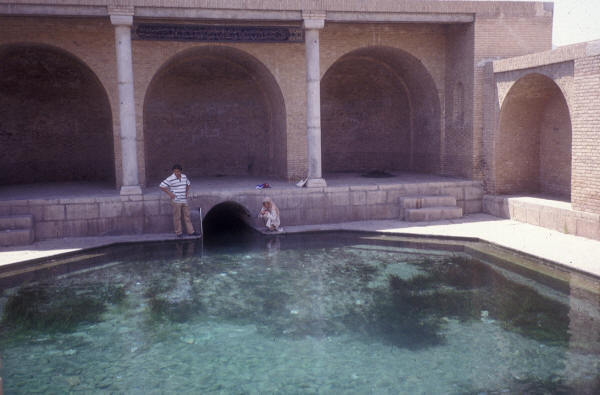
Qanat at Kashan from Wikimedia Commons
The word qanat has various suggested origins including a derivation from the Akkadian for "reed" according to Goblot (1979) in contrast to others listed in Coad (1996h).
Over 20% of the irrigated area of Iran is fed by qanats (Redding and Midlen, 1991) and numbers as high as 60,000 have been estimated. They are essentially horizontal wells which tap groundwater and provide a continual, low gradient flow of fresh water. Qanats are an advantageous habitat for fishes in several ways. The water temperature is not subject to the extremes found in natural waters, shade within the qanat provides protection against predators on adults, young and eggs and against insolation, the gradient and water flow are gentle, and a certain amount of food is provided by kitchen scraps since dishes, cooking containers and implements are washed in the jube or channel and food is cleaned and trimmed there. A school of fish will quickly gather at a washing site and maintain station in clouds of detergent in order to pick up scraps of food. Attempts to imitate washing movements will attract fish momentarily but they soon dart off when no food is forthcoming. The garden environment with trees and other vegetation provides shade, energy input from leaf fall and garbage items, and facilitates development of an invertebrate fauna as a food source. Aufwuchs on rock surfaces provide a food source along with the associated invertebrate fauna. The Zoroastrian community, once widespread in Iran, has a ceremony known as com-e mahi or "meal for the fishes" in which bread and dried fruit are thrown into running water as a libation (Boyce, 1977). Feeding of scraps to fish is also seen in Moslem communities and boys regularly attempt to attract and catch fish using any available food material and primitive fishing gear (personal observations; Edwards, 1971).
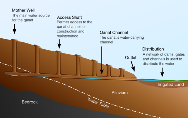
Qanat cross-section from Wikimedia Commons
Qanats are now rapidly being replaced by pump-wells which are faster and easier to excavate but do not provide fish habitat. Pump-wells often dry up qanats and natural springs by lowering the water table (Razavi, 1991; Anonymous, 2001b; Aminpouri, 2002). Also schemes to restrict water flow from qanats for conservation reasons will presumably affect the available habitat for fishes (Salim Manshadi et al., 1997).
The qanat fishes comprised 25 species in Coad's study (1996h), 40% of the fauna on the plateau of Iran. The number of species per qanat ranges from 1 to 6 although 88% of qanats have only 1-2 species. Areas with little surface water and low in diversity have 94% of the species occurring in qanats while better-watered areas with more diversity have only 29% of species in qanats. The qanat fauna is dominated by the Cyprinidae, which comprises 76% of the ichthyofauna. The qanat fauna is a subset of the basin in which the qanat occurs, comprising small species, broadcast spawners, lacking in specialised food requirements (usually scrapers of aufwuchs or feeding on invertebrates), non-migratory, and widely tolerant of environmental conditions.
The fishes in qanats are caught by local people for food but given the restricted size of this habitat and of most fishes found in them, this is not a significant dietary item. In the seventeenth century qanat fishes "were not esteemed as they never saw the light and were used only for medicinal purposes to cause vomiting" (Ferrier, 1996, quoting Jean Chardin). In the 1950s villagers in Iran believed that qanat fish lived forever and needed no food, only their own eggs (www.iras.ucalgary.ca/~volk/sylvia/qanat.htm, downloaded 24 June 2002).
Colonisation is both natural, since loaches are unlikely to be seen and caught by local people, and deliberate, since larger cyprinids are found in qanats remote from any surface water. These fish are hardy, already living in high temperature environments, and are easily transported for Now Ruz celebrations. At the Zard-Abieh qanat in Shahrud, a local man remembered putting fish into the qanat 60 years ago from one now dry (H. Rahimian, pers. comm., 2000).
iv) Salt streams and lakes
Salt lakes are common in Iran and are mostly too saline to support a fish fauna. They are discussed in a world context by Williams (1996). Fishes do exist in tributary streams (which may be saline in varying degrees). Rivers and springs around salt lakes are therefore isolated from one another and might be expected to give rise to unique populations of fishes. However all these salt lakes are shallow and liable to desiccate such that tributary streams and springs can connect and allow faunal interchanges once the lake level falls.
Many streams in Iran are highly mineralized or even salt to taste yet these support fishes which are usually regarded, at least at the family level, as salt intolerant. Salinity tolerance studies have not been carried out on Iranian fishes. The Caspian Sea is at one-third sea water (12-13‰) yet typical "fresh" water species can be found there, e.g. Cyprinus carpio.
v) Sacred waters
A number of springs in Iran are said to be "sacred" and their fish then attain a degree of importance on account of their inaccessibility to ichthyologists. Howz or tanks at Qumisheh (32°01'N, 51°52'E) were supposed to hold sacred fish, decorated with gold rings, according to John Fryer in 1698 and John Chardin in 1711, but G. N. Curzon in 1892 mentioned that the gold rings were gone and by 1978 so were the fish. A sacred tank or artificial reservoir at Soh contained fish deemed to be holy. Visitors were expected to purchase bread to feed these fishes (Anderson, 1880).
The most important "sacred" fish are those of Sa'di's Tomb in Shiraz (29°37'N, 52°35'E) which were described by Heckel (1847b) as new species Scaphiodon saadii (= Capoeta damascina) and Discognathus crenulatus (= Garra rufa). The water is a stream (?qanat) under the tomb and part is expanded into a hawz-e mahi or fish pond. Fish have been present here since at least the early nineteenth century as they are mentioned briefly by Waring (1807). Official permission was gained to collect fishes in Sa'di's tomb for study but sampling was actively discouraged by local people. Sa'di was supposed to punish any killing of these fishes with death but the traveller Chardin was able to catch some to eat by monetary means. Some of these fish too were reputedly decorated with gold rings (Ouseley, 1819-1823); regrettably my captures were not.
vi) Mordab
A mordab is a fresh or brackish water lagoon area found along the Caspian Sea coast (literally "dead water", the Russian equivalent is liman). The Anzali Mordab at 37°26'N, 49°25'E is the best known (Firouz, 1968b) and was formerly called the Pahlavi Mordab. The more modern term is "talab" (= pool or marsh, which lacks the association with death) but the older literature refers to mordab and the term is still in common use. The Anzali Mordab is about 30 km long and 4-8 km wide with clear water of only 1.5 m average depth. Much of the area is covered by Phragmites reeds and other plants and only about 15% is open water. Variations in Caspian Sea level and water abstraction from feeder streams will affect the mordab level and size. In the 1930s the mordab was 4 to 8 m deep (Vladykov, 1964) and the fall in level has severely affected the spawning migrations of fishes and the habitat for developing young. The mordab is the principal breeding ground for Rutilus frisii kutum and is also important for several other species. Further details are given below under the description of the Caspian Sea basin.
vii) Wetlands
Wetlands were originally studied and protected as feeding and overwintering grounds for important waterfowl but they do protect fish populations which might otherwise be threatened. Access and hunting is forbidden or restricted and often fishing too. Anonymous (1971), Carp (1972) and Dugan (1993) list and describe various wetlands in Iran of international importance principally:-
See also Scott (1995) where latitude-longitudes are often slightly different.
Lower Atrak River and Alagol Lake (37°21'N, 54°35'E)
Farahabad and Larim Sahra (36°45'N, 53°05'E)
Zarrin Kola (36°43'N, 53°00'E)
Bisheh Sar (36°36'N, 52°43'E)
Fereydun Kenar (36°40'N, 52°31'E)
Bandar-e Farahnaz Lagoon (37°25'N, 49°57'E)
Khalij-e Gorgan (36°50'N, 53°40'E)
Anzali Mordab (37°25'N, 49°30'E)
Nur Gol (38°00'N, 48°33'E)
Neyriz Lakes (29°30'N, 53°40'E)
Lake Parishan (Famur)(29°26'N, 51°50'E)
Khuzestan Marshes (30°30'N, 49°30'E)
Dasht-e Arjan (29°35'N, 52°00'E)
Lake Kopibalbalch, Hassanlu Marsh, Yadergarlu Marsh and surrounding marshes (37°00'N, 45°30'E)
Lake Bishovan (37°09'N, 54°52'E)
Amirkelayeh (37°17'N, 50°12'E)
Coastal lagoons north of Gomishan (37°15'N, 54°00'E)
Seyed Mahalleh (36°45'N, 53°00'E)
Sistan lowlands (31°00'N, 61°10'E)
Additional wetlands not of international importance were listed as follows:-
Safid Rud Reservoir (36°45'N, 49°24'E)
Astara (38°25'N, 48°50'E)
Bahr-e Zaribar (35°32'N, 46°07'E)
Soltanabad Marshes (29°30'N, 52°35'E)
Lake Maharlu (29°30'N, 52°50'E)
Dasht-e Mogan (39°30'N, 47°30'E)
Araxes River (39°10'N, 45°20'E)
Agh Gol (39°55'N, 44°47'E)
Rud-e Shur (35º50'N, 50°25'E)
Zarghan and Lapu'i Marshes (29°50'N, 52°50'E)
Hasanzadeh Kiabi et al. (2004) list the top 13 wetlands as Choghakhor, Mand River, Hamun-e Saberi-Hirmand, Khorekhoran, Gandoman, Orumiyeh, Hawr al Azim, Gorgan Bay + Miankaleh + Lapoo, Shadegan, Helleh estuary, Anzali, Arghan of Parishan, and Hamun-e Puzak.
Other wetlands are mentioned in the appropriate drainage basin account.
The biotopes of Iran are summarised in the figure below:-
| Biotopes of Iran (and adjacent countries)
Central Persian desert basin
Forest steppe
Eastern Anatolian forest steppe
Elburz forest steppe
Hyrcanian Caspian forests
Kopet Dag forest steppe
Kopet Dag semi desert
Desert Caspian lowlands
Azerbaijan steppe
Middle East steppe
Mesopotamian desert
Arabian desert
Tigris-Euphrates salted alluvial marshes
Persian Gulf desert
South Persian desert and semi-desert
North Pakistan sandy desert
Central Afghan woodlands
Oman Gulf desert and semi-desert
Baluchistan Woodlands
|
Peritore (1999) gives a general overview of ecological conditions and
attitudes to the environment, Foltz (2001) reviews environmental initiatives, Afasiabi (2003) reviews the
environmental movement in Iran and Valeolahy (2000) reviews the factors
affecting the abundance of fishes and suggests measures for conservation. Jawad (2003) gives an account of the
impact of environmental change on Iraqi fishes which has implications for fishes
in neighbouring waters of Iran.
The drainage basins of Iran are shown in the Figure. The delimitation of these basins is somewhat arbitrary. Iran is a mountainous country and much of it is desert. There are thousands of small springs and streams with no present or recent connection to other water bodies. Practical considerations require a large scale and I have divided the country into 19 major basins based on field work, maps, fish distributions, history of research, works on hydrography and areas deemed important for an understanding of zoogeography.
There are two main types of basin, exorheic where the rivers and lakes drain to the sea and endorheic, where rivers drain to an internal basin such as a lake, or are lost in the desert, and have no connection with the sea. The exorheic basins all fringe the southern part of Iran. The bulk of the basins, in number (15) and area (about 78.1% of Iran), are endorheic. These plateau basins lie at an average altitude of 800 m, alternating with mountains ridges at an average of 2000 m. The salt lakes and flats of these basins are fed primarily by groundwater rather than rain (Issar, 1967) and water is lost by evaporation. Wolfart (1987) makes the valuable point that Quaternary environments in the closed or endorheic basins of arid Southwest Asia often have marine and brackish fossils. These are not evidence of marine invasions but of the increasing salinity derived from the mineral content of rainwater. As the water evaporates it leaves behind the minerals and over ten thousand years or less a saline environment develops.
www.bibliothecapersica.com/articlenavigation/index.html, under drainage,
downloaded 24 December 2004 gives four main drainages for Iran as follows:-
| Drainage | Area (sq km) | % |
| Caspian Sea | 193,161 | 11.9 |
| Lake Orumiyeh | 54,747 | 3.4 |
| Persian Gulf | 335,864 | 21.9 |
| Interior | 1,626,520 | 61.8 |
| Total | 2,210,292 | 100 |
with the interior drainages as follows:-
| Drainage | Area (sq km) | % |
| Qom (Namak Lake) | 92,332 | 9.0 |
| Damghan | 19,863 | 1.9 |
| Dasht-e Kavir | 200,747 | 19.6 |
| Mashhad (Tedzhen River or Hari Rud) | 43,496 | 4.3 |
| Bejestan Highlands | 91,349 | 8.9 |
| Dasht-e Lut | 166,160 | 16.2 |
| Sistan | 90,813 | 8.9 |
| Jaz Murian | 75,193 | 7.4 |
| Yazd | 105,291 | 10.3 |
| Esfahan | 97,802 | 9.6 |
| Zagros Mountains (Tigris River) | 39,702 | 3.9 |
| Total | 1,022,748 | 100 |
Van der Leeden (1975) summarises water resources of Iran with discharges of principal rivers at various recording stations, lists of major dams and reservoirs, and resources and demand. www.bibliothecapersica.com/articlenavigation/index.html, under ab (= water), downloaded 24 December 2004 also lists major dams and gives a general overview of hydrology and has descriptions of various rivers under their names. McLachlan (1988) also considers water resources in Iran. Some of the earlier dam projects are described by Justin and Taleghani (1955). Later dam projects can be located by a search at "Netiran.com". Prior to the Islamic Revolution 13 dams had been built in Iran but the five-year development plan (1990-1995) designed 110 dams of which 22 were under construction in 1993. 60 dams have been constructed after the 1979 revolution (IRNA, 31 August 1998).
"Aquastat" from the Food and Agriculture Organization, Rome (www.fao.org/ag/agl/aglw/aquastat/iran.htm) gives an overview of Iranian water resources and water abstraction and is updated at intervals. The total domestic, industrial and agricultural water abstraction was estimated at 70 km3 in 1993, 51% of the renewable water resources. Annual abstraction from aquifers (57 km3) is more than the estimated safe yield of 46 km3. An additional 39 km3 is used annually, 20 km3 for electricity production, 11 km3 for flood control and 2 km3 for control and thence environmental protection of downstream parts of rivers, the remainder being surplus. The increasing demands will have serious effects on the water supply and hence the fish fauna. Nikravesh (1997) estimates, based on water consumption and population growth, that Iran will be added to the U.N. list of countries facing water shortages in the year 2025.
Kuros (1943) gives accounts of historical water resources and the problems of water supplies in Iran. Lambton (1953) gives an account of the allocation of water resources in Iran for irrigation. This latter work is important for an understanding of restrictions on fish habitats, e.g. in qanats, reservoirs, rivers and springs. Beaumont (1981) reviews management of water resources in the Middle East and places the Iranian resources in a wider context. Anonymous (1961c) and Beaumont (1974) outline water resource development in Iran, the construction of dams, abstraction for irrigation by traditional and modern means, and the demands of industry and domestic consumers of water. All these affect the habitat of fishes, often in deleterious ways. Noori (1966) describes the hydrology of surface water in Iran. Pirnia (1951), Anonymous (1961c) and Beaumont (1973b) give accounts of the river regimes in Iran with discharges and runoffs at various recording stations. Peak discharges occur in March to May because of snowmelt. Very low flows occur in summer because of the lack of precipitation, and because of abstraction for irrigation, and flow is mostly from groundwater sources. Most rivers are really streams for much of the year as minimum flows for principal rivers are 0.16-451 cu m/sec, average about 36 cu m/sec. The Caspian rivers are the only ones which lack a distinctive annual rhythm and show flows closely related to precipitation throughout the year. The areas with the largest runoff values are in the northern and central Zagros Mountains and in the Alborz Mountains while lowest runoff values per unit area are found around the deserts in central Iran. In the Zagros and Alborz, annual runoff values can attain more than 300,000 cu m per sq km. Löffler (1956; 1961) studied the limnology of several of the major basins within Iran. The Ramsar Convention on Wetlands has a report on the Islamic Republic of Iran (No. 37, at www.ramsar.org/ram_rpt_37e.htm, downloaded 4 May 2001).
Peritore (1999) gives a general overview of ecological conditions and attitudes to the environment in Iran. Zohary (1963) gives a general account of the vegetation of Iran. A general description of Iran, its structure and drainage can be found in Harrison et al. (1945), Neumann (1953), Fisher (1968) and Krinsley (1970). Water policy development is summarised in Aminipouri (2002). A description of natural areas in Iran, including a list of National Parks and Protected Rivers, can be found in Zehzad et al. (2002). The Protected rivers are the Jajrud and Karaj in the Namak Lake basin, and the Chalus, Sardab, Lar and Haraz rivers of the Caspian Sea basin.
The basins are as follows:-
Exorheic Basins:- Gulf, Hormuz, Makran, Tigris River
Endorheic Basins: Bejestan, Caspian Sea, Dasht-e Kavir, Dasht-e Lut, Esfahan, Hamun-e Mashkid, Hamun-e Jaz Murian, Kor River, Lake Maharlu, Lake Orumiyeh, Namak Lake, Sirjan, Sistan, Tedzhen River, Kerman-Na'in
Maharlu Lake basin lies between Kor and Gulf basins
Exorheic Basin Gulf
This basin comprises rivers which drain the southern Zagros Mountains to the head of the Persian Gulf, but which are not now tributaries of the Tigris River nor are they the salt streams of Hormuz. None of these rivers has a significant fishery. At its northern edge, the Zohreh River flows across the Khuzestan plains and is close to Tigris River tributaries. Other major rivers are the Helleh, which debouches into the Gulf north of Bushehr (28°59'N, 50°50'E) and the Mand or Qarah Aqaj (= the classical Sitakos), which, with its tributaries, drains much of Fars Province to the Gulf south of Bushehr. Near Shiraz it is known as the Qarah Aqaj or Kavar River. The Band-e Bahman, a weir or small dam on this river near Kavar, is probably pre-Islamic.
The Mand River is 480 km long and occupies a basin of about 60,000 sq km. Its flow is reduced by a low snow cover (although there can be torrential spring flow), water seepage, evaporation and abstraction for irrigation purposes. Discharge has been estimated to range from 10-2025 cu m (Merchant and Ronaghy, 1976). It is also polluted near Kavar (29°11'N, 52°44'E) by sewage and agriculture residues and does dry up to a series of isolated pools there. A fish kill, numbering in the many thousands, occurred in the Mand near Shiraz in 1977 and was attributed to chemicals used in spraying against malarial mosquitos. The people hired to spray village houses either dumped quantities of the chemical into the river to reduce their work load or washed out containers in the river (Coad, 1980c). Temperature range is at least 20C° between winter and summer. The delta of the Mand is a Protected Area of 46,700 ha. There are thin oxbow lakes and associated marshes
The Mand has a number of tributaries, at least two of which are called Shur (= salt) River. Conductivity near Firuzabad on the Shur River is 695-715 µM/cm but rises to 20,000 µM/cm below salt domes further downriver. The more southerly headwaters are close to those of the Shur River of the Hormuz basin between Darab (28°45'N, 54°34'E) and Fasa (28°56'N, 53°42'E). The headwaters of the Mand lie north-west of Shiraz near Kuh-e Tabask at 2318 m (29°52'N, 51°49'E) and there are a series of springs in this area called Chehel Chashmeh (= Forty Springs) which feed the Mand. Nearby is the Dasht-e Arzhan (29°39'N, 51°58'E), a small enclosed basin with a flooded plain encompassing about 24 sq km at maximum. It is fed by small springs and streams. The water is fresh since swallow holes in the southeast corner of the plain drain water away with a salt flushing effect. Shiraz was once "chiefly supplied with fish from this lake" (Ouseley, 1819-1823) but it does not now support such a copious ichthyofauna. A report from Reuters (8 June 2000) cites a fish kill numbering in the hundreds of thousands from the "Arjang lagoon, in a suburb of the southern city of Shiraz", presumably this lake, after it dried up (www.iran-sabz.org/news/fish2.htm). The Haft Barm-e Kudian lie about 20 km north of Dasht-e Arzhan at 29°49'N, 52°02'E at 2200 m. The seven lakes lie in rolling country and the largest is about a 1 sq km. Some may dry up in certain years but fish were found suggesting that there is a perennial water supply (Cornwallis, 1968a). Scott (1995) says the southern 5 lakes generally dry out completely in summer. In winter the lakes freeze over. They are about 2-3 m deep and some are slightly saline. These lakes have been stocked with Esox lucius, Hypophthalmichthys molitrix, Ctenopharyngodon idella and Gambusia holbrooki.
Surber (1969) gives some spot data on pH, total alkalinity, calcium-magnesium hardness, chlorides and free CO2 in the Mand basin. Near Firuzabad, the concentration of total dissolved solids is 333 mg/l while near Jahrom it reaches 6937 mg/l, indicating how there can be great variations in habitat within the same river basin over short distances, depending on local geology.
The Zohreh River and its tributary the Shul, are over 400 km long and have their headwaters near Kuh-e Barm Firuz at 3673 m (30°25'N, 51°58'E) whose northern flank spawns the Khersan River, a Karun tributary in the Tigris basin. Its basin is estimated to be 15,500 sq km. The Kowsar Dam at Gachsaran is 337.5 m high, its crest is 126 m and the reservoir capacity is 450 million cu m (http://netiran.com/news/IRNA/html/941126IRGG10.html). Gorjipoor et al. (2007) carried out a limnological investigation of the Zohreh River.
The Helleh River receives the Dalaki (205 km) and Shapur (231 km) rivers which drain the lower Zagros ranges west of Shiraz. Its basin is estimated to be 20,300 sq km (Shiati (1989) gives 10,000 sq km) and includes Lake Famur. Shiati (1989) gave an account of salinity in the rivers of this basin. Saline springs and salt domes increase the salinity about 10 times as the rivers flow down from the mountains. Total dissolved solids in the upper reaches of this basin are 366 mg/l, rising to 4219 mg/l in the lower reaches. Geological sources of sulphur also add to the chemical make up of these waters. There are no important sources of industrial pollution along these rivers but humans, domestic animals and agriculture are the main pollution sources. The levels of pollution are in the acceptable range (Gh. Izadpanahi, pers. comm., 1995). Aquaculture in the area (Helleh and Mand river basins) has not had obvious effects on coastal water quality (Omidi, 2006). The delta of the Helleh River is a complex of brackish and fresh marshes and lagoons with a maximum depth of 3.5 m. It is the largest freshwater marsh system on the Persian Gulf coast in southern Iran. It is designated as a Protected Area (42,600 ha). This area developed in the early 1970s when the main river channel was diverted onto the coastal plain.
A cave at Bishapur above the Shapur River is reputed to house a deep lake full of fish but this has not been investigated and may only be a local legend (Mounsey, 1872).
Endorheic Lake Famur, Perishan or Parishan (29°31'N, 51°48'E) is a particular feature of the Gulf basin which encompasses 42 sq km at about 820 m near Kazerun, is fed by about 80 fresh and brackish springs with a discharge of about 800 litres/second and supports a fish fauna near the springs. In years of heavy rainfall the fresh areas expand only to contract in dry years.
The ringing marshes are eutrophic and have halophytic plants of the genera Salsola, Kochia, Camphorosma and Halocnemum along with extensive reedbeds of Phragmites communis and Typha. This marshy shore attained 31°C in early June when air temperature was 43°C. Maximum depth is about 6 m, falling in summer to 3.87 m. pH is 7-8. The drainage basin encompasses about 290 sq km. Conductivity is 5 to 6,000 micromhos.
Södergren et al. (1978) recorded pollution in fish from this lake and the Shapur and Kupor rivers. Only small amounts of the organochlorine chemical p,p'-DDE were found in the lake but the rivers had very high levels of DDT and its metabolites DDE and TDE. At this time DDT was used for indoor spraying against malaria-infected mosquitos and insecticide containers were cleaned in the rivers after spraying. Kafilzadeh et al. (2012) found DDE to be the predominant residue in water, sediment and fish samples. DDT, Lindane, Endosulfan, Heptachlor and Chlordane were also found in sediment and fish although Chlordane and Heptachlor were absent in water. [The fish were identified as Barbus brachycephalus caspius, and were more likely to be Carasobarbus luteus].
An account of the lake is given in Farsi by Maafi (1996a; 1996b; 1996c). The lake is eutrophic and low concentrations of oxygen periodically cause fish mortalities. The reed beds are set on fire to increase the available agricultural land and this results in a sediment input with the consequent decrease in water depth, fingerling habitat destruction, and fish mortality through sediments clogging gills. Overfishing is also a problem. Wastewater and sewage enter the lake untreated and this enhances algal growth and eutrophication. Fishery ponds are established west of Lake Parishan resulting in exotic escapes. During periods of low rainfall, Parishan becomes a shallow saline lake and presumably fish habitat is limited to the immediate vicinity of freshwater springs.
Lake Parishan and the nearby Dasht-e Arjan (29°37'N, 51°59'E) are a Ramsar Site (World Conservation Monitoring Centre, 1990). They lie within the Arjan National Park and International Reserve which encompasses 65,750 ha as established in 1973. However the Park has been downgraded to a Protected Area of 52,800 ha with the Ramsar Site being the wetlands of Lake Parishan at 4200 ha and Dasht-e Arjan at 2400 ha (Khan et al., 1992). Dasht-e Arjan at 1950 m is a shallow, eutrophic freshwater lake fed by runoff, precipitation and the Salmon springs. The lake area in winter may be 1950 ha but shrinks in summer to a few hundred hectares. It dried completely in 2001. There is an outflow through swallow-holes in the south-east, traditionally linked to Lake Parishan. The lake margin and the spring-fed marshes have Phragmites communis, Typha and Juncus along with aquatic vegetation. Dasht-e Arjan is cooler than the environs of Lake Parishan because of its higher altitude - 15-35°C in summer and -10-15°C in winter as opposed to 22-40°C and 5-15°C.
As well as the rivers described above, springs and qanats are important in the Gulf basin. The Dalaki mineral springs have a temperature range of 30-38°C and a discharge of 200l/s. They are at 130 m above sea level and their hydrology, geology and chemistry is reviewed in Kompani-Zare and Moore (2001). The fishes in this area have not been investigated.
Rabbaniha et al. (2003) surveyed the larval ichthyofauna in the Farakeh Creek estuary area in the northern Gulf and found 15 families to be represented, Clupeidae, Gobiidae and Sillaginidae making up almost 94% of the catch.
The Shabankareh Dam is a diversion dam in the lower Helleh River basin and several other dams have been planned for this basin. Small canals or diversions are also present in this basin (Borowicka, 1958).
Berg (1940) places this basin, the Hormuz basin and the Makran
basin as part of the Sind Province of the Indian Subregion of the
Sino-Indian Region. Its eastwards extent is the lower and middle Indus
River. The Iranian portion is called the Southern Iranian District.
Small southern Iranian rivers belonged to a single river basin in the
Pliocene, facilitating dispersal according to Berg.
Hormuz The Hormuz (or Hormozgan) basin comprises a number of intermittent streams and
rivers which drain to the Straits of Hormuz. None of the rivers has a
significant fishery. The basin has a catchment of 55,800 sq km.
Rainfall is low and sporadic at this southern end of the Zagros
Mountains and streams are not always perennial. Qanats are an
important feature and there is a hot spring (41°C) at Genu (27°26'N, 56°20'E)
just north of Bandar-e Abbas. This area of Iran is rich in salt domes
rising to over 1200 m above the surrounding land surface and
consequently surface water is often contaminated and stream banks are
rimed with salt (Lehner, 1944; Shearman, 1976; Kent, 1979). Some of
the islands off this coast are salt plugs, e.g. Hormuz Island.
Temperatures in winter are high in the lower streams, 15-33°C,
and must be much higher in summer. These warm and saline streams are
home to the endemic cichlid, Iranocichla hormuzensis, and so
are distinguished from the fresh waters to the north, east and west. This
species has been collected in the Minab River where my collections in the 1970s
did not find it. The Minab River was therefore included in the Makran basin but
may well form the easternmost part of this basin. However the possibility of an
introduction of this species to the Minab cannot be ruled out.
The principal river is the Kul with its tributary the Shur (= salt)
River. The upper reaches of the Shur lie west of Darab (28°45'N,
54°34'E) and mountains here exceed 3000 m. The headwaters of the Shur approach those of the eastern
tributaries of the Mand River basin. The lower valleys parallel the
coast and drain eastwards. The Rasul River is a tributary of the Kul,
while the Mehran River drains directly into the sea. The Mehran delta
lies in the Hara Protected Area (Biosphere Reserve) described by
Zehzad et al. (1998). The offshore islands such as Qeshm, are
poor in fresh water, but have not been explored. A number of streams
cross the plain east of Bandar-e Abbas (27°11'N, 56°17'E) draining the Kuh-e Furgun at
3279 m and associated ranges. Although many streams are salty, a
freshwater oasis is found at Sar Khun (27°23'N, 56°26'E).
Several islands in the Persian Gulf are included as part of this
basin. The largest island is Qeshm but it lacks rivers although there are some
small dams to collect rainwater runoff (A. R. Zeanaie, pers. comm., 1999).
Species observed are Aphanius dispar, a mudskipper and the introduced Gambusia
holbrooki. Water temperatures reach 32°C.
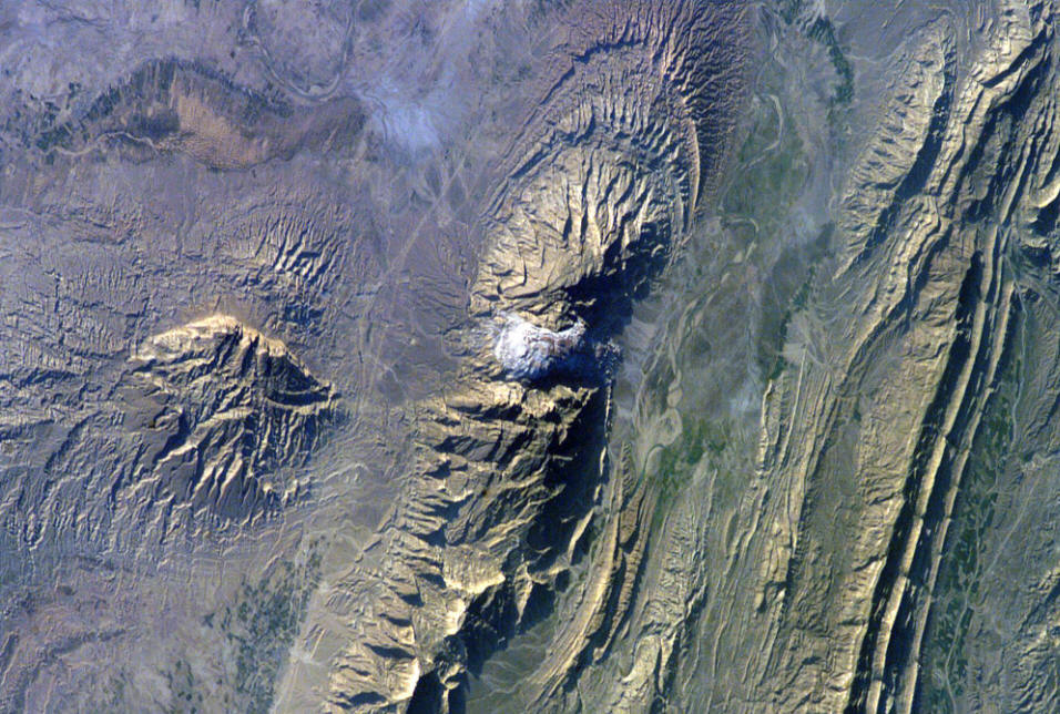
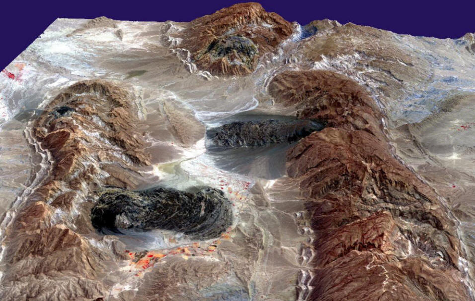
Salt domes and salt glaciers, southern Iran, from NASA and Wikimedia Commons
Makran The Makran is the coastal region of southeastern Iran between the
Straits of Hormuz and the Pakistan border. In the west of this region
the relief runs in a north-south direction parallel to the coast but
from Jask eastwards the relief runs west-east, again paralleling the
coast, to the Pakistan border. The rivers and streams of the Makran
all drain to the sea at the Straits of Hormuz and the Sea of Oman. The
inland Hamun-e Jaz Murian basin is isolated by mountain ranges
reaching peaks in excess of 2000 m. The coastal drainages are often
incised and the larger watercourses pass through tangs over 1000 m
deep (Harrison, 1968).
I have not seen the watercourses between Jask and the upper Geh (=
Nikshahr, Kaeyr or Kalar) River drainage (mouth is at 25°37'N,
60°08'E) but descriptions by Harrison
(1941) indicate they are similar to other areas of Makran. It seems
probable that only the Minab and Sarbaz Rivers have, or nearly have, a
perennial and continuous flow along most of their course. Even these
rivers are quite shallow and the Sarbaz in particular is easily
fordable on foot along its entire length (ca. 280 km). The Minab River
flows over a shorter course (ca. 220 km) than the Sarbaz, but has a
greater flow regime. At Minab (27°09'N, 57°05'E) and at Rudan (27°26'N,
57°12'E) the Minab River was up to 100 m
wide with an estimated maximum depth in pools of 2-3 m. The lower
Sarbaz River was a series of shallow, muddy pools in the bottom of a
canyon with some water flowing over sills connecting the pools (in
early December 1977). The lower Sarbaz has been designated a Wetland of
International Importance. In its middle and upper course the Sarbaz varied
from a very shallow and narrow stream connecting pools (some of which
were fishless) to what must be termed a river in the semi-desert
environment of Baluchestan, with a width of 10 m, a depth of about 1 m
and fast current. The rockfill embankment Pishin Dam built over the
rivers Pishin and Sarbaz is 63 m high, has a crest length of 400 m and
can store 175 million cu m of flood waters (http://netiran.com/news/IRNA/html/930418IRGG10.html).
The other streams of the Makran have little running water, often
become isolated pools a kilometre or more apart, and regularly dry up
along much of their length. Several rivers between the Mazavi (= Geru)
River (mouth is at 26°56'N, 56°56'E)
and the port of Jask are named and marked prominently on maps, but
these were all dry in their lower reaches in late November 1976. Some
flow in their upper reaches is to be expected, but its extent will
depend on topography and recent climatic conditions. A dam and irrigation network is to be constructed on the Jaghin River east of
Jask (IRNA, 26 June 2000).
Coad (1997a) combined the basins of the Makran, Dasht-e Lut, Hamun-e Jaz Murian,
Mashkel and the Pakistani Pishin Lora as a single entity, expanding on
earlier work by Mirza (1980). Mirza proposed the name Gedrosia for the
Baluchistan Plateau west of the Central Brahui and Hala Ranges in
Pakistan. The easternmost river along the Makran coast is the Hingol
in Pakistan. East of this river the fauna becomes much more diverse at
all taxonomic levels and the fauna is an Indus River one. In the
north, the Pishin Lora River basin lies partly in Pakistan and partly
in Afghanistan. Beyond this basin to the north and northwest lies the
Registan Desert and then the Sistan basin, with its distinctive faunal
mix including schizothoracines (Schizothorax, Schizocypris
and Schizopygopsis) and a crested loach (Paracobitis rhadinaea). To the northeast lies an area designated as Yaghistan
by Mirza (1980), with its unique faunal association. The westernmost
river is the Dasht, whose upper reaches cross the Iranian border. The
western limit of Gedrosia is the Mashkel River basin which has several
tributaries from Iran. Coad (1997a) proposed that the limits of
Gedrosia be extended westwards to encompass the Iranian part of the
Mashkel basin, along coastal Makran as far west as the Minab River,
and internally to include the Hamun-e Jaz Murian and southern Dasht-e Lut basins. West
of the Minab River, the fauna was deemed to be unique in having an
endemic cichlid, Iranocichla hormuzensis and in having members
of such Euro-Mediterranean and Southwest Asian (= Middle East)
cyprinid genera as Barbus sensu lato, Chalcalburnus (= Alburnus), Leuciscus
(= Squalius)
and the cobitid genus Cobitis not found further east. However
specimens of Iranocichla hormuzensis have been collected from
the Minab River by H. R. Esmaeili (examined by me in 1997) and this
river may properly belong to the Hormuz basin. I did not collect this
species in the 1970s and it is possible that the record is an
introduction since that time from adjacent rivers as there have been
many accidental movements of fishes in Iran associated with fish farming.
Generally basins within Gedrosia appear most closely related to
their geographical neighbours and support the argument for containing
these endorheic basins in one division. No basins are strongly and
uniquely linked although Makran and Hamun-e Jaz Murian uniquely share Garra
persica and Channa gachua, and Mashkel and Makran uniquely
share Aspidoparia morar and Paraschsitura baluchiorum.
At the species level Gedrosia is most closely related to the
adjacent Yaghistan and Indus basins to the east, then to the adjacent
Sistan and Hormuz basins, and least of all to the remoter
Tigris-Euphrates basin. Its principal relationships are eastern, to
some extent northern and very little to the west.
The generic pattern is different from the species one. The Sistan
basin has the highest share of genera, followed by Yaghistan and Hormuz. The Indus and Tigris-Euphrates
share far fewer genera but they have a greater diversity (5.8 and 2.3 times that of Gedrosia). It is
therefore not surprising that Gedrosia shares proportionately more
genera with immediately neighbouring basins whose fauna at the generic
level is also limited. However, omitting genera found in all basins or
unique to a single basin, reveals that Yaghistan and Indus share 5 of
7 such genera exclusively with Gedrosia. Only Capoeta shows a
different pattern being found in the western basins but not Yaghistan
and Indus. The last genus is Crossocheilus which is found in
the Indus, Yaghistan and Sistan basins. Therefore, generic level
comparisons also show that Gedrosia is most closely related to the east.
The transitional nature of Gedrosia is evidenced by its having the
distributional limits of certain wide-ranging species. This is most
notable for species reaching their westernmost limits, namely Aspidoparia
morar, Crossocheilus latius, Channa gachua, Labeo
dero, Puntius sophore, and Tor putitora (the last
three not recorded from Iran). Species are probably limited by
environmental conditions such as temperature in comparison with the
warm waters of South Asia. However a significant factor, as recognised
by local people, must be the poor physical condition of Baluchistan.
Freshwater marshes, lakes and large rivers are all absent. Desiccation
of water bodies is common and many streams are intermittent. Habitat
diversity for fishes is severely limited. All the common fish species
are non-predatory - most fishes feed on small insects or scrape
aufwuchs from the rocky stream beds.
In contrast to western limits, only one species has a distribution
which is principally Southwest Asian and reaches its eastern limit in
Gedrosia, namely Capoeta damascina. The remaining species have
distributions which are centred on Gedrosia and immediately adjacent
basins. There is also a link northwards in that some species have an
extensive north-south distribution, namely Garra rossica,
Paraschistura
kessleri and P. sargadensis.
One of the most interesting features of Gedrosia is its paucity of
fishes. Diversity is low, presumably a result of the physical
conditions noted above, compounded by desiccation and during climatic
variations both past and present. Gedrosia is presumably an important
former route of dispersal for taxa from South and Southeast Asia to
Southwest Asia and beyond. The significant absences are of taxa found
in the Tigris-Euphrates basin to the west and in the Indus basin to the east.
At the family level, five families are found both west and east,
but not in, Gedrosia. These are Cobitidae, Bagridae, Siluridae,
Sisoridae and Mastacembelidae. No cobitid or silurid genera are
shared. They may be quite ancient and their absence from Gedrosia is
by a vicariant event or their dispersal was via a northern route to
the Tigris-Euphrates and separately to the Indus. The most significant
absences are of such genera as Mystus in the Bagridae, Glyptothorax
in the Sisoridae, Mastacembelus in the Mastacembelidae (Mastacembelus
is not found in eastern Iran and hence does not have a continuous
range throughout the Orient (pace Travers (1984)), and also Barilius
in the Cyprinidae. The last three genera are found in drainages
entering the upper Persian Gulf separate from the Tigris-Euphrates
basin but probably had a recent connection with that basin during the
Pleistocene lowering of sea levels when the Gulf was drained.
Berg (1940) suggested that fish dispersal across this region was
facilitated by the coastal rivers of Iranian and Pakistani Baluchestan
being part of a single river system in the Pliocene, since submerged
by subsidence. This distribution of these genera is not, therefore, a
remnant of the dispersal across Iran from Asia. It is possible that
the Pleistocene fore-deep of the Himalayas had connections with the
Tigris-Euphrates basin which extending down the Persian Gulf as a
river valley. Hora (1937) and Menon (1957) refer to wet, marshy,
tropical conditions and headwater captures along the whole southern
face of the Himalayas and westwards during the Pliocene and early
Pleistocene facilitating the spread of fishes from the east to what is
now Southwest Asia (= Middle East) and Africa. However, it is here
considered unlikely that the Tigris-Euphrates and Gedrosian rivers
were once tributary to the Indus when sea levels were lower during
glaciations as the Gulf of Oman descends to an abyssal plain at 3340 m
as noted above. These taxa probably reached the Tigris-Euphrates basin
across the Iranian land mass and subsequently became extinct as
desiccation increased. Their absence from Gedrosia is probably by loss.
Hora (1937) and Briggs (1987) consider that cyprinids entered
Africa from southeast Asia 18-16 MYA, in the early Miocene, while
other groups moved through Iran and the Arabian Peninsula beginning in
the early Eocene. Kosswig (1951; 1952; 1955a; 1955b) notes the
similarity at the generic level between Indian and African fishes,
e.g. the cyprinids Barilius, Garra and Labeo,
indicating that these fishes arrived in Africa from India after the
desiccation of the Syrian-Iranian Sea in the Pliocene. The primary
route, according to Kosswig and to Por (1987), was a northern one
around the barrier of the Persian Gulf and Sea of Oman via northern
Arabia, Syria and the Levant. Cooling conditions in these areas, and
presumably too in Gedrosia, during the Pliocene and especially the
Pleistocene glaciations, and arid climates at times, were unsuitable
for tropical forms.
Potential endemic taxa are Cyprinion milesi, Paraschistura bampurensis (in Iran), Labeo gedrosicus, Labeo macmahoni,
Paraschistura baluchiorum, and Triplophysa brahui (in Pakistan).
The systematic position, as species, of Cyprinion milesi and Labeo
gedrosicus need further study, and the distributions of the three nemacheilid
species are in contention. Endemism may be relatively high or low
dependent on the resolution of these problems.
Fishes in the easternmost part of the basin have a unique predator
to contend with among Iranian species. The gandoo (marsh crocodile or
mugger, Crocodylus palustris) is found in the Sarbaz, Kaju and Bahu Kalat rivers including the Pishin Dam, makeshift lagoons and fish
culture ponds. It is feeds on Cyprinus carpio and Periophthalmus
(Crocodile Specialist Group Newsletter, IUCN, 18(1), WWW Edition,
downloaded 16 December 1999 from www.flmnh.ufl.edu/natsci/herpetology/newsletter/news181b.htm;
report by A. Mobaraki; A. Mobaraki, pers. comm., 2000). The Cyprinus carpio
are escapees from fish farms.
Asghar Mobaraki (pers. comm., 8 January 2012) recorded a fish kill on 26
December 2011 at the Zirdan Dam construction site on the Kaju River. Species
included Crossocheilus latius and Glossogobius giuris along with
Mugilidae.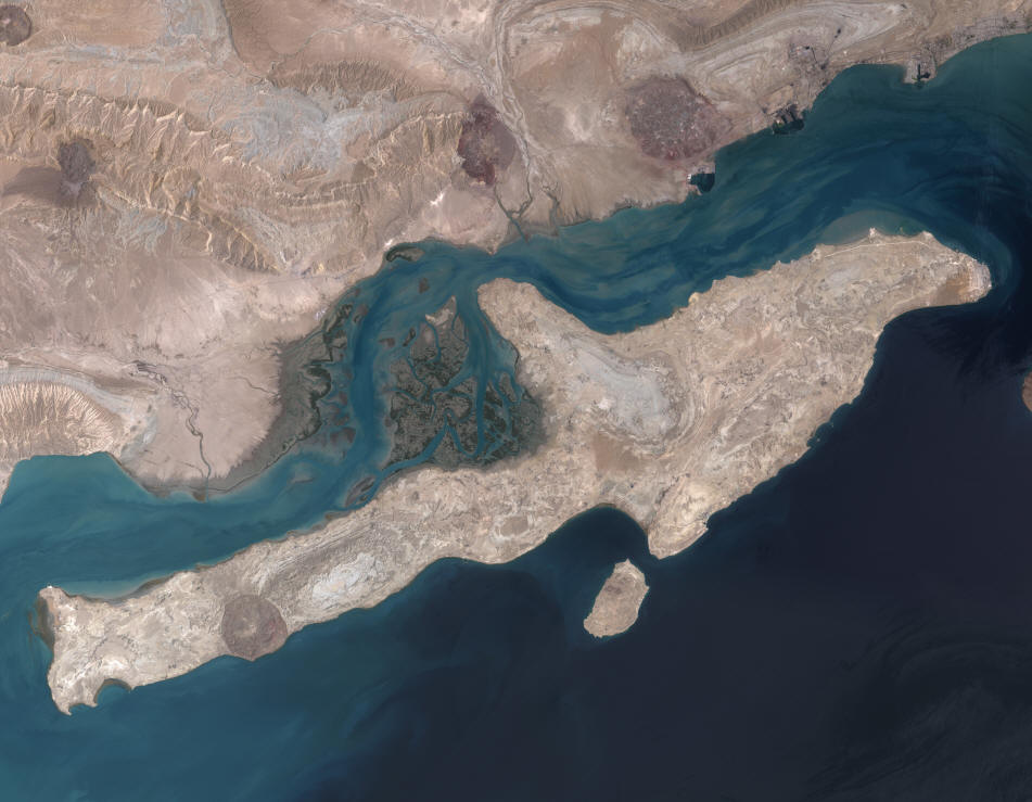
Qeshm Island and adjacent coast, including the Mehran and Kul rivers (left and centre),
from NASA and Wikimedia Commons
Tigris River The Tigris-Euphrates basin is the largest and most important river
system between the Nile and the Indus. Details of its biology can be
found in Rzóska (1980) but comparatively little was based historically on the
Iranian part of this basin although Nümann (1966) gave some limited
data on chemical and physical parameters. There is now an increasing number of
studies on environmental conditions in Iran. Studies on limnology and
pollution were restricted mostly to waters of Iraq, but probably apply
equally well to Iran, certainly as far as those marshes which cross
the border are concerned and for the Shatt al Arab, part of which
forms the southern border of Iran and Iraq. Such studies include Cressey (1958a), Jacobsen and Adams (1958), Al-Hamed (1966c), Mohammed
(1965; 1966), Salonen (1970), Al-Saadi and Arndt (1973), Al-Sahaf (1975), Al-Saadi et
al. (1975), Arndt and Al-Saadi (1975), Antoine and Al-Saadi
(1982), Maulood et al. (1979; 1981; 1993), Sarker et al.
(1980), Saad (1978a; 1978b), Saad and Antoine (1978a; 1978b; 1978c;
1982; 1983), Saad and Kell (1975), Kell and Saad (1975), Al-Hamed
(1976), Al-Daham et al. (1981), Huq et al. (1981),
Schiewer et al. (1982), Antoine (1983), DouAbul et al.
(1987; 1987; 1988), Abaychi and Al-Saad (1988), Abaychi et al.
(1988), Mohamed and Barak (1988), Al-Saadi et al. (1989),
Hussain et al. (1991), Kassim and Al-Saadi (1995), Partow (2001), among
others. Ionides (1937) describes the river regimes of the
Tigris-Euphrates basin, MacFadyen (1938) the water supplies, El Kholy
(1952) the hydrology of the Tigris River, Buringh (1957) the
physiographic regions, shores and irrigation systems on the lower
Mesopotamian plain, and Al-Khashab (1958) the water budget of the
Tigris-Euphrates basin, mainly referring to waters in Iraq. Scott
(1995) gives details of wetlands in Iraq, some of which border and/or
are contiguous with Iranian wetlands, and whose general ecological
features are very similar. Shapland (1997) reviews water disputes in
the Middle East although western Iranian rivers flow out of the
country and are not likely to be affected apart from any losses in
shared habitats or refuges in border areas.
Por and Dimentman (1989) regard the Tigris-Euphrates or
Mesopotamian basin as a cradle for inland aquatic faunas. A
proto-Euphrates collected water from the Levant and had contacts with
the Black and Caspian sea drainages before the Pliocene orogeny. Berg
(1940) points out that the upper reaches of the Tigris-Euphrates basin
today lie on a plateau close to the upper reaches of the Caspian Sea
basin. The basin acted as an area where African and Asian species
could meet or transit such as the cichlid Iranocichla. These
connections were interrupted in the early Pliocene by orogeny, rifting
and desert formation. Banarescu (1977) and Por and Dimentman (1989)
regard the area to be a zoogeographic crossroads with elements from
the Palaearctic such as the cyprinid genera Leuciscus (= Squalius) and Chondrostoma,
Mediterranean genera such as the cyprinid Acanthobrama
(although Krupp (1987) refers to this genus as Palaearctic, of
Mesopotamian origin), and Oriental genera such as the cyprinid Garra
and the spiny eel Mastacembelus.
Al-Rudainy (2008) and Coad (2010) are recent accounts of the fishes in
Iraq. Khalaji-Pirbalouty and Sari (2004) studied the biogeography of amphipods
crustaceans in the central Zagros Mountains. They consider habitat
diversification and climatic fluctuations to be the principal factors
influencing species diversity and endemism in this area, with the mountains
acting as a barrier to species distribution. Endemism is evident in lizards,
plants and amphipods as well as fish.
An analysis by Coad (1996f) shows that this basin is mainly
Black-Caspian Sea basin in its connections, with minor links to Asia
and possibly Africa. Numbers of families, genera and species shared
between the Tigris-Euphrates and neighbouring basins are summarised in
this analysis. Relatively few taxa appear to have made the transition
between Asia and Africa or survived subsequent climatic and habitat changes.
Certain families are absent from the Tigris-Euphrates but are found
in the Indus and the Nile (Notopteridae, Schilbeidae, Clariidae,
Anabantidae, Channidae). These are assumed to be of Gondwanic origin
and are separated today by plate tectonic movements. A representative
of the Channidae is found in eastern Iran but this species is at the
western limit of its range there. Only two families are shared between
the three basins but are not found to the north, Bagridae and
Mastacembelidae, and the relationships of the two species in these
families are with the Indus (Travers, 1984).
At the generic level, some have dispersed into eastern Iran from
the Indus and other eastern basins but have not reached the
Tigris-Euphrates basin, presumably for reasons of time or lack of
suitable environmental conditions, e.g. Aspidoparia, Crossocheilus,
schizothoracines. However two genera have reached the Tigris-Euphrates
(Glyptothorax, Barilius) and Howes (1982) considers Cyprinion
to be related to the eastern genus Semiplotus. Barilius
resembles Indus and other eastern species superficially although its
relationships have not been fully worked out. Assuming that these taxa
dispersed westward from the Indus and the east, the route must be
determined. All but Cyprinion are absent from much of Iran,
including the bagrid Mystus and the mastacembelid Mastacembelus
referred to at the family level above (Mastacembelus is not
found in eastern Iran and hence does not have a continuous range
throughout the Orient (pace Travers (1984)). It is unlikely
that rivers of the Tigris-Euphrates basin were once tributary to the
Indus when sea levels were lower during glaciations as the Gulf of
Oman descends to an abyssal plain at 3340 m. I suspect, but cannot
prove, that these taxa reached the Tigris-Euphrates basin across the
Iranian land mass and subsequently became extinct as desiccation
increased. Many of the rivers in southern and eastern Iran today are
very small, regularly dry up and some are highly saline. They may be
unsuitable for these taxa. Barilius, it should be noted,
appears to prefer, in Asia and the Tigris-Euphrates basin, large
lowland rivers and its dispersal across Iran is difficult to envisage
by headwater capture (the other genera can be found in small streams
at higher altitudes as well as lowland rivers). However Berg (1940)
suggested that fish dispersal across this region was facilitated by
the coastal rivers of Iranian and Pakistani Baluchestan being part of
a single river system in the Pliocene, since submerged by subsidence.
The presence of Mastacembelus and Barilius in western
Iranian basins is attributed to headwater capture and/or colonisation
from the Tigris-Euphrates basin when Gulf rivers were tributary to an
expanded Tigris-Euphrates basin during lowered sea levels in glacial
times. This distribution of these genera is not, therefore, a remnant
of the dispersal across Iran from Asia.
At the generic level, only Garra is found from the Indus to
the Nile and in the Tigris-Euphrates basin. Menon (1964) suggests that
Garra reached the Tigris-Euphrates basin and Africa in two
"waves" from Asia, the first wave being in the Miocene to
the Tigris-Euphrates basin, the second through southern Arabia to
Africa during the Pliocene. Karaman (1971) disputes Menon's Garra
waves based on anatomy and zoogeography. Garra presumably
dispersed from Asia to Africa via the Tigris-Euphrates basin and the
Levant. The apparent continuous distribution of Garra across
southern Arabia is not borne out in systematic analyses by Krupp
(1983). Garra (and Cyprinion) species of southeastern
Arabia are clearly related to southern Iranian species, having crossed
the Persian Gulf when it was drained during the Pleistocene and part
of an extended Tigris-Euphrates basin. Southwestern Arabian species
(and a Barbus species) are a mixture of African and Levantine
elements. Krupp (1983) found no evidence in his studies for the
Arabian Peninsula serving as a transition area in an exchange of
freshwater fishes between Asia and Africa.
Nemacheilus sensu lato also has a similar wide distribution but is
probably polyphyletic and detailed revisionary works are enabling
adequate zoogeographical analyses to be made. The systematics of
loaches in the Middle East is a contentious subject (Por and Dimentman,
1989). The absence of nemacheilid species from southern Arabia
also argues for a dispersal route through the Tigris-Euphrates basin
as these cryptic fishes are found today in many small streams
throughout Southwest Asia and are unlikely to have been eliminated
from southern Arabia through desiccation.
The only Nile (or east African) genus present in the
Tigris-Euphrates basin is Barbus sensu lato. Certain members of this
polyphyletic genus in Southwest Asia are characterised by sharing 6
branched anal fin rays, last unbranched dorsal fin ray a smooth spine,
large scales, few gill rakers, high dorsal fin ray counts, reduced
barbel numbers, compressed body, and other characters which set them
apart from European Barbus as a monophyletic group, probably
related to east African species (suggested by Banister (1980)). These former Barbus
species are found from southwestern Arabia (but not southeastern
Arabia), through the Levant and the Tigris-Euphrates basin to rivers
at the Strait of Hormuz in Iran. They may represent an African element
in the fauna of the Tigris-Euphrates and may reflect the route of the
cichlid Iranocichla or its ancestor from Africa to the Strait
of Hormuz. Bănărescu (1992b) considers African elements in Southwest Asia to be the oldest,
of at least Miocene age.
A significant proportion of the families and genera in the
Tigris-Euphrates basin is also found in the Black-Caspian Sea basin.
Such widespread, northern cyprinid genera as Alburnoides, Alburnus,
Aspius, Alburnus, Chondrostoma, and Leuciscus
(= Squalius)
reach their southern limit in the Tigris-Euphrates basin (and
neighbouring Iranian basins) suggesting that they reached the
Tigris-Euphrates basin from the north.
The presence of Glyptothorax in the Black Sea basin of
Anatolia (Coad and Delmastro, 1985) is a recent event through
headwater capture from the Tigris-Euphrates basin and thus far is the
only example of a clearly-defined Indus genus reaching the
Black-Caspian seas basin. It is probably an example, in reverse, of
the colonisation of the Tigris-Euphrates basin in recent times from
the Black-Caspian seas basin. Headwaters of a number of
Tigris-Euphrates basin rivers interdigitate with the upper reaches of
Black-Caspian seas basin rivers, e.g. the Aras River of the Caspian
Sea and the Kizilirmak of the Black Sea with the Euphrates near
Erzurum and Sivas respectively; the Qezel Owzan of the Caspian Sea
with Tigris River tributaries. Headwater capture is common in the
Zagros Mountains (Oberlander, 1965) and in Anatolia and pluvial
conditions in the past would have facilitated fish dispersal. Por and
Dimentman (1989) mention direct connections of a proto-Euphrates with
Black Sea and Caspian sea fluviatile drainages before the Pliocene
orogeny which would serve to allow entry of taxa to the
Tigris-Euphrates basin. Direct connections were interrupted by the
early Pliocene as orogeny, rifting and desertification took hold.
Almaça (1990) has reviewed possible routes for Barbus sensu lato species
into Iran and the Tigris-Euphrates basin from the north via what is
now Anatolia and east of the Caspian Sea dating from the early
Oligocene. A continuous route for exchange of taxa has been possible
since the upper Miocene, almost 12 million years ago. These routes
have been variously available down to modern times for Barbus sensu lato
and other taxa as exemplified by some species being in common between
the Black-Caspian seas basin while others are distinct but related at
the generic level. Bănărescu (1992b) considers that northern or European elements penetrated to the
Tigris-Euphrates basin earlier than Asian ones, and that this partially explains their prevalence.
Iranian internal and Gulf basins and the Levant show evident
affinities with the Tigris-Euphrates basin. The ichthyogeography of
the Levant has been dealt with by Krupp (1987) and will not be
reviewed here. Krupp considers that parts of the Levant were colonised
separately via branches of the Tigris-Euphrates river system. Iranian
basins to the west of the Tigris-Euphrates basin have a very similar
fauna to that of the Tigris-Euphrates at the species level. The
diversity falls off rapidly with distance (Coad, 1987). Headwater
capture in the Zagros Mountains is an evident route for species found
in common with the Tigris-Euphrates basin but not in Iranian rivers
draining separately to the Gulf. The draining of the Gulf during
Pleistocene lowering of sea levels enabled Tigris-Euphrates basin
fishes to colonise tributary Iranian rivers now separated by a rise in
sea level. The melting of the Laurentide ice sheet and drainage of Lake Agassiz
in Canada caused this rise in sea level world-wide, including the shallow
Persian Gulf (Perkins, 2002). By about 11,500 years B.P., the Gulf was filled
with present shorelines attained shortly before 6000 B.P. and exceeded by 1-2 m (Lambeck, 1996).
Por and Dimentman (1989) regard the Mesopotamian subregion or
Tigris-Euphrates basin as one of the most isolated major freshwater
areas in the world. However, as Coad (1997f) points out, endemism is
only at the species level and diversity is low with only about 52
primary division species in 7 families, 34 species of which are Cyprinidae.
Abbasi et al. (2009) studied the wetlands in Hamadan Province and
found 23 species in four families (Cyprinidae (17), Nemacheilidae (4), Cobitidae
(1) and Poeciliidae (1)). Carassius auratus, Cyprinus carpio,
Pseudorasbora parva and Gambusia holbrooki were exotics and the fauna
was dominated by Alburnus mossulensis (28.0%), Carassius auratus
(12.5%) and and Capoeta aculeata (11.7%). The Zagros Mountains form the western flank of Iran and store water
as snow. The higher peaks are snow-capped even in summer. Zard Kuh,
for example, reaches 4548 m (32°22'N, 50°04'E).
Rivers drain south and west to become tributaries of the Tigris River
in Iraq or its confluence with the Euphrates River, the Shatt al Arab
(known as the Arvand (= swift) Rud in Iran). The Shatt al Arab has a course of
190 km to the head of the Persian Gulf and is navigable by ocean-going
ships. It forms part of the Iran-Iraq border. The origin of the Tigris
River is the Hazar Gölü of Elazig (38°41'N, 39°14'E) between the Murat Nehri and the
Euphrates. It flows south-east, forming a short section of the border
of Syria with Turkey, before entering Iraq to parallel, roughly, the
course of the Euphrates River. It is a larger and swifter river than
the Euphrates because of its left bank tributaries from Iran. The
Tigris is over 1900 km long (1851 km and 2032 km are extremes cited in
the literature). It is the 81st river in size in the world. The
Tigris-Euphrates basin encompasses 784,500 sq km of which 19% or
146,000 sq km lies in Iran (Gleick (1993) gives 238,500 sq km and 27%
for Iran and 884,000 sq km for the whole basin; the Iraqi Government
in the same publication gives 378,834 sq km for the Tigris basin alone
with Iran's share 28.8%). Iran contributes 7% of the water supply of
this immense basin. The Tigris catchment is 166,155 sq km.
The Tigris is an
alkaline river (pH 7.8-8.2) with a total hardness of 200-350 mg/l.
Water temperatures range from 8.5°C in
January to 31.4°C in August. The flow
pattern of the Tigris and its tributaries has a sharp peak in April at
about 9 billion cu m, falling rapidly to about 1 billion cu m from
August to October before beginning to rise again. The water level may
fall by as much as 2 m over the summer. Interannual variation in
spring flood levels are marked. Approximate streamflows over the past
6000 years are given by Kay and Johnson (1981) based on proxy data
from paleoenvironmental sources. They found an increase in streamflow
over this period. The southern province of Khuzestan in the Tigris
river basin with 9% of Iran's surface area has an estimated 37% of its
surface water flow.
The Shatt al Arab is under tidal influence up to 110 km from the
mouth. Its waters are therefore strongly mineralised. Salinity varies
with distance from the sea. Crops are irrigated by means of the tidal
rise which is used to push fresh water into the fields (Harrison,
1942; Gholizadeh, 1963; Gholizadeh and Fatemi, 1969). This has obvious effects for the
fish fauna and its composition as well as for increased salinisation
of habitats. There are appreciable diurnal and seasonal fluctuations
in physico-chemical conditions. Tidal waters probably penetrated far
inland through the Holocene as evidenced by faunal remains in
boreholes of the Hammar Formation (MacFadyen and Vita-Finzi, 1978).
Al-Hassan and Hussain (1985) describe the hydrological parameters
affecting the penetration of marine fishes into the Shatt al Arab.
Recently an increase in the Tigris River discharge has decreased
salinity in the Shatt al Arab: previously marine species were common
at Basrah in Iraq but they became rare, Carassius auratus
appeared in Basrah fish market and Cyprinus carpio was caught
in large numbers down to the estuary (N. A. Hussain, in litt.,
1994). Pollution is widespread in the Shatt al Arab from industrial,
agricultural and untreated human wastes. Hussain et al. (2001) evaluate
environmental degradation in the Iraqi portion of the Shatt Al-Arab and its
effects on the fish fauna.
The principal Iranian tributaries of the Tigris River are the
Little Zab River (= Zab-e Kuchek) which drains a small stretch of
mountains south of Lake Orumiyeh, and the Diyala River (= Sirvan
River) which drains the western mountains of Kordestan. The Diyala
River is 442 km long. A principal tributary of the Diyala in Iran is the Qeshlaq River
which flows through Sanandaj (35°19'N, 47°00'E). The river is polluted from Sanandaj and from agriculture wastes (Jafari Salim et al., 2009).
The Qeshlaq, Gheshlagh or Vahdat Dam near Sanandaj has a fauna including Alburnus
mossulensis, Hypophthalmichthys molitrix, H. nobilis, Barbus lacerta, Capoeta damascina, C. trutta,
Ctenopharyngodon idella, Cyprinus carpio, Gambusia holbrooki,
Pseudorasbora parva and Squalius cephalus (Barzegar and Jalali,
2006; Bozorgnia et al., 2012). Thirty species of parasites were found on this fauna, notably Ligula
intestinalis, which is detrimental to native and food fishes.
Lake Zaribar, Zarivar or Zeribar is a permanent freshwater body with
fringing reed beds and extensive marshes lying at 1435 m in the Diyala
River drainage just west of Marivan at 35°32'N,
46°08'E. It has an area of 8 sq km and a
maximum depth of 6 m and an average depth of 2.5-3.5 m. Reputedly the
lake is fed by 600-700 springs. At high water it overflows into a
small river at its southern end. In winter it often freezes over. It
was damaged in the Iran-Iraq War suffering rocket and missile hits and
chemical warfare (Scott, 1995; 1997). There is a small resort at the
southeast corner of the lake, the surrounding land has livestock
grazing and agriculture with drainage channels for the peripheral
marshes, forests are cut for fuel, and there is waterfowl hunting and
fishing. Exotic fish species have been introduced by a government
organization, including Alburnus alburnus (= hohenackeri), Ctenopharyngodon
idella, Cyprinus carpio (in two varieties), Hemiculter leucisculus,
Hypophthalmichthys
molitrix, H. nobilis, Pseudorasbora parva and Gambusia
holbrooki. Native fish include Barbus lacerta, Capoeta buhsei (sic), Leuciscus
(= Squalius) cephalus, and Mastacembelus mastacembelus
(Scott, 1997). Jalali et al. (2002) add the species Capoeta damascina
(possibly the correct identification of the C. buhsei listed above but
Esmaeili et al. (2010) include C. barroisi),
Carassius auratus (given as Carassius gibelio by Esmaeili et al.
(2010, 2011), and Chalcalburnus (= Alburnus) sp.
Esmaeili et al. (2011) add Squalius lepidus from previous records
but do not mention Squalius cephalus. A number of minor streams also cross the Iran-Iraq border, but the principal
rivers drain through anticlines in spectacular gorges or tangs, funnelling the waters of the Zagros onto the Khuzestan plains through
a narrow gap near Dezful (32°23'N, 48°24'E).
Stream flows in late winter are at least ten times that of summer and
116,500 sq km of mountains and three big rivers debouch onto 38,800 sq
km of plain. Lowlands may be inundated for more than 100 days. Early
accounts of floods in Mesopotamia, dating back to Sumerian times
almost 5000 years ago, are discussed by Mallowan (1964). Floods can
encompass close to 100,000 sq km in Iran and Iraq at the head of the
Persian Gulf (Naff and Matson, 1984). Progressive clearing of woodland
over the last 7000 years increased runoff, causing higher and more
severe floods, soil erosion, increased turbidity in streams and higher
sedimentation (Wagstaff, 1985). Erosion is three times the world
standard rate at 30 tonnes/hectare and will rise twofold over the next
ten years (IRNA, 20 December 1998). All these must have, and
continue, to affect the fishes in this and other basins, favouring
those species able to cope with these conditions. Even artificial habitats such
as small dam reservoirs in Chahar Mahall and Bakhtiari are affected by high
sedimentation rates and their utility as fish habitat must be affected (Mousavi
and Samadi-Boroujeni, 1998).
The main river is the Karun, with a catchment of 67,340 sq km (Naff
and Matson, 1984) and a length of 820 km. It now drains to the Shatt
al Arab but once drained directly into the Persian Gulf. The Karun is
also connected to the Gulf via the Bahmanshir River, paralleling the
Shatt al Arab, and enclosing Abadan Island. The Bahmanshir is the only
river along the Persian Gulf coast to have a significant fishery. A
physicochemical study of the Bahmanshir was carried out by Faal (2009).
The
Karun headwaters are extensive and lie near both the Esfahan and Kor
River basins. The environmental conditions in a headwater dam, the Hanna
Reservoir, in the Karun basin are described by Esteky (2001), two-thirds of the
reservoir being covered by macrophytes. The Dez River is a Karun tributary and is 400 km long.
The Karkheh River (with the Cherdavel, Kashkan, Qareh Su, Gav Masiab and Simareh in its upper reaches)
is 320 km long, but is lost in the Hawr-al-Azim marshes of the Tigris after
draining 43,000 sq km. Sutcliffe and Carpenter (1967) described runoff from the
Karkheh basin. The Karkheh and Dez flows were depleted by 70% in 2001
during a drought and it was thought that these rivers might dry completely
(Foltz, 2002). The marshes along the Karkheh and Dez rivers,
with oxbow lakes and riverine forest, are a habitat now rare in
southern Iran and Iraq outside protected areas. The severe drought of
the year 2000 dried up the natural Dez reservoirs south of Dezful (www.irna.com/newshtm/eng/08130315.htm,
IRNA, 29 July 2000). The Karkheh Dam, 20 km northwest of
Andimeshk, has a crest 3030 m long, a height of 127 m and is
the sixth largest dam in the world with a capacity of 7.8 billion cu m,
nearly a third of the total dam capacity for the country. The dam is meant to
produce electricity, for fish farming and to control floods and drought (IRNA,
17 April 2001; 19 April 2001; Aftab Yazd, Tehran, 346(18 April 2001, 7
pp.; Sadegi, 2003). The Qareh Su near Kermanshah is about 30 m wide and less than a metre deep at its
deepest. The Qareh Su or "black water" derives its name from
its transparency over a dark, pebbly bed, distinguishing it from the
muddy rivers of the lowlands. The Qareh Su is the Classical Choaspes,
the water of which the ancient monarchs of Persia carried with them on
their military expeditions for its taste, a superiority confirmed by
Buckingham (1829). The Gawshan Dam is located at Kamyaran near
Kermanshah on the "Gaweh" River and is scheduled for
completion in 2002. The dam will be 136 m high and the complex
includes a 19 km long tunnel for water transfer (http://netiran.com/news/IranNews/html/94111305INEC.html).
Other dams include the 40 million cu m Zarivar Dam in Marivan and the
563 million cu m Kavoshan Dam 35 km south of Sanandaj (http://netiran.com/news/TehranTimes/html/95111803TTPL.html).
Partow (2001) lists 18 dams in the Tigris basin of Iran, either constructed
or planned, and these will affect the environment markedly in changing flow
regimes, impounding water and eliminating fluvial habitat, removing silt,
affecting temperature downstream, causing salinisation as return water from
irrigation projects flows back into rivers, and so on. The Karkheh Dam is planned to carry water via pipeline over land (330 km in
length) and under the sea (210 km) to Kuwait. The supply rate would be 200
million gallons per day (Partow, 2001) or 300 million cu m (www.irna.com, downloaded 29 January 2003).
The Dez (formerly Mohammed Reza Shah Pahlavi) Dam on the Dez River at 32°38'N, 48°28'E
contains 3350 million cu m of water (another source states 60 billion
cu m) and has a maximum surface area of 4000 ha. Surface water
temperatures can exceed 30°C while at 50 m plus depths it is 15-16°C in summer.
Its original life span was estimated at 100 years but this had to be
reduced to less than 50 years because of the rapid accumulation of
sediment from erosion. Sediment prevents development of a bottom fauna
and steep banks with water fluctuations limit vegetation. Nümann
(1966, 1969) gives some limnological information on this reservoir.
Nümann (1966) recommended introduction of Acanthobrama
terraesanctae and Tilapia galilaea from Israel to the
reservoir, and later Sander lucioperca and even trout. Sabzalizadeh
(2006) gives a description of the ecology of this reservoir and Eskandari et
al. (2007) a description of fish populations. Capoeta trutta, Barbus
(= Tor) grypus and Barbus (= Luciobarbus) esocinus were the most numerous species and
the fauna includes the exotics, Carassius auratus, Hypophthalmichthys
molitrix and Oncorhynchus mykiss. There is
also a diversion dam, the Sadd-e Gotvand. The Gotvand Dam is under
construction and will be 180 m high with a reservoir capacity of 4,500
million cubic metres making it the second largest dam in Iran (sic)
(IRNA, 25 January 2000). The 205 m high Karun-3 Dam near Izeh,
to be completed in the year 2001 (filling actually started in 2003 -
www.netiran.com, downloaded 15 November 2004), is a major hydroelectrical plant as
is the Karun-4 Dam (Shahid Abbaspour) near 25 km northeast of Masjed-e
Soleyman (http://netiran.com/news/IranNews/html/95040822INPL.html). A
major dam is also planned at Shushtar (IRNA, 26 September
1998). A tunnel is planned from the Dez River to Golpayegan to supply water to
Markazi Province in central Iran (www.iranmania.com, downloaded 19 January 2004).
Some literature refers to the Seymarreh-Karasu-Gamasiab (and
variant spellings) as an important complex of rivers. These are the
Simareh, Qareh Su and Gav Masiab in gazetteers. A giant dam is planned
for the Simareh (IRNA, 26 September 1998). Nümann (1966) notes
pollution in these rivers from an oil refinery and sugar factory which
decreased fish populations, a condition exacerbated through the use of
explosives, insecticides and herbicides by local people to catch fish.
He also lists explosive usage on the rivers Khairabad and Zohreh.
Lake Mirabad lies in the basin of the Karkheh at 33°05'N,
47°43'E. While it measures only 100 by 200 m it is important for establishing past vegetation and
environments based on sediment cores (Griffiths et al., 2001). The Hashelan
or Hashilan Marsh at 34°33'N, 46°55'E occupies 260 to 400 ha (accounts differ) northwest of
Kermanshah at about 1310 m. It is a complex of permanent spring-fed
pools and associated marshes with much submerged, floating and
emergent vegetation. The surrounding plains are heavily grazed and
cultivated and ducks are hunted in the marshes. The Sabz Ali spring feeding the
marsh has an average annual discharge of 323.4 l/sec, range 208.3-442.5 l/sec,
highest in March and lowest in September. The total average volume of water in
the marsh is estimated at 1.02 x 10⁷ (Karami et al., 2001).
Local people and those from Kermanshah fish in the marsh. A drought in 2008
severely affected the Hashilan Marsh (www.payvand.com/news/08/aug/1152.html,
downloaded 5 July 2009). A truck carrying diethyl hexanoyl plunged into the Kashkan River, a
Karkheh tributary in Lorestan, 15 km from Pol-e Dokhtar resulting in
the poisoning of thousands of fish on 13 April 1998 (IRNA, 14
April 1998; Brief on Iran, 880, 16 April 1998). The river suffered an oil
slick in October 2001 when the Khuzestan-Tehran pipeline fractured 4 km from Pol-e
Dokhtar. Oil pollution caused a fish kill numbering about 70,000 fish in the
Kambel River near Gachsaran, a centre of oil production (Tehran Times, 24
November 2002). Varkouhi and Sobhani (2005) and Varkouhi (2007) studied the presence of various
pollutants in the livers of fishes in the Khorramabad River. The Meymeh River in
Ilam has some pollution from urban and rural sewage, and this may potentially
increase (Cheraghi et al., 2007). The Jarrahi River is a southern Karun tributary from the east. The
Marun River is a major Jarrahi tributary. The Marun and Jarrahi feed the
Shadegan Marshes, the largest Iranian wetland according to Kurdistani and
Bajestan (2004). The Marun Reservoir Dam
northeast of Behbahan was scheduled for completion in 1996 with a
crest of 345 m (IRNA, 11 November 1998) but was to be completed in 2004 with a crest of 175 m and containing
1.2-1.3 billion cu m of water (IRNA,
12 January 1999; IRNA, 5 February 2002). There are also four diversion
dams on the Marun and one of these, the Jazaeen, has a fishway but fish are
trapped downstream of it during their migration (sic)(Kurdistani and
Bajestan, 2004). Other dams in this system lack a fishway. Later Kurdistani and
Bajestan state that there are no migratory fishes in the Marun, only resident
species (which presumably undergo local movements blocked by dams). They mention
Barbus (=
Tor)
grypus and Barbus (= Luciobarbus) pectoralis as the affected species. The Jareh Dam on the Zard River northeast of
Ramhormoz dates back to the Sassanid era and is still in use (IRNA,
26 June 2000).
The Karun has the greatest mean discharge, followed by the Dez and
Karkheh. The Karun mean discharge is the largest in Iran. The Karun
carries a heavy silt load with a hundredfold increase during flood.
The Karun discharge ranges from 207 cu m per second to 2225 cu m/sec,
average 1100 cu m/sec, while the Dez is 63-1227 cu m/sec, average 288
cu m/sec. The Jarrahi range is 8-770 cu m/sec, average 78 cu m/sec.
These figures vary among different sources indicating fluctuations
between years and gauging stations; however the relative importance of
these rivers is shown. The peak discharge of the Karun is in April,
with high values also in March and May; the lowest discharge is in
October when flow is only about a ninth of the peak. The combined
Tigris-Euphrates-Karun in flood carries five times the load of the
Nile (Fisher, 1968). Most of this is deposited north of Basrah (30°30'N,
47°47'E) and much is lost to evaporation
in the marshes, e.g. of 27 cu km of discharge into the Persian Gulf
through the Shatt al Arab, 22 cu km is from the Karun River. 22
million metric tons of dissolved chemicals are deposited each year and
hence there are siltation and salinity problems in the lower parts of
this basin.
The Karun River on the Khuzestan plains was examined in 1992 for
various parameters and at various localities (courtesy of the Iranian
Fisheries Research and Training Organization, Ahvaz). It has a pH of
7.07-8.85, mean 8.17, dissolved oxygen 5.6-12.38 p.p.m., mean 9.29
p.p.m., bicarbonate 79.3-214.72 p.p.m., mean 154.4 p.p.m., carbonate
0.6-21, mean 5.53 p.p.m., total alkalinity 1.9-3.8 meq/l, mean 2.84
meq/l, carbonate hardness 5.32-10.64 p.p.m., mean 7.95 p.p.m., total
hardness 168-474 p.p.m., mean 287 p.p.m., ash residue 40-1142 p.p.m.,
mean 425 p.p.m., chloride 45.4-518.3 p.p.m., mean 207.28 p.p.m., total
dissolved solids 226-1374 p.p.m., mean 696 p.p.m., sulphate 43.75-325
p.p.m., mean 101.73 p.p.m., calcium 33.63-101.7 p.p.m., mean 61.8
p.p.m., magnesium 16.8-78.24 p.p.m., mean 33.8 p.p.m., phosphate
0.05-4 p.p.m., mean 0.24 p.p.m., iron trace to 0.32 p.p.m., mean 0.069
p.p.m., manganese trace to 0.657 p.p.m., mean 0.483 p.p.m., and
nitrate trace to 0.657 p.p.m., mean 0.039 p.p.m. Esmaili et al.
(1999) report heavy metals in water, sediments and fish from the Karun River and
Jafarzadeh-Haghiehi et al. (2005) report on the poor water quality of the river.
Haghighi and Arabi (2010) modeled water exploitation of this river for fish
farms, tracing heavy metal pollution and concluding where water could be safely
withdrawn. As lowlands at the head of the Persian Gulf receive waters from
this vast drainage basin, floods occur, increasing the depth and
extent of marshes. Flood waters may increase depths by 1-1.5 m, with
2-3.5 m in more permanent basins. Most of the large marshes lie in
Iraq, but the Hoveyzeh or Hawr-al-Azim marshes are on the border, and occupy 3000 sq
km at high water. They are fed by the Karkheh and other rivers from
Iran. Construction of the Karkheh Dam in Iran (and pipeline water transfer to
Kuwait) will reduce input of water to this marsh, compounded by canal
construction and draining of marshes in Iraq. Additionally, irrigation
return waters will be salinised (Partow, 2001). A dam has been built by Iran
across the Hoveyzeh marsh to retain water on the border with Iraq.
Marsh temperatures range from 15°C in January to 31°C in August and fish may
retreat to deeper areas or move upriver at the higher temperatures.
Flooded marshes tend to be warmer than rivers in winter. The Shatt al
Arab has temperatures of 32°C in July and 16°C in December. Asadi et al.
(2011), using gill nets at three stations in the Hoveyzeh Marsh, found 19 fish
species with Liza abu at 23.95%, Aspius vorax at 15.03%,
Carasobarbus luteus at 10.41%, Carassius auratus at 8.14% and
Silurus triostegus at 6.4%. The average water temperature of the marsh was
21.1°C, salinity was 1.79 p.p.t. and pH was
7.5. Floods are often a feature of these southern rivers and some loss
of fish stocks must occur as they recede. For example, the Jarrahi and
Zohreh rivers overran their banks in November 1994 after torrential
rains causing widespread flooding (http://netiran.com/news/IranNews/html/94112109INEV.html).
Climate change is predicted to have effects on snowmelt runoff of the Karun
basin (Ghorbanizadeh Kharazi et al. (2010). In the period 2000-2050, peak
runoff will shift from spring to winter, summer flow is decreased slightly and
autumn not changed considerably. Spring flow is important for fish spawning. The Zagros Mountains consists of tightly packed ranges in the Tigris basin
trending north-west to south-east. A trellis drainage pattern is
imposed on this. The tangs, their formation and the drainage pattern
are described by Harrison (1937) and Oberlander (1965; 1968a). These
deep defiles may exceed 2400 m in depth with vertical walls of 300 m
splitting anticlinal mountain ranges instead of taking apparently
easier routes around their ends. They may well be barriers to the
movement of less vagile fish species or a highway into the interior
for those with some dispersal ability. Tangs formed because an
antecedent drainage over lower relief was gradually uplifted at a rate
slow enough to permit streams to cut through ridges and retain the
original pattern of drainage once the softer material was washed out
of the valleys between the anticlines.
The uppermost parts of the basin show evidence of headwater
captures and this orogenic zone is very unstable. The divide between
endo- and exo-rheic basins is not the snowline of the Zagros but is
east of it, so streams must first cross the Zagros peaks to start on
their journey to the Persian Gulf.
Springs are important in the mountains, tapping aquifers and
helping to maintain river flow. The Karun River traditionally has its
source in springs. Keivany et al. (1992) surveyed 72 springs in
Chahar Mahall va Bakhtiari Province, in the upper Karun River basin,
and found them suitable for trout culture with a potential production
of about 6000 tonnes per year. Flows varied from 50 to 4000 l/second,
temperature from 6 to 15°C, pH from 6.2
to 7.8, conductivity from 128 to 570 mMoh/cm, total alkalinity from
20-220 meq/l, total hardness from 140-250 mg/l, oxygen from 7 to 11
mg/l, carbon dioxide from 5 to 20 mg/l (falling rapidly to less than 2
mg/l within a few tens of metres of the spring source), H2S
0 mg/l, Cl- 1-28 mg/l, SO4-- 14-135
mg/l, PO4-- 0.1-0.3 mg/l, Ca++ 16-82
mg/l, Mg++ 3-34 mg/l, K+ 0.2-1.0 mg/l, Na+
0.5-1.5 mg/l, Fe+++ 0-0.06 mg/l, Fe++ 0 mg/l, NO2-
0-0.2 mg/l, NO3- 0-13 mg/l, NH4+
0-0.5 mg/l, and HCO3- 48-220 mg/l. Springs (or sarabs) in
Kermanshah Province have been described by Khatami and Shayegan (2003) and are
regarded as a significant water supply for rivers. Sarabs are used for drinking
water and irrigation, and are threatened by pollution and fish farms. Qanats are
also found, in drier parts of the basin, but they are not as
significant for fish habitat as in other parts of Iran.
Marshes and ponds as well as seasonally flooded arable land
along the Karun River in the lowlands of Khuzestan provide temporary
and permanent habitats for fishes. Some are reviewed below. The "Hawr-e Bmdej"? or "Sadi Shavour" Marshes
lie between the Karkheh and Dez rivers northwest of Ahvaz at 31°45'N,
48°36'E and encompass 12,000 ha. This is
the most extensive permanent freshwater marsh with tall reeds of Phragmites
and Typha in Khuzestan. There is relatively little open water.
Some parts are being drained for agriculture, a continuing trend for
marshes with concomitant loss of fish habitat. The "Hamidieh"
plains at 31°20'N, 48°20'E
comprise 20,000 ha of seasonally flooded (winter) plain and arable
land along the Karkheh River. Hamidieh Lake, an old oxbow of the
Karkheh, is included in this area and is permanent fresh water. The
lake is 3 ha and has extensive reed beds.
The "Susangerd" Marshes or Hawr-e Susangerd at 31°45'N,
47°55'E are northwest of Ahvaz near the
Iraqi border and form the extreme eastern edge of the Hawr-al-Azim,
most of which lies in Iraq. The marshes occupy about 30,000 ha and are
made up of permanent and seasonal fresh and brackish marshes and
seasonally flooded arable land. The marshes are on the floodplain of
the Karkheh River. Irrigation projects, grazing by livestock, reed
cutting and fishing all occur here. Parts of the marsh were damaged by
the Iran-Iraq War. The Iran-Iraq marshes declined in area from 1089 sq km to 758
sq km from 2000 to 2002 and was predicted to dry up in 5 years from 2002 because
of the Karkheh Dam. Reports conflict since once the dam was full, a relatively
normal flow regime would help maintain the marshes. Restocking with 490,000
Barbus (=
Mesopotamichthys)
sharpeyi and and Barbus (= Luciobarbus) xanthopterus took place in this marsh (www.shilat.com,
downloaded 12May 2006).
The Shadegan Marshes or Wetland at 30°20'N, 48°20'E
occupy 282,500 ha (Jones, www.ramsar.org/lib_dir_2_3.htm, downloaded 4
April 2000) gives 296,000 ha, Hashemi et al. (2012) 400,00 ha, the
largest wetland in Iran) and form the southern part of the
seasonal floodplain of the Dez, Karun and other rivers at the head of
the Persian Gulf. There are adjacent tidal mudflats. The central and
southern part of the marshes are part of a Ramsar Site, along with the
mudflats (World Conservation Monitoring Centre, 1990; Kaffashi et al.,
2012). Sabzalizadeh and
Amirineia (2003) give some physical and chemical characteristics of 5 sample
stations in this marsh. Range of pH was 7.2-9.4, maximum water temperatures
occurred in July and August. Maximum levels of dissolved oxygen were found in
November and February but were more than 5 p.p.m in most cases, optimum for fish
growth and reproduction. The water quality was hard and brackish. The whole area may dry out in late summer, a natural
condition exacerbated by dams and irrigation schemes on the major
inflowing rivers. In a November 2000 visit, much of this area was dry although
it had been flooded in 1999. When the marsh dries, fish
concentrate in the deeper pools where they are easily caught, even the
smaller ones. The marsh is re-colonised from the rivers. Fishing is important. The fishes of
this marsh in order of abundance are kopur, shirbot, touyeni, esbele,
binni, berzem, biah and very few himri and gattan (Y. Mayahi, pers.
comm., 2000). Hashemi et al. (2011) found a maximum fish biomass of
249.61 kg/ha.yr in spring and a minimum of 157.9 kg/ha/yr in winter in this
wetland while other studies/publications give 337.17 kg/ha/yr in autumn and
83.19 kg/ha/yr in summer (Hashemi et al., 2010a; 2010b) and 381 kg/ha for
spring and 71 kg/ha for summer (Hashemi et al., 2012). An estimated 2000 t can be harvested from a biomass of about 11,000 t
although over-exploitation was evident at about 3738 t. A comparison with an
earlier 1997 study showed that biomass of Mesopotamichthys sharpeyi,
Carasobarbus luteus, Carassius carassius (sic), ? gibelio
or auratus), Liza abu, Tor grypus and Silurus triostegus
increased while Aspius vorax, Luciobarbus pectoralis and
Cyprinus carpio decreased with changes in environmental conditions.
Variations in fish biomass were attributed to loss of floodplain areas, dam
construction altering the hydrological regime, increased salinity from
irrigation, and pollution. Rice paddies occupy part of this Ramsar Site and reed
cutting, fishing and grazing goes on. There is extensive reed cutting, some livestock
grazing, some rice paddies and potential pollution from main roads,
shipping and oil terminals. Over 100,000 ha were contaminated with oil from a
leaking pipeline in 2000 and 35,000 cu m of refinery wastes were dumped in the
marsh in 2004 (www.payvand.com, downloaded, 5 September 2006).
Esmaeili Sari et al. (2001) detail the damages resulting from the
war's oil
pollution when 20% of the emergent vegetation was destroyed. Chemical weapon use occurred here in the
Iran-Iraq War and acid rain fell from the burning of the Kuwaiti
oilfields in the Gulf War. About 10% of the marshes were destroyed
(Anonymous, 1988b; Scott, 1993; Jones, www.ramsar.org/lib_dir_2_3.htm, downloaded 4 April 2000). The Shadegan Wildlife Refuge, encompassing 296,000 ha, is on the
threatened list for National Parks since it was substantially damaged
in the Iran-Iraq War, both physically and by chemical agents. Kaffashi et al.
(2012) studied economic valuation and conservation of the Shadegan International
Wetland.
Davodi et al. (2010, 2011) examined edible fishes from the Shadegan Marshes
for polychlorinated biphenyls and organochlorine pesticides. Levels were
relatively low but some exceeded guidelines for food safety issued by the
European Union and the US Food and Drug Administration. The principal fishes appearing on fish stalls in Ahvaz from marshes
such as Shadegan are Luciobarbus xanthopterus, Liza abu,
Mesopotamichthys sharpeyi
and Cyprinus carpio as well as cultured Hypophthalmichthys
molitrix as escapes or plantings. Farm ponds in Khuzestan have
Luciobarbus barbulus, Ctenopharyngodon idella, Hypophthalmichthys molitrix
and Cyprinus carpio. Hawr-al-Azim, Hawr-al-Hoveyzeh and the
Shadegan marshes are important refuges for fishes in Khuzestan (Korki,
1992; N. Najafpour, pers. comm., 1995). 490,000 fingerlings of Barbus (=
Luciobarbus) sharpeyi and Barbus (= Luciobarbus) xanthopterus were stocked in this marsh in 2005, a
40% increase over the previous year (www.iranfisheries.net, downloaded 30 November 2005).
Various studies on fish parasites have been carried out in southwest Iran
(Khuzestan Province) and these are mostly dealt with under the Species Accounts.
Mortezaei et al. (2008), for example, collected fishes from the Haw-al-Azim,
Shadegan Marsh and Karun River and recorded such nematodes as Rhabdocona
denudata, R. fortunatowi, Rhabdocona sp., Proleptinae,
Cucullanus sp., Pseudocapillaria tomentosa, Philometra karunensis,
Philometra sp., Anisakis sp. and Contracaecum sp. from 10
fish species. Izeh and "Shiekho" lakes at 31°52'N,
49°54'E occupy 1400 ha in the Zagros
foothills. These small freshwater lakes are shallow with extensive
sedge marshes. Izeh is the deeper of the two with much more open
water. They are fed by runoff and springs. Shiekho, the larger lake,
is almost overgrown with emergent vegetation except where cattle have
grazed and trampled areas leaving some open water. Some fishing occurs
in the lakes and water is abstracted for irrigation.
"Choghakor" or "Chaghakhour" Marsh, Wetland or Lake at 31°55'N,
50°54'E lies in upper Karun River
drainage in the Zagros Mountains in Chahar Mahal va Bakhtiari at ca. 2100-2270 m and occupies 1600 ha.
Maximum depth in spring and winter is 2 m but in summer it is almost
entirely dry and overgrown with emergent vegetation. Construction of a dam may
enable a more permanent marsh to exist (Taqvaie and Ramezani, 2002) although
others consider dam construction to be a threat to the habitat and its diversity
as the habitat changes from a wetland to a lake (Ebrahimi and Moshari, 2006).
After the dam was built, water depth increased from 1.5 m to 6 m or more.
Mousavi Nadoushan et al. (2008) record introduction of cyprinids, which
along with water level fluctuations and agricultural discharge, caused serious
changes in trophic states. Fish yield potential was estimated at 34.4 kg.ha-1.
Rahimi and Raeisi (2009) found lead and cadmium levels in fish tissues from this
marsh exceeded tolerance limits established by the European Commission. These
high concentrations probably came from misuse of phosphate fertilisers in local
agriculture. Fadaei Fard et al. (2001) recorded Alburnus mossulensis,
Capoeta aculeata, C. damascina, Carassius auratus,
Chondrostoma orientale (sic), Cyprinus carpio,
Hypopthlalmichthys molitrix and Aphanius vladykovi from this marsh
area. The parasites Dactylogyrus lenkorani, D. extensus,
Gyrodactylus sp., Diplostomum spathaceum, Allocreadium isoporum,
Ichthyophthirius multifilis, Trichodina sp., Myxobolus sp.,
Lernaea sp., Rhabdocona sp. and Acanthocephalorhynchoides
cholodkowski were recorded from these fishes with Cyprinus carpio
with about 88% infestation and Aphanius vladykovi parasite -free. Gandoman Marsh
or Lagoon at 31°50'N, 51°07'E
at 2250 m and occupying 1500 ha (or 1200 ha, Khan et al. (1992) or 3510
ha Taqvaie and Ramezani (2002)) is a similar habitat but it has a stream running through it.
"Sulegan" wetland or marsh in the same area encompasses 164 ha and is
spring fed. These marshes have been proposed as a Ramsar Site although not yet
formally designated (Scott and Smart, 1992). Raissy et al. (2010) record
Alburnus alburnus, Capoeta aculeata, C. damascina,
Carassius auratus, Cyprinus carpio and Chondrostoma regium
from this lagoon, parasitised by Ichthyophthirius mulitifilis,
Trichodina sp. (Ciliophora), Myxobolus musayevi, Myxobolus sp.
(Myxozoa), Dactylogyrus extensus, D. lenkorani (Monogenea),
Diplostomum spathaceum, Tylodelphys clavata (Digenea), and Argulus
foliaceus and Lernaea cyprinacea (Crustacea), with 77.7% of fish
infected with at least one of these. The southern areas of this basin are areas with high temperatures
and large cities (Abadan in Iran and Basrah in Iraq). Adjacent waters
are highly polluted with sewage, agricultural waste and other
chemicals (e.g. see DouAbul et al., 1988; Diagomanolin et al.,
2004; Karamouz et al, 2005; Afkhami et al., 2007). The increased use of
motor boats has led to oil pollution. DDT is still sprayed against
malarial mosquitos on stagnant pools adjacent to the main river course
leaving a brown stain on the rocks (observations in 1995; a letter of
complaint to the appropriate agency carrying out this spraying by the
Iranian Fisheries Research and Training Organization elicited no
response). Scott (1995) records sale of Chloridrin, a persistent
insecticide, to residents of the Hawr-al-Hoveyzeh in Iran as a means
of poisoning large numbers of fish for sale. Phytoplankton blooms are
common and in canals the chlorosity increases, transparency decreases
and pH is reduced because of the dying plant material. The Shatt al
Arab is more affected by physical factors as it is an estuary.
Historical problems with salinisation of soils (and presumably water)
extend back 5000 years in southern Mesopotamia including Khuzestan, a
consequence of over-irrigation and inadequate drainage (Goldsmith and
Hildyard, 1984). The irrigation systems rose and fell with the
vicissitudes of history. There was a large-scale irrigation network in
Khuzestan during the Sassanian period (A.D. 226-639), lost through
conflict and natural disasters after this date and reconstructed in
modern times (Adams, 1962).
A theory has been advanced that the silt-laden discharge of the
Tigris-Euphrates-Karun rivers has built out a delta into the Persian
Gulf. The head of the Gulf would have reached Baghdad and Samarra
about 7000-6000 B.P. and since then the land area is supposed to have
extended some 200 km southward. The present plains would not then have
been as extensive and rivers from Iran would have entered directly
into the Gulf. The Admiralty Naval Staff (1918), Mason et al.
(1944), Adams (1962), Hansman (1978), Maltby (1994) and Lambeck (1996) provided illustrations of this
recession of the head of the Persian Gulf in historic times along with
details of historical and archaeological evidence. The sea coast was
then supposedly as far inland as Ahvaz in Iran for example. Lees and
Falcon (1952) proposed that in fact downwarping occurs under the
weight of sediment. Certainly the silt load has not built up a land
surface. The coastline, under this theory as interpreted by Fisher
(1968), has been constant since the end of the Pliocene and presumably
as a marsh habitat for fishes too. However Lees and Falcon did state
that there were advances and retreats through historic and prehistoric
time. Ionides (1954), Larsen (1975) and Nützel (1975) refuted Lees
and Falcon and maintained that marine clays and silts indicate a
marine embayment as far inland as Amara in Iraq (31°50'N,
47°09'E) and that the third millennium
cities of Ur and Eridu have left cuneiform sources placing them on the
sea although now they are 100 km from the head of the Persian Gulf.
Lees and Falcon did not take into account sea level changes such as
the postglacial rise of 100 m and interglacial rises of 30-100 m.
Active growth of a delta at the head of the Gulf over the last 20,000
years may only have occurred from 10,000 to 2000 B.P. and again in the
last 300 years. Subsidence levels are probably not as great as
postulated (Vita-Finzi, 1978). Nevertheless, there were probably
marshes to the north and they may have just become more available and
extensive in recent centuries (Aqrawi, 2001). As Larsen and Evans (1978) and Wagstaff
(1985) point out, the Persian Gulf shoreline at the head of the Gulf
has been affected by, and rendered difficult to interpret by, a
complex of factors including confusion of marine and freshwater
fossils in an estuarine environment, subsidence, eustatic sea level
fluctuations, local seismic activity, climate and therefore hydrologic
changes, and cultural changes such as irrigation. Jacobsen (1960)
detailed some of the changes in the courses of rivers and canals,
based on evidence of ancient settlements which were presumed to be
linearly arranged along water courses. Mallowan (1964) also maps some
ancient river courses. The fish fauna has evidently had to cope with a
changing availability of habitat through the post-glacial period.
Floods and changes in river courses over this time have no doubt
facilitated movement of fishes between Iran and the Tigris-Euphrates
basin. It seems unlikely that the separate entry of rivers from Iran
into the Gulf would have led to isolation of the faunas to any
significant degree.
Canals and other irrigation structures have long been a feature of
the Mesopotamian plains, forming habitats for fishes dating back
thousands of years (Bagley, 1976). Their loss through natural and
man-made disasters must have affected fish populations but sufficient
natural habitat no doubt remained to ensure survival. The construction of dams
upstream in Turkey and the large scale,
modern drainage programmes in Iraq bordering Iran such as the
"Three River Project" are drying up the extensive marsh
systems and these are regarded as an eco-disaster leading to
desertification in Iraq and adjacent regions of Iran (North, 1993;
Pearce, 1993, 2001; Ryan, 1994; National Geographic, 185(4):unnumbered page,
1994; Scott, 1995; Munro and Touron, 1997; Maltby, 1999; Partow, 2001;
www.amarappeal.com/documents/Draft_Report.pdf,
downloaded 15 November 2001). The 32 km long "Fish Lake" was
constructed as a barrier to Iranian attacks on Basrah. The Iranians
dug several drainage ditches from "Fish Lake" northeast of
Basrah to the Karun River, to dry up land for infantry attacks on
Basrah. This whole marsh area of about 17,000 sq km, is the most
important wetland in the Middle East and one of the top ten in the
world. The Central and Al-Hammar marshes in Iraq by 2001 have had 97% and 94% of
their land converted into bare ground and salt crusts. Less than one-third
of the Hawr al Hawizeh (= Hawr al Azim in Iran) survives. It was
estimated in the 1990s that the marsh area would be a desert within a decade and
this seems to be an accurate assessment. The effects
on the fishes in Iran are unknown but much habitat is being lost which
could have served as a reserve against loss in Iran through natural
and man-made changes.
The Iran-Iraq War of 1980-1988 severely damaged the
Hawr al Hawizeh in Iraq, and presumably to some extent in Iran. Bombs
and shells, chemical weapons, pollution, burning of reed beds, reed
cutting and armoured boats used to smash through obstructing reeds all
had deleterious effects (Scott, 1995). The Iraqi shores of this hawr
have been drained by dyke construction and river control presumably
for military reasons in this border area. Some marsh will survive in
Iran because it is fed from wholly Iranian rivers but Iran News
(19 February 1995) reports that draining of Iraqi marshes will lead to
desertification inside Iran.
Details on the restored Hawizeh marsh and its fishe sin Iraq can b found in
Mohamed et al. (2008) and Abd et al. (2009). The Southeast Anatolia Project (known as GAP after its Turkish
acronym) incorporates 21 dams and 19 hydroelectric facilities
including the massive Ataturk Dam on the Euphrates completed in 1993.
It plans to draw off one-third of the waters originating in Turkey and
will also use water from the Tigris River (Ottawa Citizen, 10
November 1994; Morris, 1992; Biswas, 1994; Beaumont, 1998). The reduction in flow for
Iraq may reach 60%, especially when water is taken from the Euphrates
or ath-Thawrah Dam (its reservoir is Lake Assad) at Tabqa in Syria (Vesiland,
1993). This will have major downstream effects, less so in Iran than
in Syria and Iraq, but flow into the Shatt al Arab shared between Iran
and Iraq will be greatly decreased perhaps allowing greater
penetration of saline water and restricting migrations of fishes.
Between 20 and 15 thousand years ago, the Persian Gulf was dry as
water was locked up in ice-caps and sea level was 110-120 m lower than
today (Sarnthein, 1972; Kassler, 1973; Nützel, 1975; Al-Sayari and
Zötl, 1978; Vita-Finzi, 1978). The floor of the Gulf was then thought
to be a generally waterless, flat depression with a few swampy tracts
rather than a "Garden of Eden" as has been proposed. A
marine transgression occurred between 12 to 8 thousand years ago and
by 6 thousand years ago the present sea-level was attained. Streams
now isolated from the Tigris River basin by the sea in the Gulf and Hormuz
basins would have been tributary to an extended Shatt al Arab,
extending 800 km down the gulf to form an estuary at the shelf margin
in the Sea of Oman, now under 110 m of sea. Earlier regressions no
doubt occurred and facilitated the movement of fishes.
Construction of fish farms is widespread throughout this basin in
Iran. For example in Lorestan Province, 772 tonnes were produced by
the Lorestan Province Fishery Company in 1997, 50 fish farms were
under construction and 125 pools built for aquaculture uses. The
long-term aim was to increase fish production to 20,000 tonnes worth
156 billion rials and employing 10,000 people (Tehran Times, 22
September 1998).
In Chahar Mahall va Bakhtiari Province in the highlands of this basin, 4360 tons
of trout fingerlings were produced with plans to produce 8000 tons in future
years (Tehran Times, 14 March 2005). The Indian carps Cirrhinus mrigala,
Labeo rohita and Catla catla are being reared in aquaculture
stations and are potential escapees into the natural environment (Gilkolaei,
2007). Berg (1940) places this basin in the Mesopotamian Transitional
Region, since the boundaries of three zoogeographical regions meet
here, namely the Holarctic (i.e. its Palaearctic part), Sino-Indian (=
Oriental) and the African (= Ethiopian). The Mesopotamian Transitional
Region includes the Tigris and Euphrates basins and the Quwayq River,
Syria, forming a single Mesopotamian Province. The province is
transitional between the Mediterranean Subregion and the Indian
Subregion. Genera such as Leuciscus (= Squalius) Aspius, Chondrostoma
and Alburnus point to a Mediterranean or
European association while such genera as Glyptothorax, Barilius,
Mystus and Mastacembelus point to an Indian association.
Endorheic Basins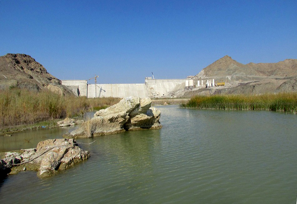
Zirdan Dam, Kaju River, 26 December 2011, courtesy of Asghar Mobaraki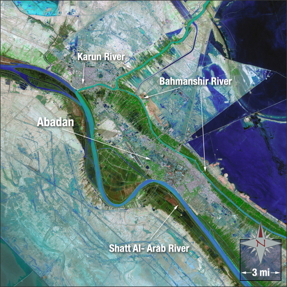
Bejestan
This basin comprises the drainages of the eastern highlands north of Birjand (32°53'N, 59°13'E) flanked by the Dasht-e Kavir basin to the west, the Dasht-e Lut and Sistan basins to the south, the Tedzhen to the north and the Afghan border to the east. The Tedzhen basin is separated by three ranges, from west to east, the Kuh-e Sorkh (35°30'N, 58°36'E) at 3017 m, the Kuh-e Bizak (35°11'N, 60°20'E) and the Kuh-e Khvaf at 2517 m east of Khvaf (34°33'N, 60°08'E). These receive snow in winter from moist Caspian Sea air. The highlands are relatively low compared with other parts of Iran and nowhere exceed 3000 m except for the Kuh-e Sorkh. The lowest points are in the sumps on the Afghan border at about 610 m. There are a number of minor sumps and the drainage patterns have been described as indeterminate. The total area is about 82,000 sq km. Tectonism commonly causes drainage disruptions (Krinsley, 1970).
The distinction of the western parts of the basin from the Dasht-e Kavir basin is somewhat arbitrary since the Kavir-e Namak near Bejestan (34°31'N, 58°10'E) lies at a similar level to the Kavir-e Bozorg and is separated by only a low rise in the land. This kavir receives intermittent streams from the east and north. The Bejestan basin does receive tributaries from Afghanistan but these are minor and do not begin to approach the input received by the Sistan and Tedzhen basins from the east. Streams drain mostly to the east, to three small terminal basins straddling the border; from north to south these are the Namakzar-e Khvaf, the Daqq-e Patargan and the Daqq-e Tondi.
The Dasht-e Lut basin to the south is separated by the drainage divide of the Birjand-Qa'in highlands, which trend north-west to south-east. Kuh-e Kalat is at 2605 m (34°18'N, 58°22'E) in the north-west and altitudes of 2779 m are reached in the south-east.
This whole basin has seasonal streams and a few springs with qanats a prominent feature. Water temperatures in qanats is 22-25°C year round and their is little fluctuation in water flow and chemical composition. Springs in contrast are influenced by the local geology and have a variable chemical composition, as well as being influenced by climate and pollution (Ruttner-Kolisko, 1964; 1966).
Caspian Sea
The Caspian Sea (Darya-ye Khazar, Darya-ye Mazandaran) basin is here taken to include both the rivers draining to that sea and the sea itself within Iranian territorial waters. This basin, in its land part, is elongate, extending from the Turkish border almost to the Afghan border and only acquires some width where the Safid River and its tributaries penetrate the Alborz Mountains in the west. According to Pirnia (1951) the Caspian basin in Iran (excluding the sea) encompasses 182,100 sq km while according to Zakeri (1997) this figure is 256,000 sq km, 15.5% of the whole country. Zakeri (1997) records 864 small and large rivers, including the Safid River with a catchment of 67,000 sq km. Much of the information on the Caspian Sea itself is restricted to waters of the former U.S.S.R. and there is relatively little on Iranian territorial waters. Rozengurt and Hedgpeth (1989), Kosarev and Yablonskaya (1994), Mandych (1995), Golubev (1996) and Ivanov (2000) summarise much of the recent Soviet literature, a general review is given by Mamaev (2002) and Bogutskaya et al. (2008) review early investigations of the sea and its fish biodiversity with special emphasis on the 1904 expedition led by N. M. Knipovich. Huseynov (2011) gives a popular account of the sea, its fauna, pollution and climate change effects. Gandomi et al. (2012) give a habitat mapping for the Golestan coast, an important tool for conservation.
An ongoing and developing source of information on this sea, the surrounding land, its history, its management, biodiversity strategy and action plan, and a wide sweep of environmental problems is the Caspian Environment Programme (CEP), Baku, Azerbaijan at www.caspianenvironment.org. This site has numerous documents and reports on-line, some with authors, e.g. Katunin (2000), Ivanov and Katunin (2001), ERM-Lahmeyer International GmbH, DHI Water & Environment and GOPA Consultants (2001a), others appearing under CEP or TACIS (Technical Assistance to the Commonwealth of Independent States, European Union), e.g. TACIS and UNDP (2000), TACIS (2002), CEP (1998, 2000b, 2002). These reports include information on the fishes and fisheries but are best referred to for the interactions between people and the environment. Kiabi et al. (1999) describe the wetlands and rivers of Golestan Province at the southeast corner of the Caspian Sea. Razavi (1999) gives an introduction to the ecology of the sea in Farsi. Nezami et al. (2000) and CEP (2001) give recent general descriptions of the Iranian Caspian coastal zone, the important rivers, wetlands, water quality, climate, pollutants, and fisheries. www.bibliothecapersica.com/articlenavigation/index.html, under Caspian Sea, downloaded 24 December 2004 also gives an overview of this basin. Nadim et al. (2006) review the management of coastal areas in the Caspian Sea. Nasrollahzadeh (2010) reviews the ecological challenges facing thus enclosed sea and Allahyari (2010) the social sustainability of fishery cooperatives in Gilan..
The Caspian Sea is the largest "lake" or inland water body in the world at 436,284 sq km, a surface area encompassing 18% of the total area of all lakes in the world, about the same area as Great Britain (other surface area figures are 378,400 sq km, 384,400 sq km and 390,000 sq km - data of this nature varies quite markedly between apparently authoritative sources). The volume is 78,100 cu km, 44% of the total volume of inland lakes of the world. Its north-south extent is 1204 km and width is 204 to 566 km. The shoreline, including islands, extends for 7000 km, 1000 km of which is Iranian. The catchment area is 3.6 million sq km. Dumont (1998) presents arguments for this water body being a true lake and not a sea.
Caspian Sea with eastern edge of Black Sea on left and Kara Bogaz Gol on right.
Lake Urmia (= Orumiyeh ) is at the lower left (turquoise)
and Lake Van in Turkey lies to its west.
Lake Sevan in Armenia is to the north
of Orumiyeh. From NASA and Wikimedia Commons
North, Middle and South Caspian basins are recognised, divided by shoals. Iranian waters fall within the South Caspian Basin which occupies 148,700 sq km and is separated from the Middle Caspian by the Apsheron Bank. The South Caspian holds over 65% of the sea's water and is the deepest basin, to -1000 m in depressions, average - 325 m. The northern basin holds only 1% of the water.
The sea receives 291 cu km from river run-off and 87 cu km from precipitation but loses 374 cu km from evaporation and 11 cu km to overflow into the Kara Bogaz Gol (Gerasimov, 1978b). The Volga River accounts for 76.3% (82% according to Dumont (1995)) of the inflow of rivers, the Kura River 4.9%, the Ural River 3.7%, the Terek River 3.2% and the remaining rivers including all those of the Iranian shore 11.9%. Iranian rivers account for only 5% of the Caspian inflow, Iran has 7% of the catchment area, 14% of the coast, contributes 3% of the settling solids, and 2% of the fishery (Badakhshan and Shayegan in Glantz and Zonn, 1997). The Volga has its headwaters near Moscow and is 3688 km long with a catchment area of 1,360,000 sq km and a mean annual flow at Volgograd of 8380 cu m/sec. The Volga is of prime importance in the Caspian Sea basin to migratory fishes as a spawning site and the biology of these species has been studied extensively. Often these studies provide the basis for much of the knowledge of Iranian fishes to the south.
Zenkevi(t)ch (1957; 1963) and Barimani (1977) have reviewed the geography, hydrology and biology of the Caspian Sea, Moiseev (1971) summarises the living resources of the whole sea, Karpinsky (1992) aspects of the benthic ecosystem, and Knipovich (1921), Iljin (1927a), and Nevraev (1929) give accounts of Iranian coastal waters and regional fisheries in the early twentieth century. Zahmatkesh (1993) describes the gammarids and bottom sediments, Fallahi (1993) the plankton and Soleimani (1994) the benthic fauna in Iranian waters. Mamaev (2002) is a recent general overview.
Water balance for this sea depends on a delicate balance of inflow, evaporation, precipitation, climate, and abstraction for human needs. Water 10 m deep or shallower has a bottom of sand and gravel while at greater depths of 50-100 m clay and softer sediments increase. There is more sand in these greater depths off Gilan compared with off Mazandaran.
Maximum depth is 1025 m, mean depth is 184 m, and depth below sea level is -28 m (-27.66 m averaged over the past 2,500 years according to Dumont (1998)). There are natural water level fluctuations - the figure cited is from 1983; in 1978 it was -29.02 m, the lowest recorded since observations began (Voropaev and Velikanov, 1985). Petr (1987) has pointed out that a decline below -28.5 m would result in a change in salinity distribution and in water currents mixing riverine and sea water. A decline in productivity would follow. A fall of only 1 m would cause a 60% reduction in fish food supply and, since this fall poses barriers to migration to better feeding grounds, a further 20% loss in food supply. Recently however, since 1978, the sea has begun to rise, by 2.1 m from 1978 to 1993 to -26.95 m, with a possible rise of 3 m in the next 25 years. Vaziri and Borghei (1995) give an average rise of 1.2 cm a month for the period 1986-1993. The sea rose 26 cm in 1994. However, over the past 2500 years the sea level has not exceeded -25 m and is not anticipated to do so in the near future; the level is cyclical (Rychagov, 1997; Gorji-Bandpy and Hooman, 2004). The reason for the rise is probably a climatic shift (Mandych, 1995; Shayegan and Badakshan, 1996; Kobori and Glantz, 1998) but a sheen of oil from pollution may be helping in the reduced evaporation of 7-10% observed over two decades. Tectonic shifts of the sea floor may also be a contributing factor. Predictions of water level changes have proved unreliable so schemes to ameliorate rises or falls are unwarranted and could be catastrophic (Abuzyarov, 1999). Georgievskiy (2001) however, predicts a lowering of the sea level to -27.6-28.9 m by the year 2030 from -27.0 m in 2000. Klige and Myagkov (1992) examined the water balance of the Caspian Sea and predicted a rise in sea level to 1995-1997 and then future declines of the order of several metres in the next century.
The rise in water level is engulfing buildings including industrial sites which will pollute the waters of the Caspian further. Iranian towns and cities damaged include Babolsar, Tonekabon, Ramsar, Ashuradeh, Bandar-e Torkoman, Anzali, Astara and Kolachai (Zonn in Glantz and Zonn (1997)). Fish caught near Nowshahr in 1999 were contaminated with oil pollutants (Tehran Times, 1 November 1999). The complex of chemical, petrochemical and metallurgical plants at Sumgait near Baku in Azerbaijan produces 335,000 tonnes of mostly toxic waste including dioxins. Hundreds of waste lakes of oil near Baku are being slowly engulfed by the rising Caspian. Nasrolazadeh Saravi (2001) and Khatoonabadai and Dehcheshmeh (2006) describe oil pollution in Iranian coastal waters although it is much less than near Baku, particularly in Mazandaran and Golestan. Heavy metals enter down the major rivers from mining and industry and the effects from the Kura River may have rendered the coast of Azerbaijan almost untenable for life (Bickham, 1996; Pohlman and Naismith, 1996; Rowe, 1996). Radioactive waste, both liquid and solid, is found in low lying depressions around nuclear power plants and is liable to enter the Caspian (Rodionov, 1994; Dumont, 1995).
On the plus side, sturgeons may benefit from easier access to spawning grounds (Ottawa Citizen, 9 July 1994; 3 July 1995) but this is probably offset by the pollution load of the major spawning rivers.
In contrast to the recent rise in sea level, a series of reports have appeared in past scientific and popular literature on the falling level of the Caspian Sea and diversionary schemes to combat this (e.g. Kovda, 1961; Lamb, 1977; Hollis, 1978; Gribbin, 1979; Micklin, 1979; 1986; Golden, 1982; Rich, 1982; 1983; Voropaev and Kosarev, 1982; Voropaev and Velikanov, 1985; Pearce, 1984; Ryan, 1986; Perera, 1989; Rozengurt and Hedgpeth, 1989; among others). The Caspian dropped 2.3 m between 1930 and 1962 and area has decreased by 10% or 40,000 sq km. Recent historical levels appear to be between -25 and -26 m, average -25.8 m. Changes in level of the Caspian due to natural or other causes in historical and pre-historical times have been reviewed above. Fall in the sea level increases salinity, destroys habitat and blocks spawning migrations, although some effects are less in the southern, Iranian Caspian because of the larger water mass. The Volga accounts for 76% (some reports say more than 80%) of the river input to the Caspian Sea. The Volga is now extensively dammed, as are other rivers in this basin, and its waters used for industry and agriculture. There are 8 large dams on the Volga, the largest being the Kuibyshevskaya with a reservoir area of 6450 sq km and a total volume of 58 cu km. Dams in the Caspian basin provide almost one third of the hydropower of the former U.S.S.R. (Rozengurt and Hedgpeth, 1989). Flow into the Caspian has been cut by at least 25% and in spring, the time of spawning migrations, by as much as 37% for the Volga-Kama systems. Berka (1990) reviewed the effects of water level changes on the northern Caspian fisheries. The North Caspian was designated as an "ecological disaster area" in 1992 because of water pollution input from the Volga. The delta is eutrophic with cyanobacterial blooms being common, affecting fish survival (Saiko in Glantz and Zonn, 1997).
The decline in sea level has been reversed in recent years and a rise of nearly 2 m was reported and, in Turkmenistan, a shoreline advance of 2-3 km in places (Rich, 1991; Anonymous, 1992a; Golub, 1992; Ottawa Citizen, 9 July 1994; Priroda, 5:3-25, 1994). This will have positive effects for some fisheries and wetland conservation but negative effects on recent, low-lying construction including oil refineries and wells in Azerbaijan and a nuclear waste dump in Turkmenistan which would cause massive pollution from oil and radioactive compounds (Pearce, 1995). Environmental hazards to the fisheries caused by sea level rise include eutrophication from farmland covered by the sea, pesticides and herbicides from inundated farmland, salt water penetration into wetlands, input of solid municipal and industrial wastes and vegetation, destruction of fish habitat, and input of soil altering the ecosystem (Shayegan and Badakhshan in Glantz and Zonn, 1997).
It has been suggested that the rise in sea level is due, in part, to seepage from the Aral Sea basin and that this could be halted by setting off underground explosions. This smacks of the large-scale alteration to the environment favoured by Soviet planners to combat the fall in sea level - both are grandiose and have unknown consequences for the environment. Climate change is probably a major factor abetted by the closing off of the Kara Bogaz Gol (responsible for an estimated 40-45 cm rise alone) and diversion of Siberian rivers into the Ural River in the northeastern Caspian (Khan et al., 1992).
Much of the former southern U.S.S.R. is water poor and a solution to this and the falling Caspian level has been advocated. This would involve diversion of north flowing Siberian rivers at a cost $40 billion. The potential for environmental damage on a local and even global scale caused this scheme to be shelved in 1986. The project involved excavations using nuclear explosives, drowning of forests and construction of canals thousands of kilometres long. Reduced flow into the Arctic Ocean could affect ice cover which influences atmospheric pressure and circulation patterns over the whole northern hemisphere. This Soviet plan has recently been revived (Pearce, 2004).
There is an abundance of historical and other evidence for variations in Caspian Sea level and its connections with other water bodies in both recent times and over several million years (Huntington, 1907; Ehlers, 1971; Lamb, 1977; Gerasimov, 1978b; Hsü, 1978; Coad, 1980c; Rögl and Steininger, 1984; Wossugh-Zamani (1991c); Oosterbroek and Arntzen, 1992; Sal'nikov, 1995; Mamedov, 1997; Rychagov, 1997; Caspian Environmental Programme, 2000; Grigorovich et al., 2003; Kotlík et al., 2008). Brooks (1949) maintains that the Oxus (= Amu Darya) flowed into the Caspian in the 14th century instead of the Aral Sea. Shnitnikov (1969) and Gerasimov (1978a) report flow along the Uzboi channel north of the Iranian border into the Caspian from the Aral Sea basin at several periods from the third millennium B.C. to the 16th century. Sal'nikov (1998) illustrates connections between the Amu Darya and the Caspian Sea from the Pleistocene to the 20th century. The connection between the Caspian and Amu Darya and Aral Sea was interrupted about 20,000 years ago when the Amu Darya turned north, was reconnected about 10,000 years ago, and essentially interrupted about 4000 years ago. These regular contacts have resulted in an Aral Sea ichthyofauna with "weakly pronounced endemics", although the Amu Darya ichthyofauna has a number of clearly defined endemics which are not yet found in the Caspian Sea basin (but see below under Tedzhen River basin). Dunin-Barkovsky (1977) records level fluctuations of up to 50 m during the Holocene due to variations in the general moistening of Eurasia and intermittent warming and cooling variously associated with changes in precipitation and evaporation. Ice melt from the Fennoscandian ice cap, as late as 4000 B.C., added large volumes of water to the Caspian and an overflow to the Black Sea was then possible. Berg (1948-1949) maintains that Atherina presbyter (=caspia) and Syngnathus caspius entered the Caspian at about this time. Some fishes, such as Salmo trutta (as then recognised), are probably immigrants from Arctic regions and certain cyprinoids and percids are freshwater immigrants. Bianco (1990; 1995b) points out that, at every glacial- interglacial ice melting phase, a network of connected rivers and lakes allowed primary freshwater fishes to disperse in the northern Palaearctic. Other fishes are relicts of earlier transgressions. Such species as herrings (Clupeidae), gobies (Gobiidae) and possibly sturgeons are believed to have evolved from the marine fauna of the Tethys Sea which ran from the modern Atlantic to the Indian Ocean before the Sarmatian basin formed. The uplift of eastern Anatolia and the Alborz in the Early Miocene between 20 and 17 million years ago (MYBP) closed a seaway from the Indo-Pacific which had extended into the Eastern Paratethys (= Black-Caspian-Aral sea in modern terms). The connection reopened in the Middle Miocene 16.8-16 MYBP) but by the Late Miocene a Sarmatian basin was cut off from the open seas and developed a unique marine fauna (Ekman, 1953). This was mostly lost as salinity decreased from freshwater input and a new fauna developed. A series of connections and breaks with the Black Sea, Mediterranean Sea and the Atlantic Ocean in various combinations with brackish and freshwater episodes gave varying opportunities for faunal interchanges and evolution. The Caspian fauna differs from the Mediterranean one because its only communication was via the Black Sea which acted as a "filter". When the Black and Caspian seas were well connected, the link to the Mediterranean was broken, and when the Black and Mediterranean seas were connected, the Caspian connection was not well developed. Mamedov (1997) and Rychagov (1997) review late Pleistocene and Holocene changes in Caspian Sea level, Chepalyga (1984) and Gerasimov (1978b) review water level changes and connections with the Black Sea over the last 80,000 years, Kosarev and Yablonskaya (1994) and Mandych (1995) for the last 500,000 years and Grigorovich et al. (2003) for the last 12.5 million years. Bianco (1990) gives an overview of the palaeohistory of the Paratethys Basin. Fluctuations in water level are correlated with climate changes Kotlík et al. (2008) using multiple gene phylogeography found the Black and Caspian seas supported separate populations of Rutilus frisii during the last glaciation, although this separation was not complete and gene exchange occurred, with the majority of migrations in the Pleistocene.
The total Caspian Sea drainage area is said to be 3,700,000 sq km, about 25% of the continental land mass of the U.S.A. (Rozengurt and Hedgpeth, 1989). The basin includes about one fifth of the crops and one third of total industrial output of the former U.S.S.R. (Rozengurt and Hedgpeth, 1989). Its northernmost waters are north of St. Petersburg (= Leningrad) in Russia while its southernmost waters rise on the flanks of the Zagros Mountains in Iran. This ranges from the subarctic to the subtropical region and is very diverse in climate and geology. Natural runoff in the South Caspian Basin ranges from 8 to 18 cu km while in the North Caspian it is 207-375 cu km. However the North Caspian is very shallow (mean 4-5 m, maximum 20-25 m) compared to the south Caspian (mean 325-334 m, maximum 980-1025 m). This is also reflected in the volume, 400-700 cu km compared to 49,000-77,500 cu km. Salinity is about 12-13‰, increasing in isolated bays and decreasing near river mouths. Summer temperatures in the south reach 27°C and in winter 9°C but the northern parts ice over. The Gorgan River area reached 30.9°C (Laloei, 2006). Surface water temperatures for the South Caspian are reported as 7.0-10.3°C in winter, 7.9-14.0°C in spring, 25.0-29.0°C in summer and 12.0-19.0°C in autumn (Rozengurt and Hedgpeth, 1989). These authors also report salinity ranges of 12.5-13.0, 12.3-13.2, 12.6-13.6 and 12.3-13.5‰ for the same seasons, oxygen levels of 7.0-7.8, 7.0-8.2, 5.0-6.0 and 6.0-8.0 ml/l, and pH values of 8.48, 8.44, 8.44 and 8.50. Vertical mixing occurs down to 50-150 m in the South Caspian (Mellat-Parast, 1992). There is little oxygen below 200-300 m and no fish life although changes to the hydrological regime of the Volga have increased aeration and oxygen content of deeper layers in the south Caspian, down to 600-800 m. The Caspian has no tides but sustained winds can cause seiches, local and temporary rises in sea level. There is a current along the Iranian shore from west to east. The shelf along the Iranian coast is narrow (6-10 km) and steep (Kosarev and Yablonskaya, 1994). Beaches are usually sand with shell gravel on the bottom further out. The extreme western coast has some shingle beaches and west of Alamdeh in the central part is some rocky shore but there are no major cliffs or headlands. The shore has coastal dunes, spits and bars with lagoons inland, either brackish or fresh, grading into the higher and dryer foothills.
Much of the coast was once forested, but it has been actively cleared and marshes reclaimed as rice paddy. Rice paddies are now being investigated for fish cultivation. About 300-500 kg of carp "seed" and a 10% increase in paddy production per hectare was recorded during the rice cultivation season. Extending this into the fall gave a production of 750-1000 kg of fish and duck and in winter 5.5-8.0 t of rainbow trout (Tehran Times, 1 October 2000). Gilan is attempting a production of 2 kg of trout per sq m of paddy field, with the aim of harvesting 46,000 t of fish (IRNA, 14 November 2001). Mazandaran has the highest farm fish production in Iran at 28,000 tonnes (2006-2007) and is expected to reach 50,000 t by 2010 (www.mehrnews.ir, downloaded 8 February 2007). The area of forests in northern Iran has been reduced from 3.4 million hectares in 1962 to 1.8 million hectares in 1977 and about 1 million hectares or less in 1995. In Gilan, 975,000 cu m of wood from the forests are burnt annually by cattle breeders for heating or cooking purposes or for production of dairy products. Additionally 450,000 cu m of wood are used for industrial purposes. Reforestation cannot keep up with the losses and forests have been reduced by half over the past 50 years (Barzegar, The Agricultural and Cattle Breeding Publication, No. 761, 22 December 1997, from www.netiran.com/Htdocs/Clippings/Deconomy/971222XXDE01.html). As a result floods now occur with destruction of fish habitat after 30-40 hours of rain where previously no flooding occurred after even 4 days of rain (Hamshahri, Tehran, 628, 20 February 1995). Abstraction of water for irrigation (60% of water use) has severely reduced water levels and runoff rates necessary for reproduction of fishes. Estuarine habitats have been degraded inhibiting the survival of eggs, larvae and juveniles of anadromous and semi-anadromous fishes (the latter are species which spawn in the lower stretches and deltas of rivers where salinity is optimal at 8 g/l for many commercial species, e.g. Sander lucioperca, Cyprinus carpio, Rutilus caspicus). Over 90% of coastal streams along the Caspian shore are dry in July in Iran because of irrigation demands. As a result larvae of spring spawners are flushed into fields where they die, migration and late summer spawning of Aspius aspius and Luciobarbus brachycephalus are obstructed, and Salmo caspius and Rutilus frisii kutum populations are depleted because they cannot spawn in the shallow, warm, weed-choked water. Nursery and reproductive areas for Abramis brama, A. sapa, Blicca bjoerkna, Aspius aspius, and Sander lucioperca among others are confined because of their low tolerance to salinities above 7-8‰. Without an adequate runoff, the sea encroaches on the estuary. Nasri-Chaari (1994) cites physical obstacles, sand removal from river banks, overfishing and water pollution for declines in fish migration in recent years.
An earlier, general work including fishes of the Iranian Caspian Sea and coast is Berg (1948-1049). More recent works are the atlas of the fish species in the Iranian Caspian Sea in English and Farsi by Jolodar and Abdoli (2004) and that on the biodiversity of the southern basin by Abdoli and Naderi (2009).
The commercially important species of fish were summarised in Abzeeyan, Tehran, 5(7):VII-IX (1995) and are divided into sturgeons (Acipenseridae, 4 species) and bony fishes (3 species of kilkas in the genus Clupeonella of the family Clupeidae; herrings or Alosa spp. also in Clupeidae; 5 species of the family Cyprinidae namely Rutilus frisii, Cyprinus carpio, Abramis brama, Rutilus rutilus (and presumably R. caspicus) and Aspius aspius; 2 species of mullets, family Mugilidae, Liza auratus and L. saliens; a member of the perch family, Percidae, namely Sander lucioperca; and a member of the salmon family, Salmonidae, namely Salmo trutta (= caspius)). About 70% of Rutilus frisii is caught in Gilan Province, while 60% of mullets and 75% of sturgeons are caught in Mazandaran Province. More than 50% of the sturgeon catch is Acipenser stellatus and 10% is Huso huso, the remainder being A. gueldenstaedtii and A. persicus, with a yearly catch for all sturgeons of about 2500 tonnes. Sturgeon fishing is carried out by the government and no private sector fishing is allowed because of the value of this fishery and the need for careful management. Accidentally caught sturgeon must be released or turned over to the government operation. Ivanov (2000) summarises the biological resources of the Caspian Sea from a Russian perspective with some comparative figures from Iran. Generally, catches in Iranian waters are always less than those in former Soviet Union countries combined. A particular exception is Rutilus frisii (safid mahi), an esteemed fish in Iran.
About 25% of the Iranian total fish catch is from the Caspian coastal area (CEP) and figures for the Iranian Caspian Sea in tonnes are:-
| Year | All fish species | Kilka | Sturgeon flesh | Caviar |
| 1976/77 | 8,428 | 1131 | 2368 | 221 |
| 1981/82 | 10,466 | 1341 | 1914 | 234 |
| 1986/87 | 11,084 | 2384 | 2500 | 303 |
| 1991/92 | 34,596 | 13,817 | 2208 | 283 |
| 1992/93 | 40,598 | 21,527 | 2198 | 262 |
| 1993/94 | 52,768 | 28,730 | 1170 | 217 |
| 1994/95 | 69,700 | 51,000 | 1700 | 218 |
| 1995/96 | 58,300 | 41,000 | 1500 | 182 |
| 1996/97 | 74,100 | 57,000 | 1600 | 195 |
| 1997/98 | 76,200 | 60,400 | 1300 | 151 |
| 1998/99 | 101,500 | 85,000 | 1200 | 157 |
The fish harvest from the southern Caspian coast of Iran for the 7 month period October 1999-April 2000 dropped by 11% over the same period from the year before, from 8630 t to 7710 t (IRNA, 10 May 2000). The decline was attributed to a rise in fish prices which encouraged illegal fishing and to habitat loss. The value for the whole Caspian fisheries is given as $6 billion by Nezami et al. (2000). A proposal for a Caspian Fisheries Commission is given by TACIS (1999; 2000b) and ERM-Lahmeyer International GmbH et al. (2001b). It would aim to conserve and utilise the living aquatic resources, including the management of fish stocks such as kilka, herrings and mullets, as well as the famous sturgeons. These species all have transboundary stocks requiring cooperative management between countries. Articles aim to protect traditional fishing for sturgeon along the Iranian coast, establish state monopolies for the export of caviar, set up cooperative research programmes to conserve sturgeon species, establish annual total allowable catches and fishing regulations, and so on.
About 50,000 tonnes of kilkas are caught each year by the Industrial Fishing Company and fishing cooperatives using deep conical nets and air lifting with artificial lights as attractants. About 20,000 t of other species are caught by licensed cooperatives using beach seines and gill nets although a report in IRNA (27 March 2000) cites more than 16,000 t including whitefish (Rutilus), Mugilidae, Cyprinidae, "anchovy" (sic), bream (Abramis) and zander (Sander). An account of site selection for beach seining is given by Zanoosi (1993). Beach seining has been restricted to the period from sunrise to 8 p.m., and to 10 p.m. in Miankaleh (www.iranfisheries.net, downloaded 14 November 2006). The 1994-1995 finfish catch (excluding sturgeon and kilka) using gill nets, coastal purse seines and beach seines, was 17,000 t, perhaps over 22,000 t with the illegal catch included. About 87% of this catch is Rutilus frisii kutum, Liza auratus and Liza saliens (Annual Report, 1994-1995, Iranian Fisheries Research and Training Organization, Tehran, p. 37, 1996). Gill nets showed a 39% decline compared to the previous year and beach seines were 16% less. Rutilus frisii kutum comprised 53%, mullet 39% and others 8% of the total catch (Abzeeyan, Tehran, 6(5, 6):IV, 1995). The harvest from the southern Caspian Sea coast dropped 11% in the year 2000 from the same seven month period in the preceding year, to 7710 t, as a consequence of poaching, neglect of river maintenance, and substandard capture methods (IRNA, 10 May 2000). The catch in Golestan Province rose from 470 t in 2000 to 3278 t in 2005, attributed to artificial propagation, restrictions on beach seining, training about closed seasons and beach seine standards, increased fishing effort, and a favourable climate (www.iranfisheries.net, downloaded 14 November 2006).
There are 5 regional fishing centres namely Bandar Anzali with 14 fishing stations, Keyashahr with 12 stations, Babolsar with 13, Ashuradeh with 9 and Nowshahr with 9 (Iranian Fisheries Research and Training Organization Newsletter, 7:7, 1995). The Caspian Environment Programme (2001c) gives 15 stations for Bandar Anzali, 9 for Keyashahr, Babolsar, Ashuradeh and Nowshahr for sturgeon fisheries. Fixed gill nets are used with a standardised mesh. The Ashuradeh Peninsula, where more than half of Iran's caviar is processed, was threatened by the rising Caspian Sea in a 1991 radio report. A 1995 agreement between Iran, Azerbaijan, Turkmenistan, Kazakhstan and Russia gives each nation an exclusive fishing zone of 20 nautical miles from shore (Iranian Fisheries Research and Training Organization Newsletter, 7:7, 1995).
Inland freshwaters of Gilan are divided into three categories by Bakhshizod-Mahmoodi (1996): natural and impounded ponds, the Safid River reservoir, and wetlands. The ponds are used primarily for cyprinid and acipenserid culture, the reservoir is fished by seining, by spreading wheat grains in littoral areas to attract fish and by using the shemshad or shaghoul net (a giant dip-net), and the wetlands are fished by seining, by the salik or mashak (cast-nets), by the la'kesh (drifting gill net using one and two boats), by fixed gill nets, by the shemshad and by angling (for ordak mahi). Abbasi et al. (2011) summarised the abundance and diversity of fishes in the Kargan River of Gilan, and found 18 species with Cyprinidae having 10 species and over 90% of the total population. Alburnoides eichwaldii, Capoeta capoeta and Alburnus hohenackeri were dominant with 29.58%, 29.15% and 19.87% respectively. Ten species were freshwater residents, 4 species were migratory and 4 were estuarine or marine. Five species were recognised as aliens.
Pollution is an important factor in the ecology of the sea, from offshore oil drilling, ship discharges of oil wastes and contaminated water as well as garbage and even discharges from ship collisions, radiation from underground, non-military explosions and nuclear waste dumped in inflowing rivers (radiation levels are 100 times above normal (Time, 1 November 1993)), manure and pesticides from farming on the surrounding land mass, city waste water, sewage and garbage, industrial wastes including mercury and other heavy metals, discharges from water desalinating plants, extraction of minerals such as sodium sulphate, mirabelite and espomite, and untreated sewage (see Sardar (1979), Nuhi and Khorasani (1981), Coad (1980c), Khalili (1994), Raiss-Tousi (1999), Namazi (2000), Abaee (2001), Charamlambous (2001), Laloei (2006), Zeynali (2009) and Saeidi et al. (2010) for Iranian problems and acceptable levels of some elements; Anonymous (1988c), Edwards (1994), Specter (1994) and Kasymov and Rogers (1996) for former Soviet waters; Stone (2000b) is a recent, short general overview).
Data collected in 1991 showed the Caspian Sea received effluents comprised of 3000 tonnes of oil products, 28,000 t of sulphites, 315,000 t of chlorides, 200,000 t of tar and 25,000 t of phenols (Namazi, 2000). In Daghestani rivers, the same author records heavy metals, pesticides, phenol, arsenic, boron and selenium, among others, at 60-100 times the maximum permissible for fisheries. The oil industry is considered to be the main source of ecological problems in the Caspian Sea (Karpyuk, M. and Shavandin, V. 1996. Astrakhaners on the Caspian Sea. International Affairs, 42(1) from http://home.eastview.com/ia/42_01_15.htm). Prospecting uses blasting operations which have caused sturgeon deaths on more than one occasion. A single offshore well during its life releases into the water 30-120 tonnes of oil, 200-1000 t of sand, clay and other waste and 150-400 t of drilling mud paraffin fractions, baryta, lime, detergents, emulsifiers and lubricants. The ecology is affected 5-12 km from each well. The oil industry in the Caspian has reserves estimated at $4 trillion and a new oil rush will further contaminate the sea.
Charamlambous (2001) concludes that municipal wastewater from 11 million people is the primary pollutant in Iranian coastal waters. Industrial discharge accounts for 31%. of organic loading, the rest being municipal discharge. The most industrialised area is around Rasht with waste going into the Anzali Mordab. The Zarjub River in Rasht is the most polluted river in Gilan, and possibly in Iran (Ghodrati et al., 2007). TACIS (2000c) reports that in Gilan, 32 of 36 major cities discharge wastewater untreated into a river and 89 of 90 industries discharge treated wastewater to a river. Ayati (2003) also reviews pollution in the mordab. Mirkou (2001) details agro-chemical usage along the Caspian shore comprising various fertilisers and pesticides. Naderi Jeloudar et al. (2007), Varedi et al. (2007), Amirkolaie (2008) and Naderi Jolodar et al. (2011) describes the environmental impact on the Haraz River of aquaculture waste water discharge from rainbow trout farms. Pollution levels in this instance were generally too low to have a significant impact of the river system although phosphorus loading was increased and levels varied with activity rates of the farms. Benthic macroinvertebrates also showed evidence of pollution being high near trout farm effluents, clearing about 3.5 km downstream.
Chlorinated pesticides have been used in anti-malarial campaigns throughout Iran and to eliminate pests on cotton, rice and other products in Mazandaran. Herbicides and pesticides are widely used in rice paddies. DDE, DDT, DDD, Lindane, Dieldrin, Eindrin and Kelthane have been identified in such rivers as the Babol and Chalus (Annual Report, 1995-1996, Iranian Fisheries Research and Training Organization, Tehran, p. 11-13, 1997). Ebadi and Shokrzadeh (2006) examined Rutilus frisii, Vimba vimba (= V. persa), Clupeonella delicatula and Liza aurata for lindane at Chalus, Babolsar, Khazarabad and Miankaleh but levels detected were less than the FAO/WHO recommended permissible intake and were no cause for public concern. Similar studies on DDT and DDE and on chlorobenzilate from the same sites and fish and levels were also less than the permissible intake (Shokrzadeh and Ebadi, 2005; 2006). Shokrazadeh et al. (2009) also found that levels of Lindane in dorsal muscle of safid mahi, kefal, kuli and kilka species were less than FAO/WHO recommended intake. The Chalus River also contains various heavy metals, such as lead, zinc, copper, iron, cadmium and chromium from mining activities (Annual Report, 1995-1996, Iranian Fisheries Research and Training Organization, Tehran, p. 18, 1997). Zeynali et al. (2009) demonstrated the presence of copper and zinc in muscle tissues of Liza aurata, Rutilus frisii kutum and Cyprinus carpio from Chalus, Anzali, Rudsar and Fereydoon Kenar in the Caspian Sea basin although levels were acceptable for human consumption. Hashemy-Tonkabony and Asadi Langaroodi (1976) have shown the presence of DDE, DDT, TDE, Dieldrin, Lindane, Aldrin and Heptachlor in a wide variety of Caspian fishes in Iran. However, Ebadi and Shokrzadeh (2006) examined Rutilus frisii, Alburnus, Clupeonella and Liza species in Mazandaran for the organochlorine pesticide lindane and found levels in muscle tissues to be less than FAO and WHO recommended permissible intake and so were not a public concern. Rutilus frisii, Cyprinus carpio, Liza species and Acipenser stellatus were tested for DDT, aldrin and heptachlor with only the latter slightly elevated above standard levels at Hashtpar (Iran Daily, 11 January 2006). Phytoplankton diversity in the western Caspian Sea fell from 74 to 40 species, biomass from 8.7 to 2.1 g/ sq m and biomass of benthic organisms in coastal areas fell from 1724 g/ sq m in 1961 to 21 g/sq m in 1969 (Clark, 1986). These declines were noted particularly in the nursery grounds for sturgeon, Abramis brama, Esox lucius and Cyprinus carpio among other fish species. In the 1980s, catches of Abramis brama, Cyprinus carpio, Rutilus rutilus (presumably R. caspicus) and Sander lucioperca fell by as much as 80% and Salmo trutta (= caspius) and "shad" had almost disappeared. It was estimated that for 1985, 10,200 tonnes of oil products and 104,200 t of sewage were dumped in the sea. One-fourth (or 40 billion cubic metres) of all the wastewater in Russia enters the Caspian Sea and petrochemical factories alone release 67,000 t of waste annually (Anonymous, 1988c; Platt, 1995; Hamshahri, Tehran, 3 (639), 7 March 1995). Salinity increased as more water was taken for irrigation - two-thirds of the Terek and Kura flows did not reach the sea (Markham, 1989). In Iran, sewage is discharged into the Caspian Sea from coastal towns, and via rivers, from towns inland. Industrial solid wastes enter the sea through the larger rivers such as the Safid, Gohar and Siah as well as the Anzali Mordab complex. The use of agricultural chemicals such as fertilisers and pesticides has led to pollution, e.g. in Gilan Province 88,851 t of fertilisers were used in the year 1992-1993, an 18.7% increase over the previous year. A survey of 30 towns in Gilan shows that 80% of rubbish dumps are located by rivers, marshes or the coast (Hamshahri, Tehran, 3 (639), 7 March 1995). An estimated 200,000 fish were killed in the Kacha River, a branch of the Siyarud in Rasht, poisoned from a dump in the Saravan region which receives 390 t of rubbish daily. Heavy rains had washed poison into the river (Tehran Times, 7 October 1998). As many as 1000 trout (presumably mahi azad, Salmo caspius) died in the Kileh River in Mazandaran from release of wastes from a dairy manufacturer; sand extraction was also blamed for affecting fish populations (Iran Daily, 21 July 2005).
The biology of the Volga River and its effects on the Caspian ecology has been reviewed by Rozengurt and Hedgpeth (1989) and Pavlov and Vilenkin (1989). This river is of critical importance for marine fisheries. Fish production is less in the central and southern parts of the sea as nutrient supply comes from upwelling and circulation rather than a riverine input. However the Volga has effects even here, changing the Caspian Sea from its regime in the 1950s. Abstraction of water for irrigation, industry and household use caused salinity increases of about 0.2-0.3‰, increased aeration of deep layers and in their oxygen content down to 600-800 m by as much as 2-3 ml/l due to convection and thermal winter mixing, an increase in the euphotic zone to 50 m and depths open to total photosynthesis to 100 m, a decrease in organic matter and its vertical gradient, and an increase in wind-driven circulation and its effects on temperature and salinity layers. In the period 1956-1972, the Caspian Sea was transformed from a fishery based on valuable species (listed above) to one dependent on kilka which now occupies 80% of the catch (or 107 times the catch in 1930). Even including the kilka, catches in the 1970s were 245 x 103 tonnes or only 37% of the 1913 catch. The catch of Caspian herrings (a complex of species in the family Clupeidae) ceased to exist commercially by the 1970s and in fact was banned. In 1967-1972 it was 0.6-2.1 x 10³ compared to 56-62 x 103 in 1945-1953 or 82-307 x 103 in 1900-1917 (Rozengurt and Hedgpeth, 1989). Moghim et al. (1994) report that, in the southern areas of the Caspian Sea, nearly 90% of the catch is composed of Rutilus frisii, Liza saliens and Liza aurata (with biomasses of 24,000, 7000 and 2400 t respectively and maximum sustainable yields of 7000, 2900 and 960 t respectively). The Volga is a major pollutant of the Caspian Sea, carrying sewage, agricultural waste, PCBs, petrochemical wastes, tannery waste, etc. from a population base of 60 million people (Golub, 1992). In 1989, 40 million t of polluted wastewater entered the Caspian via the Volga River, more than a quarter of all the wastewater of Russia (http://www.oneworld.org/patp/pap_overview.html). A report in 1995 gives the volume of pollutants and industrial wastes entering the Caspian Sea each year as 11 billion cu m. Russia accounts for 50%, Azerbaijan 16% and Iran 11% (http://netiran.com/news/IRNA/html/950731IRGG17.html).
The Volga-Don canal in the former U.S.S.R. connected the Caspian Sea with the Black Sea in 1952 and formed an invasion route for various benthic organisms while others came in attached to boats transported by rail or were deliberately introduced (Kasymov, 1982). The molluscs Abra ovata and Mytilaster lineatus, two invaders, accounted for over 90% of the total benthic biomass. Invaders provided 95.1-99.3% of the total benthic biomass in the western part of the south Caspian Sea in 1976. East of the mouth of the Safid River, the Azov-Black Sea molluscs Abra ovata and Cerastoderma lamarcki accounted for 80% of total benthic biomass. In Gorgan Bay, 99.9% of the benthos fauna is comprised of invaders. The Volga is also connected to the Baltic and White seas via the White Sea-Baltic Canal opened in 1933 (Pavlov and Vilenkin, 1989).
The fisheries may well collapse if the 10 cm long ctenophore or comb jelly Mnemiopsis leidyi from the northwestern Atlantic Ocean enters the Caspian Sea via the Volga-Don canal in ballast water. It reached the Black Sea in the early 1980s and destroyed the local pelagic food chain (Travis, 1993; Dumont, 1995; Pearce, 1995; GESAMP, Joint Group of Experts on the Scientific Aspects of Marine Environmental Protection, 1997; Negarestan et al., 2002; Kideys, 2002a; 2002b; 2003). The ctenophore eats fish eggs and larvae directly as well as zooplankton and crustaceans which are foods for fish (Bagheri et al., 2005). The Black Sea fish catches fell 90% in 6 years and the biomass of the ctenophore reached an estimated 900 million tonnes, ten times the world annual fish catch (or 1 billion t, about equal to the world fish catch - sources differ). The wet weight biomass of the whole Black Sea at times was 95% ctenophore. This suggestion of the mid-1990s was borne out, as detailed below. A continuing series of reports, magazine articles and studies on this invader are not all cited here.
The earliest report for the Caspian appears to be in 1995 by the Iranian Fisheries Research Organization (Bilio and Niermann, 2004; www.caspianenvironment.org/mnemiopsis/mnem_attach13.htm). The Islamic Republic News Agency (IRNA) on 12 May 1998 reported that a number of jellyfish had been observed in the Caspian Sea recently, presumably brought in the ballast of oil tankers, and its occurrence is documented by Esmaili Sari et al. (1999) and in numerous other studies by this author and co-authors. Various studies on the biology of the comb jelly and its impacts have been carried out in the Iranian Caspian Sea including, e.g. Movahedinia et al. (2002), Esmaeili et al. (2003), Yussefian (2002), Moghim and Rouhi (2009) and Bagheri et al. (2010).
The kilka fisheries are now threatened by the comb jelly which spread through the entire sea by the year 2000. J. Muir (http://news.bbc.co.uk/hi/english/world/middle_east/newsid_1453000/1453117.stm, downloaded 30 August 2001), Kideys (2002b) and Kideys and Moghim (2003) report a 50% drop in kilka numbers with catches down from 3-6 t per night to half a tonne for one boat. A 50% decrease in kilka catches meant a minimum U.S.$15 million loss to the fishermen (Kideys and Moghim, 2003). Iran's kilka fishery fell from 85,000 t in 1999 to 15,000 t in 2004 and losses exceed $125 million (Stone, 2005a). Ghafar Zadeh and Honar Bakhsh (2008) summarise the economic consequences for Iran. This comb jelly can double in size in one day, reaches maturity in 2 weeks and then produces 8,000 young every day. Maximum abundance reached 5122 individuals per square metre in October 2001 and biomass 1024.5 g/sq metre in August-October 2002 (Roohi et al., 2003; Bagheri, 2004; 2006). Bagheri et al. (2012) gives figures of ca. 200 individuals m-3 (2000 m-2) and 16 g wet weight m-3 (180 g.m-2), in the same range as previous surveys for Iranian waters. The fisheries may recover somewhat after the comb jelly population collapses (Tidwell, 2001b). The website www.caspianenvironment.org/mnemiopsis/index. htm, downloaded 9 April 2003 and Dumont (2002) have extensive information on this problem and Stone (2002b) and IFRO Newsletter (29:4, 2001; 65:4, 2011) confirm a severe depression in kilka and herring stocks. Beroe ovata, a comb jelly that preys on Mnemiopsis, is being cultured in Iran (Kideys, 2002b; Kideys et al., 2004; Rezvani Gilkolaei et al., 2005; Mirzajani, 2006; Mirzajani et al., 2007) and does not appear to feed on other organisms in the Iranian Caspian (Iranian Fisheries Research Organization Newsletter, 38:3, 2004). Reproduction and growth are slower, and mortality higher, than in the Black Sea, due either to the lower salinity in the Caspian Sea water or damage to individuals during transportation for the experiments. If this comb jelly fails to control Mnemiopsis, the introduction of the exotic American species, the butterfish (Peprilus triacanthus), known to feed on ctenophores has been advocated but this fish could also feed on other fishes (Harbison, 2002; Bilio and Niermann, 2004). The complex politics of the nations surrounding the Caspian have prevented the introduction of Beroe (Stone, 2005a).
The Kara Bogaz Gol ("Black Throat Bay"), an eastern arm of the Caspian Sea in Turkmenistan, is 160 km long by 140 km broad (18,389 sq km) but only 2-3 m deep. It acts as a salt precipitator. This water body was blocked off by a dam to conserve the water lost in it by evaporation in 1980. The Caspian Sea has a net annual water deficit of 15 cu km with 5 cu km being lost through the Kara Bogaz Gol alone (Rich, 1982; 1983). However this resulted in salts being spread by the winds, ruining fish spawning grounds and fish farms in the Caspian basin, and ultimately would lead to the salinisation of the Caspian Sea. A dike has now been constructed to allow some flow into the Kara Bogaz Gol and allow the flushing effect to operate. The refilling process over 3 years prevented a 35 cm rise in the Caspian Sea level (Dumont, 1995). Use of this water body to reduce level rises in the Caspian Sea and prevent flooding has been proposed (Wardlaw, 2001). Fish which enter the salty Kara Bogaz Gol lose their swimming capacity, become blind and thrashing about often come to lie on the shore. Birds eat them but those that are missed become salted and dried and may be preserved for a year or so. The Turkmenistan government re-established natural flow into the Kara Bogaz Gol in 1992 because of the Caspian Sea level rise (Zonn in Glantz and Zonn (1997)).
The Caspian coastal plain in Iran runs for almost 650 km from Astara (38°26'N, 48°52'E) in the west to Bandar-e Torkeman (= Bandar-e Shah) (36°56'N, 54°06'E) in the east. This plain has a width of about 25-32 km, but is as narrow as 2 km in places, although it opens out in the east. The Alborz Mountains are almost 1000 km long, on average less than 100 km wide but very high. Damavand reaches 5766 m - an estimate - at 35°56'N, 52° 08'E and is the highest of any mountain to the west of it in Europe and Asia. It has a continuous snow cover. There are persistent snow fields and Alam Kuh at 4849 m has small icefields. The north or Caspian slope is very steep and streams tend to be short and torrential, fed by snow melt and year-round rain. However there are some longer rivers and the principal ones are detailed below. There are about 128 small to large rivers along the Caspian shore. Nümann (1966) gives some limited biological, chemical and physical data on these streams based on spot recordings. Surber (1969) gives values of total alkalinity and calcium-magnesium hardness for a number of streams and reservoirs along the Caspian shore. Most were moderately to relatively hard and therefore productive for aquatic organisms such as insect larvae on which fish feed. The Caspian Environmental Programme (2001b) gives an overview of habitats and biodiversity along this Iranian shore. Environmentally managed areas are listed along with factors affecting their status under the headings of development, drainage, land use alteration, pollution, destruction of vegetation, over-grazing, mining, hunting and fishing, exotics, dams, and roads. Of 123 fish species only 10 or just over 8% are protected with one protected species on the verge of extinction.
Most rivers along the Caspian shore have less than 30% of their discharge in the two wettest months and 40% in the six driest months so discharge is well distributed through the year. In contrast, the Gorgan River at the eastern end of the Caspian basin has 70% of its discharge in the two wettest months, figures comparable with drier areas such as Azarbayjan at 50-60% and the Zayandeh and Kor rivers at 40-60%. Annual discharges can vary markedly, e.g. the Lar River had 545 mm on its basin area in 1949-1950 and 1560 mm in 1950-1951 (Ghahraman, 1958).
The Aras (= Araxes or Araks) is a tributary of the Kura River of Azerbaijan. The Kura rises in Turkey and is 1510 km long. The Aras forms the border between Iran and the former U.S.S.R. (now Azerbaijan and Armenia) for 430 km and has its source near Erzurum (39°55'N, 41°17'E) in Anatolia and the headwaters of the Euphrates River. Its total length is 1072 km. The Aras can be wide and meandering with braided channels and backwaters. Depth range of the Aras is 0.5-4.0 m, average 2.5 m (Zakeri, 1997). The Araxes or Aras Dam was a joint Iranian-Soviet project on this river. Iranian authorities stocked the dam with 1.8 million fingerlings (species not specified) weighing over 10 g each in 1997 to enhance fish farming (Islamic Republic News Agency, 29 December 1997). Akh Gol occupies 600 ha at 820 m in the Aras River valley in northeastern Iran (Scott, 1995). It comprises a small brackish lake with associated marshes and springs and rains to the Aras 5 km away. The area is being converted to agriculture and the lake is being drained. Principal tributaries of the Aras in Iran are the Qareh Su (= black water, draining easily eroded, volcanic soil) draining from the Kuhha-ye Sabalan at 4810 m (38°15'N, 47°49'E) near Ardabil (38°15'N, 48°18'E) and the Qotur River draining past Kuh-e Zaki at 3079 m on the Turkish border through Khvoy (38°33'N, 44°58'E) to the Azerbaijan border near Jolfa (38°57'N, 45°38'E). The Aras and the Safid are two of the three largest rivers in Iran (with the Karun River of Khuzestan). The Kura-Araks basin encompasses 225,000 sq km of which 28,000 sq km or 12.4% is found in Iran (Gleick, 1993). Azerbaijan discharges 303 million cu m of waste into the Caspian Sea annually according to Golub (1992), presumably through the Kura and other major rivers.
Derzhavin (1929a) gave an interesting account of the formation of a new channel of the Aras north of the Iranian border in 1896 which led to the freshening of the Kyzylagach Bay. This favoured migrations of fishes into the Kura River. However, irrigation schemes on the Mugan steppe severely reduced catches as well as causing salinisation of soil. Water abstraction prevented entry of adequate numbers of sturgeons onto the Kura spawning grounds. This type of water usage is paralleled along the Caspian shore in Iran with deleterious effects on a variety of sedentary and migratory fish species.
The Safid (= Sefid or White from its sediment load, up to 60 g/l) River is the only one to completely pierce the Alborz Mountains and has a considerable basin (54,100 sq km) on the plateau. Various sources give differing accounts of its length, up to 800 km. The Safid has the greatest mean discharge of Iranian Caspian rivers, over three times that of the Heraz, the next most important. In flood the Safid discharge is twice that of the Karun, but its minimum is less than a tenth, because the Karun drains a greater area with higher elevations and a more extensive snow pack. The Safid discharge is 4000 cu m per second at maximum, falling to only 15 cu m per second. An average discharge is 182.17 cu m per second. There used to be two freshets before the dam was constructed at Manjil, one fed by spring snow melt in March-May and one by rainfall in the autumn. The rise in water levels and increased sediment load attracted sturgeons, in particular Acipenser persicus. The catch of this species and A. gueldenstaedtii in the Safid River area reached 733,127 kg in 1927/1928 representing 46,500 fish and a caviar yield of 120,958 kg (Vladykov, 1964).
The width of the Safid River varies from 100 to 250 m and depth from 2 to 8 m. The average instant yield is 128.79 m/sec, range 76.5-288.5 m/sec. The average annual yield is 3,998.4 million cu m (Zakeri, 1997).
The Safid is formed from the Qezel Owzan from the west and the Shah River from the east which meet on the plateau and flow through a narrow gorge. This gorge is dammed by what was named the Shahbanou Farah Dam at Manjil (now the Safid or Manjil Dam) (dam height 106 m, length 425 m; reservoir 1860 million cu m, surface area 56 sq km maximum, 14 sq km minimum, maximum depth 80 m, minimum 30 m, summer temperature 24°C, winter 7°C, pH 7.8, 31 g/l turbid materials, Cl- 229 mg/l, SO4 178 mg/l). Strong water level fluctuations prevent the development of a belt of vegetation and the heavy sedimentation inhibit a bottom fauna. Khodjeini and Mohamed (1975) detailed the rate of sediment accumulation in this dam, 757 cu m/sq km/year, evidence of severe erosion of a devegetated drainage basin. The reservoir was half filled with sediment after only 20 years despite an expected life span of 100 years. The reservoir is apparently drained at intervals to remove some of the accumulated sediment. This would severely affect littoral spawning and feeding habitats for fishes. Nümann (1966, 1969) gives details on the limnology of this reservoir. The dam decreased turbidity in the river, raised water temperatures at the river bed in summer and caused marked diurnal temperature changes. This prevented ascent of Salmo caspius to the upper reaches and the dam itself prevented ascent of Rutilus caspicus. Nümann (1966) recommended introducing Sander lucioperca, Acanthobrama terraesanctae (a Levantine species) and cichlids to the reservoir.
Sarpanah et al. (2004) found 45 species and subspecies in the Safid River basin with 29 of these economically important. Thirteen species were migratory, 11 species estuarine and the rest resident. Thirty-six species were recorded as endemics (presumably native) with rest exotics and migrants. The Boojagh National Park near the estuary of the Safid River in Gilan has 25 species and subspecies of fish (Khara et al., 2004).
Lower dams on the Safid, such as the Tarik (10 m high) and the Sangar (3 m high), divert water for irrigation purposes on the Gilan plain, the former through a 16.7 km long tunnel. Construction of the Alamut Dam in the upper reaches of the Safid River basin would affect such species as Luciobarbus mursa, prized for sport fishing, which would need full habitat protection to survive (Aghili et al., 2008). Salmo trutta would not need protection as its habitat is confined to a stretch of river above the dam.
The Safid breaks up into distributaries near its mouth and its flow is carried off into a complex of canals and irrigation ditches. The Safid has changed its delta several times, (Vladykov, 1964). In 1911 it shifted 2-3 km east from the fishing post of 12 Bahman to Hasan Kiadeh. An account in Farsi on the Safid River is given by Wossugh-Zamani (1991b).
The headwaters of the Qezel Owzan lie in Kordestan, near the Iraqi border, and so drain part of the northern Zagros Mountains as well as areas near Lake Orumiyeh such as the Kuh-e Sahand (37°44'N, 46°27'E), mountains near Hamadan (34°48'N, 48°30'E) and the southern slopes of the Alborz Mountains. The Qezel Owzan is about 550 km long. The Taham Dam project 12 km northwest of Zanjan lies in the Qezel Owzan basin on the Taham Chay. This dam is to be 120 m high with a crest length of 450 m and a capacity of 82.7 million cu m. The fish fauna behind the earth dam at "Maljiq", 50 km southwest of Hashtrud in the upper Qezel Owzan basin, suffered severely in the drought of the year 2000. Twenty-five tonnes of fish died after the reservoir dried up (www.irna.com/newshtm/eng/09151847.htm, IRNA, 30 July 2000). Kazemian et al. (2009) studied fish diversity and abundance in the Qezel Owzan in Zanjan Province, finding 9 cyprinid and one nemacheilid species. Capoeta capoeta gracilis, Alburnoides bipunctatus (sic) and Luciobarbus capito were the most abundant at 33.6%, 22.1% and 13.1% of the total number of fishes caught. The greatest diversity was in a downstream station.
The Shah River is much shorter (ca. 175 km) than the Qezel Owzan and drains the southern Alborz as far east as Takht-e Soleyman at 4819 m (36°22'N, 50°58'E).
The 500 ha Bandar Kiashahr Lagoon (= Bandar-e Farahnaz) Ramsar Site (World Conservation Monitoring Centre, 1990) at 37°25'N, 49°19'E east of the mouth of the Safid Rud was a freshwater coastal lagoon and swamp fed by two streams from the Safid Rud to the west and draining to the Caspian Sea via a channel to the north. The recent rise in Caspian Sea level has converted this area into a bay of the sea as it was in the 1950s before the fall in sea level (Khan et al., 1992). The lagoon bed is sand and mud and the water was oligotrophic except near the marshes to the west. There were reedbeds of Phragmites communis, Typha and Juncus, now restricted to the extreme west end. There were several factors affecting this habitat including a fishery with a fish-processing warehouse, grazing, reed cutting, irrigation abstraction and recreational activities. It was an important spawning and nursery ground for fishes (effects of recent changes unknown) and is still an important centre for commercial fishing.
The Heraz (or Haraz) River drains the Alborz east of Tehran and has a number of longitudinal tributaries in the mountains. These depend on snow melt and are cold even in summer. Fishes are reported to be present in these high streams, but were not easily caught. The Heraz debouches onto a plain and splits up into distributaries. It is polluted from rainbow trout farms (Kazemzadeh Khajuie et al., 2002) and heavy metals (lead and cadmium) are present in fish (Riahi Bakhtiyari, 2001; 2002). Banagar et al. (2008, 2009) record the fish biodiversity as 20 species in 9 families, dominated by cyprinids at 67.2% and with 70% of species resident, the rest anadromous. Exotics are Oncorhynchus mykiss, Carassius auratus, Liza saliens, Gasterosteus aculeatus and Gambusia holbrooki.
The Tajan or Tadjan River was studied by Ro(o)shan Tabari (1995; 1996) who reported on its hydrology and biology. Its mouth lies at 36°49'N, 53°05'E. The maximum flow is in April, decreasing from May onward. In April 1989 flow was 45 cu m/sec falling rapidly to 0.11 cu m/sec in June. Over 70% of the fishes are anadromous with sturgeons being the most important species (Acipenser persicus, A. gueldenstaedtii and Huso huso). Salmo caspius is the most important species in the upper reaches. Other species found in this river are Cyprinus carpio, Alburnus sp. (presumably Alburnus hohenackeri), Capoeta capoeta, Luciobarbus capito, Vimba vimba (= V. persa), Alburnus chalcoides, Rutilus frisii, Rutilus rutilus, Liza sp., Gobiidae, and Esox lucius. Rural, agricultural and industrial pollutants are found in the Tajan and affect the fishes along with dams and other physical obstacles, sand removal and overfishing. The Shahid Rajaee Reservoir Dam, inaugurated in 1997, is found on this river 41 km south of Sari (http://netiran.com/news/IRNA/html/951016IRGG15.html and http://netiran.com/news/IRNA/current.html#HLNO4). The Independent (London) reported on 13 July 1994 that tens of thousands of fish died in this river after poachers poured poison into it about 9 miles (14.4 km) above the estuary. Dead fish covered the river bed for 6 miles (9.6 km).
The south-eastern corner of the Caspian Sea receives two major rivers, the Gorgan and the Atrak or Atrek (ancient Sarnois). Their courses are roughly east-west and parallel each other with the Atrak forming part of the border with Turkmenistan. The Atrak is 495 km long (with 145 km of this in Turkmenistan; Nezami et al. (2000) state 715 km for the Atrak) and the Gorgan 240 km. Stream flow in the Atrak River basin has shown a downward trend over a 35-year period from 1971 with precipitation, land use and increased evapotranspiration due to higher temperatures as possible factors (Sheikh and Bahremand, 2011). The Gorgan River drains 10,200 sq km and has an average discharge of 9.39 cu m per second (cf. Safid River with 182.17 cu m per second; the Chalus River, directly north of Tehran, has a discharge of 12.65 cu m per second). The Voshmgir or Sangarsavar Dam at 37°12'N, 54°45'E on the Gorgan stores 60 million cu m of water. The water level fluctuates markedly, banks are steep and there is little emergent vegetation. The Golestan Dam (same as preceding?) is 20 km north of Gonbad-e Qabus on the Gorgan River and has a capacity of 86 million cu m. Keivany et al. (1990; http://gause.biology.ualberta.ca/Keivany/bsc/html - 1996) report an irregular pH range for the Gorgan River from 6.3 to 7.9 with an average of 7.1. Temperature range was 8 to 33°C. Conductivity varied greatly from 667 to 10,000 µM/cm, with an average of 875 µM/cm. Chlorides, especially sodium chloride, were the most abundant soluble salts. Total dissolved solids varied from 21 mg/l to 4300 mg/l in an inverse relationship with water volume. Water volume at the dam inlet varied from 2 to 75 m3/second and almost 52% of the sediments entered the dam during a high flood. Water quality was assessed as polluted. The major fish species were Cyprinus carpio, Barbus barbus (sic - possibly Luciobarbus capito), Alburnus spp., Cobitis taenia (presumably C. keyvani), Gambusia affinis, and Carassius carassius (sic - presumably C. auratus). A fish kill noted by Coad (1980c) in 1978 was attributed by local informants to careless insecticide spraying on fields neighbouring the Gorgan. Newspaper and radio reports variously stated that 200 barrels of a highly toxic chemical spilled into the river when a truck overturned and that the chemical, identified as Turbidan from the Trintext chemical plant, was dumped by a technician commissioned to get rid of the waste product (Kayhan International, 7 May 1978).
The Atrak headwaters are close to those of the Tedzhen basin. The Atrak basin comprises about 40,000 sq km. The Atrak is only about 10-15 m wide and about 0.5 m deep over much of its lower course. It only reaches the Caspian Sea during floods. A tributary of the Atrak from Turkmenistan is the saline Sambar River, about 203 km long. Petr (1987) reports that efforts were being made to divert this river so as to increase the water quality in the Atrak. The fresh section of the Atrak has a conductivity of 2362 µS and the saline section 23,500 µS. The Caspian Sea off the Atrak River is an important fishery economic zone. Gasan-kuli or Hasan Kuli is a town in Turkmenistan near the Iranian border referred to in fishery reports from this area. The catch of Rutilus caspicus, Cyprinus carpio and Sander marinum was nearly 1.44 x 10⁴ tonnes with only 1.9% being accounted for by Clupeonella cultriventris (= caspia). However by 1972 the catch of the commercially important species had declined to 1.5% and the less desirable Clupeonella had increased to 5.73 x 10⁴ t or 98.3% of the catch. The causes were reduction in the Atrak runoff through irrigation withdrawals, pollution from agriculture, overfishing in the sea and the drop in sea level. Flows of the Atrak did not reach the sea in 1984, 1986, 1990 and 1991and spawning of species using the lower reaches did not occur (Caspian Environmental Programme, 2000).
There are 5 lakes along the Atrak, fed by the river, which have been recently dyked to improve water retention. Their fauna is dominated by native cyprinids. The lowest lake is saline and they range in size from 400 to 2500 ha.
The lakes Alagol or Ala-Gol at 37°21-22'N, 54°35'E, Ulmogol, Alma-Gol or Ulmagol 37°24-25'N, 54°38-39'E and Ajigol or Adji-Gol at 37°24-25'N, 54°40'E comprise a Ramsar Site (World Conservation Monitoring Centre, 1990; Scott, 1995) near the frontier with Turkmenistan just east of the Caspian Sea. Alagol occupies 1400 ha (Scott (1995) states 900 ha) and both Ulmogol and Ajigol 200 ha (Scott (1995) states 280 ha and 360 ha respectively). The Alagol Lake is slightly saline with a mud and sand bottom. It is fed by springs, seepage and precipitation and may dry out completely in summer. It overflows westwards when full. Vegetation is sparse with Juncus, Carex and grasses mainly in the northeast and small patches of Phragmites communis. It is oligotrophic and vegetation poor. The other two lakes have seasonal fresh water fed by precipitation and have a mud and clay bottom. They are eutrophic and water levels vary greatly so that they may dry up completely. Ulmogol has little vegetation such as Juncus, the duckweed Lemna, Phragmites communis, Alhagi and algae while Ajigol has extensive Phragmites reedbeds at its eastern end and abundant submerged vegetation. Fishing occurs in the lakes and the habitats are affected by cattle grazing and reed cutting. Water is abstracted for irrigation and for a fish hatchery. In Alma-Gol and Ala-Gol, 90.91% and 82.18% of the total frequency of fishes was comprised of exotic species. Hemiculter leucisculus was the most frequent in Alma-Gol (58%) and Adji-Gol (16.82%) and Carassius auratus in Ala-Gol (77.6%). Other exotics were Gambusia holbrooki, Pseudorasbora parva and Cyprinus carpio (Patimar and Kiabi, 2005; Patimar, 2007). Patimar (2008) details the environment of these lakes and lists six native species (Alburnus alburnus (= hohenackeri), Barbus (= Luciobarbus) capito, Capoeta capoeta, Cyprinus carpio, Rutilus rutilus and Atherina boyeri (= caspia)) and 4 introduced species (Carassius auratus, Hemiculter leucisculus, Pseudorasbora parva and Gambusia holbrooki), variously distributed among the lakes.
The Qareh Su (= Gharesoo) is another river entering the Gorgan Mordab. In its upper reaches it has a rocky bed and a fauna of Paracobitis malapterura, Capoeta capoeta and Alburnoides cf. bipunctatus, resembling the grayling zone of Europe. The central part of the river dries up (the barbel zone) while the lower river (bream zone) is brackish from gulf input, has high temperatures and pollution. This lower zone has Carassius auratus, Alburnus alburnus (= hohenackeri), Cyprinus carpio, Pseudorasbora parva, Gambusia holbrooki and Gasterosteus aculeatus with Atherina boyeri (= caspia), Neogobius kessleri (= Ponticola gorlap), Neogobius melanostomus, Neogobius pallasi, Knipowitschia caucasica, and Liza saliens feeding in the estuary, and Acipenser stellatus, Alburnus chalcoides, Cyprinus carpio, Rutilius rutilus (= R. caspicus) and Vimba vimba (= V. persa) migrating into the river for reproduction.
Incheh Borun Lake at 37°13'N, 54°30'E is a small and isolated freshwater body of 50 ha about 40 km north of Gorgan. Lake Bibishervan at 37°09'N, 54°52'E and Lake Eymar at 37°08'N, 54°52'E are two more small isolated freshwater lakes occupying 300 ha and 250 ha respectively. All three lakes lie on a cultivated plain. The fish faunas of these lakes are unknown.
The Golestan National Park lies between Bojnurd and Gonbad-e Qabus and is divided by the Tehran-Mashhad highway. The Iran Nature and Wildlife Magazine (volume 3, 1999; downloaded from its English website) states that fish in the Doogh River include rainbow trout and Umbra krameri (sic), both exotics. The latter species is an error of translation from Farsi to English of common names (B. Kiabi, pers. comm., 23 February 2000). A description of the park is given by Kiabi et al. (1994) and of the Madar-Su Stream in the park, which has been studied ichthyologically, by Mikaeili et al. (2005).
The Anzali (= Enzeli or Pahlavi) Mordab (37°26'N, 49°25'E) is a freshwater to brackish lagoon (Firouz, 1968b) separated from the Caspian Sea by a sandy barrier about 1 km wide. The more modern term is "talab" (= pool or marsh, which lacks the association with death) but the older literature refers to mordab and the term is still in common use. It is surrounded by ab-bandans such as the Selke Ab-bandan of 360 ha at 37°24'N, 49°29'E which is protected as a Wildlife Refuge. Ab-bandans are a feature of the Caspian coastal plain, being a shallow and artificial freshwater impoundment managed in winter for duck hunting and in summer as an irrigation reservoir. Safaian and Shokri (2003) describe ab-bandans in Mazandaran based on 423 of these features and Khorasani and Rokni (2001) examined two Mazandaran ab-bandans in particular. The Anzali Mordab complex of 15,000 ha is a Ramsar Site and this includes the whole mordab, the Siah-Kesheem marshes, Selke Ab-bandan and several other ab-bandans. The main mordab comprising open water is 26 km long and 2.0-3.5 km wide encompassing about 11,000 ha. Reed beds extend the eastern limit by a further 7 km. The Siah-Kesheem (or Siah-Keshim) Protected Region has a lagoonal surface area of 4500 ha (Khara, 1994; 6700 ha in Scott, 1995) and is about 12 km long by 4.5 km wide. It lies to the southwest of the main mordab, of which is was probably once part, and is fed by the Esfand River. Note that Khan et al. (1992) state that the Anzali Mordab is unprotected except for the Siah-Kesheem Protected Region and the Selke Ab-bandan of 360 ha. A description of the Siah-Keshim Protected Area is given by Riazi (1996) and of the wetland generally by Monawari (1990). Pollution in the Sia-Keshim Wetland is reviewed by Ganjidoust et al. (2009). Important fishes are listed as Sander lucioperca, Cyprinus carpio, Silurus glanis and Esox lucius (Iran Nature and Wildlife Magazine, 5, www.neda.net/inwm/no.5/english/pre_sites/pre_sites01.html, downloaded 8 March 2000).
The main mordab is drained by the Sowsar Roga, Pir Bazar Roga, "Raste-Khaleh" (? Rasteh Kenar) Roga, Nahang Roga and Pahlavi or "Koulivar" (? Kolver) Roga over a distance of about 4 km to the Caspian Sea. Warm, dense and saline sea water is able to penetrate up these effluent rivers for as much as 10 km, which generally have low flow because of water abstraction and seasonally low precipitation, because of the rise in sea level since 1977. Fresh water flows across the surface of the saline water mixing at depths of 0.5-2.0 m. Salt water contamination is always a danger as more water is abstracted in this heavily populated and farmed area (Kimball, 1973; Kimball and Shayegan, 1973; Sharifi, 2006). Abdolmaleki (1994) gives some data on the benthic macrofauna of this lagoon. Hosseinpour (1995) surveys the zoobenthic resources of the Siahdarvishan and Pasikhan, two principal rivers which enter the lagoon. Other entering rivers are the "Bohambar, Chakoor and Esfand".
Forest clearance around the mordab, rice production and other agriculture, dams and weirs on inflowing rivers, river bed erosion through decline in Caspian Sea level, influx of pesticides such as Diazinon (Talebi, 1998), Paraquat, Glyphosite, and chemical fertilisers, domestic and agricultural sewage, excessive aquatic plant growth and natural decay of vegetation (Nezami and Khodaparast, 1996; Filizadeh and Khodaparast, 2005), phytoplankton blooms, some toxic (Nejatkhah et al., 2003) anionic surfactants (Dadaye Ghandi et al., 2005), siltation from deforestation of feeder streams, introduction of exotic species of fish and plants such as Azolla (Iran Daily, 2 November 2006), grazing for livestock, reed cutting for mats, fences and building materials, and a high urban population growth of 4.6% per year, all affect the habitat and the marsh is highly eutrophic (Mirzajani et al., 2010). These factors also contribute to the fall in commercial fishing success. In the 1930s the catch was dominated by the valuable Rutilus frisii kutum but in the 1990s the catch was 50-75 times lower and the mordab now has a low value to fisheries. The situation is compounded by the absence of effective fishery management. The introduced Carassius auratus dominates catches. The mordab was a principal breeding ground for Rutilus frisii kutum, Abramis brama and Cyprinus carpio, and to a lesser extent Sander lucioperca, and was an important habitat for Esox lucius. Fish kills occur, more than 100,000 dying in August 1997 due to a lack of oxygen after "torrential rain and the growth of aquatic herbs had created an unsuitable environment" (a Reuters report) and more fish died in 2005 (Iran Daily, 21 August 2005). Ghahraman and Atar (2003) concluded that the wetland is dying.
The bottom of the shallow west basin was completely covered by perennial submerged vegetation in the early 1970s (Chara, Nitella, Ceratophyllum, Myriophyllum, Hydrilla, and Vallisneria). Water chestnut (Trapa natans) was the predominant floating plant and covered the central basin in 1966. The Caspian lotus, Nelumbium caspium is found all across the lagoon and is a significant part of the standing stock. Phragmites, Sparganium and Typha are emergent plants which engulfed open water. Reeds were formerly cut extensively for building purposes but are now replaced by sheet metal and cement blocks. Falling Caspian Sea water level and eutrophication from domestic sewage and fertilizers aided plant growth. The fern, Azolla filiculoides, was introduced as an additive to cattle feed and rice cultivation from the Philippines in 1986. It soon entered the mordab from the rice fields and mats up to 20 cm thick covered much of the open water in 1991 (Holčík and Oláh, 1992; Filizadeh, 2002). Dense growths of macrophytes have contributed to declines in commercial fish catches as spawning grounds have decreased, eutrophication is enhanced, and light penetration is decreased and so oxygen declines. There are about 200 sq km of marshes and 30 sq km of shallow open water fed by rivers from the Alborz Mountains. The area of open water in 1989 was only 22.5% of that in the late 1930s (Holčík and Oláh, 1992). However the rise in Caspian Sea level since 1978 has led to a salt water intrusion during the summer months when the Caspian level is at its highest and freshwater input from rivers is at its lowest. Deeper and more saline water may well inhibit plant growth in the future (Khan et al., 1992).
The marsh is only a few metres higher than the Caspian Sea and had a maximum depth of 2.5 m in the early 1970s. Caspian Sea level fluctuations have serious effects on the level of the mordab and hence its utility as a habitat for fishes. The optimum level for the fish industry in general in the Caspian basin is given as -27±1 m (Mandych, 1995). The rise in Caspian Sea level since 1977 is gradually returning the mordab to its supposed, natural brackish state and may improve the fisheries situation which had declined over the last 50 years. Emergent and submergent aquatic macrophytes were decreasing and such fish as Atherina boyeri (= caspia), Alosa caspia, Liza aurata, Syngnathus caspius and Clupeonella cultriventris (= caspia) were increasing in numbers since 1989. However the fishery will require extensive engineering and management innovations to recover.
Hydrorybproject (1965), Kimball (1973), Kimball and Shayegan (1973), Kimball and Kimball (1974), Hagh-Panah (1992), Holčík and Oláh (1992) and Caspian Environmental Programme (2001c) give details of the limnology of the marsh. Water temperatures vary seasonally from 0° to 28.8°C (average about 16ºC) and dissolved oxygen from 0 to 17.5 mg/l for example. Phytoplankton blooms have killed fish in the mordab, e.g. on 5 June 1997 when dissolved oxygen in the western part was at 0-0.2 mg/l and hydrogen sulphide was at 2.0-2.5 mg/l (Iranian Fisheries Research and Training Organization Newsletter, 17:7, 1997).. Conversely, low phytoplankton populations have probably resulted in lowered fish catches. High water temperatures and chlorophyll inactivation through high light levels reduce the numbers of phytoplankton and hence zooplankton, on which fish feed, also decline. Higgins (1973) found that DDT levels in sturgeon, sturgeon caviar, Cyprinus carpio and Rutilus frisii taken near Anzali were not hazardous to humans in flesh (0.2-1.8 p.p.m.) or in caviar (0.05 to 2.5 p.p.m.), both less than the limit for edible fishes set by the U.S. Food and Drug Administration at 5 p.p.m., but that the level in the caviar was a serious threat to sturgeon reproduction. DDT was more concentrated in the eggs because of their fats and oils in which DDT is more soluble. Certain heavy metals, lead and silver, were potentially harmful to the fishes also. Pourang (1995, 1996), Amini Ranjbar (1998), CEP (2001a) and Sartaj et al. (2005) describe heavy metal concentrations (lead, chromium, copper, cadmium, zinc, manganese and nickel) in fish, surficial sediments and various macroinvertebrates of the Anzali wetland. Levels in Carassius auratus and Esox lucius were below recommended levels for human consumption. Carassius auratus, Cyprinus carpio, Esox lucius and Hypophthalmichthys molitrix in the Anzali Mordab have zinc (5.39-27.98, mean 17.28 p.p.m.), cadmium (0-0.08, mean 0.0251 p.p.m.), cobalt (0-1.67, mean 0.6935 p.p.m.), lead (0.11-2.95, mean 1.04 p.p.m.) and mercury (0.113-0.63, mean 0.3 p.p.m.) in their muscle tissues (Annual Report, 1995-1996, Iranian Fisheries Research and Training Organization, Tehran, p. 46-47, 1997). Nadim (1977) found the highest mercury levels in Caspian Sea fish were 0.51 and 0.36 mg/kg in Rutilus frisii and Esox lucius respectively with the lowest in Liza aurata at 0.07 mg/kg. As the acceptable limit was 0.5 mg/kg, mercury contamination in fish was not considered a problem. The lowest zinc concentration was in H. molitrix, the highest lead concentration was in C. carpio and the highest cobalt concentration in C. auratus but concentrations were less than those set by WHO as significant. Södergren et al. (1978) reported on pollution with organochlorines in Esox lucius from the mordab and found this predatory fish to have accumulated the DDT metabolite p,p'-DDE, suggesting that this occurred over considerable time and was not a recent event. DDT did not appear to be incorporated in the pelagic food chain, although it has been used for agriculture and vector control problems. Most DDT probably attaches to clay and soil particles and settles out on the mordab bottom. These authors also recorded DDT from sturgeon species and their eggs in Iranian waters. Pollution continues to be a problem in this heavily populated, industrial and farming region. Heavy rains in October 1995 swept industrial wastes including heavy metals such as lead and zinc, agricultural waste and domestic sewage into the mordab. A fish kill resulted as evidenced by the mordab being covered with floating dead fish. The kill was attributed to the heavy metals and to oxygen depletion (http://netiran.com:80/news/IRNA/html/941029IRGG01.html).
Mercury concentrations in fish and fishermen's hair were studied from the Caspian shore by Zolfaghari et al. (2008). The mean hair mercury concentration was below the WHO threshold level and there was a weak correlation between number of fish meals per month and mercury levels. Levels in Vimba vimba (= V. persa), Rutilus rutilus (possibly R. caspicus), R. frisii, Liza spp., Carassius auratus and Esox lucius exceeded US EPA guidelines.
Amini Rad (2001) assesses the socio-economic importance of fisheries in Bandar Anzali. Fishes are very popular food items there with an average consumption of 11.3 kg, 70% more than in the rest of Iran. White fish (safid mahi, Rutilus frisii) was 1.5 times more expensive than mullets (Mugilidae), 2.6 more than other species and almost 28 times kilka.
Gorgan (= Asterabad or Astrabad) Bay (36°40'N, 53°50'E) is 56 km long by 16 km long and is brackish (8.7-10.0‰) because of input from rivers although Bayrami et al. (20030 give 16 p.p.t. The bay encompasses about 400 sq km. A general description is given by Zanusi (1995) who considers it to be the second richest resource for caviar in the Caspian Sea after the Volga River. The Caspian Environmental Programme (2001c) gives an average surface water temperature of 19.1ºC, oxygen from 2.4 to 11.1 mg/l, pH 8.0-8.5 and total dissolved solids 11.23 mg/l in February to 15,052 mg/l in March. The bay's ecology has been changed by the recent rise in sea level which resulted in storm surges over the sand bar between it and the Caspian Sea. The construction of the Voshmgir Dam on the Gorgan River in 1970 also had an effect, reducing the amount of fresh water to the river mouth which provided spawning areas for Cyprinus carpio and Rutilus rutilus (presumably R. caspicus). Over 40% of the total sturgeon fishing in the Caspian Sea is centred on Bandar-e Torkeman. There is also a black market in sturgeon products. Authorised fishing resources shrunk by 33% from 1993-1994 to 1994-1995 through unauthorised fishing, lack of controls and decrease in controlled sturgeon reproduction. The authorised catch in 1994 for the region from the Neka River to the Turkmenistan border was 1500 tonnes and the unauthorised catch was probably of similar size. The caviar production was 57,000 kg.
The bay once had a valuable Rutilus rutilus (sic = R. caspicus) fishery with an annual catch of 4000 t per year about 20-30 years ago but this has disappeared (Petr, 1987). The bay is now dominated by Mugilidae (CEP, 1998). The catch in the Voshmgir reservoir was 60 t in 1986 although it may improve with stocking programmes. Lalouie (1993) surveyed the hydrobiology of the bay and found an average pH of 8.3, similar to the sea proper as were alkalinity and total hardness. Water temperatures ranged from 5°C to 30°C annually. Pollution from urban and industrial sewage and pesticides is present.
Gorgan Bay is believed to be an important nursery ground for Liza aurata, a major food fish, although an exotic. Cage and pen culture operations in the bay may result in escapes of exotics that could affect native species. On three separate occasions, cages capsized in storms releasing millions of Oncorhynchus mykiss fingerlings (www.ramsar.org/ram_rpt_37e/htm, downloaded 4 May 2001).
The area of the Miankaleh Peninsula, Gorgan Bay and the nearby freshwater Lapoo-Zaghmarz Ab-bandans is designated as a Ramsar Site (World Conservation Monitoring Centre, 1990). The Miankaleh Wildlife Refuge encompasses 81,180 ha and is part of the Miankaleh Protected Region (97,200 ha). Jones (www.ramsar.org/lib_dir_2_3.htm downloaded 14 April 2000) gives 68,800 ha for the Wildlife Refuge. The Miankaleh wetland may encompass 40,000 ha, not the larger figures as originally designated (Khan et al., 1992). The bay has a sand and mud bottom and is oligotrophic. There are extensive marshes along the southern and eastern shores which flood in fall and winter. These marshes are eutrophic from agricultural runoff and stream and irrigation channel inputs. The bay vegetation comprises principally glasswort (Salicornia), sedges (Carex) and rushes (Juncus) with some small reedbeds of Phragmites communis. The ab-bandans have extensive reedbeds of Phragmites communis with stands of reedmace (Typha) and abundant submerged vegetation. Several factors will affect the ichthyofauna including irrigation requirements limiting freshwater flow into the bay and ab-bandans, a fish processing plant at Ashuradeh with associated wastes, a new road along the peninsula which facilitates access and potentially increased pollution and poaching, reed cutting, heavy livestock grazing, agricultural wastes, aquaculture ponds using exotics, fishing by local people and a proposed nuclear power plant. The whole area is an important nursery and breeding ground for fishes. The ab-bandans are not protected although they are within the Ramsar Site. The two shallow ab-bandans occupy 950 ha at 36°50'N, 53°17'E northwest of Behshahr. They are fed by irrigation ditches and drain east into Gorgan Bay.
The Gomishan Marshes at 37°15'N, 53°55'E extends along the eastern shore of the Caspian Sea from Gomishan north and northwest to the Turkmenistan border. There are about 4850 ha of brackish lagoons and marshes, their brackish nature occasioned by the rise in Caspian Sea level. There is agriculture, livestock grazing and waterfowl hunting. The fish fauna is mostly unknown but the area is probably and important breeding ground for the commercially important mullet Liza aurata (www.ramsar.org/ram_rpt_37e.htm, downloaded 4 May 2001), for Rutilus rutilus (presumably includes or is R. caspicus) and for Sander lucioperca, and the latter two are open to hydrocarbon pollution (Ghasempouri and Esmaili Sari, 2002).
The Astara lagoon at the western end of the Caspian coast of Iran is separated from the Caspian Sea by a sand bar, and is flooded across this bar during winter storms. The lagoon encompasses about 950 ha and is fed by a river during August to March, reducing its salinity to about 7 p.p.m. There is a rich growth of aquatic plants and the area has potential for fishing and aquaculture (Petr, 1987). Lavandavil Marsh at 38°20'N, 48°50'E is found about 10 km south of Astara and lies within a Protected Area of 949 ha. It is a small swampy woodland and freshwater marsh with extensive stands of Juncus. Abbasabad Dam at 38°23'N, 48°50'E south of Astara is a 45 ha water storage reservoir. Nur or Neur Gol at 38°00'N, 48°33'E in the northwest Alborz Mountains is a 200 ha freshwater lake at 2300 m about 50 km south of Astara. It lies within the Lisar Protected Area which includes the whole watershed of the Lisar River. The lake drains north to an Aras River tributary but freezes over for about 6 months each year. The submergent vegetation is rich. Rainbow trout (Oncorhynchus mykiss - see account of this species) were introduced to the lake in the early 1970s in an attempt to start a sport fishery. There is also a number of permanent and seasonal lakes along the Sabalan Mountain range which lies partly in this basin and partly in the Lake Orumiyeh basin and these are known to have fishes (www.netiran.com, downloaded 17 June 2004).
The "Lapu" Lake, about 20 km northeast of Sari in Mazandaran, is an example of a smaller water body along the Caspian shore, covering about 100 ha with a maximum depth of about 2.5 m, perhaps 3.5 m in winter (Petr, 1987). There is a rich assortment of aquatic plants. In 1985, 90,000 fingerlings of common carp or kopur (Cyprinus carpio), grass carp (Ctenopharyngodon idella) and silver carp (Hypophthalmichthys molitrix) were stocked and 120,000 fingerlings were added in 1986. A good harvest was reported in 1986. There is a wide variety of reservoirs on the Caspian shore, varying in size from about 10 to 400 ha. Some completely dry out in summer when water demands are high but others are stocked with common carp, silver carp and, to a lesser degree, grass carp. There are also populations of native fishes such as kopur Cyprinus carpio and ordak mahi (Esox lucius) but not in commercial quantities.
The "Amirkelayeh" Lake or Lagoon is located between the cities of Lahijan, Langarud and Kiashahr at 37°17'N, 50°12'E. It is an example of a larger, freshwater lagoon as it encompasses 1230 ha, being 4.5 km long and up to 1.7 km wide. The lake is in the Amirkelayeh Wildlife Refuge and is a Ramsar Site (World Conservation Monitoring Centre, 1990). Average depth is only 1.6 m although some areas reach 4 m (Scott (1995) states 3-4 m on average but up to 6 m). The lake is fed by springs and precipitation and is eutrophic. It lies above the 1980s rise in water level of the Caspian Sea (Khan et al., 1992). It may flood into marshes or the Caspian Sea via a small stream into a channel of the Safid River but is above the recent (1990s) rise in Caspian Sea level. Vegetation is Phragmites communis and Typha with abundant submerged and floating plants such as Nelumbium, Lemna, Potamogeton, Hydrilla, Myriophyllum and Ceratophyllum. The fishes comprise Esox lucius, Sander lucioperca, Carassius sp. (listed as Crucian carp, probably C. auratus), Blicca bjoerkna, Syngnathus caspius, Pungitius platygaster, Silurus glanis, Rutilus rutilus, Cyprinus carpio, and Tinca tinca. Ctenopharyngodon idella has been introduced (Nejatsanatee, 1994).
The Fereidookenar or Fereydun Kenar Marshes at 36°35'N, 52°31'E lie 13 km southwest of Babolsar and occupy 1000 ha. These marshes are artificial, being a damgah or shallow impoundment for duck hunting and water storage. They are one of the best protected wetlands along the Caspian shore as the local duck hunters aggressively restrict access (Khan et al., 1992). There are fringing reed beds of Phragmites australis and Typha with abundant floating and submerged vegetation.
"Seyed Mohalli, Zarin Kola (both at 36°44'N, 53°00'E) and Larim Sara (36°45'N, 53°03'E)" are ab-bandans and associated marshy areas found north of Sari and east of the Tajan River mouth. The first two occupy 600 ha and the last one 1000 ha. Aquatic vegetation is rich, both submerged and floating, and there are extensive stands of Typha and Phragmites. Construction of a large dam on the Tajan will result in an associated network of irrigation canals which may cause ab-bandans to be neglected. The ab-bandans, although artificial, have more of the character of a natural marsh than irrigation channels. Much of this area of the coastal plain has been converted to agriculture which destroys natural wetlands so ab-bandans take on a disproportionate importance as a refuge for wildlife including fishes.
Various dams have been built or are under construction in this basin including the Gourchye Embankment Dam 15 km southeast of Ardebil with a capacity of 20 million cu m, the Yamchi Dam 20 km southwest of Ardebil and the Gaybeglou Dam 40 km south of Meshgin Shahr in East Azarbayjan Province, the Maku Dam with a 150 million cu m capacity in West Azarbayjan and the Agh Chay or Ziaeddin Dam near Khvoy (http://netiran.com/news/IRNA/html/950914IRGG06.html; http://netiran.com/news/IRNA/html/950914IRGG10.html; http://netiran.com/news/IranNews/html/96102201INEC.html). The Neka Power Plant in the eastern Caspian basin entrains a large amount of debris and algae that prevent effective physical systems of fish protection from entrainment. An electrical fish protection system is used instead. Inflatable rubber dams are now being constructed in the lower reaches of rivers, e.g. the Babol, to block the rise in Caspian Sea level such that agricultural water intakes will not be contaminated with saline water. The effects of these dams on fish migrations and biology is unknown (www.satujo.com/english/barrage/dams4.htm, downloaded 20 December 2002).
Qanats and springs are not a feature of this basin as in so many other parts of Iran, except for the drier areas drained by the Qezel Owzan and other streams of the plateau and in the drier valleys of the east away from the rainfall of the Alborz-backed Caspian lowlands. One particular artificial habitat for fishes in the lowlands are the ab-bandans, shallow freshwater marshes maintained as habitat and overwintering areas for waterfowl and for conserving water for rice fields (Beaumont and Neville, 1968). Some ab-bandans around the Anzali Mordab were set aside as refuges for waterfowl and incidentally would protect some fish species threatened by the draining of marshes. Construction of irrigation dams will also lead to abandonment of ab-bandans. Ab-bandans and damgah (ponds made specifically for duck trapping) have declined in number but still encompass 10,000 ha (Scott, 1995).
Extensive stocking of commercially important species in the sturgeon (Acipenseridae) and carp (Cyprindiae) families takes place annually in the Caspian waters of Iran. These are detailed under the Species Accounts. Varedi and Fazli (2005) examined the rivers Shirud, Tonekabon, Larim, Tajan and Goharbara of Mazandaran for the physico-chemical properties of estuarine water in 2000-2001. Only the Shirud and Tonekabon met U.S. Environmental Protection Agency standards for release of fingerlings, the other rivers failing because of water abstraction and improper land use development.
Introduced species based on a summary by Mamaev (2002) include Liza aurata and L. saliens (Mugilidae), Platichthys flesus (Pleuronectidae, apparently not surviving), Psetta maxima maeotica (Scophthalmidae, as Rhombus maeoticus in TACIS (2002) and probably not surviving), Scomber scombrus (Scombridae, not often recorded elsewhere in the literature (an example is TACIS (2002), probably not surviving), Engraulis encrasicholus (Engraulidae, probably not surviving), Anguilla anguilla (Anguillidae), Gambusia affinis (Poeciliidae), Oncorhynchus keta , O. kisutch, O. gorbuscha and Salmo salar (Salmonidae), and Ctenopharyngodon idella, Hypophthalmichthys molitrix, H. nobilis (Cyprinidae). The Indian carps Cirrhinus mrigala, Labeo rohita and Catla catla are being reared in aquaculture stations and are potential escapees into the natural environment (Gilkolaei, 2007). Sal'nikov (2009) reports the capture of an Atractosteus sp. (Lepisosteidae), a North American gar, on the Turkmenistan coast of the Caspian Sea.
A wide variety of parasites have been recorded from fishes in this basin and these are mostly dealt with in the Species Accounts. Pazooki et al. (2008), for example, recorded 7 monogenean species from 11 fish species in the Aras, Zangbar and Ghotor rivers of northwest Iran, namely Dactylogyrus extensus, D. chramuli, D. lenkorani, D. kendalanicus, Silurodiscoides siluri, Diplozoon megan and Gyrodactylus varicorhini.
Zoogeographically, Berg (1940) considers this part of Iran to belong to the Kura-Iranian sector of the Caspian District of the Ponto-Caspian-Aral Province. This fauna is very similar to that of the Kura River although certain genera are absent, even in the Safid - a major river, such as Chondrostoma, Gobio and Leucalburnus.
Dasht-e Kavir
This basin occupies an immense area of north-central Iran, over 200,000 sq km in the rain shadow of the Alborz Mountains. Mahdavi and Anderson (1983) detailed the qanat water supply of the margins of this basin. Intermittent streams drain to several kavirs which are grouped together under this basin for convenience. The principal kavirs are the Damghan Kavir in the north, the Sabzevar Kavir in the north-east and the Kavir-e Bozorg (or Great Kavir) occupying much of the basin, being about 450 km in east-west extent and 250 km in north-south extent. The Kavir-e Bozorg receives waters exiting from other kavirs. The principal streams entering this basin drain the Alborz Mountains and their eastern extensions in Khorasan. The Alborz peaks exceed 4000 m and even to the east the Kuh-e Binalud (36°30'N, 58°55'E) attains 3416 m near Neyshabur (36°12'N, 58°50'E) while the lowest points are at an altitude of 650 m. The Damghan Kavir receives two major streams from the Alborz, the Damghan River and the Hasanabad River, and other streams dry up in early summer. The Sabzevar Kavir has numerous small and temporary streams which feed it as well as two major streams, the Mureh River, 320 km long, and its tributary, the Kalshur River, 240 km long. The Kalshur drains the Kuh-e Binalud and flows west to meet the south flowing Mureh. These rivers drain areas rich in salt domes and samples taken show water to be saline and some streams are fishless. Qanats support fishes in this area although the fish only emerge at night in some cases. Ruttner-Kolisko (1964; 1966) and Ruttner and Ruttner-Kolisko (1972; 1973) studied the chemistry and limnology of natural springs and qanats in a mountain area separating this basin from the Bejestan basin. Several factors were found to affect the limnology. Climatic factors were temperature, precipitation and evaporation, edaphic factors were geology, salt content of soil and intensity of waterflow, and pollution by man and animals was a factor. There was a range in salinity from low (<15 mval/l) to high (>120 mval/l). Qanat discharges in this area were 20-50 l/sec. Springs were small and many were dammed to form small pools for livestock.
These large central basins of Iran were once thought to be desiccating lake basins. However more recent studies have shown that although there may have been shallow lakes, e.g. saline Lake Damghan, and rivers carried more flow and were perhaps more closely linked than today, there was no extensive and continuous freshwater lake over the whole of central Iran that could have facilitated fish dispersal. While the hills received increased rainfall, the central deserts remained arid during Pleistocene "pluvials" and cold phases (Bobek, 1959; Scharlau, 1968; Krinsley, 1970).
Dasht-e Kavir (NASA and Wikimedia Commons)
Dasht-e Lut
The Dasht-e Lut basin of south-central Iran is ringed by mountains yet has the lowest point on the plateau at 205 m in the Namakzar-e Shahdad. The central portions of this basin are some of the most barren and inhospitable in Iran or indeed the world. Conrad and Conrad (1970) and Gabriel (1938) give descriptions of this desert basin. Intermittent streams drain the mountain ranges around Kerman east to the namakzar or namaksar (= salt waste), north from mountains near Bam (29°06'N, 58°21'E) such as the Kuh-e Jebal Barez (28°30'N, 58°20'E) and Kuh-e Bazman (28°04'N, 60°01'E) which delimit the northern edge of the Hamun-e Jaz Murian basin, west from the slopes of the active volcano Kuh-e Taftan (28°36'N, 61°06'E) and south from the mountain ranges near Birjand (32°53'N, 58°13'E). High points include the Kuh-e Hazaran west of Bam and south of Kerman at 4402 m. Such heights retain snow and have more abundant precipitation which feed streams at least in the mountains. However many minor and some apparently major streams marked on maps are completely dry. Much of the water is absorbed into the ground and tapped by qanats. The Shah River at Birjand is dry through most of the year (Fisher, 1968). Tabas (33°36'N, 56°54'E) at the northern end of this basin has numerous qanats (Krinsley, 1970) but I have not seen samples from this area.
The Shahdad River is presumably in this basin based on maps and supplies water to Kerman and some nearby villages. One sample station was polluted by wastes from a rainbow trout farm (Rezaei Tavabi et al., 2009). The Tahrud is an important stream which drains the Hazaran to a small sump in the south of the Dasht-e Lut basin and has a continuous flow which becomes subsurface well east of Bam (compare maps). Its maximum map extent approaches 250 km. In the mountains, the Tahrud is 1-8 m wide and up to 50 cm deep. Water temperature was a warm, 15°C on a cool December day.
The Dasht-e Lut includes the largest sand dune field in Iran (ca. 10,000 sq km) which has developed through aeolian erosion. Sand dunes block roads and may well fill in or divert streams.
Qanats in this basin can have water temperatures much higher than the few surface streams. One qanat near Bam had a temperature of 25°C in a snowstorm, yet stream temperatures below 10°C are not uncommon.
Esfahan
The principal feature of this basin is the Zayandeh River which rises in the Zagros Mountains east of Zard Kuh at 4548 m (32°22'N, 50°04'E) and flows east for about 300 km to its terminal basin, the Batlaq-e Gavkhuni at 32°20'N, 52°47'E, a salt marsh with a salinity of 315‰ (Löffler, 1961) and an average depth of about 1 m (www.netiran.com/php/artp.php?id=1615, downloaded 19 July 2004). The salt marsh can dry up in summer. Wetlands associated with the terminal basin are a Ramsar Site of 43,000 ha (or 37,000 ha; sources vary as does the size of the marsh seasonally and annually). Associated marshes at the river delta and along its banks are fresh to brackish. These marshes are fed by flooding and by irrigation canals but dry up in late spring or early summer. Flooded areas often freeze over in winter. There is little natural marsh vegetation and flooding occurs over degraded steppe and cultivated land. Water is diverted for irrigation and for domestic and industrial uses. It receives pollution from Esfahan and other urban sources. Esfahan is a major oasis city on the Zayandeh at 32°40'N, 51°38'E with a population over 1 million, famous for its bridges (pol in Farsi) among other sites.
..jpg)
Zayandeh River at Si-o-Se Pol (Photo by Farokh Behmardi from
Wikimedia Commons)
Zayandeh River at Pol-e Khaju in winter (Wikimedia Commons)
The Zayandeh basin encompasses about 30,480 sq km and is connected to the upper Karun River basin (which drains to the Persian Gulf) by the Kuhrang Tunnel constructed in 1953 although first proposed in the early sixteenth century (Fitt, 1953; Afifi, 1966; IRNA, 5 February 2002). Two additional tunnels are under construction (Stoltz, 2002). A hydroelectric dam at Godar-e Langar (also known as Karun-4) would also supply piped water to Esfahan 300 km away if it is completed (Whitley and Gallagher, 1995). Dams have deleterious effects on a riverine fish fauna and are often stocked with exotic species. The upper Karun has not been well explored for endemic taxa. Mean annual flow of the Zayandeh is estimated at 1.2-1.45 billion cu m, used mostly for agriculture but an increase in population and industry has necessitated dam construction (Shah Abbas Kabir or Sadd-e Zayandeh Rud, capacity 1450 million cu m) and diversion schemes. The dam is an oligo- mesotrophic water body based on phytoplankton studies (Shams and Afsharzadeh, 2009). There is also the Hana Dam on the Hana River at Semirom with a height of 35 m and a capacity of 45 million cu m (http://netiran.com/news/IRNA/html931003IRGG04.html) and the Izadkhast dam to the southwest of the Batlaq-e Gavkhuni (www.irna.com/newshtm/eng/12003142.htm, IRNA, 2 July 2000). As well as man-made diversions, the upper Zayandeh basin has captured headwaters from systems tributary to the Persian Gulf. The Shah Abbas dam has reduced the natural flood flows downstream and little water now enters the salt desert.
Plans have been made to transfer Zayandeh River water from the Band-e Cham-e Asseman to Yazd's Shahneh Reservoir by pipeline over a distance of 375 km (Hamshahri, Tehran, 629:5, 22 February 1995). 78 million cu m of water will be transferred annually and this will decrease the habitat for fishes in the Zayandeh River basin.
Spring flow is at least 1700 cu m per second, but this drops to 28 cu m per second in autumn (Oberlander, 1968b). Discharge peaks in April with low values in September-October and decreases dramatically downstream after abstraction, evaporation and infiltration (Beaumont, 1981). The Zayandeh can be forded on foot at Esfahan in summer and Buckingham (1829) reported it to be dry. It dried again in 2000, 2001 and 2003 under drought conditions, partly through water abstraction upstream for irrigation and partly through aqueducts to other desert cities (Rafsanjan and Yazd) not in the Esfahan basin (Anonymous, 2001b; Foltz, 2002; newspaper reports). The river is polluted by city sewage, local wastes dumped directly into the river, and industrial wastes (Moghadam, 1976; Al-Hashimi, 1987; Tehran Times, 15 September 1997). 172,000 cu m of industrial pollutants enter the river daily. Pollutants include phosphorus, nitrogen, lead, nickel, zinc, organic substances, iron, manganese, oil products, mineral and organic dyes and the sewage from villages with a population of 900,000 people. Nadim (1977) found the highest mercury levels in fish were 0.19 mg/kg. As the acceptable limit was 0.5 mg/kg, mercury contamination in fish was not considered a problem. The flow is 1.45 billion cu m annually of which 1.1 billion cu m is used for agriculture, 150 million cu m for industry and the remainder is used as drinking water. Maabodi et al. (2011) found high levels of zinc but normal levels of lead in Carsssius auratus, Capoeta aculeata, C. damascina and Cyprinus carpio taken at five stations in the Zayandeh River.
The basin has a high demand for water supplies and has been under stress in this regard for the last 50 years. It will be unable to meet water demands in less than 15 years (Salemi and Heydari, 2006).
Ouseley (1819-1823) noted numerous small "bleak" and caught several carp-like fish up to 12-14 inches long (ca. 30-36 cm) in the deeper waters around the bridges over the Zayandeh at Esfahan.
The Batlaq-e Gavkhuni and marshes on the lower Zayandeh are a Ramsar Site, the lake occupying 12,000 ha, permanent marsh 1000 ha and temporary marsh 30,000 ha (World Conservation Monitoring Centre, 1990) or 47,000 ha (Mehrabi, 2004). It lies at 1470 m and has an average depth of 1 m. The Batlaq (= salt lake or marsh, gavkhuni = cowshed because cattle are put out to pasture in the marshes) is fishless but the marshes have a freshwater character depending on the input from the Zayandeh River. The substrate is silt and mud. Much of the marsh has been converted for agriculture. Flooded areas may freeze over in winter. The salt lake is said not to dry out completely (Mehrabi, 2004) although flows were down to 10-100l/s in the dry years 2000-2002 and the lake was dried out (Esteky, 2006).
As with all plateau basins, this one also has springs and qanats which contain fishes. Surber (1969) gives some data on total alkalinity and calcium-magnesium hardness in this basin and characterises it as moderately hard.
Fish farms have been developed in Esfahan Province (Tehran Times, 31 October 1999). Thirteen cold water and 10 warm water fish farms are expected to yield 490 t of fish, rising to 18 cold water and 15 warm water farms by the year 2000 with a yield of 760 t.
Hamun-e Jaz Murian
The Hamun (= marshy lake, in this instance) is dry for most of the year, but fills with fresh water in winter (Harrison, 1941). Its extent is presumably variable, depending on rainfall. It lies at an altitude of about 300 m, with a still-subsiding depression within the Jaz Murian plain, and is ringed by mountains.
The two major rivers flowing into the Hamun are the Halil (or Haliri) River, known as the Kharan or Zar Dasht River in its upper reaches, which flows from the neighbourhood of Kuh-e Laleh Zar at 4374 m lying to the northwest, and the Bampur River which flows towards the Hamun from the east but follows a southerly course in its upper reaches (Tipper, 1921). The source of the Bampur River lies between 1000 and 1500 m. The Halil is a longer river (ca. 390 km) than the Bampur (ca. 315 km) with a stronger and more continuous flow. However, this river was nearly dry downstream of the Jiroft Dam and there was only minimum flow upstream in 2008 during a drought (Atabak Mahjoor Azad, pers. comm., 6 October 2008). There is a 130 m high dam on the Halil, the Jiroft Dam, 40 km upriver of Jiroft. A flood water storage dam at Bazman is 37 m high with a capacity of 3.3 million cu m (www.irna.com, downloaded 26 January 2003). Discharge is only 1-3 m3/second in summer. Floods occur (including an historical one which destroyed Jiroft in 1000 A.D., and one in 1993) and river discharge can reach 800 m3/second in 15 hours with an 18 m rise in reservoir level in 40 hours and massive sediment transport with turbidity reaching 280 gr/liter (sic) (www.stucky.ch/publication/JIRFLOOD.htm downloaded 19 July 1999). The Bampur River in late November and early December was flowing in its upper reaches near Karevandar and around Iranshahr and Bampur but was dry between these two areas. Judging from its width and depth below Bampur it probably did not reach the Hamun by surface flow. Most rain at Iranshahr falls in January and February (15 and 52 mm respectively) with none in the remaining months except for rare summer monsoonal rains (Ganji, 1960). Irrigation and canal schemes in the Bampur basin suffer from erosion and siltation problems as elsewhere in Iran (Borowicka, 1958).
The Hamun-e Jaz Murian basin is ringed by much smaller streams draining the surrounding mountains. These are all very small, e.g. the Ughin River was as narrow as 30 cm and maximum depth in pools was about 50 cm when sampled on 4 December 1977.
Hamun-e Mashkid
The Hamun-e Mashkid (= Mashkel) lies within Pakistan with its western edge on the border with Iran. In this instance hamun means a salt waste. The mountain ranges in this area of Iran are parallel with the Iran-Pakistan border and run in a northwest-southeast direction.
The Mashkid River rises to the east of the mountains ringing the Hamun-e Jaz Murian basin and flows east into Pakistan where it receives a right bank tributary, the Rakhshan River, before turning north to flow into the Hamun-e Mashkid. Its total length is ca. 430 km. Two tributaries of the Mashkid within Iran are the Rutak River and the Simish (= Sunish River) which drain the lowlands between Kuh-e Birag (27°35'N, 61°20'E) and the Badamo Range (27°38'N, 62°08'E) from the northwest to enter the Mashkid River southeast of Saravan (27°22'N, 62°20'E). The upper Mashkid River is a small mountain stream, probably with a perennial flow. The lower reaches of this river, and of the Simish, comprise a series of muddy pools of varying size. Some of these pools were isolated and fishless in early December 1977, while larger ones, perhaps 1 km long, contained some emaciated specimens. In this area fish are found more abundantly in perennially flowing qanat streams.
The Tahlab River and its tributaries drain the eastern slopes of the mountains south of Zahedan. The Tahlab flows in a southeasterly direction into the Hamun over a ca. 160 km course. It was dry between Zahedan and Mirjaveh (29°01'N, 61°28'E) in early December 1977. The Ladiz River is a short (ca. 80 km) right bank tributary of the Tahlab flowing from Kuh-e Taftan. In its lower reach it was a small stream flowing in the bottom of a deep and wide canyon. The stream banks were white with salt deposits.
Kor River
This basin occupies 26,440 sq km north and east of Shiraz at a lowest altitude of ca. 1525 m. Its lowest part is occupied by a chloride lake, the third largest lake in Iran, composed of two parts, a northern basin known as Narges or Tashk and a southern basin known as Neyriz = (Niriz) or Bakhtegan. The two basins are not always connected and the southern basin is saltier because major freshwater input is from the north. Löffler (1956; 1957; 1959; 1968; 1981) gives details of this lake. The lake area varies between 1210 and 2400 sq km, with a maximum depth of 1.1-1.7 m and a mean depth of 0.5 m. Salinity is 13.7-101.6 gl-1 and temperatures range from 15°C to 45°C in the shallows. The lake is reported to have dried out completely in 1871, 1933 and 1966 (Cornwallis, 1968a) and in 2000 (www.irna.com/newshtm/eng/05142727.htm, IRNA, 26 July 2000). Löffler (1993) considers that this lake may dry out permanently in the near future if abstraction of water from the Kor River for irrigation continues to grow. The drought in 2003 reduced Lake Bakhtegan to a series of puddles. Fluctuations in lake levels affect the freshwater faunas of springs, including fishes, which drain into the lake: high levels swamp the springs with water too saline for fishes to survive. Low levels, however, allow streams to connect and exchange faunas on the lake bed so they are not as isolated as they might appear.
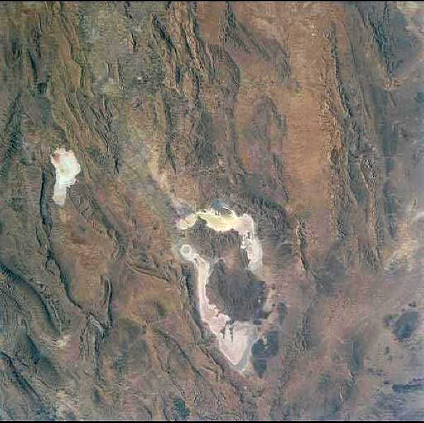
Lakes Tashk and Bakhtegan (centre) with Lake Maharlu on upper left
(NASA and Wikimedia Commons)
Bobek (1963) suggests that there may have been an outflow from this basin to the Gulf at the south-east corner of the lake which was cut off at the end of the Pleistocene by alluvial fans. However Krinsley (1970) maintains that any outlet was closed by the late Pliocene.
Major rivers are the Kor (= the classical Araxes) and its tributary the Pulvar (or Sivan) (= the classical Medus) which rise in the Zagros Mountains to the north and north-west and drain to the north-west corner of Lake Tashk. These mountains are high enough (Kuh-e Dinar at 4432 m and 30°50'N, 51°35'E) to have a snow cover and thus there is a continuous flow throughout the year. However in summer water does not reach the lake because of the demands of irrigation. Drainage and irrigation canals run through the basin on the plains at the north end of the lake. Several springs feed marshes, notably the Lapu'i marshes, a wetland of 150 sq km to the north-west of the Kor-Pulvar junction, the Zarqan marshes of 4 sq km, an extension of the Lapu'i marsh (both now severely damaged by construction of a drainage canal as part of the Dorudzan or Sadd-e Daryush-e Kabir (dam) at 30°15'N, 52°20'E, a project on the Kor River), the "Gomun", "Gumoon", "Gumoo" or "Sangare" marshes of 2 sq km at the north-west corner of Lake Tashk and the Sahlabad marshes of 5 sq km on the south-east coast of Lake Bakhtegan (Cornwallis, 1968a; 1968b). The Band-e Amir or Kamjan Marshes at 29°40'N, 53°05'E are formed at the delta of the Kor River and encompassed about 100 sq km but the Daryush-e Kabir Dam severely restricts the water flow to these marshes. A dam on the Bolaghi Gorge is proposed which would affect the flow of the Pulvar but is being opposed on archaeological grounds (www.netiran.com, downloaded 4 October 2004).
The fish, Aphanius sophiae, is found in these marshes and springs, but suffers predatory attacks in an unusual way. The greater flamingo stirs up mud in its feeding and this releases H2S, CO2, and CH4, suffocating the fish and making them easy prey for herons.
The Neyriz Lakes and Kamjan Marshes are a Ramsar Site (World Conservation Monitoring Centre, 1990; Khan et al., 1992) although the Kamjan Marsh area may be deleted because of drought and other factors such as rice, wheat and cotton growing and livestock grazing. The "Cheghakhur" and "Gandoman" marshes in Chahar Mahall and Bakhtiari Province will be substituted for the Kamjan Marshes as a listed Ramsar Site (Khan et al., 1992). The "Gumoon" marshes have been partially drained for irrigation and for conversion into aquaculture ponds (Khan et al., 1992).
The Ghadamghah spring-stream system at 30°15'N, 52°25'E and 1660 m altitude has been described by Esmaeili et al. (2007) and is a regional hotspot for biodiversity. The fishes present are Petroleucsicus persidis (Cyrpinidae), Cobitis linea (Cobitidae), Seminemacheilus tongiorgii, Oxynoemacheilus farsicus (Nemacheilidae), Aphanius sophiae (Cyprinodontidae) - all Iranian endemics, and Alburnus mossulensis, Capoeta aculeata and Capoeta damascina.
The Daryush-e Kabir Dam on the Kor River contains 990 million cu m of water, is 24 km long and about 9.5 km wide. Its conductivity is 363 µS compared to Lake Bakhtegan at 105,900 µS and consequently it can support a fish fauna. Band-e Amir on the Kor River is a diversion dam over 1000 years old and also provides a small reservoir habitat for fishes (Houtum-Schindler, 1891). At least three other dam sites have been proposed in this basin (Tang "Boraghi" (= Tang-e Boraq), "Tang Bulak" and "Ghaderabad" (= Qaderabad)). Surber (1969) gives some spot data on pH, total alkalinity, calcium-magnesium hardness, chlorides and free CO2 in this area. Water is relatively hard. Concentrations of total dissolved solids vary between 202 mg/l and 436 mg/l in the rivers compared to a range of 333-6937 mg/l in the Gulf basin.
Kaftar Lake at 30°34'N, 52°47'E is at ca. 2300 m in the Zagros Mountains northeast of Shiraz. It occupies 4700 ha (500 ha in Khan et al. (1992)) and is a shallow, semi-permanent freshwater lake which can dry out completely in summer and is frozen over in winter. The annual mean water temperature is 14.4°C, the mean maximum 23.5°C and the mean minimum about 2°C (B. Jalali, pers. comm., 1999); and Nowrouzi and Valavi (2011) give various physicochemical parameters. Lake water has been proposed for irrigation usage in the past and a recently proposed earthen dam would reduce the lake area by half (Scott, 1995). It has a mixed ichthyofauna of native species and exotics. The fishes recolonise from springs and the main river entering the lake and are also stocked.
The Kor River basin also contains qanats. Some of these flank the Pulvar River, for example, and serve to bring water to fields above the incised river bed.
Pollution in this basin has been recorded by Merchant and Ronaghy (1976) where industry discharges waste untreated into surface and ground waters. Waste from a sugar mill killed 1 million fish in 1994 and a further 500,000 fish died in 1996 from industrial waste (http://www.iran-e-azad.org/english/noi/noi-83.html or News on Iran, 83, 15 November 1996). A fish kill was reported from the Pulvar River in 1978, polluted by wastes from a food factory (Coad, 1980c). Peritore (1999) and Moussavi and Saber (1999) record the Kor River receiving organic wastes from animal processing plants, ammonium and mercury from petrochemical complexes and such heavy metals as cadmium, chromium and arsenic from electronics manufacturers. Ebrahimi et al. (2008) and Taherianfard et al. (2008) report lead and mercury levels in Cyprinus carpio and Capoeta spp. to be less than the maximum allowable by the European Union but still of concern. Ebrahimi and Taherianfard (2010a, b), however, found that levels of arsenic, cadmium, lead and mercury for these species were higher than permissible for human consumption.
Channels started in 1981 to provide more agricultural land drain through the Kamjan Marshes to Lake Tashk and the Kharameh Marshes to Lake Bakhtegan. Much of the marsh habitat has been destroyed. The "Gumoon" Marsh has been drained for agriculture and fish ponds.
Miller (1985) reports on deforestation in this part of Iran during the fourth to second millennium B.C. Even marsh areas were probably treed before demands for charcoal and construction materials increased. The fish faunas must have adapted to increased insolation and any species sensitive to higher marsh and stream temperatures would become less common.
Lake Maharlu
The Maharlu basin is the valley of Shiraz (29°36'N, 52°32'E) and encompasses about 4100 sq km. Lake Maharlu is at an altitude of about 1460 m, has an estimated average area of 220 sq km, a maximum depth variously cited as 0.5 and 3 m, a salinity of 124‰ or 304.95 gl-1 and is fishless. The lake dried out completely in 1967 (Cornwallis, 1968a). The lake is fed by minor streams and springs around its margin. The Khoshk River flowing through Shiraz is dry for much of the year or composed mostly of polluted wastes from businesses, domestic sources, industry and agriculture (Kafilzadeh et al., 2007). The basin also has a number of qanats. Stream temperatures vary between 8°C in January to 32°C in June while qanats can be warm, e.g. at Sarvestan (29°16'N, 53°13'E) in December a qanat was 25°C. Surber (1969) gives some spot data on pH, total alkalinity, calcium-magnesium hardness, chlorides and free CO2 in this area.
The basin is separated by only a small rise from the Mand River of the Gulf basin, but is treated separately here because fish collections have been focused on this valley as Shiraz is the major city of southern Iran.
Major fresh to brackish springs and their associated marshes (Ab-e Paravan (2.5 sq km), Barm-e Shur (1.5 sq km) and Soltanabad (7 sq km)) are concentrated at the northern end of the lake (Cornwallis, 1968a). Larger springs have pools which are about 2 m deep and reed beds of Phragmites and Typha, some of which are cut. Livestock grazing occurs. Amphibious tanks were tested in Barm-e Shur, stirring up anoxic bottom mud and leading to a fish kill.
Numerous small springs around the lake are isolated from one another by the intervening hypersaline water. Lake levels fluctuate markedly and allow streams to meet on the exposed salt flat when the water level is low. At high levels, salty water invades the lower springs and eliminates their fishes, which only recolonise when the lake level falls again and connection is made with a stream from a spring which was above the last rise in lake level. One spring had a salinity of 34‰ at the source when the lake had risen to "invade" the spring. Aphanius persicus were concentrated close to the source but would attempt to evade capture by swimming into the salt lake where salinity was 180‰. Their excursions into water of this salinity was brief and fish paled visibly while darting in and out. Another spring was replete with tooth-carps at 144‰. Temperature on 8 June 1976 at one spring was 27°C at the surface and 32°C on the bottom, at about 1 m depth.
Lake Orumiyeh
Lake Orumiyeh (= Reza'iyeh, Urmia, Urmi, Urumiyeh or Darya-e Shahi) lies in north-west Iran and is the only Iranian lake large enough to appear on general maps of the world. This lake is a Ramsar Site and includes Orumiyeh National Park. Brackish marshes in the northeast, northwest and southern shores probably support some fishes but the lake itself is too salty.
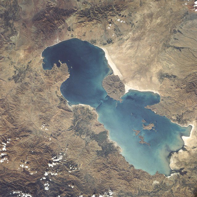
Lake Orumiyeh, October 1984 (NASA and Wikimedia Commons)
Orumiyeh lies at about 1275-1300 m (accounts vary), is about 128-149 km long and 40-60 km wide. This thalassohaline lake has a surface area of 4750-6100 sq km, a volume of 29.4 cu km, a mean depth of 4.9-6.0 m, a maximum depth of 16 m, and a temperature range of -1.3-27.5°C. Lake level can rise as much as 2 m in one season, as it did in the winter of 1968-1969. It is a sodium chloride-sulphate system with a salinity up to 340.0 gl-1 (but mostly 217-235gl-1) and consequently is fishless (Abich, 1856; von Seidlitz, 1858; Rodler, 1887; De Mecquenem, 1908; Plattner, 1955; Vladykov, 1964; Kelts and Shahrabi, 1986; Ghaheri et al., 1999; www.neda.net/inwm/no.6/english/geology/geology01.html, downloaded 10 July 2000; Van Stappen et al., 2001; Eimanifar and Mohebbi, 2007; Karbassi et al., 2010). Initially the lake was probably fresh (Admiralty Naval Staff, 1918). A causeway has divided the lake into two parts since 1989; a gap allows a limited exchange between the two parts. Its drainage basin approaches 57,000 sq km (or 51,786 sq km, authors differ) and the lake is the terminal basin for a number of streams and rivers. Annual inflow is 6900 x 106 m3 (Ghaheri et al., 1999). During spring runoff a freshwater plume covers large areas over the saline lake near river mouths. Prominent perennial streams include the Zarrineh River (230 km long) entering from the south and draining part of the northern Zagros with a range in discharge of 10-510 cu m per second with the Tata'u or Simineh River (145 km) as a major tributary, the saline Aji Chay or Talkheh (= bitter) River from the east draining the flanks of Kuhha-ye Sabalan at 4810 m (38°15'N, 47°49'E) and Kuh-e Sahand at 3710 m (37°44'N, 46°27'E), and the smaller streams from the west such as the Zowla (= "Zola") Chay (84 km), Nazlu Chay (85 km), Shahr (= "Shaher") Chay (70 km), Baranduz Chay (70 km) and Gadar (= "Qader") Chay (100 km) (Günther, 1899). Both the Zarrineh and the Talkheh exceed 200 km in length. The Talkheh River has a hardness of 820 mg/l according to Surber (1969), who also gives values of total alkalinity and calcium-magnesium hardness for a number of streams and lakes around Tabriz. The Talkheh floods extensively in the spring and forms large marshes. Most streams were relatively hard like the Talkheh although some were soft such as the Basmenj Chay draining Kuh-e Sahand at 70 mg/l.
Lake Kobi (= Ghopi) is a Ramsar Site lying at 36°57'N, 45°52'E and 1240 m altitude in this basin. It is south of Lake Orumiyeh and northeast of Mahabad. It comprises the fresh to brackish lake and associated but discontinuous marshes of about 1200 ha. The endorheic lake is shallow with a maximum depth of 1.5 m and a mud bottom. It is fed by precipitation and springs, and when full floods marshes to the north. It freezes over in winter. The lake is eutrophic and has reedbeds of Phragmites communis and abundant submerged vegetation. Livestock grazing and wildfowl hunting occur.
The Shur Gol and the "Yadegarlu" (= Yadergarlu) and "Dorgeh Sangi" endorheic lakes are at 37°00', 45°26-35'E south of Lake Orumiyeh and northwest of Mahabad at 1290 m are also a Ramsar Site comprising 2500 ha of lakes and associated marshes. They are fed by precipitation, springs and small streams. Shur Gol at 2000 ha is surrounded by the Hassanlu Marshes. Its water is brackish to saline. The eutrophic marshes flood in fall and winter and have abundant submerged vegetation. "Yadegarlu" is a shallow freshwater lake of 350 ha with abundant submerged vegetation and a surrounding of eutrophic sedge marshes. It may dry out in summer. It apparently suffered in the Iran-Iraq war (Jones, www.ramsar.org/lib_dir_2_3.htm, downloaded 4 April 2000) and may be deleted as a Ramsar Site. "Dorgeh Sangi" is 150 ha in extent and is a shallow freshwater and eutrophic lake. All three lakes may freeze over in winter. Reed cutting, grazing and waterfowl hunting occurs in this complex and some drainage of wetlands for agriculture may occur (Khan et al., 1992).
"Gerde Gheet" (Gordeh Git) and "Mamiyand" (= Meimand?) at 37°02'N, 45°40'E are freshwater marshes south of Lake Orumiyeh and north of Mahabad occupy 500 ha at 1300 m. The marshes are covered by Phragmites. Waterfowl hunting occurs here and some livestock grazing.
The "Ghara Gheshlaq" freshwater marshes at 37°10'N, 45°50'E occupy 400 ha at 1290 m south of Lake Orumiyeh and north of Mahabad. The water is about 1 m deep, eutrophic and freezes over in winter. Large parts of these marshes were drained by the "Mahabad Multipurpose Drainage and Irrigation Project" in the 1970s despite environmental concerns. Cornwallis (1976) notes both the draining of these marshes and the cessation of freshwater discharge from the Mahabad River. He also points out the likelihood of chemical contamination from agriculture, choking by vegetation and the probable use of herbicides. He recommends introduction of Ctenopharyngodon idella and Hypophthalmichthys molitrix. The marshes have been proposed as a Ramsar Site.
Lagoons in the Mahabad area dried in the year 2000 (www.irna.com/newshtm/eng/05142727.htm, IRNA, 26 July 2000).
Gori Gol or Lake Gory at 37°5'N, 46°42'E is a fresh to brackish lake near Tabriz occupying 120 ha at 1950 m. Depth is 2-3 m on average. It is a Ramsar Site (World Conservation Monitoring Centre, 1990; Scott, 1995). It is fed by precipitation, springs and small streams, with overflow through a small stream. The lake freezes over in winter. The submerged vegetation is abundant and there are extensive reedbeds of Phragmites communis, Juncus, Carex and Scirpus. It is under pressure from the population of the major city of Tabriz through sport fishing and wildfowl hunting as well as reed cutting and cattle grazing.
Qanats are found in this basin where surface water is saline. About 225 million cu m of water are produced annually by qanats and wells on the northern and eastern coast of the lake (Alamouti, 1966). Dams are found on the Zarrineh River and on the river which flows through Mahabad paralleling the Zarrineh. The Mahabad Dam has a fish catch of 130 tons (sic) annually and 300,000 fingerlings (species unspecified) were stocked to save the fish reserves from possible extinction (IRNA, 7 January 1999). The Mahabad reservoir has a leech fauna (Codonobdella trunata, Parcanthobdella livanowi, Baicalobdella torquata, Piscicola geometra) which may affect local fish farms and fish populations elsewhere if fish are transplanted (Abdi, 1999: www.mondialvet99.com, downloaded 31 May 2000). The Nowruzlu Dam on the Zarrineh is at 36°55'N, 46°10'E, occupying 1000 ha at 1260 m. It is water storage reservoir with heavy input from surrounding farming activities. The Alavian Dam near Maragheh is 80 m high, 935 m long and has a reservoir of 145 million cu m (http://netiran.com/news/IRNA/html/951214IRGG11.html). The Nahand Reservoir Dam northeast of Tabriz was inaugurated in 1995 with a capacity of 30 million cu m and a second dam, the Shahid Madani also near Tabriz, was under construction. Other dams include those at Ahar, Tabriz, Hashtrud, Hasanlu, Mianeh (= Onligh) and Heris which were scheduled to be completed in the period 1995-2000 (http://netiran.com/news/TehranTimes/95121601TTEC.html and www.irna.com/newshtm/eng/12003142.htm, IRNA, 2 July 2000). ? check basins for dams
The Hassanlou Reservoir Dam at Naqadeh was to open in 1998 with a height of 10 m, a crest of 5160 m (sic) and a capacity of 107 million cu m (http://netiran.com/news/IRNA/html/950915IRGG06.html). A total of 6 reservoir dams and 10 dams for re-directing water flow will decrease water input to the lake by 1.04 billion cu m by 2014. The volume of surface water has fallen from 42 to 22 billion cu m since 1995. The lake salt has increased to more than 260g/l, up from about 185 g/l. The lake may well dry up by 2014 (IRNA, 10 September 2001).
Khorasani et al. (2004) determined the environmental consequences of the construction of a dam on the Shahr Chai, a river 12 km southwest of Orumiyeh. Recommendations were made as to discharge and it was noted that fisheries potential would increase because of the reservoir.
Löffler (1993) details the eutrophication threat to this lake since a traffic embankment was built across the lake 35 km north of Orumiyeh in 1990. Untreated sewage from Orumiyeh will pollute the southern part of the lake.
Pollution occurs in various localities on a sporadic basis such as the Godar River in Naqadeh where a fish kill numbering in the thousands was reported (Tehran Times, 18 July 1999). Haji Hassani et al. (2004) found that levels of Ni, Pb and Cu in the Talkheh Rud were higher than acceptable limits for fish culture while Cr and Fe were lower. The river receives waste water from agricultural and industrial activities.
Water reservoirs behind the Mahabad, Miandoab and Shahid Kazemi dams were stocked with 3.6 million fish fry (species not specified) from the Pol-e Dasht Complex in 2000. This aquaculture site has the capacity to produce 4 million fry. West Azarbayjan produces over 600 tons of fish annually (Tehran Times, 2 January 2001).
Lake Orumiyeh is the largest natural habitat for brine shrimp in the world and, since 2000, is has been harvested, processed and used to feed sturgeon in hatcheries (www.worldfishingcompanies.com/html/us/world.report.html?id=1, downloaded 23 October 2001).
The lake was formed during the late Pliocene-Pleistocene and lies at 1275-1300 m and may well have had a Pleistocene connection to the Caspian Sea basin although this is in dispute (Scharlu, 1968; Schweizer, 1975). Pleistocene shorelines from 30 to 115 m above the present level have been confirmed, and the lake covered twice its present area, but this would not permit an external discharge. Berg (1940) reports benches at levels of about 1800 m, 1650-1550 m and 1500-1360 m, which may represent shorelines, and a level of about 1570 m would have had an outlet to the Aras River basin through the Kara-tepe Pass in the northwest and across the plain near Khvoy. Saadati (1977) suggests two connections with the Caspian Sea, an early one in the Pliocene to early Pleistocene resulting in endemic species and a later one in the late Pleistocene resulting in species which are the same as the Caspian or only subspecifically distinct. Stream capture may have allowed the entry of some species in recent times as evidenced by a Salmo cf. trutta/caspius population.
Fish farming is extensive in West Azarbayjan. In the Iranian year ending 20 March 2002, 840 tonnes of coldwater fish were produced and 3000 t of warmwater fish (Tehran Times, 24 November 2002).
Günther (1899) details a method of catching fish used in the rivers of this basin. Flour and the pounded berries of Cocculus indicus are mixed with butter to form a stiff paste. Small pellets of the paste are thrown into slow flowing water and after 10-15 minutes, if the fish are feeding, they will begin to swim at the surface in small circles or lie helpless in the shallows and are then easily scooped up. Some fish can recover from the poison. There is no effect on humans if poisoned fish are eaten.
Berg (1940) considers that this basin falls within his assignment of the Iranian shore of the Caspian Sea. Species in common include Leuciscus (= Squalius) cephalus, Barbus lacerta, Gobio (= Romanogobio) persus, Capoeta capoeta, Alburnoides bipunctatus (sic), and Silurus glanis, and Acanthalburnus urmianus is related to A. microlepis. Groombridge (1992) notes that the ichthyofauna of this region is badly in need of re-examination. Naseka (2010) recognises Urmia (Orumiyeh) Lake as a District within a West Asian Transitional Region related zoogeographically to the East Transcaucasian District (southern Caspian Sea area from the Kura River to the Atrek River). Both these Districts are linked to Iranian endorheic basins, including those listed as ecoregions in Abell et al. (2008), namely Namak, Kavir, Lut, Esfahan and Sistan, plus Kavir, Kor, Sirjan, Maharlu Kerman-Na'in and Jaz Murian basins in this work.
Namak Lake
This basin is flanked by the Alborz Mountains to the north and the Zagros Mountains to the west. On the east is the vast expanse of the Dasht-e Kavir basin and on the south such ranges as the Kuh-e Karkas at 3899 m (33°27'N, 51°48'E). The basin encloses about 87,600 sq km.
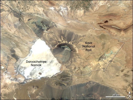
NASA and Wikimedia Commons
A small sump near Arak (34°05'N, 49°41'E) is included as part of this basin as it is not separated by any major landform. A second salt lake is the Howz-e Soltan by the Tehran-Qom road and this lies in the same depression as the much larger Namak Lake south of Tehran. The lowest part of this basin is at 765 m and is covered by water in spring but this generally evaporates by the middle of summer.
The proximity of the capital, Tehran, to the rivers of this basin and its rapid growth in population and industry has led to many water diversionary schemes (Anonymous, 2003). A proposed dam northwest of Tehran would be the largest man-made lake in the country and the Middle East (sic) (Nouri et al., 2005). Much of this basin lies in Markazi or Central Province which has 42 dams of varying sizes. The Abbasabad Embankment Dam in Khomein, for example, is 36 m high, has a crest of 260 m and has a reservoir of 25,000 ha (IRNA, 3 February 1999).
The principal river in the west draining the Alborz south towards the Namak Lake is the Karaj River. Average temperatures of the Karaj River at the dam site before construction ranged from 2.5°C in January to 16.4°C in August (Nümann, 1966). Rieben (1954) and Hariri (1966) give details of surface and ground water in this river basin. The Amir Kabir Dam on the Karaj contains 205 million cu m of water and feeds through pipelines to Tehran. The reservoir has an area of 4 sq km at high water, 1.1 sq km at low water. Vladykov (1964) and Nümann (1966, 1969) give some details on the limnology of this reservoir, particularly temperature regimes. The Karaj has a discharge of 124 cu m per second in spring but this falls to 4.2 cu m per second in autumn. 55.6% of the annual discharge occurs during spring. There is no vegetation because of the steep rock sides and water fluctuations. Nümann (1966) recommended stocking the Karaj reservoir with Coregonus sp., Sander lucioperca, Acanthobrama terraesanctae (a Levantine species) and cichlids from Israel as environmental conditions and plankton levels were suitable. Nadim (1977) found the highest mercury levels in fish from the Karaj were 0.05 mg/kg. As the acceptable limit was 0.5 mg/kg, mercury contamination in fish was not considered a problem.
The Abhar River and its tributaries drain the land west of Tehran and south of Qazvin (36°16'N, 50°00'E). Its headwaters approach those of the Zanjan River, a Caspian Sea tributary. The course of the Abhar is about 350 km from its headwaters to the terminal sump. The lower part of this river is known as the Shur and is salty. Sewage and untreated factory wastes, as much as 40,000 cu m, flowed into the streams around the city of Qazvin although waste-water and sewage treatment plants are offsetting this problem (http://netiran.com/news/IRNA/html/941220IRGG05.html).
Other rivers draining the Alborz are much shorter. The Jajrud (Jaj, Jaji or Jaje River) to the east of Tehran is dammed at Latian (95 million cu m) for the Tehran water supply also. The Jajrud discharge is 60.5 cu m per second in spring and 1.5 cu m per second in autumn. Nümann (1966) reports fish kills in the thousands for Capoeta buhsei on turbid spring floods of this river. Khorasani (2001) give an environmental survey of this river. Mirzaei et al. (2010) give details of Eurasian Otters feeding on Alburnoides bipunctatus (sic, = namaki), Squalius cephalus and Capoeta spp. in the Jajrud. The Band Ali Khan River flows from the Khasrang Mountain (as does the the Jajrud which it receives) and its branches on the Varamin Plain are used for irrigation. Much of this river is polluted from wastes in the Jajrud and Tehran's sewage floodway (Rohani, 2004; Kashefi Alasl and Zaeimdar, 2009). The Lar River, a Caspian Sea tributary, was scheduled for diversion via a massive tunnel into the Jajrud (Marwick and Germond, 1975a; 1975b). This would affect flow in the Heraz River of the Caspian Sea basin and plans to offset this involved weirs and canal construction no doubt with the usual deleterious effects on fishes. These major projects are a far cry from the days in the twentieth century when Tehran depended solely on qanats for its water supply (Rieben, 1954).
The Namak Lake receives the Qareh Su (Gharechay), which flows north of Qom, and the Qom River from the Zagros Mountains. Discharge of both these rivers is about 312 cu m per second in flood falling to about 4 cu m per second in October (Oberlander, 1968b). The Qareh Su exceeds 400 km in length. The Qom River has captured headwater streams of Persian Gulf drainage. The Golpayegan River near Golpayegan has a storage reservoir, the Sadd-e Shah Esma`il. Borowicka (1958) gives some early figures on siltation and irrigation requirements. The Haroon Canal had diverted water for irrigation from the Golpayegan River for over 1000 years, and during the summer and fall all river water entered this canal. The Ghadir or Qadir Dam near Saveh has a volume of 290 million cu m of water. The 15th Khordad Dam is located 80 km south of Qom on the Qom-Delijan road (http://netiran.com/news/IranNews/html/95030718INPL.html). The Khandab Diversionary Dam is near Arak (http://netiran.com/news/IRNA/html/951217IRGG09.html).
Egglishaw (1980) gives some details on the water quality and environment of rivers and streams of this basin. Imandel et al. (1978) recorded ground water pollution by detergents in Tehran, where there was no method of sewage disposal other than discharge to wells and seepage pits. Södergren et al. (1978) reported on pollution with organochlorines in the Karaj and Latian reservoirs. Capoeta buhsei, Oncorhynchus mykiss, Alburnoides bipunctatus (= namaki) Coregonus sp. had accumulated the DDT metabolite p,p'-DDE, particularly in the Latian Reservoir. Direct removal of plants for fuel and laying bare the roots of such thorny plants as "giavan" for extracting gum tragacanth leading to plant loss has caused soil loss by erosion, gullying and affected recharge of groundwater. Poor farming practices on steep slopes has also led to the loss of topsoil such that runoff is too fast for infiltration of rain and snow (Rieben, 1954). These factors causing silting of reservoirs, added silt input to rivers and reduced groundwater recharge with consequent reduction in spring and qanat flows, all detrimental to fish habitats. Some areas of southern Tehran receive 300 kg/ha/yr of sulphate ions as acid rain which lowers river pH and has effects on the fish fauna (Salahi Kojoure, 1997). An effluent leak from a power station in the Vian area of Hamedan sent 40-50,000 litres of furnace oil into 1 km of river in the Qareh Su basin (Iran Network 1, Persian TV, 1730 GMT, 2 January 2000). Monavari and Mardani (2007) record the effects of sewage from fish culture ponds in this basin on water quality in the Jajrud, most factors being within acceptable limits except coliform bacteria.
Qanats are still a major feature of this basin. Alamouti (1966) records 260 qanats producing 99 million cu m per year on the Varamin Plain (35°20'N, 51°39'E), 220 qanats producing 161 million cu m per year on the Karaj Plain and 600 qanats producing 200 million cu m per year on the Qazvin Plain. However numerous pump wells have led to the drying of qanats and a complex irrigation system has reduced groundwater recharge (Beaumont, 1974). Alibekov (1994) gives a Russian account of qanats in Central Asia and also refers to those around Tehran in the Namak basin.
The Qazvin area has more than 20 aquarium fish farms producing over 2 million fish (www.tehrantimes.com, downloaded 28 July 2004). Waters in this area drain also to the Caspian Sea and there may be potential for escapes of exotics.
Berg (1940) refers this basin to his Tehran District of the Iranian Province. He notes that some drainages are close to those of the Caspian Sea basin and that the fauna may be of quite recent origin, rather than the Pliocene advocated by Derzhavin (1934) for Salmo trutta or presumably now caspius). Saadati (1977) considered that the fish fauna of this basin was not derived from movements through a large freshwater lake connecting all the tributaries. Some species came from the Caspian Sea basin and others from the Esfahan and Tigris River basins. The basin may also have served as a "filter-bridge" allowing such species as Capoeta aculeata, Capoeta capoeta and the progenitor of Capoeta fusca to reach the Dasht-e Kavir basin.
Sirjan
The Sirjan basin extends south-east of the Esfahan basin and parallels the Kerman-Na'in basin. It is named for the town of Sirjan at 29°28'N, 55°42'E which lies at the edge of the largest salt flat in the basin. It is somewhat higher than the Esfahan basin which is at 1300 m, being 1448-1710 m. It is distinguished from the Esfahan basin by its lack of a significant river. There are four major sumps in this basin, strung out along its length at regular intervals, and the northern two are connected as are the southern two. The sumps are fed by intermittent streams. Qanats and minor springs are found in this basin which has not been extensively explored. The sump in the north near Abarqu (31°08'N, 53°17'E) receives streams from the west (Kuh-e Bul at 3661 m and 30°48'N, 52°45'E) and from the east (Khar Kuh at 3512 m and 31°39'N, 53°46'E, and Shir Kuh at 4074 m and 31°37'N, 54°04'E). The southern basins near Sirjan receive their streams from lower elevations.
Sistan
The Sistan (= Seistan) basin straddles the Iran-Afghanistan border and is a north-west to south-east oval in shape. It comprises a number of minor streams and qanats flowing from the west and the Birjand highlands, but these are rapidly absorbed or run for only a few days each year. Its most obvious feature is the vast hamun or swamp comprising open freshwater lakes, reed beds or neizar, and the rivers that feed the lakes. This is a major oasis of fresh water surrounded by hundreds of kilometres of arid plains. Huntington (1905a; 1905b), Annandale (1919a), Ahmadi and Wossughi (1988), Noorbakhsh (1993), Mansoori (1994), Ibrahimzadeh (1995), Scott (1995), Weier (2002), CIRSPE (2006a), van Beek et al. (2008), Najafi and Vatanfada (2011), Piri (2011) and Sharifikia (2013) give descriptions of this basin and its environmental challenges. Note that Weier's (2002) statement (repeated in various newspaper reports and in UNEP (2003)) that there is nearly 140 species of fish in Sistan is an error by an order of magnitude! The native ichthyofauna comprises a mixture of endemic species, species related to or conspecific with high-altitude species from Central Asia and species from Baluchestan in the wider sense. There is little relationship to species from Iran to the west. Variations in water level and crowded conditions lead to disease and parasite outbreaks in the fishes (Mansoori, 1994).
The principal river is the Helmand (or Hirmand) which flows from the Paghman Mountains just west of Kabul to end in Sistan after a journey of 1400 km. Along with the Hari or Tedzhen, this is the only major river entering Iran. Snow and rain in the Hindu Kush mountains ultimately reaches Sistan at 427 m from heights of 5300 m. The Helmand is the most important river between the Tigris and the Indus and drains an area of 386,000 sq km of which 78,000 sq km or 20.2% lies in Iran (Gleick, 1993).
The Helmand produces 1700-2000 cu m per second in flood and 56 cu m per second in the dry season. The average annual flow is 78 cu m per second. The river varies between 200 and 900 m in width and between 2 and 5 m in depth. The annual water income to Iran is about 6 billion cu m but this varies markedly and was 14,740 million cu m in 1970-1971 and 1976-1977 and 600 cu m in 1985-1986 (Mansoori, 1994). UNEP (2003) gives the following flows in million cu m:-
| 1991-2 | 1992-3 | 1993-4 | 1994-5 | 1995-6 | 1996-7 | 1997-8 | 1998-9 | 1999-2000 | 2000-1 |
| 2211.7 | 1783.8 | 529.5 | 829.7 | 1023.8 | 908.7 | 2193 | 258.8 | 114.1 | 48 |
As it enters the Sistan depression, the Helmand splits into several branches which feed the swamps, the two main ones being the Sistan feeding the Hamun-e Helmand (also Hirmand or Hamun Lake) in Iran and the Parian feeding the Hamun-e Puzak (or Parian) lying mostly in Afghanistan. The northern part of the Hamun-e Helmand is called Hamun-e Sabari, or Lake Sistan, which lies half in Afghanistan and half in Iran, and the southern part is called Hamun-e Hirmand. Hamun-e Sabari receives water from the Farah River and overflow from Hamun-e Puzak. The Hamun-e Hirmand receives water from the southern or Sistan branch of the Helmand River and overflow from Hamun-e Sabari. Other rivers flowing from Afghanistan are the Harut, Khospas and Khash but their flow is minor and intermittent compared to the Helmand (Gabriel, 1938). The whole lake area of Sistan is often called the Hamun Lake.
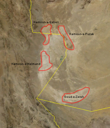
Sistan lakes from NASA and Wikimedia Commons
The plentiful natural flow of the Helmand is reduced by irrigation dams in Afghanistan; the Arqhandab and Kajaki dams extract about half of the 12 billion cu m which enter the Afghan plain (Michel, 1973; Mansoori, 1994; Mojtahedzadeh, 2001). A third dam is under construction in Afghanistan without environmental considerations being taken into account (World Conservation Monitoring Centre, 1990). The proposed Kamal Khan Dam on the Helmand in Afghanistan and the "Sistan Drainage and Irrigation Completion and Rehabilitation Project" in Iran would lower water level in the lake complex. There are also plans to divert water from the Sistan area to the city of Zahedan in the south. The Char-Neimeh (or Chahnimeh) Lake is a depression used as a water reservoir and is filled from the Parian branch of the Helmand. It has a surface area of 4,700 ha and is used for irrigation and fish culture but does reduce flow into the hamuns. However floods in spring 1991 destroyed the Kajaki Dam and associated irrigation controls and the lakes were more extensive than they had been in over a decade. Rainfall in Afghanistan increased flow of the Helmand in 2003 and some flooding was expected in Sistan (www.irna.com, downloaded 23 April 2003). The Helmand was dry at the Iran-Afghanistan border in 2004 (Gall, 2004). Sadeq (1999) lists several factors which are threatening the Hamun Lake namely, fluctuation in incoming water, sedimentation, exotic species, urbanization and increased population pressure on the hamun resources.
The south end of Hamun-e Puzak and the contiguous Hamun-e Sabari (or Lake Hamun) are Ramsar Sites (World Conservation Monitoring Centre, 1990). The Lake Hamun Ramsar Site is on the threatened list of National Parks (Anonymous, 1988b).
Puzak is very shallow, with maximum depth of less than 4 m, and is the first of the Sistan lakes to flood and may never dry out completely unlike the other lakes (Khan et al., 1992; Scott, 1995). This lake has extensive reed beds of Phragmites australis with associated submerged Ceratophyllum demersum and relatively little open water. Reeds are cut as forage for cattle, burnt to improve grazing for livestock, used for boats, for wind-breaks and for cooking and heating. Local people engage in fishing.
The Helmand is very turbid and deposits 8 g of silt for each litre of water (Fisher, 1968). The sediment load in 1975-1976 was 15,149,000 t and in 1985-1986 280,000 t (Mansoori, 1994). Drinking water looks like milk! (personal observations, 1977). Rain accounts for little input to the lake, the annual mean precipitation over 12 years being only 51 mm, most rain falling within 10-15 days (Mansoori, 1994). UNEP (2003) reports evidence of pesticide pollution in the Helmand and the swamps, e.g. dieldrin.
The lake bottom in Iran is clay and silt and the waters are markedly alkaline. Water at the edges of the reed swamp were 31°C in early May, warmer than the inflowing rivers and the irrigation ditches which were only 22°C at this time. Annandale (1919a) and Mansoori (1994) give a brief chemistry of Sistan water. There are marked variations in conductivity, temperature, pH, oxygen, alkalinity and hardness between sites. Conductivity ranges from 1280 to 64,000 mmhos (sic), pH from 7.5 to 9.15, oxygen from 0.64 to 11 mg/l, alkalinity from 3.6 to 165 mval and hardness (CaCO3) 180 to 3500 mg/l in Mansoori's water samples from the Hamun Lake.
Evaporation lowers the water level each year and is caused by extreme heat and the famous Bad-e Sad-o Bist Ruz (Wind of 120 Days) which approaches 200 km per hour. This wind causes serious erosion and marching sand dunes often block streams causing them to change channel. Evaporation has been measured at 4 m per year because of temperatures over 40°C in July (Mansoori, 1994). Refilling occurs in February-June and in flood years various hamuns are joined together into one vast lake. 75% of flooding occurs in March-May. There are about 3900 sq km of seasonal lake and marsh at a maximum, dropping to 1930 sq km in July-January. The maximum flood zone is about 200 km long and 20 km wide, but the lakes have dried up completely, or almost so, at least 5 times in the past 100 years, e.g. in 1907, 1962 for 5 years, 1970-1971, 1984 for 4 years, 1988-1989, and 1998-2002, with major fish kills resulting (Tate, 1910; Harrington, 1976; Costantini and Tosi, 1978; Anonymous, 1992a; Khan et al., 1992; MacFarquahar, 2001; Foltz, 2002; Weier, 2002; www.netiran.com, downloaded 18 June 2002; Boudaghpour, 2011; Sharifikia, 2013). There was a big flood in March 1989, spring 1990 and an exceptional flood in February/March 1991 (Khan et al., 1992). The lakes filled in 2005 (E. Penning, pers. comm., 28 July 2005). Mansoori (1994) mentions historical floods, e.g. in 1247 A.D., and droughts, e.g. in 835 A.D. UNEP (2003) gives satellite photographs showing variations in water extent. The fish fauna can recolonise newly-flooded marsh areas from the Helmand but population numbers in the hamun vary greatly between years.
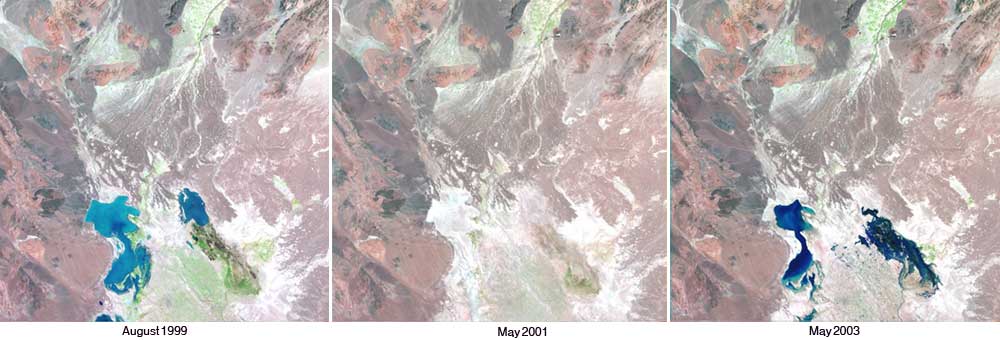
Sistan showing variations in water extent, U.S. Geological Survey
and Wikimedia Commons
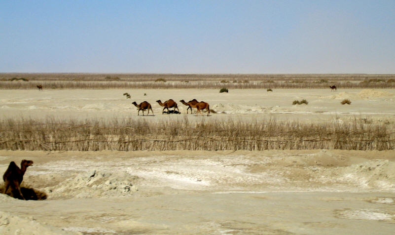
East Hamun-e Saberi near Afghan border, January 2005, courtesy of Ellis Penning
Dead reeds in Hamun-e Hirmand near volcanic mount,
January 2005,
courtesy of Ellis
Penning
The centre of the hamun is only about 2-3 m deep on average with a maximum depth of 5 m at highest water level (www.bibliothecapersica.com/articlenavigation/index.html, under hamun, downloaded 24 December 2004, gives 11 m). Overflow spills into the salt flat Gowd-e Zereh of Afghanistan through the Shelah River. This flushing effect probably prevents this endorheic basin from becoming saline. The Shelah was reduced to isolated and fishless pools in May 1977. The Gowd-e Zereh is at 467 m at its lowest point.
Extensive canals and ditches form a network over Iranian Sistan and serve to irrigate and drain fields. These waters contain fish, but may dry up. The Hirmand is dammed to feed the major canals. The open lake areas are fringed by reed beds comprised of Typha, Phragmites and Scirpus which are concentrated at the ends of the detrital cones of the river deltas (Costantini and Tosi, 1978). Mansoori (1994) and Ibrahimzadeh (1995) report an absence of Phragmites in area which was two-thirds covered in previous studies, drought being advanced as the causative agent along with cattle grazing (Khan et al., 1992). Usually the reeds recover after drought but in 1991 this did not happen (probably the effects of introduced Ctenopharyngodon idella on the young shoots since fenced areas excluding fish show successful reed growth). Two million fish were introduced in early January 1992 near Kuh-e Khvajeh. Scott (1995) also suggests that local people may have dug up tubers to use as fuel. A major fish and bird kill occurred in November 1994 but the cause was never ascertained (Scott, 1995).
Agricultural land around the Sistan lakes is being abandoned because of increasing soil salinity. Wind-blown salt is becoming a problem in summer and the area might suffer the same fate as the Aral Sea (Scott, 1995). A new road running between the Sabari and Helmand lakes in the Ramsar Site may impede water flow despite bridges having been constructed. A canal between Puzak and Sabari will also have major hydrological impacts.
Curiously, both the open lake and the reed beds are poor in fish
but channels among the reeds and areas at the edge of reed beds are
productive. The effluents of the Helmand are particularly productive
and provide a refuge for fish if the lakes dry out. Annandale in
Annandale and Hora (1921) gives an interesting account of the
fisheries of the Sistan lakes in the early years of the 20th century.
Only one species, Schizothorax zarudnyi, was pursued (q.v.)
using reed boats or skiffs called tutin which were still in
evidence in the 1970s. The introduction of exotic species resulted in
an increased fish catch in the 1980s and 1990s and the number of active
fishermen was 1090 (Abzeeyan, Tehran 5(5):III, 1994, M. H. Karim Koshteh,
in litt., 2003). However, Ibrahimzadeh (1995) reports that there is no fish catch in the lake.
Local people took more fish as the population increased (4% per
annum, with added impact from Afghani refugees), as transport facilities
improved and as animal husbandry decreased through degradation of reed beds (M.
H. Karim Koshteh, in litt., 2003). The Islamic Republic
News Agency (IRNA, 22 March 2000) reports a catch of 7000
tonnes from the Hamun Lake; the following figures are from M. H. Karim Koshteh (in
litt., 2003):-
| Year | 1990 | 1991 | 1992 | 1993 | 1994 | 1995 | 1996 | 1997 | 1998 | 1999 | 2000 |
| tonnes | 2790 | 3520 | 4380 | 4106 | 3543 | 5998 | 4251 | 3900 | 6044 | 12,000 | 2426 |
Meijer (2006) gives an estimated catch in a semi-wet year as high as 21,840 tons although official figures give 9000 t. Variations reflect drought conditions, the year 2000 being particularly severe. Fluctuations in catches make the fishery a difficult occupation. Gilkolaei (2007) estimates a commercial catch of stocked fish at 22.5-45,000 tons/year in the whole Sistan basin.
Sistan has fish farming in various water bodies. In 2005, 1.3 million juveniles of grass carp, common carp, bighead and silver carp produced by the Zahak hatchery were stocked in farms (www.iranfisheries.net, downloaded 17 January 2005; CIRSPE, 2006b). Goldfish and silver carp are exotics found in the hamuns (E. Penning, pers. comm., 28 July 2005). CIRSPE (2006a) also lists Rutilus frisii, Abramis brama and Sander lucioperca, all Caspian Sea basin species, as being present in Sistan but this may be an error. Gilkolaei (2007) discusses breeding of Schizothorax zarudnyi, culture of Ctenopharyngodon idella, Hypophthalmichthys molitrix and Oncorhynchus mykiss and ornamental fish breeding in this basin.
Berg (1940) places this basin in his Sistan District of the Iranian Province. It excludes the upper reaches of the Hirmand River. The schizothoracine fauna is particularly characteristic and had its origins either by descent from higher altitudes during the Pleistocene glaciations (favoured by Berg) or are autochthonous as the forms at high altitudes in the Pamirs and Himalayas rose with mountain building.
Tedzhen River
The Tedzhen River is the more familiar, international name and is used here. In Iran this major river is known as the Harirud or Hari River. The Tedzhen rises in the Selseleh-ye Kuh-e Baba of Afghanistan and flows west for about 490 km before turning north as the Iran-Afghanistan border for 160 km. Along with the Hirmand and Aras, this is the only major river entering Iran. At Sarakhs (36°32'N, 61°11'E) it enters Turkmenistan and is known there as the Tedzhen, and is eventually lost in the Karakum desert. The river is usually dry even at Sarakhs (Barthold, 1984). Most of the water in the Tedzhen remains in Afghanistan where it is used for irrigation of the Herat valley. Spring floods (March-April) can increase flow ten-fold for short periods of time. The Jam River is a southern tributary from Iran, draining the mountains around Torbat-e Jam (35°14'N, 60°36'E) and the Kashaf River is a northern Iranian tributary draining past Mashhad from the northern slopes of the Kuh-e Binalud (3416 m at 36°30'N, 58°55'E) and the southern slopes of the Kuh-e Hazar Masjed (3146 m at 36°52'N, 59°26'E). The Kashaf is about 310 km long. Its discharge is comparable to, if not as great as, central Zagros streams and is larger than the plethora of minor streams draining the Alborz (Oberlander, 1968b). The upper reaches of the Kashaf approach those of the Atrak River, a Caspian Sea tributary, and are separated by only a small upfold. This area is very unstable with frequent earthquakes. The catchment area for the Tedzhen basin approaches 45,000 sq km (Pirnia, 1951).
Bazangan Lake between Mashhad and Serakhs (36°17'N, 60°29'E) is the largest natural lake in northeast Iran with an area of 690,000 sq m and a maximum depth of 6-11 m. It is hyposaline oligotrophic with low phyto- and zooplankton communities, and with a corresponding low diversity of fishes (Ghassemzadeh, 2004).
Najafpoor et al. (2007) give a water quality assessment for the Kashaf River and note its use for water supply, agriculture fishing and recreation. Pollution from agriculture, and from industrial and municipal wastes at Mashhad, is recorded. Supersaturation from excessive plant life and low night-time levels of dissolved oxygen through respiration could lead to fish kills in the Kashaf.
A number of minor streams drain northward from the Koppeh Dagh (= Kopet Dagh or Kopetdag) in the west, a range which straddles the border of Iran and Turkmenistan in this north-eastern part of Iran, and from the Hazar Masjed and intervening ranges in the east. These have not been collected. The Iranian tributaries of the Tedzhen have not been well collected either, but there is data on the fish fauna from both Afghanistan and the former U.S.S.R. (now Turkmenistan). Coad (1981d) lists fishes from Afghanistan, and Aliev et al. (1987; 1988), Starostin (1992) and Salnikov (1994) fishes from Turkmenistan. Aliev et al. (1987) list rare and endangered species in Turkmenistan.
There is evidently a strong possibility of exotic species from Turkmenistan entering Iranian waters via the Tedzhen drainage. Fishes, including exotics, are farmed along the basin of the Karakum Canal, a 1372 km long diversion from the Amu Darya. Some of these exotics can be expected to enter the Tedzhen River basin via its delta and eventually the Caspian Sea basin via the Atrek River through runoff and collector canals (Sal'nikov, 1995; 1998). Potential exotics for Iran from the Karakum Canal include Pseudoscaphirhyncus kaufmanni (Acipenseridae), Alburnoides taeniatus, Aristichthys nobilis (= Hypophthalmichthys nobilis), Aspiolucius esocinus, Aspius aspius iblioides, Barbus (= Luciobarbus) capito conocephalus, Capoetobrama kuschakewitschi, Carassius auratus gibelio, Chalcalburnus (= Alburnus) chalcoides aralensis, Ctenopharyngodon idella, Hemiculter eigenmanni (= leucisculus), Hypophthalmichthys molitrix, Mylopharyngodon piceus, Parabramis pekinensis, Pseudogobio rivularis, Pseudorasbora parva, Rhodeus ocellatus, Rutilus rutilus aralensis (all Cyprinidae), Cobitis aurata aralensis, Misgurnus anguillicaudatus (Cobitidae), Barbatula oxiana (Nemacheilidae), Gambusia holbrooki (Poeciliidae), Oryzias latipes (Oryziatidae), Channa argus warpachowskii (Channidae), Micropercops cinctus (Odontobutidae), and Rhinogobius brunneus or Rhinogobius similis (Gobiidae). A Rhinogobius species is now found in Iran (Coad and Abdoli, 2000a; Abdoli et al., 2000). Other species not native to the Tedzhen basin but found elsewhere in Iran are also reported such as Acipenser nudiventris (Acipenseridae), Pelecus cultratus (Cyprinidae), and Sander lucioperca (Percidae). Cyprinus carpio stocks are a mix of native and Chinese imports. Silurus glanis (Siluridae) has also been introduced along with carp from the Amu Darya although it is also native. Sal'nikov (1995; 1998) also lists other species which may penetrate the canal eventually. These exotics have a great potential to cause devastation in the native fauna through competition and through genetic swamping of related taxa.
The fauna of the Tedzhen basin is found in rivers and streams as well as springs and qanats. Dams include the Barzou, 40 km north of Shirvan, which is 85 m high with a crest of 325 m and the Shirnin Darreh north of Bojnurd which produces 60 million cu m of water for irrigation (Iran News, 17 September 1997). A dam is scheduled for completion in 2005 at the Iran-Turkmenistan border. It will have a capacity of 1,250 million cu m of water (IRNA, 3 September 1999).
Berg (1940) places this basin as a part of his Turkmen District of the Iranian Province (other parts include the Murgab River of Afghanistan and Turkmenistan and northslope streams of the Kopet Dagh in Iran and Turkmenistan). He considers that the Hari River once belonged to the Amu Darya basin of Central Asia.
Kerman-Na'in
The Kerman-Na'in basin extends from Ardestan (33°22'N, 52°23'E) in the north-west to Kerman (30°17'N, 57°05'E) in the south-east. It is an elongate series of small basins combined here for convenience and named for two major towns at the ends of the basin. Its length exceeds 600 km and its maximum width is 175 km. An almost continuous range of mountains, paralleling the Zagros, flanks this basin on the west, while the eastern edge is lower and abuts the Dasht-e Kavir and Dasht-e Lut basins, particularly in the north-east. The Kerman-Na'in basin lies at a similar altitude to the other interior basins, ca. 1000 m.
In the south-east, streams drain the mountains ringing Kerman, such as the Kuh-e Hazaran at 4420 m (29°30'N, 57°18'E), the Kuhpayeh at 3142 m (30°35'N, 57°15'E), and the Kuh-e Masahim at 3600 m (30°21'N, 55°20'E), to a sump just west of Bafq (31°35'N, 55°24'E). These streams bear names such as Namak and Shur and may well be inhospitable to fishes. Several streams between Kerman and Yazd marked prominently on maps were dry in January. Irrigation requirements may have reduced their flow and most of the fishes from this area are to be found in qanats. Qanats have temperatures in this region of 17-21°C in January and have been studied in one village by Smith (1953; 1979).
Around Yazd streams drain the Shir Kuh at 4074 m (31°37'N, 54°04'E) and the Khar Kuh at 3512 m (31°39'N, 53°46'E) but there is no major terminal sump. Some of the streams enter the Bafq sump while others drain north to a sump near Na'in (32°52'N, 53°05'E) which also receives intermittent streams from around Na'in.
Intermittent streams from the Kuh-e Karkas at 3899 m (33°27'N, 51°48'E) drain to a sump near Ardestan but, as in the southern parts of this basin, are not a prominent feature of the landscape and fishes are mostly to be caught in qanats.
The underground water resources of Yazd Province have been examined in a newspaper article (Hamshahri, Tehran, 629:5, 22 February 1995) and, although the province is not the same area as the drainage basin outlined here, it is indicative of the underground water resources of this part of Iran. These resources comprise 1751 subterranean water canals (probably this means qanats), 2084 semi-deep wells and 897 deep wells with an annual discharge of 1100 million cu m of underground water. The authorised capacity is 893 million cu m and the excess removal has resulted in an annual drop in the water table of 70 cm. In addition, chemical and biological pollution of groundwater is a continuing problem and these factors too will affect fish survival.
Much of the fish fauna of the Kerman-Na'in basin appears to be restricted
to qanats, although there may be a fauna in high mountain streams not
readily accessible by road.
The common names of fishes vary with language between countries and within a country with local usage. This problem is overcome to the scientists' satisfaction by the scientific name, consisting of two words, the genus name and the specific or trivial name. A genus, e.g. Luciobarbus, may contain many species but each species is a unique combination of Luciobarbus and a specific or trivial name. This scientific name is used the world over whatever the local common name may be. It is always written in Latin script and the genus and trivial names are derived from and spelt according to rules of grammar in Latin and Classical Greek. Both these languages are "dead" so the rules and spelling are fixed and not subject to change with time as modern languages are. It is generally felt that the advantages of this system outweigh the unfamiliarity of Latin and Greek words and grammar for most people.
As an example of the scientific name, we can consider the first species dealt with in this work, the Caspian lamprey or Volga lamprey Caspiomyzon wagneri (Kessler, 1870). The scientific name is underlined or set in italics or bold face to denote its scientific status. Caspiomyzon is the genus name and wagneri the trivial or specific name. This species was first described by Kessler in a publication dated 1870. Kessler placed this new species in the genus Petromyzon but L. S. Berg later published reasons for placing it in a distinct genus, Caspiomyzon. The parentheses around the author (or first describer of the new species) and the date of description indicate that its generic allocation has been changed.
Sometimes the author of a work (paper or book) is not the describer of the new species, e.g. the multi-volume work by G. Cuvier and A. Valenciennes (1828-1849, Histoire naturelle des poissons, 22 volumes - see above) continued to appear after Cuvier died. For many years, the species author appeared in taxonomic works as "Valenciennes in Cuvier and Valenciennes" to indicate that Valenciennes described the species but the description appeared in a volume of the book on whose title page both Cuvier and Valenciennes appeared as authors. Bailey (1951) determined who authored which species in this case. The trend now is to cite simply a single name, Valenciennes in this example, and this is seen in "FishBase" and "Catalog of Fishes".
Another example of a confusing author name involves Francis Buchanan (see above for details of fishes described by him). His name also appears as Hamilton or Hamilton-Buchanan or Buchanan-Hamilton - the name Hamilton was assumed on succeeding to property in Scotland from his mother, formerly a Miss Hamilton.
The scientific name is also used to show relationships between species and it can therefore be changed if views on the relationships of the species are changed according to the "International Code of Zoological Nomenclature". The Fourth Edition of the Code came into effect on 1 January 2000. Errors also arise in giving species scientific names and these must be corrected by name changes according to the Code. The Code is complicated and detailed explanations based on fishes may be found in Eschmeyer (1998; this Catalog of Fishes is now online). Some of the more common reasons for name changes are given below.
A single species may be described twice, either by the same person or by two people. At the time of these descriptions it was genuinely believed that there were two species but subsequent studies showed that they were the same. This error often arises with confusion between juveniles and adults and between males and females which may be quite different in appearance. Older collections from remote areas often comprised only a few specimens and could be in rather poor condition by the time they came into the hands of an ichthyologist and were described scientifically. An example of confusion of males and females of the same species is found in the genus Aphanius. In 1910, J. T. Jenkins described three species of Aphanius (under the genus Cyprinodon as it was recognised then) from near Shiraz. This material had been collected in 1872 by W. T. Blanford and was comprised of 10 specimens, mostly in good condition. The three species were Cyprinodon blanfordi, C. persicus and C. pluristriatus. The first of these was thought by Berg (1949) to be a female Aphanius sophiae and the latter two to be males differing in characters not now considered to be specifically important. I have a differing opinion! It is also possible, where two people are concerned, that the author who published his description later was ignorant of the first author's work. The first name published has priority and the second name is called a synonym and is no longer used. There may be several synonyms for a species. These are listed in the species descriptions. There is also the problem of misidentification of specimens. When these specimens are available for study identification can be confirmed (or amended) but often specimens are discarded or lost. These errors too may be listed in a synonymy. Krupp (1984a) gives a synonymy for Aphanius cypris which amply illustrates how a scientific name may be mis-applied (there are 89 uses of names which all refer to one species in Krupp's opinion). A. cypris is now thought to be correctly named A. mento.
Occasionally the same name is given to two distinct species because the later author was not aware that the name had already been used. The name of the species described first is called a senior homonym and is retained while the later species name, the junior homonym, must by replaced.
The genus name of a species can be changed because an ichthyologist, who has studied the species and its relatives in detail, considers that it is more closely related to another species or group of species with a distinct genus name. A similar case was discussed above with Caspiomyzon wagneri where a new genus was erected for this species. In both cases, parentheses are placed around the author's name and the date of description to indicate that the genus name used has been changed. The species placed in a different genus will retain its trivial or species name unless this trivial name is already in use in the different genus. Homonymy has then occurred and the species which has priority retains its trivial name and a replacement name must be given to the more recently described species. It is not unusual for scientists to disagree about the interpretation of the same data and a species may have a long and complex career being switched from genus to genus as publications advocate one view or another of its relationships.
There is a higher classification which groups together related genera into Families,
Families into Orders and Orders into Classes. The vast majority of Iranian freshwater fishes belong to the Class
Actinopterygii, the ray-finned bony fishes, with only the Caspian lamprey in
the Class Cephalaspidomorphi. Some sharks penetrate freshwater and these belong to a third Class, Chondrichthyes
or cartilaginous fishes.
A knowledge of fish anatomy is essential in identifying specimens. The head of a fish carries a number of structures. The eyes are without eyelids although sharks have a protective membrane, the nictitating membrane, which acts as an eyelid. Eye size varies with age within a species but can also be a distinguishing characteristic between species. There are nostrils, for detecting odours, on the snout, that part of the head before the eyes. Nostrils are blind sacs and do not connect with the mouth cavity. Their position and shape may be useful characters. Barbels are slender, fleshy structures on the snout or chin used for touch and taste. Their presence, number, position and length are important characters. Sharks and sturgeons have a small opening near the eye called the spiracle, not found in the bony fishes. Teeth may be found variously on the tongue, roof and floor of the mouth and even in the throat. The pharyngeal teeth of Cyprinidae are often useful characters in identification and may be dissected out from the posterior part of the gill cavity under the operculum using dissecting equipment. This requires some practice to avoid damaging the specimen too extensively. Some teeth are sharp and pointed for piercing and holding prey, while others are rounded and heavy for crushing food items covered by a protective shell. The side of the head behind the eye is the gill cover in bony fishes, composed mainly of one bone, the opercle, which protects the gills. The gill cover opens posteriorly; bony fishes have one opening on each side of the head, but lampreys have seven rounded openings and sharks five to seven vertical slits. The cheek is the area between the gill cover and the eye. Spines and scales may be found at various places on the gill cover and cheek. A membrane is found below the gill cover, supported by thin slivers of bone, the branchiostegals, and connected with the gill cover on the other side of the head. Under the gill cover lie the gills which serve in gaseous exchange. Gill rakers on the front of each gill arch serve to prevent food from damaging the gills and direct food into the gut. Rakers may be short and widely spaced where food items are large and easily deflected, or long and close together where food items are minute like plankton.
The head leads directly to the body; there is no neck. The body is made up mostly of a trunk. The caudal peduncle or tail stem starts behind the anal fin and ends at the tail fin. The number and presence of different types of fins on the body varies with the species of fish and is often a useful character for identification. The back may carry 1-3 dorsal fins and an adipose fin between the last dorsal fin and the tail fin. The tail (or caudal) fin is at the end of the body and may be forked, square cut, rounded, pointed, lanceolate or lunate. Its skeletal structure may be almost symmetrical or upturned at the end. This upturn is obvious in sharks and sturgeons which also have a large upper lobe to the tail fin and a smaller lower lobe. The anal fin, or fins, lies on the underside of the body surface behind the vent which is the exit for the intestine, kidney ducts and gonads. The pectoral fins are found behind the gill cover on each side of the body and a pair of pelvic fins are behind (abdominal), below (thoracic), or in front (jugular) of the pectorals on the lower body surface. An axillary pelvic scale above the pelvic fin streamlines the fin when it is pressed against the body. The pectoral fin may also have an axillary scale. All the fins except the fleshy adipose fin are supported by rays. Soft rays are flexible and jointed while spines are rigid, pointed and unjointed. The number of soft rays and spines in the various fins is very useful for identification.
Most fishes have a body covering of scales which may extend onto the head and certain fins. Notable exceptions are the catfish families Bagridae, Siluridae, Sisoridae and Heteropneustidae, which are completely naked. Rounded, smooth scales are called cycloid and are found in less advanced bony fishes. Large cycloid scales may easily detach, as in herrings (Clupeidae) but small cycloid scales can be embedded and hard to see as in the eel (Anguillidae). Ctenoid scales bear small teeth on the posterior margin and feel rough to the touch. Such scales are found in the more advanced bony fishes such as Percidae. Sturgeons have heavy bony plates called scutes. Sharks have placoid scales which can be so rough as to scrape the skin off a human. The teeth of sharks are modified placoid scales. Scales grow with the fish, laying down rings of material as do trees. In areas with a change of seasons, the growth rings are widely spaced during the summer growing season and cramped together in winter when growth is slow. Fish age can be determined from these rings. The energy expended in spawning is reflected in the scales which may resorb the edge producing a spawning check. A fish which lives and grows slowly in fresh water and then migrates to the rich feeding grounds of the sea will have this history reflected in the spacing of the growth rings. Scales can be "read" to reveal much about the life history of an individual fish. The scales also bear radii, or radiating lines, and their distribution can be useful in identification along with other scale characters such as shape and focus (growth origin) position. The scales are covered by an almost undetectable layer of skin. The skin contains mucus cells which give the fish a slippery feel and colour cells which give the fish its colour. Some fish are characteristically more slimy than others, e.g. the eel. Most fish have a distinctive colour pattern but this can change with age, maturity, behaviour, background, between sexes, and after death.
Fishes have a sensory lateral line system which runs along the flank and a similar system on the head. The extent and development of these systems varies with the species of fish. The lateral line is a tube in the skin with openings to the outside through pores in the scales. A lateral line pore count is often used in separating fish species.
The internal structure of a fish may be summarised as follows. The gills and teeth have already been mentioned. After these structures, the mouth cavity narrows to an oesophagus which passes to a straight, U- or J-shaped stomach. Pyloric caeca, which produce enzymes, may be attached at the junction of the stomach and intestine in some fishes and counts of these caeca are used in identification of some species. The intestine ends at the vent. The length of the intestine varies with the diet. Fishes which feed on plant material have long guts while those that feed on animals have a short, often s-shaped intestine. Fish have a liver, a reddish organ at the front of the body cavity. The liver may be very large in sharks and form a significant part of the body weight. There may be a small, green gall-bladder associated with the liver. The swimbladder (gasbladder) is a gas-filled sac with thin walls lying near the top of the body cavity where it functions as a buoyancy organ and can be used to transmit sounds to the brain or even produce sounds by means of special drumming muscles. The swimbladder shape has been used to characterize species. Some fishes have a poorly developed swimbladder or none at all, since they live on the bottom of stream beds and must avoid being swept away. Just below the backbone above the swimbladder are two long, dark-coloured kidneys and below these are the ovaries, which may be filled with eggs, or the testes which produce the sperm. A small urinary bladder lies at the end of the body cavity. The body cavity is lined with a membrane which may vary in colour from silvery-white to jet black. The main body muscles are in the form of W-shaped, interlocking blocks and this arrangement helps produce the sinuous body movements by which fish swim.
Lampreys (Petromyzontidae) differ in structure from bony fishes. They lack true jaws and have a round, suctorial mouth armed with teeth. There is a single nostril on top of the head rather than a pair on each side. There are no scales or paired fins (pectorals and pelvics). There are seven rounded gill openings in a row behind each eye. The larval lamprey is called an ammocoete and lives buried in fine sediments, filter feeding minute particles from the water. In this stage it lacks teeth and the eye is poorly developed.
Sharks also have a somewhat different structure from bony fishes. Some species produce living young rather than eggs, while in others the embryo is laid in a horny egg-case known as a mermaid's purse when it washes up on a beach. Male sharks have claspers derived from the pelvic fins, which serve to ensure that sperm are delivered to the female. The length of time food stays in the gut of sharks, and also sturgeons, is increased by a spiral valve. The food follows the spiral around rather than going straight through the gut and so there is more time for digestion and absorption. There is no swimbladder in sharks, which have to swim constantly to stay above the bottom. Sharks produce teeth in multiple rows, and as older teeth at the front of the jaw fall out, new ones move forward to replace them.
The skeleton includes the skull comprising the cranium, which contains the brain, the jaws, gill arches, operculum and other associated bones. The cranium also contains small objects known as otoliths in the inner ear. These aid in sensing change of direction and in balance. Otoliths can be characteristic of species. There is a vertebral column with ribs anteriorly enclosing and protecting the body cavity and its contents. The number of vertebrae is a useful character and can be counted easily, without damage to the fish, by taking x-rays. A tail skeleton supports the tail fin and the pectoral and pelvic girdles support their respective fins. There are fin supports too for the dorsal and anal fins. Lampreys, sharks and sturgeons have a skeleton composed of cartilage, a substance not as strong as bone, but when impregnated with salts (like shark teeth) are remarkably effective.
Most characters used for fish identification are external for convenience. The most used internal characters are gill raker counts, pharyngeal teeth counts, gut shape and body cavity lining colour, pyloric caeca counts and vertebral counts.
The general structure and biology of fishes is covered
in various general works. Coad (1993; 1995b) gives a list of general ichthyology
texts and the Dictionary of Ichthyology
describes various anatomical terms.
Collecting methods and literature are summarised by Coad (1993; 1995b). Luck plays a part even in scientific collecting as discovery of new species in areas previously sampled demonstrates (e.g. P. G. Bianco did not collect Petroleuciscus persidis in Fars, while I found several populations of that previously unknown species; conversely he found several populations of Cobitis linea, previously known only from badly damaged type specimens, while I found none!). Repeated visits to areas already sampled may prove rewarding.
It is essential that a collector obtain the necessary licences for scientific purposes. The Department of the Environment, Tehran, issues licences for set periods and areas. There are about 70 National Parks, National Nature Monuments, Wildlife Refuges and Protected Areas or Regions where special licences to collect in these biotic reserves are only issued if there is no threat to endangered species. The Chalus River, Sardab River, Karaj River, Jajrud, Lar-Haraz River and all marshes, wetlands, waterways, deltas and bays along the Caspian Sea coast, and all rivers of Gilan and Mazandaran provinces that enter those waters are protected rivers and wetlands. Penalties for unlawful fishing range up to a year in prison and fines of 50,000 rials. Caspian salmon, cave fishes and trout are protected specifically and by additional fines (Anonymous, 1977-1978).
Captured fishes which cannot be identified or seem unusual enough to warrant further attention should be preserved. Labeled, preserved specimens deposited in a museum are a permanent record of species identity and distribution. Some taxa present problems of identification even for experts so that misidentifications are often a nuisance if there is no material to examine. There is a developing aquarium industry in Iran that imports fishes from Singapore and Malaysia. Khalafian et al. (2010), for example, list parasitic infections in aquarium fish from Ahvaz. There is a potential for exotic species (and their diseases) to become established as there are no controls or statistics are not kept (Tehran Times, 28 July 2001). Various exotics are now established through the aquaculture industry (Coad and Abdoli, 1993b). Samples from ecological or experimental studies as well as systematic and distributional works may be preserved and sent to a museum where their identity can be confirmed and where they are available to workers in the future. The National Museum of Natural History, Tehran (Muze-ye Melli-ye Tarikh-e Tabi'i or MMTT) has a small collection of Iranian fishes but it is not extensive enough for systematic studies. Major museums in a number of countries welcome exotic material to enhance the variety of their collections. Acronyms for museum collections can be found in Sabaj Pérez (2010).
Specimens should be preserved whole, without removal of the guts or gills so that no key characters are lost. Specimens may be frozen, or even salted, but the best method and the one used by scientists is to drop fish into 1 part full-strength formalin to kill the fish quickly and then immediately add 9 parts of water to form a 10% preserving solution. Large specimens (larger than about 15 cm) should have a small slit made in the right side of the belly to allow formalin to penetrate the tissues. Ichthyologists cut the right side of the fish and leave the left side undamaged for illustration and scale counting. Hypodermic syringes are used to inject the abdominal cavity and muscle blocks of very large fish with formalin, otherwise the preservative will not penetrate all the tissues before decay sets in. This is especially important in a hot climate like that of Iran. Syringes should have a capacity of up to 100 ml and be capable of taking needles of various sizes. Particular care should be taken when injecting formalin into tissues; the needle should be withdrawn gradually while injecting the formalin solution to avoid a sudden spurt of liquid under pressure from the injection site.
Wherever possible some specimens should be preserved in 95+% ethanol or other appropriate solutions for potential molecular studies. Modern DNA techniques may be the only way to resolve some systematic problems as morphology has proved inadequate.
Formalin should be handled with care as it is a noxious chemical which irritates the eyes and nose and is painful in skin cuts. It may be carcinogenic and repeated exposure can trigger allergic reactions in the skin. Gloves and safety glasses are useful when diluting full-strength formalin. It should only be handled in well-ventilated rooms or in the open air. In the field, care should be exercised in packing specimens for transport so that leakages do not occur. Long-term preservation in formalin is not advisable as the solution becomes acidic and rots the fish. It also wrinkles and hardens the specimens.
Most museums store their specimens in alcohol for the long term. The formalin-fixed specimens are washed briefly in water and then transferred to 45% iso-propyl alcohol or 70% ethanol. These chemicals are pleasanter to work with. Some care should be taken such that specimens are not twisted and bent inside the preserving container. It is difficult to make counts and measurements necessary for identification on badly deformed specimens. Each specimen or group of specimens should have at least an equal volume of preservative as water in the fish tissues tends to dilute the preserving fluid. Specimens may be stepped through 30%, 50% and 70% alcohol solutions to reduce wrinkling and ensure a fuller penetration of alcohol into tissues and a final storage solution of at least 70% ethanol. Ethanol may be difficult to obtain in Islamic countries and undrinkable iso-propyl alcohol can be substituted.
The best containers for long-term storage are made of glass with tightly-sealing polypropylene lids. Plastic containers deteriorate with time and tend to crack. Metal containers and metal lids eventually rust. In the field, large plastic buckets with tightly-sealed lids are less likely to break than glass containers and are not as heavy. Very large fish may require sone sort of drum, such as a clean oil drum but it should be noted that formalin corrodes metal and the drums should be lined with plastic or lacquered. Fluid levels in the collection should be checked regularly and alcohol concentrations maintained at the recommended values or the specimens will deteriorate. Collections should be kept in the dark to reduce fading of pigments and at a constant, cool temperature.
Fish which have been preserved for a week in formalin, more for larger fishes, or transferred to alcohol can be sent to a museum for identification. Glass containers full of formalin or alcohol should not be mailed because of the danger of breakage. The fish should be wrapped in cheesecloth or some other absorbent packaging, with its label, the cheesecloth dampened with preservative, and tightly sealed in several, leak-proof plastic bags before being placed in a padded box for mailing. Spiny fish should be especially well wrapped to avoid puncturing the plastic bags. A tightly-sealed package retains the preservative which keeps the fish in good condition. The box may be labelled "Scientific specimens, no commercial value".
The label is as important as the fish itself. An interesting specimen is of little or no scientific value if there is no locality data. Labels should be written at the time of capture. Faulty memory and good intentions to label specimens later make a poor combination and often result in collections with no data, or worse with incorrect data. The label should bear the place of capture, such as a stream, lake, spring, qanat, etc., including a reference to the nearest town (local names may not be on maps or in gazetteers and some village names are very common, e.g. Hoseynabad, of which there are over 170 in Iran!), latitude and longitude, province, date, name of collector, notes on the habitat and live colour of the specimens, and any other items likely to be useful. Colour photographs of fresh fish are most useful, especially if the fins are pinned erect. Pencil or India ink should be used on stout, waterproof paper which will not disintegrate in liquid. The label must be dropped in the jar with the fish. Labels on the outside of jars always fall off and lids with labels always get put on the wrong jar!
In fact the amount of information which should be usefully recorded cannot be put on a small label. Instead extensive field sheets are used and related to the specimen or sample by a field number. The Canadian Museum of Nature, Ottawa (formerly National Museum of Natural Sciences) has field sheets with over 70 categories which can, potentially, be filled in and some categories have as many as 30 alternatives, e.g. Category 17, Environment includes fresh spring, cave, canal, stream/river, river-lake junction, flooded area, fresh pool, pond, lake, marsh (treeless), swamp (with trees), reservoir, ditch, etc. (see below). As an insurance against loss of field sheets or confusion of numbers, the jar label should carry minimal locality data as well as the field number.
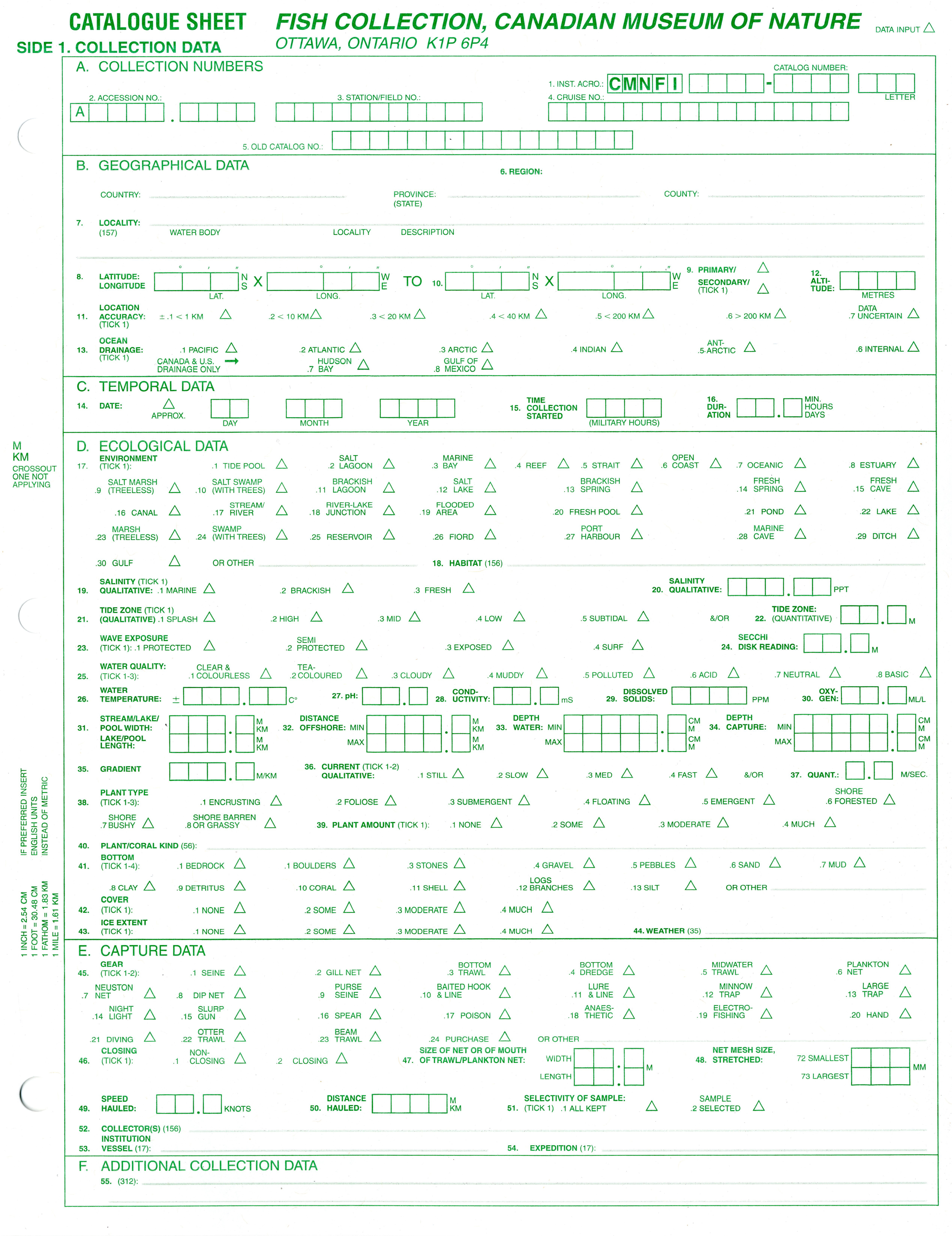
|
* = Iranian
endemic; ( / ) = confirmed/unconfirmed species in family in Iran, sum
for total; (E) = number of exotic species
out of total in family and E = exotic
species; ? = uncertain occurrence in Iran. Family Petromyzontidae (1) |
| Caspiomyzon wagneri (Kessler, 1870) |
| Family Carcharhinidae (1) |
| Carcharhinus leucas (Müller and Henle, 1839) |
| Family Acipenseridae (5/1) |
| Acipenser gueldenstaedtii Brandt and Ratzenburg, 1833 |
| Acipenser nudiventris Lovetzky, 1828 |
| Acipenser persicus Borodin, 1897 |
| Acipenser ruthenus Linnaeus, 1758 ? |
| Acipenser stellatus Pallas, 1771 |
| Huso huso (Linnaeus, 1758) |
| Anguillidae (1) (1E) |
| Anguilla anguilla (Linnaeus, 1758) (E) |
| Clupeidae (9/2) |
| Alosa braschnikowii (Borodin, 1904) |
| Alosa caspia (Eichwald, 1838) |
| Alosa curensis (Suvorov, 1907) ? |
| Alosa kessleri (Grimm, 1887) |
| Alosa saposchnikowii (Grimm, 1887) |
| Alosa sphaerocephala (Berg, 1913) |
| Alosa volgensis (Berg, 1913) ? |
| Clupeonella caspia Sveotovidov, 1941 |
| Clupeoenlla engrauliformis (Borodin, 1904) |
| Clupeonella grimmi Kessler, 1877 |
| Tenualosa ilisha (Hamilton, 1822) |
| Chanidae (1) |
| Chanos chanos (Forsskål, 1775) |
| Cyprinidae (94/1) (9-10E) |
| Abramis brama (Linnaeus, 1758) |
| Abramis sapa (Pallas, 1814) |
| Acanthalburnus microlepis (De Filippi, 1863) |
| Acanthalburnus urmianus (Günther, 1899) * |
| Alburnoides eichwaldii (De Filippi, 1863) |
| Alburnoides idignensis Bogutskaya and Coad, 2009 * |
| Alburnoides namaki Bogutskaya and Coad, 2009 * |
| Alburnoides nicolausi Bogutskaya and Coad, 2009 * |
| Alburnoides petrubanarescui Bogutskaya and Coad, 2009 * |
| Alburnoides qanati Coad and Bogutskaya, 2009 * |
| Alburnoides sp. * |
| Alburnoides sp. |
| Alburnus atropatenae Berg, 1925 * |
| Alburnus caeruleus Heckel, 1843 |
| Alburnus chalcoides (Güldenstaedt, 1772) |
| Alburnus doriae De Filippi, 1865 * |
| Alburnus filippi Kessler, 1877 |
| Alburnus hohenackeri Kessler, 1877 |
| Alburnus mossulensis Heckel, 1843 |
| Alburnus zagrosensis Coad, 2009 * |
| Aspidoparia morar (Hamilton, 1822) |
| Aspius aspius (Linnaeus, 1758) |
| Aspius vorax Heckel, 1843 |
| Barbus lacerta Heckel, 1843 |
| Barilius mesopotamicus Berg, 1932 |
| Blicca bjoerkna (Linnaeus, 1758) |
| Capoeta aculeata (Valenciennes, 1844) |
| Capoeta barroisi Lortet, 1894 |
| Capoeta buhsei Kessler, 1877 * |
| Capoeta capoeta (Güldenstaedt, 1773) |
| Capoeta damascina (Valenciennes, 1842) |
| Capoeta fusca Nikol'skii, 1897 |
| Capoeta trutta (Heckel, 1843) |
| Carasobarbus luteus (Heckel, 1843) |
| Carassius auratus (Linnaeus, 1758) (E) |
| Carassius gibelio (Bloch, 1782) (E) |
| Chondrostoma cyri Kessler, 1877 |
| Chondrostoma orientale Bianco and Bănărescu, 1982 * |
| Chondrostoma regium (Heckel, 1843) |
| Crossocheilus latius (Hamilton, 1822) |
| Ctenopharyngodon idella (Valenciennes, 1844) (E) |
| Cyprinion kais Heckel, 1843 |
| Cyprinion macrostomum Heckel, 1843 |
| Cyprinion milesi (Day, 1880) * |
| Cyprinion tenuiradius Heckel, 1847 * |
| Cyprinion watsoni (Day, 1872) |
| Cyprinus carpio Linnaeus, 1758 (E, and native) |
| Garra persica Berg, 1913 * |
| Garra rossica (Nikol'skii, 1900) |
| Garra rufa (Heckel, 1843) |
| Garra variabilis (Heckel, 1843) ? |
| Gobio lepidolaemus Kessler, 1872 |
| Hemiculter leucisculus (Basilewsky, 1855) (E) |
| Hypophthalmichthys molitrix (Valenciennes, 1844) (E) |
| Hypophthalmichthys nobilis (Richardson, 1844) (E) |
| Iranocypris typhlops Bruun and Kaiser, 1944 * |
| Kosswigobarbus kosswigi (Ladiges, 1960) |
| Kosswigobarbus sublimus Coad and Najafpour, 1997 * |
| Leucaspius delineatus (Heckel, 1843) |
| Leuciscus latus (Keyserling, 1861) |
| Luciobarbus barbulus (Heckel, 1847) |
| Luciobarbus brachycephalus (Kessler, 1872) |
| Luciobarbus capito (Güldenstaedt, 1773) |
| Luciobarbus esocinus Heckel, 1843 |
| Luciobarbus kersin (Heckel, 1843) |
| Luciobarbus mursa (Güldenstaedt, 1773) |
| Luciobarbus pectoralis (Heckel, 1843) |
| Luciobarbus subquincunciatus (Günther, 1868) |
| Luciobarbus xanthopterus Heckel, 1843 |
| Mesopotamichthys sharpeyi (Günther, 1874) |
| Mylopharyngodon piceus (Richardson, 1846) (E) |
| Pelecus cultratus (Linnaeus, 1758) |
| Petroleuciscus esfahani Coad and Bogutskaya, 2010 * |
| Petroleuciscus persidis (Coad, 1981) * |
| Petroleuciscus ulanus (Günther, 1899) * |
| Pimephales promelas Rafinesque, 1820 (E) |
| Pseudorasbora parva (Temminck and Schlegel, 1846) (E) |
| Rhodeus amarus (Bloch, 1782) |
| Romanogobio macropterus (Kamenskii, 1901) |
| Romanogobio persus (Günther, 1899) * |
| Rutilus caspicus (Yakovlev, 1870) |
| Rutilus kutum Kamenskii, 1901 |
| Rutilus rutilus (Linnaeus, 1758) |
| Scardinius erythrophthalmus (Linnaeus, 1758) |
| Schizocypris alitidorsalis Bianco and Bănărescu, 1982 |
| Schizopygopsis stoliczkai Steindachner, 1866 |
| Schizothorax intermedius McClelland, 1842 |
| Schizothorax pelzami Kessler, 1870 |
| Schizothorax zarudnyi (Nikol'skii, 1897) |
| Squalius cephalus (Linnaeus, 1758) |
| Squalius lepidus Heckel, 1843 |
| Tinca tinca (Linnaeus, 1758) |
| Tor grypus (Heckel, 1843) |
| Vimba persa (Pallas, 1814) |
| Cobitidae (6/1) |
| Cobitis faridpaki Mousavi-Sabet, Vasil'eva, Vatandoust and Vasil'ev, 2011 * |
| Cobitis keyvani Mousavi-Sabet, Yerli, Vatandoust, Özeren and Moradkhani, 2012 * |
| Cobitis linea (Heckel, 1847) * |
| Cobitis sp. |
| Sabanejewia aurata (De Filippi, 1863) |
| Sabanejewia caspia (Eichwald, 1838) |
| Sabanejewia caucasica (Berg, 1906) ? |
| Nemacheilidae (23) |
| Ilamnemacheilus longipinnis Coad and Nalbant, 2005 * |
| Metaschistura cristata (Berg, 1898) |
| Oxynoemacheilus bergianus (Derzhavin, 1934) * |
| Oxynoemacheilus brandtii (Kessler, 1877) |
| Oxynoemacheilus kermanshahensis (Bănărescu and Nalbant, 1967) * |
| Oxynoemacheilus kiabii Golzarianpour, Abdoli and Freyhof, 2011 * |
| Oxynoemacheilus persa (Heckel, 1847) * |
| Oxynoemacheilus tongiorgii (Nalbant and Bianco, 1998) * |
| Oxynoemacheilus sp.* |
| Paracobitis iranica Nalbant and Bianco, 1998 * |
| Paracobitis longicauda (Kessler, 1872) |
| Paracobitis malapterura (Valenciennes, 1846) |
| Paracobitis rhadinaeus (Regan, 1906) |
| Paracobitis smithi (Greenwood, 1976) * |
| Paracobitis vignai Nalbant and Bianco, 1998 * |
| Paracobitis sp. * |
| Paraschistura bampurensis (Nikol'skii, 1900) * |
| Paraschistura kessleri (Günther, 1889) |
| Paraschistura nielseni (Nalbant and Bianco, 1998) * |
| Paraschistura sargadensis (Nikol'skii, 1900) * |
| Triplophysa stoliczkai (Steindachner, 1866) |
| Turcinoemacheilus kosswigi Bănărescu and Nalbant, 1964 |
| Turcinoemacheilus sp. * |
| Bagridae (1) |
| Mystus pelusius (Solander, 1794) |
| Siluridae (2) |
| Silurus glanis Linnaeus, 1758 |
| Silurus triostegus Heckel, 1843 |
| Sisoridae (2) |
| Glyptothorax kurdistanicus (Berg, 1931) |
| Glyptothorax silviae Coad, 1981* |
| Heteropneustidae (1) (1E) |
| Heteropneustes fossilis (Bloch, 1794) € |
| Salmonidae (8) (5E) |
| Coregonus lavaretus (Linnaeus, 1758) (E) |
| Oncorhynchus keta (Walbaum, 1792) (E) |
| Oncorhynchus mykiss (Walbaum, 1792) (E) |
| Salmo caspius Kessler, 1877 |
| Salmo trutta Linnaeus, 1758 (E) |
| Salmo sp. * |
| Salvelinus fontinalis (Mitchill, 1814) (E) |
| Stenodus leucichthys (Güldenstaedt, 1772) |
| Esocidae (1) |
| Esox lucius Linnaeus, 1758 (I) |
| Gadidae (1) |
| Lota lota (Linnaeus, 1758) |
| Mugilidae (6) (2E) |
| Liza abu (Heckel, 1843) |
| Liza aurata (Risso, 1810) (E) |
| Liza saliens (Risso, 1810) (E) |
| Liza subviridis (Valenciennes, 1836) |
| Liza vaigiensis Quoy and Gaimard, 1824) |
| Mugil cephalus Linnaeus, 1758 |
| Atherinidae (1) |
| Atherina caspia Eichwald, 1831 |
| Cyprinodontidae (10) |
| Aphanius arakensis Teimori, Esmaeili, Gholami, Zarei and Reichenbacher, 2012 |
| Aphanius dispar Rüppell, 1829) |
| Aphanius farsicus Teimori, Esmaeili and Reichenbacher, 2011 * |
| Aphanius ginaonis (Holly, 1929) * |
| Aphanius isfahanensis Hrbek, Keivany and Coad, 2007 * |
| Aphanius mento (Heckel, 1843) |
| Aphanius mesopotamicus Coad, 2009 |
| Aphanius sophiae (Heckel, 1847) * |
| Aphanius vladykovi Coad, 1988 * |
| Aphanius sp. * |
| Poeciliidae (2) (2E) |
| Gambusia holbrooki Girard, 1859 (E) |
| Xiphophorus hellerii Heckel, 1848 (E) |
| Gasterosteidae (2) (1E) |
| Gasterosteus aculeatus Linnaeus, 1758 (E) |
| Pungitius platygaster (Kessler, 1859) |
| Syngnathidae (1) |
| Syngnathus caspius Eichwald, 1831 |
| Mastacembelidae (1) |
| Mastacembelus mastacembelus (Banks and Solander, 1794) |
| Percidae (3) |
| Perca fluviatilis Linnaeus, 1758 |
| Sander lucioperca (Linnaeus, 1758) |
| Sander marinus (Cuvier, 1828) |
| Sparidae (1) |
| Acanthopagrus latus (Houttuyn, 1782) |
| Cichlidae (1) |
| Iranocichla hormuzensis Coad, 1982 * |
| Gobiidae (21/18) (1E) |
| Anatirostrum profundorum (Berg, 1927) |
| Babka gymnotrachelus (Kessler, 1857) ? |
| Babka macrophthalma (Kessler, 1877) ? |
| Benthophiloides brauneri Beling and Iljin, 1927 |
| Benthophiloides turcomanus Iljin, 1941) |
| Benthophilus abdurahmanovi Ragimov, 1978 |
| Benthophilus baeri Kessler, 1877 |
| Benthophilus casachicus Ragimov, 1978 |
| Benthophilus ctenolepidus Kessler, 1877 |
| Benthophilus granulosus Kessler, 1877 |
| Benthophilus grimmi Kessler, 1877 |
| Benthophilus kessleri Berg, 1927 |
| Benthophilus leobergius Berg, 1949 |
| Benthophilus leptocephalus Kesssler, 1877 |
| Benthophilus leptorhynchus Kessler, 1877 |
| Benthophilus macrocephalus (Pallas, 1787) |
| Benthophilus mahmudbejovi Ragimov, 1976 |
| Benthophilus pinchuki Ragimov, 1982 |
| Benthophilus ragimovi Boldyrev and Bogutskaya, 2004 |
| Benthophilus spinosus Kessler, 1877 |
| Benthophilus svetovidovi Pinchuk and Ragimov, 1979 |
| Boleophthalmus dussumieri Valenciennes, 1837 |
| Chasar bathybius (Kessler, 1877) |
| Glossogobius giurus (Hamilton, 1822) |
| Hyrcanogobius bergi Iljin, 1928 |
| Knipowitschia caucasica (Berg, 1916) |
| Knipowitschia iljini Berg, 1931 |
| Knipowitschia longecaudata (Kessler, 1877) |
| Mesogobius nigronotatus (Kessler,1877) |
| Neogobius caspius (Eichwald, 1831) |
| Neogobius melanostomus (Pallas, 1814) |
| Neogobius pallasi (Berg, 1916) |
| Periophthalmus waltoni Koumans, 1955 |
| Ponticola cyrius (Kesser, 1874) |
| Ponticola goebelii (Kessler, 1874) |
| Ponticola gorlap (Iljin, 1949) |
| Ponticola syrman (Nordmann, 1840) |
| Proterorhinus nasalis (De Filippi, 1863) |
| Rhinogobius similis Gill, 1859 (E) |
| Channidae (1) |
| Channa gachua (Hamilton, 1822) |
The link below will give an Excel file with the checklist and distributions by basin:-
Checklist file .... note this file is updated regularly.
Esmaeili et al. (2010) is a recent listing of the fauna with various
comments, and this website contains much more commentary on individual taxa.
1. Geographical Glossary
The following glossary of geographical and other terms is mostly in Farsi (which includes words
taken from Turkic, Kurdish and Arabic) with a few Russian words, all
of which appear on maps, in the literature and in the text of the
"Freshwater Fishes of Iran" web site. They may be of help to those
unfamiliar with these languages and avoid tautologies such as Safidrud River.
There are various diacritical marking systems for
Farsi but these do not always transfer accurately across platforms,
appearing as strange symbols or gaps in text. I
have eschewed the use of these as being irrelevant for native speakers
of Farsi and too confusing for those unfamiliar with this language.
ab = water, intermittent stream, stream, spring, lake, well
ab-bandan = shallow, freshwater reservoir on the Caspian plain used for duck hunting in
winter and water storage for irrigation in the dry summer
abad = a suffix indicating an inhabited place
ab-e garm = hot spring
ab ambar = cistern
ab anbar = cistern
abshur rud = salt river, common name of salty rivers
anbar = tank
ateshkade = fire-temple (archaeological feature)
av = stream
`ayn = spring
bagh = garden
bahr = sea
Bahr-e Khazar = Caspian Sea
baksh= municipality
band = dam, reservoir, lake, mountain range (old dams for water storage - see sadd for modern dams)
bandar = port, harbour, anchorage, bay
bankari = constructing temporary weirs for water diversion
bar andaz = halting place
barm = marsh, lake, pond
batlaq = marsh, swamp
berkeh = tank, pool, cistern
biaban = desert (also the name of the coastal plain south of the Minab River to
the cape of Ra's al-Kuh in Hormozgan Province)
birkat = pool, well, marsh, lake
borj = fort, tower
botlaq = marsh, swamp
caviar = sturgeon eggs as food
çay = stream
centner = 100 kg (used in Russian texts as a measure of commercial catches; sometimes given as
50 kg elsewhere but internal evidence in Russian papers indicates 100 kg is correct)
chah = well, spring, cistern
chai = stream
cham = stream, gorge
chashmeh = spring, well
chay = stream
cheng = hill, mountain, promontory
cheshmeh = spring, well
dag = mountain
dagh = mountain
dahaneh = section of a stream, gorge, pass, defile, water gap
damagheh = cape, promontory
damgah = an artificial, freshwater wetland, maintained primarily as a duck-hunting area but
also used for irrigation during the dry summer months
daqq = salt flat, salt depression, salt waste, marsh, intermittent salt lake
darband = gorge or pass
darreh = stream, valley, gorge, ravine
darya = sea, stream, intermittent stream, channel
daryacheh = lake, marshy lake, stream
Darya-ye Mazandaran = Caspian Sea
dasht = plain, desert, steppe, depression, upland, open country, field; usually dry desert
with a firm base of pebbles or silts
deh = village
dehkadeh = village
dez = fortress
echbel = eggs of fishes other than sturgeons as food
emamzadeh = tomb, shrine
eskeleh = jetty
estakhr = pool
gadik, gaduk = pass
galal = stream
gardan, gardaneh = pass
godar = pass
garmsir = hot country, winter quarters in the lowlands
ghadamgah = a religious site; usually no fishing allowed.
gharb(i) = west(ern), as in the province Azarbayjan-e Gharbi)
godar = pass
göl = lake, marsh, swamp
gölü = lake, marsh, swamp
gowd = depression
hammam = bath
hamun = marshy lake, salt waste
hawr = marsh, lake
hesar = fort, castle
hor = marsh
howr = marsh
howz = tank, cistern, pond, pool, lake, reservoir, spring
il'men = a shallow, flood-plain lake heavily overgrown with reeds and rushes (Russian)
ishan = hill
istgah = railway station
jabal = hill, mountain
jangal = forest
jar = stream
jazirat = island
jazireh = island
jebal = hill, mountain
jehil = lake
jolgeh = plain
jonub(i) = south(ern)
ju = stream, irrigation channel
jub, jube = irrigation channel, watercourse, gutter, ditch
juy = stream, watercourse
kal = stream, intermittent stream
kalleh = peak
kamar = hill, mountain, ridge
kani = well
karavansara = caravansary
karez = underground irrigation channel
kaur = stream
kavir = salt waste, salt desert, marsh; usually a salt crust over silt deposits which can be fatal mires of slimy mud (= playa)
khalij = bay, gulf
Khalij-e Fars = Persian Gulf
kharabeh = ruins
khirr = stream
khowr = inlet, stream, channel, bay, bight, tidal creek, estuary
khwar = stream
kizil ala = brown trout (see also qezelala)
kotal = mountain pass
kowr = stream
kuh = mountain, range, hill, peak, ridge, spur
kuhha = mountains, range, hills
liman = a brackish bay of the sea, usually at a river mouth, sometimes cut off from the sea but
still brackish; also an estuary (Russian, mordab in Farsi)
lut = desert
mahur = hill
mandah = stream
markazi = central, as in Markazi Province
masjed = mosque
mordab = lagoon, backwater, creek, swamp, stagnant water (literally dead water, now replaced by talab)
nahr = river, stream, canal, docking basin
naizar = reed swamp (Sistan)
namak = salt; usually a salt lake with open water or a salt crust but without much mud
namaksar = salt waste
naveh = stream
nawah = stream
nehri = stream
neizar = reed swamp in Sistan
ostan = province, governorate-general
ozero = lake
pal = hill, mountain
paskuh = mountain range
pereval = pass
poshteh = hill, mountain
qabr = tomb
qabrestan = cemetery
qal'at = fort
qal'eh = fortress
qanat = underground irrigation channel; an adit shaft
qasr = fort
qolleh = hill, mountain, peak
ramlat = sandy area
ra's = cape, point, promontory
reka = river
reshteh = mountain, mountain range, hill, spur
reshteh kuh = mountain range
rig = sand area, dunes
riz ab = stream
roga = outflow (in the Enzeli or Anzali Mordab)
rud = river, stream, intermittent stream
rudbar = valley drained by a river with flowing water; place watered by many streams
rudkhaneh = river, river bed, watercourse, intermittent stream
rusta = village, inhabited place
sabkhat = salt marsh, lake
sadd = dam, reservoir (used for modern dams)
saddi qanat = a qanat drawing water from a dam
sahel = coast, beach, shore
sar = cape
sarab = spring (in western Iran), literally "beginning water"
saray = caravansaray
sardsir = cold country, summer quarters in the highlands
sarhadd = frontier
sazhen = a marine sazhen equals 1.83 m (Russian)
selseleh = mountain range, mountains
shahr = town, city
shahrdari = municipality
shahrestan = district
shahzadeh = shrine
shamal(i) = north(ern)
sharq(i) = east(ern), as in the province Azarbayjan-e Sharqi
shatt = large river, bank of a river, stream
saydgah = fishing station, as along the Caspian coast
shebh-e jazireh = peninsula
shekasteh = hill, mountain
shil = a wooden barrier erected across a river for catching fish; hence shilat (in Gilaki, the Persian dialect of Gilan)
shilat = fisheries company; Sherkat Shilat = Northern Fisheries Company concerned with the Caspian
Sea; Shilat Jonub = Southern Fisheries Company concerned with the Persian Gulf
shur = salt, brackish, stream
shurab = salt water
shurehzar = salt stream, salt marsh
su = water, stream
suyu = stream
talab = more modern version of mordab.
tall = hill, mountain, spur
tang = pass
tangeh = valley
tappeh = hill, mountain, mound
tell = hill
tepe = hill, mound
vareh = a small dam
vilayet = province
ziarat = shrine
2. Ichthyological Glossary
Technical terms used in ichthyology and in this work are in the
Dictionary of Ichthyology of this website
(q.v.).
Quotes
A weak fisherman caught a strong fish in his net and not being able to
retain it the fish overcame him and pulled the net from his hand.
A boy went to bring water from the torrent.
The torrent came and took the boy away.
The net brought every time a fish.
This time the fish went and carried off the net.
The other fishermen were sorry and blamed him for not being
able to retain such a fish which had fallen into his net. He replied:
'O brothers, what can be done? My day was not lucky but the fish had
yet one remaining'. Moral: A fisherman cannot catch a fish in the
Tigris without a day of luck and a fish cannot die on dry ground
without the decree of fate. ---- Story 24 from the Gulistan of Sheikh Muslih-uddin Sa'di Shirazi, 1258.
The Caspian sea is marueilous full of fish, but no kind of monstrous fish, as farre as I could vnderstand, yet hath it sundry sortes of fishes which are not
in these parts of the world. ---- Principal Navigations, Voyages, Traffiques and Discoveries of the English Nation, Richard Hakluyt, 1599.
Fresh-water Fish is not so plentiful, because there are but few Rivers in Persia, and they take abundance of Water out
of them, so that very little Fish can breed there..... There are three sorts of Fresh-water Fish in that large Empire; that of Lakes, that of
Rivers, and that of Kerises, or Subterraneous Canals. ---- Sir John Chardin, 1724.
No sea, perhaps, in the world, produces so great a quantity of fish. ---- Said of the Caspian Sea by J. M. Kinneir, 1813.
Thus a man told me that the Caspian Sea, (on the shore of which we conversed) was a Maaden-i-mahi or mine of fish. ---- Sir William Ouseley, 1819.
I may remark as a curious fact in zoology, that many of the cannauts, both here and at Shahrood, swarmed with fish, some of which were of considerable size. ----
James B. Fraser, 1825.
Of fish, in a country which possesses so few rivers, we are not to look for either abundance or variety; nor do the inhabitants make any great use of what they
have." ---- James B. Fraser, 1834.
"If you trip over a pebble on the ground, you can be sure that an Englishman put it there" (Persian saying) - as an Englishman I hope there are not
too many pebbles in this work, and
those that are were inadvertent.
Tomumshud
©
Brian W. Coad (www.briancoad.com)